
Mosses Under the Drumlin30215 BCE
30,215 BCE is a modern chronological label, not a recoverable Irish event. During Late Pleistocene Marine Isotope Stage 3, Ireland experienced unstable varied climates as the British–Irish Ice Sheet advanced and retreated. At Derryvree, County Fermanagh, freshwater sediments between till layers preserve cold-adapted mosses and plants, indicating tundra wetlands before renewed glaciation. Cave remains at Castlepook show mammoth, reindeer and fauna reached Ireland; a possibly cut-marked reindeer bone suggests, but cannot prove, brief human activity. Low sea levels altered routes without ensuring access. No evidence supports settled communities, politics or culture. The record documents changing ice, water, vegetation and habitats.
Dateline
30,215 BCE is not an anniversary that can be recovered from the Irish archaeological record. It is a modern calendar label for a point roughly 32,164 years before AD 1950, the conventional reference point for calibrated ‘before present’ dating. No written evidence, settlement sequence or securely dated event allows historians to say what happened in Ireland in that individual year. The responsible subject is instead the changing Late Pleistocene world to which the date belongs: a cold, unstable interval of Marine Isotope Stage 3, when the British–Irish Ice Sheet was growing and retreating in different regions, and when Ireland’s landscapes were intermittently capable of supporting tundra plants and large mammals.
Calendar Years and Deep Time
Deep prehistory has its own chronology, and it does not fit neatly into BCE labels. Radiocarbon laboratories report ages in radiocarbon years BP, not calendar years; the amount of atmospheric carbon-14 has varied through time, so measurements must be calibrated against independently dated records. At ages around 30,000 radiocarbon years, both laboratory uncertainty and the shape of the calibration curve can generate broad, sometimes discontinuous calendar ranges. A date such as 30,215 BCE should therefore be treated as a useful modern point of reference, not as evidence for a precise Irish season, generation or occurrence.
It also falls before the climatic peak normally called the Last Glacial Maximum, broadly after c. 26,000 years ago and before c. 20,000 years ago. That distinction matters. Ireland was not simply an unchanging white wilderness throughout the Ice Age. Ice margins moved, climatic conditions fluctuated abruptly, and the island’s regions did not necessarily share one environmental history at the same moment. The evidence allows a reconstruction in ranges and landscapes, not an island-wide weather report for a single year.
A Freshwater Interval at Derryvree
The most illuminating Irish archive for this broad phase lies at Derryvree, near Maguiresbridge in County Fermanagh. Roadworks in 1969 exposed a striking sequence within a drumlin: a layer of freshwater silts and fine sands lay between two substantial till sheets, sediments deposited directly by glacier ice. This sequence records an important order of events. Ice had affected the locality; subsequently, open ground with freshwater deposits existed there; then later glacier ice overrode and sealed the deposit. It is physical evidence for environmental change, preserved beneath a familiar glacial landform.
Organic material in the Derryvree sediments produced the conventional radiocarbon determination BIRM-166, 30,500 radiocarbon years BP, with a large quoted uncertainty of +1,170 and –1,030 years. That result is highly relevant to the wider world around 30,215 BCE, but it is not a date for that BCE year and should not be converted by simply subtracting 30,500 from 1950. The original determination predates modern IntCal20 calibration practice, while its sizeable uncertainty makes a narrow calendar placement unwarranted. Its secure value is stratigraphic and environmental: it identifies a late Marine Isotope Stage 3 freshwater episode in south Fermanagh before renewed glaciation.
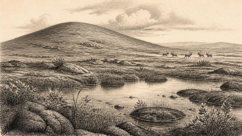
The plant and animal evidence is unusually informative. Pollen was poorly preserved, but the macrofossils included mosses and plants associated with cold, open conditions, including sedges, dwarf willow, mountain avens, lesser clubmoss, bogbean and water-milfoil. These were not the ingredients of a forested Irish countryside. They suggest a treeless tundra or tundra-steppe mosaic, with wet hollows, shallow water and damp margins amid sparsely vegetated ground. The presence of aquatic plants is especially important: severe cold did not mean a uniformly frozen surface. At least locally, freshwater habitats formed and supported vegetation during a short productive season.
Ice, Water and Open Ground
The Derryvree bed cannot be scaled up automatically into a map of all Ireland. A freshwater basin in Fermanagh demonstrates local ice-free conditions while it accumulated; it does not prove that every coast, upland and lowland was free of ice at the same time. Conversely, evidence from western Irish marine deposits has been interpreted as showing substantial ice loading and high relative sea levels during parts of the long interval between about 40,000 and 19,000 calibrated years ago. More recent British–Irish Ice Sheet research similarly emphasises a dynamic, asynchronous system rather than one simple advance.
By the wider period around 32,000 calibrated years ago, ice was expanding in parts of the Irish Sea and adjacent Britain. Research on the terrestrial Irish Sea Glacier places an early advance to south Lancashire around 30 ± 1.2 thousand years ago, followed by further advance towards its later maximum. This does not fix the condition of Fermanagh or Cork on one date, but it explains why landscapes such as Derryvree could be temporary. An exposed wetland could be buried by till; a route usable by animals in one climatic phase could become impassable in another. The future Irish landscape of drumlins, scoured rock and glacial sediments was being made through such advances and reorganisations.
Sea level was much lower than today because water was stored in continental ice sheets, and the outlines of coasts and shallow seas were consequently different. Yet lower seas did not create a permanently easy land route into Ireland. The Irish Sea basin, ice streams, exposed plains, rapidly changing shorelines and cold maritime weather made movement contingent. Any ecological connection with Britain and the European mainland was a changing corridor, not a stable bridge or a political frontier.
Fauna and the Castlepook Question
Irish cave collections show that large Ice Age mammals reached the island during the wider period. Castlepook Cave, near Doneraile in north County Cork, has yielded remains of woolly mammoth, reindeer, spotted hyaena, brown bear, fox, hare and lemmings. Earlier work by the Irish Quaternary Fauna Project established that mammals colonised Ireland during parts of the Late Pleistocene, though many cave accumulations had been disturbed by carnivores, water, collapse and early excavation. Cave bones are valuable evidence, but they must not be mistaken for a neatly preserved living floor.
A reindeer femur from Castlepook has made this date range particularly important. Zooarchaeologist Ruth Carden identified a deep linear incision interpreted as a fresh-bone cut mark made by a sharp stone tool during carcass processing. County Cork heritage material places the bone broadly around 31,000 BCE. If that interpretation is upheld, it indicates that people handled a reindeer in Ireland during the Upper Palaeolithic, far earlier than the long-recognised post-glacial record. It is a remarkable possibility, but the conclusion must remain carefully limited. The bone is not from a securely excavated contemporary camp, and no associated stone-tool assemblage, hearth, dwelling, human burial or occupation surface has yet established a settled community at Castlepook.
What Cannot Be Claimed
For 30,215 BCE there is no evidence for Irish rulers, tribes, political institutions, warfare, treaties or diplomacy. There is no basis for naming a people, language or territory. Nor do we have proof of permanent villages, agriculture, animal husbandry, pottery, long-distance trade or religious monuments. The evidence does not support a story of a settled society enduring through the cold in Fermanagh or Cork. If people did visit Ireland during this broader interval, they were likely highly mobile hunter-gatherers operating within a north-west European world of changing animal movements and hazardous routes; even that is an interpretation from regional comparison, not a directly observed Irish social system.
Religion, art and learning are equally beyond recovery here. The cave fauna and buried wetland have not produced portable art, ritual deposits, engravings, tools or human remains attributable to this particular phase. The absence of such evidence is not proof that no beliefs, skills or social traditions existed among any visitors. It means that Ireland’s present evidence cannot describe them. The archaeological silence is itself historically significant: repeated glaciation, erosion, inundation and the scarcity of protected deposits have left an exceptionally fragmentary record.
An Environmental History
The most defensible account of Ireland around this nominal year is therefore an environmental one. In south Fermanagh, a freshwater hollow supported cold-adapted plants and mosses between episodes of glaciation. Elsewhere, mammoth, reindeer and carnivores demonstrate that an Ice Age fauna could enter parts of Ireland during favourable windows. Across the Irish Sea region, ice was building towards the far more extensive glaciation that would later transform the island. A possible cut-marked reindeer bone raises the prospect of brief human activity, but does not convert this landscape into a known homeland or settlement.
What survives from this remote horizon is not a chronicle of events but a set of witnesses: silt beneath till, seeds and moss fragments, animal bones in caves, and the marks left by moving ice. Together they show that Ireland was neither timeless nor empty of ecological possibility. Its history at 30,215 BCE is a history of unstable ground, seasonal water, tundra life and evidence measured in ranges rather than years.
Primary Sources
- A Middle Midlandian Freshwater Series at Derryvree, Maguiresbridge, County Fermanagh, Northern Ireland
- Palaeoecology: Field Guide 16
- The Irish Quaternary Fauna Project
- A Reconsideration of the Radiocarbon Dating of the Marine Isotope Stage 3 Fauna from Southern Ireland
- Heritage Artefacts of County Cork
- First Evidence of a Late Upper Palaeolithic Human Presence in Ireland
- New Insights on the Fauna of Ireland’s Younger Dryas and Early Holocene from Alice & Gwendoline Cave
- The Evolution of the Terrestrial-Terminating Irish Sea Glacier During the Last Glaciation
- Maximum Extent and Readvance Dynamics of the Irish Sea Ice Stream and Irish Sea Glacier Since the Last Glacial Maximum
- Growth and Retreat of the Last British–Irish Ice Sheet, 31,000 to 15,000 Years Ago: the BRITICE-CHRONO Reconstruction
- Radiocarbon Constraints on the History of the Western Irish Ice Sheet Prior to the Last Glacial Maximum
- Britain and Ireland: Glacial Landforms from the Last Glacial Maximum
- Deglaciation Chronology of the Donegal Ice Centre, North-West Ireland
- BRITICE Glacial Map, Version 2: A Map and GIS Database of Glacial Landforms of the Last British–Irish Ice Sheet
- Trimlines, Blockfields and the Vertical Extent of the Last Ice Sheet in Southern Ireland
- AMS 14C Dating of Deglacial Events in the Irish Sea Basin and Other Sectors of the British–Irish Ice Sheet
- Oscillating Retreat of the Last British–Irish Ice Sheet on the Continental Shelf Offshore Galway Bay, Western Ireland
- The Deglaciation of the Western Sector of the Irish Ice Sheet from the Inner Continental Shelf to its Terrestrial Margin
- Pattern, Style and Timing of British–Irish Ice Sheet Advance and Retreat Over the Last 45,000 Years: Evidence from NW Scotland and the Adjacent Continental Shelf
- The IntCal20 Northern Hemisphere Radiocarbon Age Calibration Curve (0–55 cal kBP)
- OxCal: Radiocarbon Calibration and Analysis
- A Stratigraphic Framework for Abrupt Climatic Changes During the Last Glacial Period Based on Three Synchronised Greenland Ice-Core Records
- Water Mass Exchange Between the Nordic Seas and the Arctic Ocean on Millennial Timescale During MIS 4–MIS 2
