
Derryvree’s Thawwater Margin30214 BCE
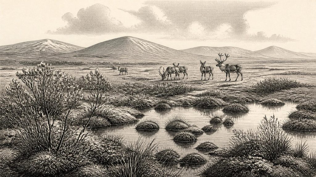
Around 30,214 BCE, Ireland lay within the fluctuating cold of Marine Isotope Stage 3, preceding Last Glacial Maximum ice cover. Derryvree, County Fermanagh, preserves freshwater organic sediments between glacial tills, indicating treeless, open wetland with mosses, sedges and aquatic plants during an ice-free interval. Greenagho and Crag Cave likewise indicate episodic environmental improvement. Castlepook Cave demonstrates a diverse MIS 3 fauna, including mammoth, reindeer, predators and cold-adapted mammals, although dates and associations remain uncertain. Lower sea levels altered coasts and possible routes. No secure evidence proves settlement; a modified reindeer bone only tentatively suggests human activity. Later ice buried evidence.
Dateline
30,214 BCE is a modern chronological label, not a date that can be recovered as a year in an Irish Ice Age calendar. It corresponds approximately to 32,160 years before the archaeological present of AD 1950. At that depth of time, even good radiocarbon results carry substantial uncertainty and must be calibrated; deposits also accumulate over periods rather than recording a single day or season. The responsible question is therefore not what happened in Ireland in this exact year, but what evidence can illuminate the island during the broad interval into which it falls.
The date lies in Marine Isotope Stage 3 (MIS 3), an unstable phase of the Late Pleistocene. Ireland was entering the long build-up to the Last Glacial Maximum, when ice eventually covered the island and much of its continental shelf. Yet the evidence does not support a simple picture of a permanently frozen or uniformly ice-covered Ireland at this earlier point. Instead, it suggests a changing north-western landscape in which cold, open country, freshwater habitats, mobile animals and advancing or recurring ice existed at different times and places. The most revealing Irish record close to this notional date is at Derryvree near Maguiresbridge, County Fermanagh.
A Wetland Between Ice Advances
Roadworks in 1969 cut through a drumlin at Derryvree and revealed an exceptional sequence: freshwater sands, silts and organic deposits lying between two bodies of glacial till. Till is the mixed sediment left directly by glacier ice. The order of layers is crucial. An earlier glacial episode had affected the locality; water, sediment, plants and small animals then accumulated in an ice-free interval; later glacier ice or ice-related sediment buried and preserved the wetland beneath another till.
One organic sample, BIRM-166, produced a conventional radiocarbon determination of 30,500 years before present, with a large uncertainty. Subsequent calibration places the Derryvree organic horizon broadly at about 36,900–31,700 calibrated years before present. In calendar terms that wide span is roughly 34,950–29,750 BCE. 30,214 BCE lies within it, but the range does not date a particular plant, pool or activity to this precise year. It establishes only that Derryvree preserves an important environmental episode relevant to this part of MIS 3.
The distinction matters because the deposits are often described as an ‘interstadial’, a comparatively milder interval within the last Ice Age. ‘Milder’ must not be mistaken for modern warmth. Derryvree’s fossil record indicates a cold, treeless setting, but one with standing or slow-moving fresh water, wet margins and enough seasonal productivity to support a varied community of plants and invertebrates. The site shows that a glacial landscape could briefly or locally contain living wetlands rather than being an unbroken field of ice.
The Derryvree Plant Record
Plant macrofossils and pollen from the organic silts offer the closest evidence for everyday ecological conditions. The reported assemblage includes mosses and sedges, bogbean (Menyanthes trifoliata) and water-milfoil (Myriophyllum), plants associated with freshwater and wet ground. Other indicators, including dwarf willow, mountain avens and lesser clubmoss, point towards open, cold conditions. This was not woodland. Trees requiring a long, reliable growing season were absent or insignificant in the local record; exposed ground, short vegetation and wet hollows were more characteristic.
Such evidence allows a restrained reconstruction. During a favourable summer, water margins could have supported flowering plants, insect life and grazing. In winter, frost, snow, wind and long periods of low biological activity would have governed the landscape. Permafrost is not proven at Derryvree merely by the presence of cold-adapted species, nor can a single sediment layer tell us the length of each season. But the combined flora demonstrates a functioning freshwater ecosystem in a severe climatic regime.
Nearby Greenagho, near Belcoo in County Fermanagh, provides a second and older Middle Midlandian freshwater record, dated broadly to about 37,200–35,700 calibrated years before present. It does not make Greenagho and Derryvree one continuous lake or prove identical weather across Fermanagh. It does, however, strengthen the regional conclusion that northern Ireland preserved environmental windows between glacial episodes. Farther south-west, uranium-series dates from speleothems at Crag Cave, County Kerry, show that cave calcite grew episodically during MIS 3, probably when climate and groundwater conditions became less hostile. Ireland’s evidence is sparse, but it consistently records climatic fluctuation rather than one unchanging Ice Age state.
Animals in an Open Country
The strongest faunal evidence comes from Castlepook Cave, also called Mammoth Cave, near Doneraile in north County Cork. Its nineteenth- and early twentieth-century excavations produced Ireland’s richest assemblage of Pleistocene vertebrates. The collection includes remains attributed to woolly mammoth, reindeer, giant deer, brown bear, wolf, Arctic fox, mountain hare, lemmings and spotted hyaena. It is powerful testimony that Ireland could at times sustain large herbivores, smaller cold-adapted mammals and predators.
It would nevertheless be wrong to place all these animals together in a single scene in 30,214 BCE. Cave deposits are difficult archives. Carnivores may carry bones into dens; water can move remains; roof falls and later digging can disturb layers; and Castlepook was excavated before modern methods of stratigraphic recording became standard. Improved radiocarbon pretreatment has also shown that several older determinations from southern Irish caves were too young, moving important elements of the Castlepook fauna further back into MIS 3. Some species, notably giant deer and spotted hyaena, may have vanished locally before the Last Glacial Maximum.
The careful conclusion is that cold, open habitats and a diverse large-mammal fauna existed in Ireland during overlapping parts of MIS 3. They provide an ecological context for the Derryvree wetland, not a census for one year. Mammoth and reindeer imply substantial forage somewhere in the wider landscape; hyaenas and wolves imply scavenging and predation opportunities; lemmings and Arctic fox speak to cold-country connections. Exactly when each species arrived, retreated or disappeared remains less certain.
Ice, Coasts and Connection
At this date, sea level was much lower than today because great quantities of water were held in northern ice sheets. The Irish coastline was therefore unlike the modern shore: parts of the continental shelf were exposed, while glaciers, proglacial waters and changing sea routes reshaped access around Ireland and Britain. Lower seas could expand terrestrial habitats and potential movement corridors, but they do not automatically prove a dry land bridge, a safe route or human travel at any particular moment. Ice margins and sea levels changed repeatedly, while the geography of the Irish Sea basin was especially complex.
Later in the glacial cycle, the British–Irish Ice Sheet expanded dramatically. Reconstructions show that by the Last Glacial Maximum, approximately 27,000–23,000 calibrated years before present, ice covered Ireland and extended across the shelf. The Derryvree sequence is important partly because later glaciation buried its organic layer. It preserves proof that conditions before that advance were different from those that followed. At 30,214 BCE, Ireland should be understood as a landscape under mounting climatic pressure, not as a settled island awaiting a known historical event.
The Human Question
No securely excavated settlement, hearth, house, burial, stone-tool assemblage or human skeleton demonstrates a resident Irish population at this date. Consequently there can be no responsible account of Irish rulers, political alliances, warfare, diplomacy, social ranks, religious institutions, languages, education, trade systems or named communities. Farming was many millennia in the future. There is likewise no evidence for villages, monuments, boats or a sustained economy on the island in the thirty-first millennium BCE.
One object makes the question of human presence impossible to dismiss altogether. A reindeer femur from the old Castlepook collection bears a deep linear modification interpreted by zooarchaeologist Ruth Carden as a mark made by a sharp stone edge while the bone was fresh. It has been publicly associated with an age of roughly 33,000 years ago, close enough to this broader period to be highly significant. If the interpretation and dating are confirmed, it could indicate that one or more Upper Palaeolithic people processed a reindeer in Ireland.
That possibility is not evidence of a settlement. The bone lacks a modern, securely controlled excavation context, no associated stone tools have been published, and the cave’s animal remains may have been rearranged by carnivores and water. Even a genuine cut mark would show an encounter with an animal, perhaps by a small and mobile party, rather than a permanent population. The distinction between a visit, repeated seasonal use and colonisation is central to interpreting the earliest human traces.
What Can Be Said
Ireland around 30,214 BCE was not politically silent because its people left no writing; it is archaeologically silent because no secure human society has yet been recovered from this period. Its history is instead read through sediments, fossils, cave deposits and the physical imprint of ice. Derryvree supplies the clearest local lesson: between glacial deposits, cold freshwater habitats supported vegetation and small life in Fermanagh. Castlepook shows that, during the broader MIS 3 world, large mammals and predators reached or occupied parts of the island. Crag Cave and regional ice-sheet research reveal a climate capable of shifting sharply over millennia and sometimes more quickly.
This is therefore a history of environmental possibility and evidential limits. Ireland was neither the familiar wooded island nor simply an empty white expanse. It was a variable, exposed Atlantic-edge landscape: wet in places, open in others, inhabited by changing animal communities, and vulnerable to the expansion of ice that would later erase or bury much of what had existed. The Derryvree silts survive precisely because the next glacial advance sealed them away, leaving a narrow but remarkable view of an Irish Ice Age world.
Primary Sources
- A Middle Midlandian Freshwater Series at Derryvree, Maguiresbridge, County Fermanagh, Northern Ireland
- Middle Midlandian Interstadial Deposits at Greenagho, Near Belcoo, County Fermanagh, Northern Ireland
- Episodic Speleothem Deposition Tracks the Terrestrial Impact of Millennial-Scale Last Glacial Climate Variability in SW Ireland
- Episodic Speleothem Deposition Tracks the Terrestrial Impact of Millennial-Scale Last Glacial Climate Variability in SW Ireland
- A Reconsideration of the Radiocarbon Dating of the Marine Isotope Stage 3 Fauna from Southern Ireland
- The Irish Quaternary Fauna Project
- Castlepook Cave, County Cork: Geological Heritage Audit Report
- Heritage Artefacts of County Cork
- Sedimentary Ancient DNA Reveals Late Pleistocene Faunal Connectivity Between Ireland and Eurasia
- Growth and Retreat of the Last British–Irish Ice Sheet, 31,000 to 15,000 Years Ago: the BRITICE-CHRONO Reconstruction
- Growth and Retreat of the Last British–Irish Ice Sheet, 31,000 to 15,000 Years Ago: the BRITICE-CHRONO Reconstruction
- Dimensions and Chronology of the Last Ice Sheet in Western Ireland
- Trimlines, Blockfields and the Vertical Extent of the Last Ice Sheet in Southern Ireland
- Deglaciation Chronology of the Donegal Ice Centre, North-West Ireland
- Reconstructing the Last Irish Ice Sheet 2: A Geomorphologically-Driven Model of Ice Sheet Growth, Retreat and Dynamics
- Last Glacial Maximum Cirque Glaciation in Ireland and Implications for Reconstructions of the Irish Ice Sheet
- Ireland: Submerged Prehistoric Sites and Landscapes
- The Colonization of Ireland: A Human Ecology Perspective
- First Evidence of a Late Upper Palaeolithic Human Presence in Ireland
- New Insights on the Fauna of Ireland’s Younger Dryas and Early Holocene from Alice & Gwendoline Cave
- Figure 6: The Subdivision of the Quaternary Period in Ireland
- Introduction to the Glacial Sand and Gravel Landscapes of Northern Ireland
