

Doneraile’s Marked Hindleg31811 BCE
At the notional date of 31,811 BCE, Ireland lay in the variable MIS 3 phase before the Last Glacial Maximum, not in a historically identifiable year. Evidence is necessarily broad and uncertain. Organic sediments at Derryvree indicate a treeless, periglacial wetland with tundra vegetation during an interval encompassing this date. Castlepook Cave preserves remains of cold-adapted fauna, including reindeer, but cave deposits are mixed and imperfectly dated. A marked reindeer femur may indicate human butchery, suggesting transient Upper Palaeolithic visits, not permanent settlement. Low sea levels altered routes but did not guarantee a land bridge. Glaciation destroyed or buried evidence.
Dateline
The label 31,811 BCE is a modern chronological convenience, not a year that anyone in Ireland could have named, recorded or experienced as a fixed date. There were no written calendars, rulers, states or documentary archives on the island. Nor can archaeological science isolate a particular season, generation or event so precisely at this depth of time. In calendar terms, the year corresponds to roughly 33,761 years before 1950, the conventional reference point for “before present”. It belongs broadly to the Late Pleistocene, during Marine Isotope Stage 3 (MIS 3), a highly variable phase of the last Ice Age.
The responsible history of Ireland at this point is therefore a history of ranges, deposits and probabilities. A radiocarbon determination from organic sediments at Derryvree, near Maguiresbridge in County Fermanagh, has been calibrated broadly to about 36,900–31,700 cal BP. That wide span includes the notional date considered here, but it does not demonstrate that Derryvree looked exactly the same in 31,811 BCE. A reindeer femur from Castlepook Cave near Doneraile, County Cork, is likewise publicised as approximately 31,000 BCE. It is exceptionally important, but its dating and interpretation cannot establish an event in one numbered year.
Before the Glacial Maximum
Ireland was not yet at the peak of the last glaciation. The global Last Glacial Maximum came later, broadly between about 26,500 and 19,000 years ago, although the timing of maximum ice extent differed from one sector of the British–Irish Ice Sheet to another. Around 33,800 cal BP, the island lay in a long and unstable approach towards more extensive glaciation. Ice did not simply advance as a smooth, uniform blanket. Its growth, movement and retreat varied by region, while climate alternated between colder stadials and relatively milder interstadials.
Modern reconstructions of the British–Irish Ice Sheet begin to offer maps at thousand-year intervals around 31,000 years before present, but even these are explicitly reconstructions with uncertainty zones, not photographs of the past. The best current synthesis depicts ice nourishment on high ground in Northern Ireland at about 31 ka, while acknowledging a shortage of direct constraints. That matters for a date more than two millennia earlier: conditions in Ireland at 31,811 BCE cannot safely be reduced to a single map saying either “ice-covered” or “ice-free”.
What can be said is that Ireland’s terrain was being reshaped by cold-climate processes. Frost shattered exposed rock; seasonal freezing and thawing disturbed soils; wind moved fine sediment; and meltwater or seasonal streams rearranged gravel and sand. Later glaciers would scour bedrock, deepen basins, redistribute boulders and cover older surfaces with till. Much of the evidence that might once have recorded life or human activity was therefore destroyed, reworked or buried. The patchiness of the surviving record is itself one of the central facts of this period.
Derryvree’s Cold Wetland
The strongest local evidence for an environment relevant to this date comes from Derryvree. There, organic-rich silts and fine sands occur between two substantial glacial tills. Their stratigraphic position shows that an interval of non-glacial or less heavily glaciated conditions separated two phases of ice advance. The dated organic material produced a conventional radiocarbon age of 30,500 ± 1,170 radiocarbon years BP; calibration turns this into a much broader calendar-age range. It is this calibrated uncertainty, rather than a deceptively exact BCE equivalent, that should govern discussion.
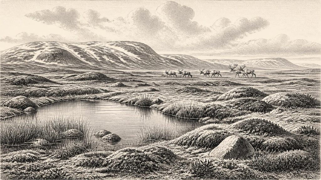
The plants and animals preserved in the Derryvree sediments indicate open tundra vegetation and a periglacial regime. “Periglacial” does not mean that the site lay beside an ice wall at all times. It describes a landscape strongly governed by severe cold, frozen ground and frost action. The old wetland probably included shallow freshwater, marshy margins, mosses, sedges and hardy herbs. The vegetation was treeless or nearly so. Familiar later Irish landscapes of dense woodland, deep peat bog and enclosed pasture belong to much more recent millennia and should not be projected backwards.
This was nevertheless a living landscape, not an empty white wasteland. Short growing seasons could still support productive bursts of grasses, sedges and flowering herbs. Such plant communities offered forage to herbivores, especially in sheltered places and during favourable seasons. The precise distribution of water, vegetation and snow cover would have varied sharply with local relief, drainage and exposure to Atlantic weather. Derryvree supplies evidence for one inland environmental window; it cannot provide a complete inventory of every region of Ireland.
Animals in the Cave Record
Castlepook Cave is the other key site for this period. Its antiquarian excavations yielded a large but difficult collection of bones, now associated with the National Museum of Ireland. The broader Castlepook fauna includes cold- and open-country animals such as reindeer, mountain hare, Arctic fox, wolves, lemmings, brown bear, horse, giant deer, mammoth and spotted hyaena. It demonstrates that Ireland was, at intervals during MIS 3, connected ecologically to the wider north-west European world and capable of supporting strikingly different animal communities from those of later historic Ireland.
That list must be handled carefully. Cave collections accumulated over long periods and through several processes: carnivores could drag remains into dens; animals could die in caves; water and sediment could move bones; and early excavators did not recover or record deposits to modern standards. Improved radiocarbon pretreatment has also shown that several older dates from Irish cave bones require reassessment. The presence of mammoth, hyaena and reindeer in the Castlepook archive does not prove that those species stood together around Doneraile in 31,811 BCE, nor that they formed one simultaneous hunting ground.
Reindeer are especially relevant because they point towards open, cold-adapted country. Their movements could have been seasonal and their local numbers are unknowable, but a reindeer landscape was unlike a wooded Holocene deer park. Predators and scavengers followed prey or carrion, while caves could provide shelter or dens. The faunal evidence supports an interpretation of shifting ecological opportunities, not a stable or populous ecosystem known in detail.
The Castlepook Human Question
A reindeer hind-leg femur from Castlepook has acquired special significance because zooarchaeologist Ruth Carden identified a deep mark interpreted as having been made by a sharp stone tool during carcass processing. County Cork heritage material dates the specimen approximately to 31,000 BCE and presents it as evidence that Stone Age hunters may have handled reindeer in the Doneraile area. If the mark is confirmed as anthropogenic and contemporary with the animal’s death, it would be the earliest known evidence of human activity in Ireland by a very large margin.
The finding is promising rather than conclusive proof of a settled population. The bone came from an old collection, not a newly excavated, securely stratified occupation floor. Its radiocarbon measurement dates the animal’s death, not necessarily the making of the mark, the place where the carcass was killed, or the period during which people may have visited. The cave has yielded no securely associated stone toolkit, hearth, dwelling, burial, art or repeated domestic debris from this remote period. Indeed, the possibility that a carcass was butchered elsewhere and a discarded bone later carried into the cave by carnivores remains an important distinction.
Consequently, the most defensible conclusion is modest but significant: small groups of Upper Palaeolithic hunter-gatherers may have reached Ireland during a comparatively favourable MIS 3 interval and exploited reindeer or other animals. Their presence is possible and perhaps indicated by the marked femur; permanent settlement, a continuous population and descent from them to later Irish communities are not demonstrated. The term “Irish” is geographical here, not an ethnic, linguistic or political identity for people who may have briefly travelled across this changing landscape.
Society Beyond the Evidence
If people were present, their practical life would have been constrained by mobility, weather and food. In north-west Europe, Upper Palaeolithic communities used stone tools, made clothing and shelters from available materials, and followed seasonal resources. That wider context makes a hunting visit to Ireland plausible, but it must not be converted into unsupported claims about Castlepook itself. Irish evidence does not reveal the visitors’ language, group size, kinship arrangements, camp layout or technology beyond the possible action implied by a single bone mark.
There is no evidence in Ireland at this date for political institutions, named leaders, warfare, diplomacy, agriculture, livestock, trade routes, formal religion, monuments or learning in the later historical sense. Nor can artefacts or stories from mainland Europe be assigned to Ireland merely because people elsewhere made them. A temporary hunter-gatherer visit would have involved social knowledge and practical skill, but neither can be reconstructed in local detail.
An Island Not Yet Fixed
Sea level was much lower during the Ice Age than today, exposing extensive continental-shelf land around Ireland and Britain. Yet lower sea level did not automatically create a simple, dry and safe land bridge. The Irish Sea basin, changing coastlines, rivers, ice margins and cold maritime conditions created barriers as well as possible routes. Any human movement into Ireland would have depended on a particular combination of geography, season, weather and ice conditions. The evidence does not presently identify which route, if any, was used.
For 31,811 BCE, then, the chief development is not a recoverable political event but a threshold of possibility. Derryvree shows that a cold, open freshwater and tundra environment existed in Ireland during a broad interval encompassing this date. Castlepook preserves a wider MIS 3 fauna and a reindeer bone that may record human butchery. Later ice expansion obscured much of the evidence. What survives points to an ecologically connected, climatically severe and rapidly changing Ireland, while reminding us how little can honestly be claimed about one year so far beyond written history.
Primary Sources
- A Middle Midlandian Freshwater Series at Derryvree, Maguiresbridge, County Fermanagh, Northern Ireland
- Figure 6.— The Subdivision of the Quaternary Period in Ireland
- The Irish Quaternary Fauna Project
- A Reconsideration of the Radiocarbon Dating of the Marine Isotope Stage 3 Fauna from Southern Ireland
- Heritage Artefacts of County Cork
- Archaeological Heritage of County Cork
- Europe and the County of Cork: A Heritage Perspective
- Archaeology Research Excavation Grant 2022
- Castlepook Cave, Co. Cork, 2022
- Prehistoric Details: Mell Flint Flake
- Stone Age
- Growth and Retreat of the Last British–Irish Ice Sheet, 31,000 to 15,000 Years Ago: The BRITICE-CHRONO Reconstruction
- BRITICE-CHRONO Maps and GIS Data of the Last British-Irish Ice Sheet 31 to 15 ka
- Timing, Pace and Controls on Ice Sheet Retreat: An Introduction to the BRITICE-CHRONO Transect Reconstructions of the British-Irish Ice Sheet
- Extent and Deglacial Chronology of the Last British–Irish Ice Sheet: Implications of Exposure Dating Using Cosmogenic Isotopes
- Dimensions and Chronology of the Last Ice Sheet in Western Ireland
- Maximum Extent and Readvance Dynamics of the Irish Sea Ice Stream and Irish Sea Glacier Since the Last Glacial Maximum
- The Timing and Magnitude of the British–Irish Ice Sheet Between Marine Isotope Stages 5d and 2
- The IntCal20 Northern Hemisphere Radiocarbon Age Calibration Curve (0–55 cal kBP)
- IntCal Publications
- New Insights on the Fauna of Ireland’s Younger Dryas and Early Holocene from Alice & Gwendoline Cave
- Ireland’s Palaeolithic Archaeology – Fleeting Footprints in a Frozen Land




