

Bogbean Under Derryvree31807 BCE
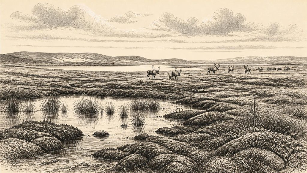
31,807 BCE is a modern marker within unstable Marine Isotope Stage 3, not a documented Irish year. Derryvree, County Fermanagh, preserves freshwater sediments between glacial tills, dated broadly enough to encompass this period. Bogbean, mosses, sedges, insects and sparse herbs indicate cold, open, wet tundra-like ground during an ice-free interval. Greenagho confirms intermittent freshwater environments, challenging assumptions of continuous ice cover. Castlepook Cave records cold-stage fauna, including reindeer, mammoth, predators and scavengers, but represents successive episodes rather than one community. A possible cut-marked reindeer bone suggests transient Upper Palaeolithic visitors, not settlement. Ireland was a shifting frontier before maximum glaciation.
Dateline
Modern calendar-year precision is not available for 31,807 BCE. No Irish community kept a calendar, wrote an annal or left a monument that can be assigned to that numbered year. The date is best treated as a modern index for a point roughly 33,800 calendar years before AD 1950, during the Late Pleistocene and broadly within Marine Isotope Stage 3 (MIS 3), a long, unstable part of the last Ice Age. The responsible evidence is consequently indirect: sediments trapped beneath later glacial deposits, fossil pollen and plants, animal bone from caves, and the landforms left by ice. These sources illuminate intervals spanning centuries or millennia, not a single year.
Dating a Vanished Landscape
At this depth in time, the distinction between radiocarbon years and calibrated calendar years matters. Radiocarbon determinations measure the remaining carbon-14 in organic material; they must then be calibrated against independent records of past atmospheric carbon-14. The resulting calendar ranges are usually broad, especially beyond 30,000 years ago. A date may establish that a deposit belongs to a general climatic episode without proving that its plants, animals or people were present in any particular season of 31,807 BCE.
The date falls before the global Last Glacial Maximum, conventionally placed at about 26,500–19,000 years ago, when the last Irish Ice Sheet became far more extensive. It was nevertheless no tranquil prelude. MIS 3 was marked across the North Atlantic by abrupt climatic swings. Ice margins advanced and retreated; sea level, coastlines and animal routes changed; and areas that were habitable in one interval could later be overridden by ice. Ireland’s evidence records this changing world unevenly, because later glaciers eroded, buried and rearranged much of what had existed before them.
A Freshwater Archive at Derryvree
The most useful Irish environmental evidence close to this broad horizon comes from Derryvree, near Maguiresbridge in County Fermanagh. Roadworks in 1969 exposed organic silts and fine sands between two tills, the compact debris laid down by separate glacial advances. The intervening freshwater deposit formed when the locality was not beneath glacier ice and was later sealed beneath renewed ice. Organic material produced a radiocarbon age of 30,500 ± 1,170/1,030 radiocarbon years before present. Published calibration places this within an approximate range of 36,900–31,700 calendar years before present. That wide interval encompasses the modern date under discussion, but it cannot make Derryvree a year-by-year record.
Its contents are nevertheless exceptionally informative. Poorly preserved pollen was dominated by herbaceous plants, while plant macrofossils, mosses and insect remains add substantial detail. Together they support an interpretation of open tundra or muskeg-like terrain: mossy, sedgy, wet ground, shallow freshwater and sparse dry-land vegetation affected by a periglacial climate of repeated freezing and thawing. A fossil seed of bogbean, a plant of wet places, is a modest but vivid reminder that this was not a lifeless white desert. In favourable seasons, water, mosses, sedges, grasses and herbs supported a productive, if exacting, ecology.
This should not be expanded into a panoramic certainty. Derryvree was one locality in south Fermanagh, not a weather station for the whole island. A few grains of pine or hazel pollen do not demonstrate a local forest: they may have travelled far or been reworked from older material. The stronger conclusion is negative as well as positive. There is no evidence here for the wooded, farmed Ireland of later prehistory. The landscape was predominantly open, cold and wet, with vegetation low to the ground.
Ground Between Ice Advances
Greenagho, near Belcoo in the same broad Fermanagh region, supplies a complementary record. Organic material from a lake deposit beneath till produced an age calibrated to about 37,200–35,700 calendar years before present. It is earlier than the date considered here, but demonstrates that ice-free freshwater environments occurred in north-central Ireland during MIS 3. Taken with Derryvree, it argues against the old assumption that Ireland was simply and continuously ice-covered until the final glacial maximum.
That does not mean all Ireland was simultaneously free of ice or joined by a straightforward land bridge to Britain and continental Europe. The British–Irish Ice Sheet had already developed and behaved dynamically. Marine evidence points to fluctuating, sometimes calving ice margins, while later glacial growth eventually transformed the island. Lower global sea levels exposed more of the continental shelf than exists today, but local relative sea level was also affected by the immense weight of neighbouring ice. For 31,807 BCE, it is safer to speak of shifting ecological connections and changing coastal plains than to draw a definite migration corridor across a modern map.
Castlepook’s Uneven Fauna
Far to the south, Castlepook Cave near Doneraile in north County Cork is Ireland’s richest known cave archive for vertebrates preceding the Last Glacial Maximum. Excavations in the late nineteenth and early twentieth centuries recovered a large and complicated assemblage, including remains attributed to reindeer, giant deer, woolly mammoth, brown bear, wolf, fox, Arctic fox, hare, lemmings and spotted hyaena. The cave therefore establishes that parts of Ireland could support, at different times, a strikingly varied cold-stage fauna.
It cannot, however, be used as a single scene in which every species stands together on the same hillside. Cave bones arrived through many processes: carnivores carried in prey and scavenged carcasses; animals died in or near the cave; water moved sediment; and early excavations did not record every layer to modern standards. Spotted hyaena is particularly important because Castlepook is Ireland’s only known site for the species, and its presence helps explain the accumulated bones and gnawed remains. Recent redating of bone collagen has also shown that several older Irish cave dates were too young, in some cases by thousands of radiocarbon years. The revised chronology suggests that giant deer and spotted hyaena may have disappeared locally before the Last Glacial Maximum, perhaps around 40,000 calibrated years before present.
The evidence closest to 31,807 BCE should thus be read as a sequence of faunal episodes, not a census. Reindeer and mammoth show that grazing animals entered Irish landscapes during parts of MIS 3; predators and scavengers followed the resources available to them. Their presence implies seasonal forage, water and routes through the wider north-west European region. It does not tell us where every herd wintered, whether migration occurred annually, or how long any population remained.
The Human Question
Human history at this date is even more tentative. A reindeer femur from Castlepook has been identified as bearing a cut mark consistent with a sharp stone tool and has been reported as dating to about 33,000 years ago. If that interpretation and association stand, it is important evidence that Upper Palaeolithic people processed a reindeer in Ireland far earlier than the previously accepted terminal-Pleistocene indications of human activity. It is evidence for an action involving an animal carcass, not for a settled population.
No securely associated stone-tool assemblage, hearth, dwelling floor, burial, artwork or occupation layer has yet been recovered from Castlepook for this period. Nor is the cave necessarily the place where an animal was killed or butchered; a carnivore could have transported a discarded bone into its den. The most cautious interpretation is that one or more small, mobile hunting groups may have reached Ireland during a favourable interval and exploited large game. Permanent settlement, population size, language, kinship, clothing and routes of arrival remain unknown.
Society Without States
There is no evidence for political institutions, named leaders, territories, diplomacy, warfare or organised religion in Ireland at this time. Such categories belong to much later archaeological and written worlds. If people were present, their social life would have been organised at the scale of small foraging groups rather than states. Hunting, butchery, hide-working, the sharing of food and knowledge of shifting terrain are plausible activities in a north-west European Upper Palaeolithic context, but they cannot be demonstrated specifically for Ireland in 31,807 BCE.
Likewise, there is no basis for describing trade in Irish goods. Movement of people, animals and useful stone across exposed shelves may be inferred as a regional possibility, yet no Irish exchange network is archaeologically visible. The essential economy was ecological rather than commercial: plants grew during short seasons, herbivores grazed open ground, predators followed prey, and any human visitors had to make decisions in a landscape whose ice, water and animal resources could alter over generations.
What This Date Can Mean
31,807 BCE is therefore best understood not as an eventful “year” but as a point within a precarious interval before maximum glaciation. Derryvree preserves the clearest local image: freshwater silts, bogbean, mosses and tundra plants in a cold, open Fermanagh landscape. Castlepook preserves a longer and more complex southern record of animals moving through an Ice-Age world, with a possible trace of human carcass processing. Both records show that Late Pleistocene Ireland was neither the familiar island of later history nor an empty abstraction. It was a changing frontier of wet ground, sparse vegetation, mobile fauna and encroaching ice, known chiefly through the fragile materials that survived beneath it.
Primary Sources
- A Reconsideration of the Radiocarbon Dating of the Marine Isotope Stage 3 Fauna from Southern Ireland
- Castlepook Cave, County Geological Site Report
- Trimlines, Blockfields and the Vertical Extent of the Last Ice Sheet in Southern Ireland
- The Timing and Magnitude of the British–Irish Ice Sheet Between Marine Isotope Stages 5d and 2
- Growth and Retreat of the Last British–Irish Ice Sheet, 31,000 to 15,000 Years Ago: the BRITICE-CHRONO Reconstruction
- Growth, Dynamics and Deglaciation of the Last British-Irish Ice Sheet: the Deep-Sea Ice-Rafted Detritus Record
- Middle Midlandian Interstadial Deposits at Greenagho, Near Belcoo, County Fermanagh, Northern Ireland
- Palaeoecology: Field Guide 16
- The Subdivision of the Quaternary Period in Ireland
- Environmental and Social Change in the Upper Palaeolithic and Mesolithic of Northern Ireland
- Areas of Scientific Interest in County Cork
- Archaeological Heritage of County Cork
- Heritage Artefacts of County Cork
- 2022:564 – Castlepook Cave, Castlepook South, Cork
- Ireland’s Palaeolithic Archaeology – Fleeting Footprints in a Frozen Land
- New Insights on the Fauna of Ireland’s Younger Dryas and Early Holocene from Alice & Gwendoline Cave
- The IntCal20 Northern Hemisphere Radiocarbon Age Calibration Curve (0–55 cal kBP)
- A Stratigraphic Framework for Abrupt Climatic Changes During the Last Glacial Period Based on Three Synchronized Greenland Ice-Core Records
- The Irish Quaternary Fauna Project
- Pleistocene Vertebrates in the British Isles





