
Fermanagh’s Mountain Avens31732 BCE
About 31,732 BCE, Ireland cannot be described through annual history, but through uncertain Late Pleistocene evidence. Derryvree, County Fermanagh, preserves freshwater silts between tills, dated broadly to 36,900–31,700 cal BP, indicating ice-free tundra-like wetlands with bogbean, mountain avens and other Arctic-alpine plants. Greenagho supports intermittent northern ice-free conditions, although glacier margins and coastal connections remain uncertain. Castlepook Cave in Cork records diverse MIS 3 fauna, including reindeer, mammoth, giant deer and predators. A possibly cut-marked reindeer bone suggests transient human activity, but no secure settlement evidence exists. Later ice expansion reworked landscapes, leaving environmental fragments rather than recoverable political history.
Dateline
The numerical label 31,732 BCE cannot be treated as a recoverable year in Irish history. No calendar, inscription, named leader, settlement sequence or environmental record permits an event to be placed in that single year. In the conventional archaeological scale, it lies about 33,682 years before AD 1950, or roughly 33.7 thousand calibrated years before present (cal BP). That puts it in the Late Pleistocene, within Marine Isotope Stage 3 (MIS 3), a long and climatically unstable part of the last Ice Age. The responsible history of Ireland at this point is therefore a history of dated ranges, buried sediments, animal remains and changing ice margins—not an annual chronicle.
Radiocarbon results do not translate directly into calendar dates. Atmospheric carbon-14 changed through time, and older samples require calibration against several independently dated records. IntCal20 extends the Northern Hemisphere calibration framework to 55,000 cal BP, but uncertainty remains substantial at this depth of time. The modern BCE date is useful as a filing point; it must not be mistaken for a precise ancient anniversary.
A Freshwater Interval at Derryvree
The most illuminating evidence close to this broad horizon comes from Derryvree, near Maguiresbridge in County Fermanagh. Road works in 1969 cut through a drumlin and exposed fine sands and organic freshwater silts lying between two thick deposits of till. This sequence is unusually valuable. The lower till records an earlier phase of glaciation; the silts accumulated when water, plants and animals occupied an ice-free local basin; and the upper till shows that later ice overran and sealed the deposit. It is a rare surviving fragment of a landscape that subsequent glaciation mostly destroyed or buried.
A conventional radiocarbon measurement from the Derryvree organic deposit was 30,500 ± 1,170 radiocarbon years BP. In later discussion, its calibrated span has been given broadly as c.36,900–31,700 cal BP. The nominal date considered here falls within that wide window, but this does not mean that the layer formed in 31,732 BCE, nor that all its plants and animals were contemporary. It means that Derryvree provides the closest securely relevant Irish environmental archive for understanding this stretch of time.
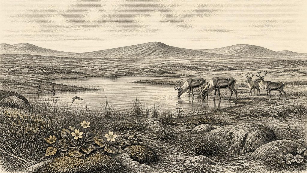
The assemblage describes a severe but not empty world. Pollen was poorly preserved, yet it was predominantly herbaceous. Plant macrofossils, mosses and invertebrates indicate open tundra-like vegetation, wet ground and freshwater conditions under a periglacial climate. Bogbean, a plant of shallow water and marshy margins, is represented by a fossil seed. Mountain avens and other Arctic-alpine elements point to short growing seasons, exposed soils and a treeless landscape rather than forest. Grasses, sedges, herbs and mosses could nevertheless make sheltered wet places productive during summer. The title image of an unbroken desert of snow would be as misleading as an image of a green modern countryside.
Ice, Water and Uncertain Coasts
Derryvree does not provide a map of all Ireland. It records a particular basin in the north-western part of the island, and its date range is broad. Nevertheless, it decisively complicates any simple belief that Ireland was continuously entombed under ice throughout the late Ice Age. Nearby Greenagho, also in County Fermanagh, has lacustrine organic material beneath till dated to c.37,200–35,700 cal BP. Together, such deposits suggest that north-central Ireland retained ice-free ground until at least about 34,000 cal BP, before the major build-up of the last Irish ice sheet. The exact position of glacier margins around 33.7 cal ka remains uncertain.
This uncertainty matters. Recent work shows that the British–Irish Ice Sheet had a longer and more dynamic pre-maximum history than once assumed, including retreat-and-advance phases during MIS 3. Its later growth was not a single wall moving evenly across the island. Uplands, basins, coastal waters and ice streams responded differently. The large-scale BRITICE-CHRONO reconstruction begins at 31,000 years ago, after this article’s notional date, because evidence for earlier margins is patchier and less securely dated. It depicts ice accumulating in northern Ireland as well as Scotland, while stressing the uncertainty inherent in reconstructing an ancient moving ice mass.
Sea level was far lower than today because water was held in continental ice sheets. Coastlines lay farther out over parts of the continental shelf, and the geography of the Irish Sea and Celtic Sea was profoundly altered. Yet lowered sea level should not automatically be turned into a convenient land bridge. Local ice, broad rivers, tidal channels, rising and falling shorelines, and changing marine basins shaped possible routes. For a precise point around 33.7 cal ka, there is no evidence for a particular crossing route linking Ireland, Britain and mainland Europe. Connectivity was a shifting geographical possibility, not a demonstrated road.
Animals in a Cold Mosaic
Southern Irish caves provide the principal evidence for the island’s MIS 3 mammals. Castlepook Cave—also called Mammoth Cave or Doneraile Cave—in north Cork yielded a rich but complicated collection during antiquarian excavations in the early twentieth century. The cave’s deposits were disturbed and material from different periods could become mixed, a problem that makes modern re-dating and contextual excavation essential. Reassessment using improved radiocarbon preparation has shown that several Castlepook bones are much older than earlier results suggested, firmly placing important parts of the faunal record in MIS 3.
The fauna known from Castlepook includes reindeer, woolly mammoth, giant deer, brown bear, fox, Arctic fox, hare, lemmings, wolf and spotted hyaena. These remains do not prove that every species lived together at one moment, or that each ranged across the whole island. They do establish that Ireland, during phases of MIS 3, supported or received a substantially richer cold-stage fauna than the later historical island. The combination suggests a mosaic of open grazing ground, rocky shelter, wetlands and routes along which large herbivores and their predators could move. Carden and colleagues have argued that giant deer and spotted hyaena may have disappeared locally before the Last Glacial Maximum, perhaps around 40,000 cal BP; this is a regional interpretation from dated samples, not a claim that their final Irish disappearance can be fixed to a year.
The Castlepook Human Question
People may have entered this landscape, but the evidence is presently too slight to describe an Irish population. A reindeer femur from Castlepook has been reported as bearing a deep incision consistent with cutting during carcass processing and as dating to about 33,000 years ago. If the mark is confirmed as anthropogenic, it would be exceptionally early evidence for human activity in Ireland—far earlier than the well-established terminal-Pleistocene and Mesolithic record. It could indicate a brief visit by Upper Palaeolithic hunters who obtained meat, marrow, hide, sinew or bone from a reindeer carcass. It cannot demonstrate a village, a permanent homeland or a continuous occupation.
The caution is more than academic. No securely associated Upper Palaeolithic stone-tool assemblage, hearth, dwelling floor, human burial or stratified camp at this age has been identified in Ireland. Castlepook’s early excavations removed much of the original sedimentary context, and a 2022 investigation found surviving deposits but no cultural artefacts. The responsible conclusion is that an early human incursion is possible, perhaps even plausible in a wider north-west European setting, while a sustained Irish occupation around this time is unproven. A different interpretation, emphasising ecological constraints and the absence of diagnostic artefact assemblages, holds that lasting colonisation did not occur until the Early Holocene.
Society Beyond Recovery
There is no evidence for political institutions, rulers, territories, diplomacy, organised warfare, law or social ranks in Ireland at this horizon. Nor is there Irish evidence from which to reconstruct language, kinship rules, clothing styles, music, ritual or religious belief. The absence of such evidence must not be mistaken for proof that any visitors lacked social lives, knowledge or spiritual ideas. Mobile hunter-gatherers elsewhere in Upper Palaeolithic Europe had sophisticated technologies, seasonal knowledge and extensive social networks. But transferring those facts directly to Ireland would be interpretation, not evidence.
Even the basic question of everyday life has to remain conditional. If people reached Ireland, they would have needed formidable practical skills: reading the movements of reindeer and predators; selecting sheltered ground; managing fire; preserving food; and navigating a landscape where weather, frozen ground and water could change the cost of travel dramatically. Such a party may have carried tools and supplies with it and left little behind. Those are reasonable inferences from the environment and from Upper Palaeolithic lifeways elsewhere, but no excavated Irish camp allows them to be observed directly.
No Economy, No Trade Network
Farming, herding, metalworking, pottery, monumental construction and market exchange belong to much later Irish prehistory. Around this date there is no evidence for fields, livestock, granaries, mines, trade goods or built settlements. The only defensible economic setting is a natural one: the seasonal use of wild plants and animals, if people were present at all. Reindeer would have offered concentrated food and raw materials; wetland plants and freshwater may have supported birds, fish or small mammals, though no Irish evidence demonstrates their human use in this interval.
Regional change, rather than human politics, is the central development. The Derryvree silts preserve an interval when freshwater life and sparse vegetation endured between glacial advances. Castlepook preserves traces of animals moving through a southern limestone landscape. In the millennia ahead, the British–Irish Ice Sheet would expand far more extensively, reworking the ground and erasing much of the evidence needed for a fuller human history. What survives around 31,732 BCE is therefore precious precisely because it is incomplete: mountain avens and bogbean at a Fermanagh water margin, cave bones in north Cork, and an Ice-Age Ireland whose changing environments can be studied more securely than its people.
Primary Sources
- Palaeoecology
- Figure 6.— The Subdivision of the Quaternary Period in Ireland
- Trimlines, blockfields and the vertical extent of the last ice sheet in southern Ireland
- Middle Midlandian Interstadial Deposits at Greenagho, Near Belcoo, County Fermanagh, Northern Ireland
- A Reconsideration of the Radiocarbon Dating of the Marine Isotope Stage 3 Fauna from Southern Ireland
- The Irish Quaternary Fauna Project
- The Colonization of Ireland: A Human Ecology Perspective
- Growth and Retreat of the Last British–Irish Ice Sheet, 31,000 to 15,000 Years Ago: The BRITICE-CHRONO Reconstruction
- BRITICE-CHRONO Maps and GIS Data of the Last British-Irish Ice Sheet 31 to 15 ka, Including Model Reconstruction, Geochronometric Age Spreadsheet, Palaeotopographies and Coastline Positions
- The Timing and Magnitude of the British–Irish Ice Sheet Between Marine Isotope Stages 5d and 2: Implications for Glacio-Isostatic Adjustment, High Relative Sea Levels and ‘Giant Erratic’ Emplacement
- Late Pleistocene Chronostratigraphy and Ice Sheet Limits, Southern Ireland
- Freshwater Organic Deposits and Stratified Sediments Between Early and Late Midlandian (Devensian) Till Sheets, at Aghnadarragh, County Antrim, Northern Ireland
- The IntCal20 Northern Hemisphere Radiocarbon Age Calibration Curve (0–55 cal kBP)
- The IntCal20 Approach to Radiocarbon Calibration Curve Construction: A New Methodology Using Bayesian Splines and Errors-in-Variables
- A 60,000 Year Greenland Stratigraphic Ice Core Chronology
- A Stratigraphic Framework for Abrupt Climatic Changes During the Last Glacial Period Based on Three Synchronized Greenland Ice-Core Records: Refining and Extending the INTIMATE Event Stratigraphy
- First Evidence of a Late Upper Palaeolithic Human Presence in Ireland
- New Insights on the Fauna of Ireland’s Younger Dryas and Early Holocene from Alice & Gwendoline Cave
- Archaeology Research Excavation Grant 2022
- 2022:564 – Castlepook Cave, Castlepook South, Cork
- Mammoth Cave
