
Maguirebridge’s Freshwater Interval31794 BCE
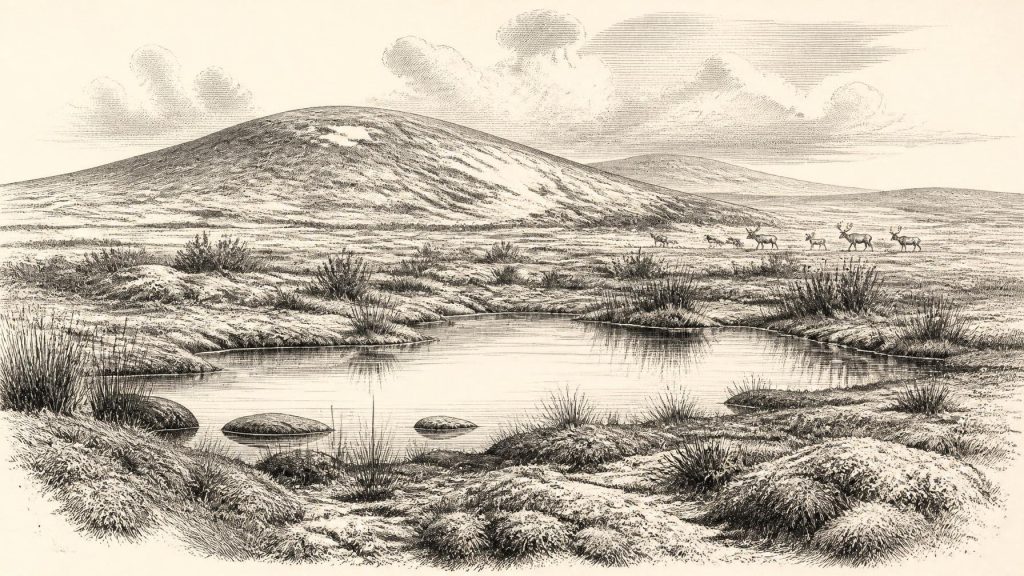
31,794 BCE cannot be treated as a precise Irish historical year, but falls within a fluctuating Late Glacial interval. At Derryvree near Maguiresbridge, Fermanagh, freshwater silts between glacial tills preserve evidence of an ice-free phase: open tundra, wetlands, sedges, mosses and cold-adapted insects. Conditions varied regionally as ice advanced and retreated before later extensive glaciation. Castlepook Cave, Cork, contains reindeer, mammoth and spotted hyena remains, showing a productive cold-stage fauna. A marked reindeer bone may indicate brief human activity around 33,000 years ago, but cannot prove settlement. The sparse record depicts a living, precarious landscape, reconstructed through deposits and probabilities.
Dateline
An Archaeological Time-Window
31,794 BCE is a modern chronological label, not a year that can be recovered from Ireland’s prehistoric evidence. No written record, annually layered archive, settlement sequence or securely dated event allows Irish history to be narrated at calendar-year precision this far back. In archaeological terms the date falls roughly 33,700 years ago, within the later part of the Last Glacial period and Marine Isotope Stage 3. Radiocarbon results of this age must be calibrated, and their ranges commonly span many centuries or millennia. The responsible task is therefore not to invent an episode for one numbered year, but to examine the dated environmental and faunal evidence that illuminates Ireland around this broad horizon.
The point in time lies near the beginning of Greenland Interstadial 6 in the Greenland ice-core chronology: a comparatively milder interval within an Ice Age marked by abrupt climatic swings. That does not mean that Ireland experienced a neat, instant warming in the year named here. Greenland ice cores provide a North Atlantic climatic framework, while Irish deposits preserve local conditions only intermittently. The available evidence suggests a cold, exposed and strongly seasonal island-region whose landscapes, ice margins, watercourses and animal populations changed repeatedly over long periods.
There was no Ireland in the political sense of a kingdom, people or nation. There are no rulers, alliances, wars, diplomatic exchanges, laws or institutions to identify. Nor is there evidence for permanent communities, cultivated fields, villages, monuments, burials, metalworking, writing or religious practice. These absences are historically important. They mark the limits of what can be known, and prevent later Irish identities from being projected back into a world tens of thousands of years before the first secure long-term settlement of the island.
Freshwater Beneath a Drumlin
The most informative Irish evidence close to this horizon comes from Derryvree, near Maguiresbridge in County Fermanagh. Road works in 1969 cut through a drumlin, exposing organic-rich freshwater silts and fine sands sealed between two distinct layers of till, the unsorted debris deposited by glaciers. The sequence records a simple but powerful relative history: an earlier ice advance laid down the lower till; an ice-free interval permitted a freshwater environment to form; and a later glacier covered the deposit with a new till sheet. Much of the Irish Pleistocene record was eroded or disturbed by later glaciation, making this survival exceptionally valuable.
The organic layers at Derryvree produced a conventional radiocarbon age of 30,500 years BP, with a substantial uncertainty of +1,170 and −1,030 years. Later calibration places the result broadly around 36,900–31,700 calibrated years BP. The nominal year 31,794 BCE lies within that wide interval, but this overlap must not be overstated. The deposit does not preserve a scene from that year, nor does it establish that every part of Ireland shared the same conditions at the same moment. It provides a long environmental window on north-central Ireland before the later, major expansion of the Irish sector of the British–Irish Ice Sheet.
Its pollen, plant macrofossils and insect remains indicate open tundra vegetation and a periglacial regime. Freshwater mosses and sedges grew around pools or slow water; cold-adapted insects add detail to a picture of wet ground amid an otherwise sparse landscape. Grasses, herbs and low shrubs were better suited to these conditions than dense woodland. Frost action, seasonal snow, short growing seasons and exposure would have shaped soils and vegetation. This was not a featureless white desert, however. Shallow basins, stream margins, sheltered hollows and patches of better-drained ground created a mosaic of habitats, each important to plants, invertebrates and grazing mammals.
A Land Between Ice Advances
Derryvree demonstrates that at least parts of Ireland were not continuously buried beneath ice during this phase. Other Fermanagh deposits, including evidence from Hollymount near Maguiresbridge and Greenagho near Belcoo, also point to cold non-glacial intervals, though their dating and correlation have limitations. The correct picture is regional and changing rather than a single nationwide map. Ice could persist in one district, advance from uplands or marine basins in another, and leave ice-free ground, lakes, river corridors or periglacial terrain elsewhere.
By comparison with the later Last Glacial Maximum, the Ireland of this period retained more environmental possibility. Large-scale reconstructions show that the British–Irish Ice Sheet expanded substantially after this broad interval, with different sectors reaching maximum positions at different times. Evidence from Derryvree and elsewhere is consistent with largely ice-free conditions in north-central Ireland until about 34,000 years ago, before the main build-up. Subsequent growth was neither instantaneous nor uniform. In the west and south, ice later reached the continental shelf and crossed the southern coast only after about 24,000 years ago; ice-sheet-wide maximum volume is modelled around 23,000 years ago. These later developments would erase, bury and transform many earlier landscapes.
Sea level was lower than today because vast quantities of water were locked in global ice sheets, and the surrounding shelf seas had a different shape. Yet neither the exact coastline nor the availability of crossings can be reconstructed securely for one particular year in this period. The presence of land animals in Ireland shows ecological connection with Britain and north-west Europe at intervals, but it does not by itself prove a specific land bridge, route or season of arrival. Any claim about a particular crossing would go beyond the evidence.
Castlepook’s Animal Evidence
In County Cork, Castlepook Cave near Doneraile—also called Mammoth Cave—offers the most striking faunal archive from the Irish Late Pleistocene. Excavations between 1904 and 1908 recovered a large collection of bones. Reassessment and radiocarbon dating of the cave material have shown that mammals including reindeer, spotted hyena and woolly mammoth belonged to the broad cold-stage world of roughly 45,000 to 30,000 years ago. The National Museum of Ireland regards Castlepook as Ireland’s most important cave site for mammal remains of the last cold stage.
These animals convey both opportunity and danger. Reindeer could have used open ground and seasonal forage, while mammoths attest to extensive herbivore habitat somewhere within the wider region. Spotted hyenas were major scavengers and predators. A cave containing their bones and those of prey cannot automatically be treated as a human camp: carnivores, water movement, excavation methods and later disturbance all affect what survives and where it is found. Cave deposits are not straightforward inventories of a living community. They require taphonomic study—analysis of how remains accumulated, were modified and were buried—before conclusions about the landscape can be drawn.
A reindeer femur from Castlepook has made this caution especially necessary. It has been reported as carrying a mark made while the bone was fresh and interpreted as possible evidence of cutting with a stone tool. Modern radiocarbon dating has placed the bone at approximately 33,000 years ago. If the modification is confirmed as anthropogenic, it may record a brief visit by Upper Palaeolithic people and the processing of a reindeer carcass, far earlier than Ireland’s formerly accepted evidence for human activity. It would not demonstrate a resident population, a settlement, a named culture or continuous occupation. No associated hearth, stone-tool assemblage, dwelling floor or securely excavated occupation layer has yet been identified at Castlepook.
People: Possibility, Not a Population
For that reason, human history at this date must be stated negatively and carefully. Ireland may have been visited episodically by highly mobile hunter-gatherers during favourable intervals, perhaps from populations already present in Britain or continental north-west Europe. Such people elsewhere used sophisticated stone technologies, hunted and scavenged animals, made clothing and shelters, maintained social networks and sometimes produced art. None of those continental facts can be assumed for Ireland without Irish evidence. The Castlepook bone is a significant clue, not a licence to supply an Irish campfire, trading system, ritual life or political world from imagination.
The absence of identifiable human communities also means that economy and exchange cannot be described in normal historical terms. There is no evidence here for farming, livestock management, domestic food production, markets or trade. The only securely visible economy is ecological: plants converted a brief growing season into forage; herbivores moved through available habitat; carnivores and scavengers followed them; freshwater margins supported their own small but vital communities. If people were present, animal fat, meat, hide, sinew, bone and antler would have been valuable resources, but this remains an inference from wider Upper Palaeolithic practice rather than a demonstrated Irish activity.
What This Date Can Mean
31,794 BCE is therefore best understood as a point within a dynamic interval, not as a conventional historical year. Derryvree preserves direct evidence for cold, open, freshwater-edged tundra in Fermanagh during a pre-maximum ice-free phase. Castlepook preserves evidence that large mammals occupied parts of Ireland’s wider Late Pleistocene landscape, and a debated indication that people may have briefly done so as well. Together, these records replace any simple tale of an eternally frozen, empty island. They do not establish an inhabited country in the later sense.
The great development was environmental instability. Local wetlands and tundra communities existed between advances of ice; animal populations reached Ireland at intervals; and changing climate was gradually preparing the conditions for the much more extensive glaciation that followed. The record is sparse because later ice was an active geological force, not because nothing happened. What survives beneath a drumlin in Fermanagh and within a Cork cave is enough to show a living but precarious landscape—and enough to remind us that deep prehistory is reconstructed from ranges, deposits and probabilities, rather than exact dates and invented events.
Primary Sources
- A Middle Midlandian Freshwater Series at Derryvree, Maguiresbridge, County Fermanagh, Northern Ireland
- Early Midlandian–Middle Midlandian, Pleistocene, Northern Ireland
- Trimlines, Blockfields and the Vertical Extent of the Last Ice Sheet in Southern Ireland
- Growth and Retreat of the Last British–Irish Ice Sheet, 31,000 to 15,000 Years Ago: the BRITICE-CHRONO Reconstruction
- Pattern and Timing of Retreat of the Last British-Irish Ice Sheet
- Maximum Extent and Dynamic Behaviour of the Last British–Irish Ice Sheet West of Ireland
- Radiocarbon Constraints on the Age of the Maximum Advance of the British-Irish Ice Sheet in the Celtic Sea
- Timing and Pace of Ice-Sheet Withdrawal Across the Marine–Terrestrial Transition West of Ireland During the Last Glaciation
- Early Deglaciation of the British-Irish Ice Sheet on the Atlantic Shelf Northwest of Ireland Driven by Glacioisostatic Depression and High Relative Sea Level
- Exploring Controls of the Early and Stepped Deglaciation on the Western Margin of the British Irish Ice Sheet
- Spotted Hyena Skull
- Heritage Artefacts of County Cork
- The Irish Quaternary Fauna Project
- Irish Pleistocene Biostratigraphy
- The Subdivision of the Quaternary Period in Ireland
- A Stratigraphic Framework for Abrupt Climatic Changes During the Last Glacial Period Based on Three Synchronized Greenland Ice-Core Records: Refining and Extending the INTIMATE Event Stratigraphy
- Independent Tephrochronological Evidence for Rapid and Synchronous Oceanic and Atmospheric Temperature Rises Over the Greenland Stadial-Interstadial Transitions Between ca. 32 and 40 ka b2k
- Consistently Dated Atlantic Sediment Cores Over the Last 40 Thousand Years
- The Mesolithic in Ireland: When Was It?
- On the Cave of Castlepook, Near Doneraile, Co. Cork
- Ireland's Palaeolithic Archaeology – Fleeting Footprints in a Frozen Land
- What Was on the Menu in Prehistoric Ireland?
- New Insights on the Fauna of Ireland's Younger Dryas and Early Holocene from Alice & Gwendoline Cave
