
Birm-166 at Derryvree31617 BCE
About 31,617 BCE, Ireland lay within the unstable later Marine Isotope Stage 3, rather than a precisely datable year. At Derryvree, County Fermanagh, organic freshwater sediments between glacial tills demonstrate an ice-free interval with cold, treeless tundra wetland, although they cannot define island-wide conditions. Comparable deposits and Crag Cave calcite confirm intermittent milder phases before major ice-sheet growth. Cave remains, notably at Castlepook, show reindeer, mammoth, hyaena and other mammals connected Ireland to European faunas. A possibly cut-marked reindeer femur suggests, but does not prove, a potential human presence. Evidence supports mobile visitors, not permanent settlement, agriculture, or recorded society.
Dateline
The label “31,617 BCE” is a modern chronological convenience, not a year that anybody in prehistoric Ireland could have named or recorded. No written calendar, ruler-list, settlement sequence or archaeological layer can be assigned to that single year. The responsible history of this point in time is therefore a history of ranges, deposits and probabilities. It falls broadly within the later part of Marine Isotope Stage 3 (MIS 3), a highly variable phase of the last Ice Age, and just before the major expansion of the last British–Irish Ice Sheet. Ireland was not yet the familiar wooded island of later prehistory. Its landscapes were changing sharply between cold, open environments, local freshwater habitats and advancing ice.
A Date Range, Not a Dated Event
At this depth of time, radiocarbon dates require particular care. A radiocarbon measurement records the remaining carbon-14 in once-living material, not a calendar date; it must then be calibrated against independently constructed records of past atmospheric carbon. The modern IntCal20 calibration curve extends to 55,000 calendar years before present, but calibrated results at this age remain ranges, sometimes with more than one possible interval. “Before present” conventionally means before AD 1950. Thus 31,617 BCE lies approximately 33,567 calendar years before present, but that conversion should not imply accuracy to a year.
The most useful Irish evidence close to this horizon comes from Derryvree, near Maguiresbridge in County Fermanagh. Organic freshwater silts and fine sands exposed during roadworks in 1969 lay between two thick sheets of glacial till within a drumlin. The organic deposit produced a conventional radiocarbon determination of 30,500 radiocarbon years before present, with a substantial error range. Later calibration has placed the wider Derryvree interval at roughly 36,900–31,700 calibrated years before present. The named year therefore belongs within the broad chronological world illuminated by the deposit, but Derryvree cannot tell us what happened there in that particular year.
Freshwater Between the Ice Advances
The arrangement of the Derryvree deposits is itself the central historical evidence. Till is sediment deposited directly by glacier ice. Beneath the freshwater bed lies one glacial deposit; above it lies another. Between those episodes, the locality supported standing or slow-moving freshwater and accumulated organic silt. This proves an interval in which ice did not cover that ground. It does not prove that the entire island was ice-free, nor does it map the exact edge of every glacier. Yet it decisively rules out a simple picture of Ireland as an unchanging, wholly frozen land throughout the period.
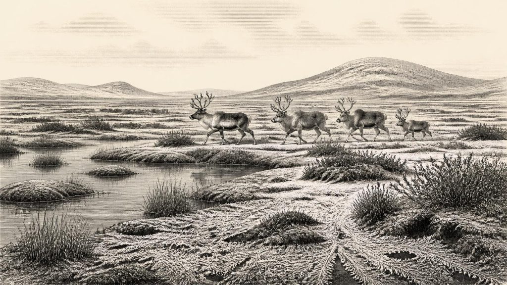
Plant macrofossils, pollen and small animal remains from Derryvree point towards an open, cold and largely treeless periglacial landscape. Pollen preservation was poor, and conclusions must remain proportionate to that limitation. Nevertheless, the plant evidence included herbaceous taxa associated with tundra, while mosses and wetland plants indicate waterlogged ground. Researchers have described a setting comparable in some respects to muskeg: sedge- and moss-rich wet ground, shallow pools and frost-affected soils. In a short growing season, low vegetation would have dominated exposed slopes and river margins. There is no sound evidence here for the oak, hazel and dense mixed woodland usually imagined as “Irish countryside”.
An Unstable Ice-Age Climate
Derryvree was not an isolated curiosity. Other Irish deposits beneath later glacial sediments, including records near Belcoo and Maguiresbridge, indicate that non-glacial environments survived during portions of the Midlandian glaciation. In south-west Ireland, uranium-thorium dating of broken cave calcite at Crag Cave has shown that speleothems formed episodically during MIS 3. Because calcite needs liquid water to grow, these episodes provide independent evidence that milder intervals interrupted the harsher conditions of the last glacial cycle.
That does not mean warmth in any modern sense. The Irish landmass stood on the Atlantic edge of north-west Europe, subject to abrupt climatic oscillations reflected in Greenland ice cores and North Atlantic records. Freezing conditions, snow cover, seasonal thaw, strong winds and ground frost would have structured life. Ice sheets did not necessarily grow as a uniform wall from all directions: their margins advanced, changed flow and sometimes paused or retreated. The best recent reconstructions place the principal growth of the last British–Irish Ice Sheet between about 31,000 and 26,000 years before present, with maximum extent reached later. Around this horizon, environmental transformation mattered more than any recoverable human political event.
Caves and the Animal World
The richest evidence for animals in southern Ireland comes from limestone caves, especially Castlepook Cave near Doneraile in north County Cork. Excavated in the early twentieth century and revisited by recent research, the cave has yielded a striking Pleistocene fauna. Re-dating has shown that some Castlepook material is considerably older than earlier laboratory results suggested. The wider Irish Quaternary Fauna Project concluded that a varied mammalian fauna reached Ireland between at least about 45,000 and 20,000 years ago, though cave deposits frequently have disturbed histories and individual bones cannot always be treated as a single contemporaneous assemblage.
Reindeer are especially relevant to the landscape around 31,617 BCE. Their presence is consistent with open, cold country where lichens, sedges, grasses and dwarf shrubs could sustain seasonal movements. Castlepook also preserves evidence for animals now absent from Ireland, including spotted hyaena and woolly mammoth, alongside bears and smaller mammals. Such finds demonstrate that Ireland was periodically connected ecologically to wider north-western European faunal networks. They do not demonstrate that every listed species met at the cave, shared one habitat, or survived to the exact year under discussion. Cave bone collections record death, scavenging, denning, water movement and excavation history as well as living communities.
The Castlepook Human Question
This period has exceptional importance because a reindeer femur from Castlepook has been interpreted as carrying a deep cut made by a sharp stone edge during butchery. County Cork heritage material dates the object broadly to about 31,000 BC, and its identification has opened the possibility that Upper Palaeolithic hunters reached Ireland far earlier than the previously accepted evidence of human activity. The implication is considerable: people may have followed or encountered reindeer herds on the western edge of Ice-Age Europe.
But the distinction between evidence and interpretation is essential. The bone is direct evidence that a reindeer existed; the surface mark is the subject of a specialist interpretation as a tool cut. No stone tool has been securely linked to the femur, no camp floor of equivalent age has been excavated in Ireland, and the cave was not found in an intact modern excavation context. Furthermore, the cave may have been a carnivore den or a place where scavengers accumulated parts of carcasses, rather than a hunting station. The most cautious conclusion is not that Ireland possessed a permanent population, village or territory at this date. It is that a human visit or short-lived presence in southern Ireland is plausible and potentially signalled by the Castlepook bone.
Life Without a Recorded Society
If people did enter Ireland during this wider period, their lives would have been mobile and practical. Comparable Upper Palaeolithic groups elsewhere in north-west Europe used stone-edged tools, managed fire, made clothing and equipment from animal materials, and moved through seasonal landscapes in small social groups. Those comparisons can suggest what visitors to Ireland may have needed: warmth, shelter, fresh water, reliable routes and access to large game. They cannot supply Irish proof for clothing styles, language, kinship, ritual practice, artistic traditions or the number of people present.
There is no evidence for farming, livestock, fields, pottery, metalworking, permanent houses, exchange institutions or long-distance Irish trade at this date. Nor can archaeologists identify political affairs, warfare, diplomacy, chiefs, tribes or borders. The term “Ireland” is geographical here, referring to the landmass that later became the island, not to a state or people. Lower global sea levels changed coastlines and shelf environments, but this should not be turned automatically into a claim of a walkable land bridge. The channels, ice margins, changing sea levels and practical routes available to animals or people varied through time.
What This Moment Means
The enduring development around 31,617 BCE was the creation of a harsh but not lifeless Irish environment during an unstable Ice-Age interval. Derryvree’s freshwater sediments preserve the strongest local picture: tundra-like wetland thriving between separate glacial advances. Castlepook’s fauna shows that large mammals repeatedly reached southern Ireland, and its marked reindeer femur raises the serious, still limited possibility of a human encounter with that world. The record is fragmentary, but it is not empty. Its lesson is one of caution: deep Irish history begins here not with kings or monuments, but with silts beneath a drumlin, bones in a cave and the advancing shadow of ice.
Primary Sources
- A Middle Midlandian Freshwater Series at Derryvree, Maguiresbridge, County Fermanagh, Northern Ireland
- A Reconsideration of the Radiocarbon Dating of the Marine Isotope Stage 3 Fauna from Southern Ireland
- The Irish Quaternary Fauna Project
- Episodic Speleothem Deposition Tracks the Terrestrial Impact of Millennial-Scale Last Glacial Climate Variability in SW Ireland
- Late Pleistocene Chronostratigraphy and Ice Sheet Limits, Southern Ireland
- Timing and Pace of Ice-Sheet Withdrawal Across the Marine–Terrestrial Transition West of Ireland During the Last Glaciation
- Growth and Retreat of the Last British–Irish Ice Sheet, 31,000 to 15,000 Years Ago: the BRITICE-CHRONO Reconstruction
- The Timing and Magnitude of the British–Irish Ice Sheet Between Marine Isotope Stages 5d and 2
- The IntCal20 Northern Hemisphere Radiocarbon Age Calibration Curve (0–55 cal kBP)
- Palaeoecology: Irish Quaternary Association Field Guide
- Heritage Artefacts of County Cork
- 2022:564 – Castlepook Cave, Castlepook South, Cork
- First Evidence of a Late Upper Palaeolithic Human Presence in Ireland
- New Insights on the Fauna of Ireland’s Younger Dryas and Early Holocene from Alice & Gwendoline Cave
- Irish Quaternary Association
- Quaternary Geomorphology Map Service
- Timing and Pace of Ice-Sheet Withdrawal Across the Marine–Terrestrial Transition West of Ireland During the Last Glaciation
- Growth and Retreat of the Last British–Irish Ice Sheet, 31,000 to 15,000 Years Ago
- Late Pleistocene Chronostratigraphy and Ice Sheet Limits, Southern Ireland
- Episodic Speleothem Deposition Tracks the Terrestrial Impact of Millennial-Scale Last Glacial Climate Variability in SW Ireland
- First Evidence of a Late Upper Palaeolithic Human Presence in Ireland