
Stone Mark in the Awbeg31616 BCE
Around 31,616 BCE, Ireland lay within the climatically unstable Marine Isotope Stage 3, before the Last Glacial Maximum. Evidence indicates varied cold environments, including tundra wetlands at Derryvree, County Fermanagh, and open-country ecosystems supporting large mammals. Castlepook Cave in County Cork preserves a time-layered fauna of mammoth, reindeer, giant deer, predators and smaller cold-adapted animals. A deeply incised reindeer femur may bear a stone-tool butchery mark, potentially indicating a brief Upper Palaeolithic human visit. However, its context is disturbed and inconclusive. No evidence supports permanent settlement, society or continuity. The period is chiefly understood through fragmentary environmental and archaeological records.
Dateline
The label 31,616 BCE is a modern chronological convenience, not a date that can be matched to an Irish event, ruler, settlement or season. No calendar, written record or archaeological sequence can resolve life in Ireland to this individual year. Expressed in the conventions used by Quaternary scientists, it lies approximately 33,566 years before AD 1950, within Marine Isotope Stage 3 (MIS 3), a long and climatically unstable part of the last Ice Age. At this depth of time, radiocarbon results require calibration and are properly presented as ranges or broad phases. The evidence can illuminate an Ireland of cold environments, mobile animals and changing access to surrounding lands; it cannot provide a year-by-year national narrative.
A Landscape Before the Maximum
This was not yet the Last Glacial Maximum, the point at which the British–Irish Ice Sheet reached its greatest late-Pleistocene extent, broadly between about 27,000 and 23,000 years ago in different sectors. Ice was nevertheless an increasingly decisive force in the region. Later glaciers scraped away, buried or reworked much of the older Irish land surface. Their legacy is visible in tills, drumlins, scoured rock, meltwater channels and offshore landforms, but these features cannot identify conditions in a particular valley in 31,616 BCE.
The most responsible picture is therefore regional and provisional. Ireland was part of north-west Europe’s glacial-world margin: a place whose climates changed sharply over millennia and sometimes more rapidly. Greenland ice cores demonstrate repeated abrupt switches between colder stadials and relatively milder interstadials across the last glacial period. Such records are essential for understanding the North Atlantic setting, but they are not an Irish thermometer. Local topography, snowfall, wind, water and proximity to ice meant that conditions differed across the island. There is no basis for imagining Ireland either as a uniformly frozen wasteland or as a stable, welcoming plain.
Sea level was much lower than today because vast volumes of water were stored in continental ice sheets. The coastline consequently lay far beyond many modern shores, and portions of the Irish Sea basin were exposed at lower stands. Yet low sea level does not by itself establish an easy, continuous land route between Ireland, Britain and continental Europe at this particular date. The detailed timing, elevation and interruption of possible connections remain subjects for palaeogeographical reconstruction. Animals certainly reached Ireland during parts of MIS 3. How each population crossed, and whether people could have followed the same routes, remains less certain.
The Derryvree Wetland Window
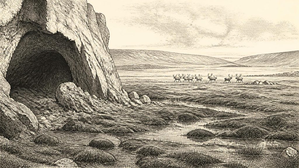
A rare Irish environmental archive comes from Derryvree near Maguiresbridge in County Fermanagh. There, organic freshwater sediments survived between glacial deposits. Their plants, mosses, insects and sedimentary character have been interpreted as evidence for a cold, treeless, waterlogged landscape resembling muskeg: a mosaic of sedges, mosses, shallow water and frost-affected ground rather than woodland. Finds associated with the deposit include species adapted to open northern conditions, while plant evidence includes forms such as dwarf willow and mountain avens.
The Derryvree series has a conventional radiocarbon determination of about 30,500 radiocarbon years before present, with a substantial uncertainty. Calibration and the complexities of the deposit mean it cannot be treated as a photograph taken in 31,616 BCE. It does, however, provide a valuable nearby window on the sorts of periglacial wetlands that existed during the wider Middle Midlandian, or MIS 3, interval. It establishes environmental possibility: freshwater habitats and sparse tundra vegetation could occur in Ireland between phases of more extensive glaciation. It does not establish a settlement at Maguiresbridge, much less a continuous inhabited landscape.
For everyday animal life, this would have been a demanding but productive environment in season. Sedges, herbs, grasses, mosses and low shrubs could sustain grazing and browsing animals, while pools and wet ground attracted birds and smaller creatures. Winter cold, high winds and frozen soil would have constrained forage and movement. The rhythm of life was ecological rather than political: growth and dormancy, migration and scavenging, shelter and exposure.
Castlepook’s Deep Archive
The chief Irish evidence for large mammals before the glacial maximum lies far to the south at Castlepook Cave, also known as Mammoth Cave or Doneraile Cave, in the Awbeg Valley of north County Cork. This limestone maze cave is Ireland’s richest known vertebrate archive for the period leading towards the Last Glacial Maximum. More than 2,000 bones have been recovered, and dates from individual specimens span a long interval, roughly 45,700 to 19,950 radiocarbon years before present. That span is itself a warning: the cave is an archive accumulated across many millennia, not a single contemporaneous scene.
Its fauna includes woolly mammoth, giant deer, reindeer, brown bear, wolf and spotted hyaena, with Arctic fox, lemmings and mountain hare represented in later cold-stage material. These animals should not be assembled into an imagined parade at the cave mouth in one year. Some remains belong to different climatic phases, and a cave can combine bones deposited by predators, scavengers, water, gravity and people. Still, the assemblage decisively shows that Ireland was repeatedly connected ecologically to the wider north-west European world, and that open-country food webs could be sustained here before the peak of the last glaciation.
Spotted hyaena is especially important to interpretation. Hyaenas could carry carcass parts into dens, gnaw bones and leave accumulations that resemble human food debris at first glance. Wolves, bears and other processes further complicate the record. The cave’s nineteenth- and early twentieth-century excavations also predate modern standards of stratigraphic recovery. Much original context was removed or disturbed. Recent fieldwork has sought surviving deposits, but the challenge is considerable: a scientifically valuable bone collection does not automatically preserve the relationships needed to reconstruct a hunt, a camp or a season.
The Reindeer Femur Question
A reindeer femur from Castlepook has given this period exceptional historical interest. County Cork heritage material identifies it broadly as c. 31,000 BC, and zooarchaeologist Ruth Carden has interpreted a deep incision on the bone as a mark made by a sharp stone tool during butchery. If that assessment is confirmed, it would indicate that one or more Upper Palaeolithic people processed reindeer in Ireland tens of millennia before the previously secure terminal-Pleistocene evidence for human activity.
That possibility must be stated with equal care. A radiocarbon determination dates the animal’s death, not automatically the cutting action, the kill site or the length of any human visit. The femur derives from an older cave collection, not from an intact occupation floor associated with hearths, tools, food-preparation features or human remains. Stone-tool marks must also be distinguished microscopically from damage caused by carnivores, abrasion, breakage, excavation and later handling. No securely associated Palaeolithic stone-tool assemblage has yet been recovered from Ireland for this episode.
The femur is thus neither trivial nor conclusive. It is a potentially transformative object, and its importance lies precisely in the questions it raises. If it is humanly modified, it may record a short visit by hunters following herds or exploiting a carcass, rather than a settled community. It cannot demonstrate a permanent population, family group, territorial boundary or cultural continuity. The most secure later indication of Palaeolithic activity remains the cut-marked brown-bear patella from Alice and Gwendoline Cave in County Clare, directly dated to 12,810–12,590 calibrated years before present. That later evidence reinforces the value of rigorous dating and taphonomic analysis, rather than converting every marked Ice Age bone into proof of occupation.
Society Beyond the Evidence
There is no direct evidence from Ireland around this point for political affairs, diplomacy, warfare, named communities, burial rites, art, language, religious practice, trade networks or formal learning. Nor can archaeology responsibly infer them from the Castlepook femur alone. If people did reach Ireland, they would have belonged to Upper Palaeolithic worlds known elsewhere in Europe, where small mobile groups used stone technologies, shared knowledge through face-to-face networks and adapted closely to seasonal resources. But that is comparative context, not a description of a proven Irish society.
Likewise, there is no evidence for farming, livestock, permanent villages, cereal cultivation or an Irish economy in the later prehistoric sense. The only credible economic inference is ecological: reindeer and other large herbivores offered meat, fat, hide, sinew, bone and antler to any human groups capable of reaching them. A single butchered element would suggest carcass processing, not a regular hunting territory or trade in animal products. The cave itself may have been a carnivore den or a natural bone trap rather than a human shelter.
What This Date Can Mean
For Ireland, 31,616 BCE is best understood not as an anniversary but as a point within a profound environmental transition. The island’s landscapes were being shaped by climatic instability and by ice sheets that would later transform much of the terrain. Cold wetlands in Fermanagh and the rich, time-layered cave fauna of the Awbeg Valley reveal an Ireland capable, at intervals, of supporting tundra vegetation, reindeer, mammoth and formidable predators. They also reveal how fragmentary the record is.
The possible cut on the Castlepook reindeer femur gives human history a tantalising foothold in that world. It may prove that hunters briefly entered Ireland during MIS 3; it may yet require revision as research continues. Either way, the responsible story is not one of an established Ice Age nation, but of evidence patiently assembled from bone, silt, pollen, insects, cave passages, ice-sheet landforms and calibrated dates. Around this modernly numbered year, Ireland’s most legible history is the history of an unsettled glacial landscape—and of the difficult work required to determine whether people ever crossed it.
Primary Sources
- Cork County Geological Site Report: Castlepook Cave
- Heritage Artefacts of County Cork
- 2022:564 – Castlepook Cave, Castlepook South, Cork
- Archaeology Research Excavation Grant Report: Castlepook Caves Project
- The Irish Quaternary Fauna Project
- A Reconsideration of the Radiocarbon Dating of the Marine Isotope Stage 3 Fauna from Southern Ireland
- Occurrence of Mammalia Relicts at Site Castlepook Cave
- New Insights on the Fauna of Ireland’s Younger Dryas and Early Holocene from Alice & Gwendoline Cave
- First Evidence of a Late Upper Palaeolithic Human Presence in Ireland
- Late Pleistocene Chronostratigraphy and Ice Sheet Limits, Southern Ireland
- Growth and Retreat of the Last British–Irish Ice Sheet, 31,000 to 15,000 Years Ago: the BRITICE-CHRONO Reconstruction
- Pattern and Timing of Retreat of the Last British-Irish Ice Sheet
- Growth, Dynamics and Deglaciation of the Last British-Irish Ice Sheet: the Deep-Sea Ice-Rafted Detritus Record
- Stratigraphic and Palaeo-Geomorphological Evidence for the Glacial-Deglacial History of the Last British-Irish Ice Sheet in the North-Western Irish Sea
- The Island of Ireland: Drowning the Myth of an Irish Land-Bridge?
- The IntCal20 Northern Hemisphere Radiocarbon Age Calibration Curve (0–55 cal kBP)
- A Stratigraphic Framework for Abrupt Climatic Changes During the Last Glacial Period Based on Three Synchronized Greenland Ice-Core Records
- The Quaternary Period in Ireland: A Field Guide
- References and Recommended Reading: Irish Quaternary Association Field Guide
- The Mesolithic in Ireland: When Was It?
- Castlepook Caves
- Mammoth Cave, County Cork
- Ireland’s Palaeolithic Archaeology – Fleeting Footprints in a Frozen Land