
Castlepook’s Stadial Fauna31632 BCE
Around 31,632 BCE, Ireland lay within a severe, unstable Middle Midlandian climate, but the nominal year cannot identify a specific event. Ice margins, periglacial ground and lowered seas changed over millennia, while faunal links with Britain and Europe remained uncertain. Derryvree in Fermanagh preserves evidence of treeless, waterlogged tundra vegetation and freshwater habitats. Castlepook Cave in Cork contains a time-mixed Late Pleistocene bone archive, including mammoth, giant deer, reindeer, bear, hyaena, wolves and lemmings. These remains indicate open cold-country ecosystems, not a simultaneous community. Direct evidence for human occupation is absent or disputed. Glacial processes shaped landscapes inherited by Ireland.
Dateline
The label 31,632 BCE should not be mistaken for a date at which Irish prehistory can be read like an annal. No written record, settlement sequence or archaeological deposit can identify an event in that individual year. In modern chronological terms it is approximately 33,581 years before 1950, during the Middle Midlandian portion of Ireland’s last glacial cycle and within Marine Isotope Stage 3. At this depth of time, radiocarbon results require calibration and retain wide uncertainties; the responsible subject is therefore Ireland in the broad interval around the nominal date, not an invented episode on a particular day.
There is, however, an extraordinary Irish archive for this part of the Ice Age. At Castlepook Cave, also called Mammoth Cave, near Doneraile in north County Cork, caves preserved bones from animals that occupied or reached Ireland long before the island’s documented human settlement. Together with a freshwater deposit beneath a drumlin at Derryvree near Maguiresbridge, County Fermanagh, and with the changing record of ice, sea and sediments around the island, these remains allow a cautious reconstruction of an Ireland radically unlike the later wooded and inhabited country.
A Date Without a Calendar
Radiocarbon laboratories conventionally report ages in years “before present”, where “present” means 1950, not the current year. Such measurements are not direct calendar dates, because atmospheric carbon-14 has varied through time. The internationally used IntCal20 curve converts radiocarbon measurements into probability ranges in calendar years before 1950. At c. 30,000–40,000 years ago, those ranges may be broad and may contain more than one plausible interval. A single BCE label is consequently useful for ordering a long chronology, but it has a precision that the evidence itself does not possess.
The same caution applies to climatic terminology. On the Greenland ice-core chronology, a date roughly equivalent to 31,632 BCE falls close to Greenland Stadial 6, conventionally dated from about 33,740 to 33,360 years before AD 2000. That identifies a cold phase in a high-resolution Greenland record, not a weather report from Cork or Fermanagh. North Atlantic changes strongly affected Ireland, but local landscapes responded through ice growth, wind, precipitation, vegetation, drainage and sea level in ways that need independent Irish evidence.
The Island at the Edge of Ice
Ireland lay in the outer zone of the British–Irish Ice Sheet system. It had experienced repeated glacial advances and retreats through the Quaternary, and its present relief was already being reshaped by ice, meltwater, frost action and sediment movement. The vast maximum of the last ice sheet came later, broadly between 26,000 and 19,000 years ago, though the timing and thickness of ice differed markedly between regions. The latest large-scale reconstructions show that the ice sheet’s growth and decay were neither simple nor simultaneous around its margins.
For the interval around this article’s nominal date, certainty is lower. Recent synthesis indicates substantial pre-Last Glacial Maximum ice growth somewhere in the British–Irish system, while Irish land evidence is patchy, often overrun or obscured by later ice. It would be wrong to portray every valley as sealed beneath a uniform cap. Equally, it would be wrong to imagine a wholly open Ireland awaiting colonists. The strongest inference is a climatically severe and unstable setting in which ice margins, exposed ground and periglacial terrain changed over millennial rather than annual timescales.
Lower global sea levels exposed much more of the continental shelf than survives above water today. Yet a lowered sea is not automatically a dry, walkable land bridge, and glacial ice, marine channels and shifting coastlines complicate every route. The presence of large mammals in Ireland demonstrates some form of faunal connection with Britain and north-western Europe at intervals during the Late Pleistocene. It does not by itself reveal precisely where, when or whether each population crossed on dry ground, coastal margins, seasonal ice or a changing mosaic of these conditions.
Derryvree’s Treeless Wetland
The most informative inland environmental record comes from Derryvree, two kilometres north-east of Maguiresbridge in south Fermanagh. Road works in 1969 exposed fine sands and freshwater silts enclosed between glacial tills within a drumlin. Organic material from the deposit produced a conventional radiocarbon determination of 30,500 ± 1,100 years BP. That result is not interchangeable with 30,500 calendar years ago; calibrated equivalents are substantially older and uncertain. Nonetheless, the deposit securely belongs to the wider cold-stage world relevant to the nominal year.
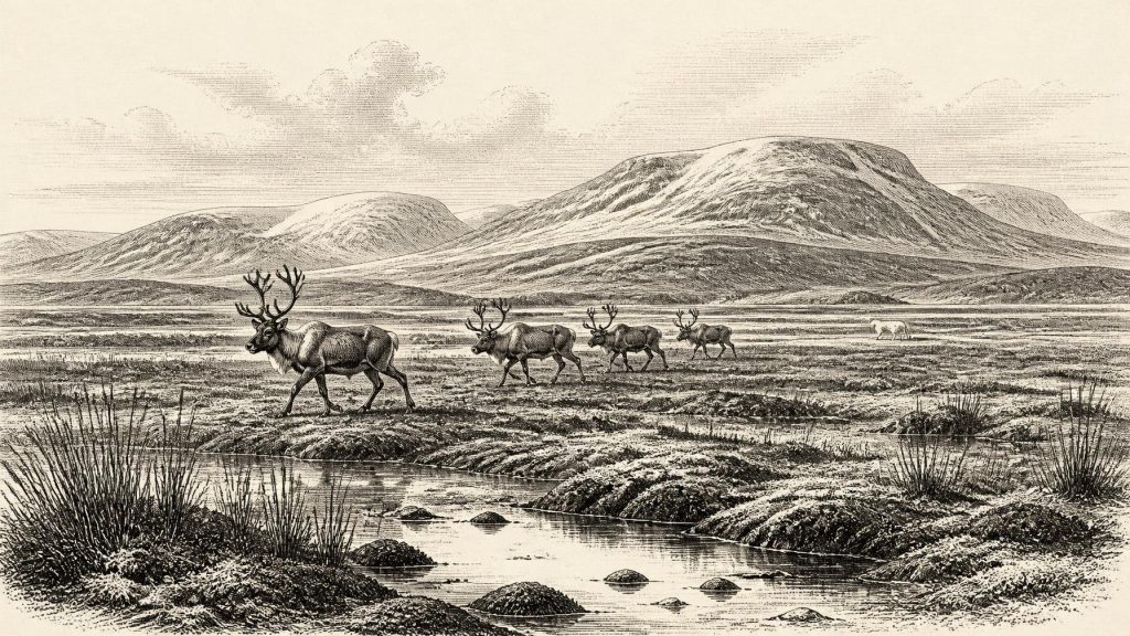
Its plant and animal remains indicate open tundra and periglacial conditions. Pollen was poorly preserved but was predominantly herbaceous. Macrofossils included mosses and plants such as bogbean, mountain avens and alternate water-milfoil. These are not evidence for a modern Irish bog or a continuous carpet of the same species across the island. They document a particular freshwater or wet-ground habitat, surrounded by sparse, treeless vegetation, and show that cold-stage Ireland contained local pools, sedge-rich ground and sheltered ecological niches rather than only barren ice.
The word muskeg, used by researchers for the Derryvree environment, conveys waterlogged, mossy tundra ground. It should be understood as a comparison, not as a map of the whole island. Uplands, limestone country, river corridors and coasts would have offered different surfaces and vegetation. Sparse cover also meant exposed mineral soils and sediments were vulnerable to frost heave, wind and meltwater. The familiar later ingredients of Ireland’s landscape—dense temperate woodland, deep blanket peat, fields, hedges and villages—belonged to vastly later worlds.
The Cave Bone Archive
Castlepook gives this remote era its most vivid Irish evidence. Excavations from 1904 to 1918 recovered more than 2,000 bones from narrow limestone galleries and chambers given evocative names including Hyenahall and Elephant Hall. The cave was a repository, not a neatly sealed snapshot: water disturbance, old excavation methods and deposits of different ages mean that bones cannot simply be assembled into one simultaneous herd. Modern dating and re-dating have therefore been essential.
The assemblage demonstrates that Ireland supported, or was visited by, a remarkable Late Pleistocene fauna. Identified remains include woolly mammoth, giant deer, reindeer, brown bear and spotted hyaena; other levels have yielded wolf, Arctic fox, mountain hare, collared lemming and Norway lemming. The combination is powerful evidence for cold, open-country ecological connections. Mammoths and giant deer required substantial food resources; reindeer and lemmings point towards northern or tundra-like conditions; hyaenas indicate a carnivore capable of transporting and chewing bones into a den.
But the bone collection must not be treated as a census. A bone may record an animal’s death, scavenging or transport into the cave, rather than a local breeding population. Some species are represented by few specimens. New radiocarbon work has also shown that several earlier dates on southern Irish cave bones were too young because older techniques could not always remove contamination adequately. That reassessment suggests that giant deer and spotted hyaena may have disappeared locally before the Last Glacial Maximum, around 40,000 calibrated years BP. The evidence is thus strongest for a long and changing Middle-to-Late Pleistocene faunal history, not for a precise animal encounter in 31,632 BCE.
Food Webs, Not an Economy
There was no Irish economy in the human sense that can be described for this date: no proven farm, market, craft industry, field system, mine, harbour or trading community. What the evidence does reveal is an animal economy of grazing, browsing, predation and scavenging. Herbivores converted sparse vegetation into meat; wolves and hyaenas competed or scavenged; cave deposits preserved traces of those relationships. The gnawed and accumulated bones at Castlepook make the hyaena especially important, not as an exotic curiosity but as an agent that shaped the archive archaeologists now study.
There is likewise no responsible evidence for Irish political affairs, diplomacy, warfare, religious practice, language, art, formal learning or human settlement at this date. These absences matter. They prevent the misleading transfer of later prehistoric categories—tribes, chiefs, rituals or trade routes—into a period where the record is chiefly geological and palaeontological.
The Human Question
Claims for very early people in Ireland require particular restraint. The National Museum of Ireland has long noted the absence of clear Palaeolithic evidence for human presence on the island. A bear kneecap from Alice and Gwendoline Cave, County Clare, dated to about 10,800–10,500 BCE, has been interpreted as bearing fresh-bone stone-tool cut marks. This is thousands of years later than the date considered here. Reports have also drawn attention to possible marks on a Castlepook reindeer bone, but a marked bone alone cannot establish a securely dated settlement, hearth, toolkit, dwelling or enduring population.
Accordingly, the most defensible picture around 31,632 BCE is not one of known Ice Age Irish hunters pursuing mammoth or reindeer. It is an Ireland whose caves and wetlands record animal movements and cold-climate habitats, while direct human evidence remains absent or disputed. If people ever entered the island in this broader period, surviving archaeology has not yet demonstrated their lives with the clarity required to describe society or events.
What This Landscape Bequeathed
The importance of this interval lies in its deep legacy. Glacial erosion and deposition helped prepare the ground on which later rivers, lakes, soils and wetlands developed. Drumlins in Fermanagh, caves in Cork and sediments on the surrounding seabed are not merely scenery or scientific curiosities: they are archives of former climates and vanished animal communities. They show that Ireland’s apparently familiar island environment was repeatedly reconfigured before people made their durable mark upon it.
For 31,632 BCE, then, the truthful history is one of qualified knowledge. A cold North Atlantic world, changing ice margins, treeless wetland in south Fermanagh and the long-lived faunal archive of Castlepook can be supported by evidence. A named year, a human leader, a battle, a ritual or a settlement cannot. Respecting that distinction makes the period more compelling, not less: beneath later Ireland lies a dynamic Pleistocene country of frost, water, open ground and animals now absent from the island.
Primary Sources
- A Middle Midlandian freshwater series at Derryvree, Maguiresbridge, County Fermanagh, Northern Ireland
- Palaeoecology: The Middle Midlandian palaeoenvironment of south Fermanagh
- Figure 6—The Subdivision of the Quaternary Period in Ireland
- Castlepook Cave, County Geological Site Report
- Spotted Hyena Skull, Castlepook Cave
- Prehistoric Details: Stone Age Collections
- A Reconsideration of the Radiocarbon Dating of the Marine Isotope Stage 3 Fauna from Southern Ireland
- The Irish Quaternary Fauna Project
- Growth and Retreat of the Last British–Irish Ice Sheet, 31,000 to 15,000 Years Ago: the BRITICE-CHRONO Reconstruction
- The Timing and Magnitude of the British–Irish Ice Sheet Between Marine Isotope Stages 5d and 2
- Last Glacial Maximum Cirque Glaciation in Ireland and Implications for Reconstructions of the Irish Ice Sheet
- Trimlines, Blockfields and the Vertical Extent of the Last Ice Sheet in Southern Ireland
- Timing and Pace of Ice-Sheet Withdrawal Across the Marine–Terrestrial Transition West of Ireland During the Last Glaciation
- Response of the Irish Ice Sheet to Abrupt Climate Change During the Last Deglaciation
- Radiocarbon Constraints on the Age of the Maximum Advance of the British-Irish Ice Sheet in the Celtic Sea
- The Island of Ireland: Drowning the Myth of an Irish Land-Bridge?
- A Stratigraphic Framework for Abrupt Climatic Changes During the Last Glacial Period Based on Three Synchronized Greenland Ice-Core Records
- The IntCal20 Northern Hemisphere Radiocarbon Age Calibration Curve (0–55 cal kBP)
- Quaternary Geology of Ireland
- The Mesolithic in Ireland: When Was It?
