Mammoths Before the Advance31641 BCE
About 31,641 BCE, Ireland lay within the climatically unstable later Marine Isotope Stage 3. Organic sediments at Derryvree, County Fermanagh, record an ice-free freshwater basin amid open, cold tundra vegetation, including Arctic-alpine fringed sandwort. Southern caves, Castlepook and Shandon, preserve remains of mammoth, giant deer, reindeer and predators, though their dates and deposition require caution. These environments preceded wider glaciation during the Last Glacial Maximum, which erased or buried evidence. No secure evidence confirms human occupation at this date; the earliest indication of human presence is later, around 12,810–12,590 years ago. Ireland’s record therefore documents changing ecosystems, not human communities.
Dateline
The label 31,641 BCE is a modern chronological convenience, not a year that can be isolated in Ireland’s archaeological record. It corresponds approximately to 33,590 years before AD 1950, the conventional radiocarbon “present”, but radiocarbon results require calibration and have substantial ranges at this depth of time. The responsible frame is therefore not a single year but the later part of Marine Isotope Stage 3, a fluctuating cold phase of the Late Pleistocene. The most relevant Irish environmental evidence, from organic sediments at Derryvree near Maguiresbridge in County Fermanagh, has produced calibrated ages spanning roughly 36,900–31,700 years ago. This numbered year falls within that broad interval, not at an identifiable episode within it.
A Landscape Known Through Sediment
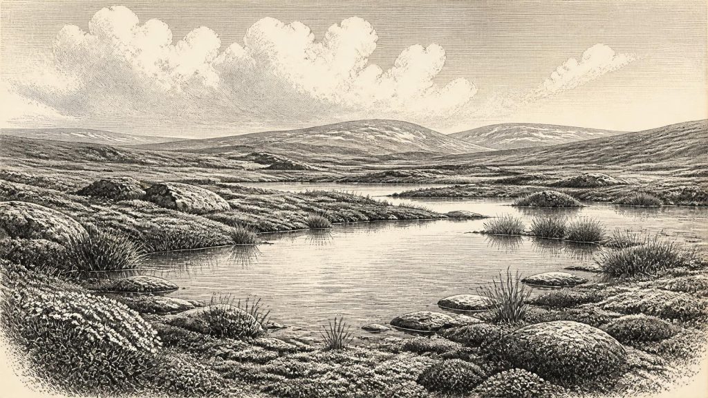
Derryvree is exceptionally important because it preserves organic-rich freshwater silts between two layers of glacial till. Such a sequence records a spell when water, plants and animals occupied a lowland basin before later ice overrode and sealed it. The deposit cannot supply a diary of Ireland in 31,641 BCE; its dates and sediments represent an accumulated environmental interval. Yet pollen, seeds, plant fragments and insects can illuminate conditions in the north-west of the island during a period for which archaeological sites are almost wholly absent. They indicate open, cold ground rather than forest: a wet tundra or muskeg landscape with shallow pools, abundant mosses and plant matter, surrounded by sparse vegetation able to withstand long, severe winters.
One particularly evocative element is the fossil evidence for fringed sandwort, Arenaria ciliata, at Derryvree. It is a plant now associated with Arctic-alpine environments, and its Late Pleistocene occurrence confirms that Ireland then supported a flora far removed from the island’s modern green, wooded appearance. That does not mean every district resembled the Fermanagh basin. Ireland’s terrain, drainage and exposure varied greatly, while the sediments themselves offer a local record. Nevertheless, Derryvree gives the clearest securely dated indication that parts of Ireland held open tundra vegetation during this broad period.
Cold, But Not Permanently Buried
This was not yet the fullest extent of the last British–Irish Ice Sheet. Later research places Ireland’s maximum last-glacial ice cover broadly between about 27,000 and 23,000 calibrated years ago, although advance and maximum extent differed from sector to sector. At the time represented by the Derryvree dates, the island’s climate was cold and unstable, but at least some areas were sufficiently ice-free for freshwater basins and their surrounding tundra to exist. The crucial historical fact is changeability: climates of Marine Isotope Stage 3 could shift markedly over centuries and millennia. A habitable-looking wetland should not be mistaken for a mild or secure environment. It was part of a landscape on the threshold of much more extensive glaciation.
Ice nevertheless shaped the setting long before it covered all of Ireland. Earlier glacier advances had eroded older surfaces, redirected drainage and deposited the tills that underlay Derryvree’s freshwater sediments. Later ice covered the basin again, creating the layered archive by burying its organic material beneath another till. Modern reconstructions of the British–Irish Ice Sheet show that expansion was neither uniform nor instantaneous: different marine and terrestrial sectors advanced at different times. That geological history explains both why Ireland’s surviving record is fragmentary and why rare protected pockets of silt, cave fill and bone matter are so valuable.
Mammals in the Southern Caves
County Cork and County Waterford caves supply a second, very different line of evidence. Castlepook Cave, near Doneraile, has yielded more than 2,000 animal bones from deposits ranging across a long stretch of the Ice Age. Its documented fauna includes woolly mammoth, giant deer, reindeer, brown bear and spotted hyaena; later cold-stage material includes Arctic fox, wolf and lemmings. Shandon Cave near Dungarvan also produced mammoth, reindeer and horse remains. These assemblages demonstrate that Ireland was periodically part of a wider north-west European ecological zone in which large herbivores and carnivores could reach and inhabit the island.
They must, however, be handled with care. The old cave excavations were undertaken before modern field recording, and bones could be redeposited by water, scavengers, roof collapse or later disturbance. Moreover, newer laboratory methods have shown that some early radiocarbon measurements on Irish cave bones were too young. Re-dating has pushed parts of the Castlepook fauna further back within Marine Isotope Stage 3 and suggests that giant deer and spotted hyaena may have disappeared locally well before the Last Glacial Maximum, perhaps around 40,000 calibrated years ago. Thus it is responsible to say that the caves reveal the ecological world of this general era; it is not responsible to place a particular mammoth, hyaena pack or reindeer herd in Ireland in this exact modern-numbered year.
People: Evidence and Silence
There is no securely dated human settlement, hearth, tool-making floor, burial or occupation site in Ireland from around 31,641 BCE. Nor is there defensible evidence for a political community, a leader, warfare, diplomacy, religious observance, language or formal learning on the island at this point. These are not gaps that historical imagination should fill with a generic band of hunters. They are questions to which the current Irish record supplies no answer. The earliest strong evidence for a human incursion belongs much later, in the terminal Pleistocene: cut-marked bear bone from Alice and Gwendoline Cave in County Clare has been dated to approximately 12,810–12,590 calibrated years ago. Sustained settlement is later still, beginning in the Mesolithic.
This absence does not prove that no person ever set foot in Ireland during Marine Isotope Stage 3. Archaeologists allow for the possibility of brief, unsuccessful or archaeologically invisible visits, especially where later glaciers may have destroyed open-air evidence. Four isolated Irish lithic finds have been described as Lower or Middle Palaeolithic in appearance, but their uncertain provenance or reworked contexts prevent them from establishing occupation. The distinction matters: a plausible route, abundant animals or a hospitable interval is not evidence of people. For 31,641 BCE, the proper conclusion is agnosticism rather than either assertion or denial.
Economy Without Human Economy
Accordingly, there can be no account of farming, markets, craft production, trade or domestic routine in Ireland for this date. The relevant “economy” was ecological. Grazing and browsing animals converted the productivity of open vegetation into mobile meat, hides, bone and dung; predators and scavengers redistributed carcasses; pools and wetlands concentrated water, plants and insects. Cave accumulations may preserve some of the resulting food webs, but they do not by themselves disclose how every bone arrived in a chamber. At Castlepook, the evidence for spotted hyaena is especially important because carnivores probably helped create the bone assemblage. A cave is therefore a record of animal activity, geological transport and excavation history as much as a snapshot of living communities.
Long-distance movement is better understood at the scale of species than of human exchange. Low global sea levels altered coastlines and expanded exposed shelves around north-west Europe, but the precise geography of crossings into Ireland and the changing availability of routes remain debated. The presence of large mammals shows that dispersal happened during favourable phases, but it does not demonstrate a permanent land bridge at this date. Ireland’s position at Europe’s north-western edge could make colonisation episodic and local extinctions likely when climates deteriorated or ice and sea barriers changed.
No Known Ritual Landscape
Religion and culture leave no direct traces for Ireland in this interval. There are no monuments, grave goods, rock art traditions or objects that can be assigned to it. Natural features later invested with cultural significance—caves, springs, ridges and river valleys—were already physically present or developing, but no continuity of meaning can be projected backwards across tens of millennia. The most legitimate cultural lesson is methodological. Derryvree’s tiny fossils and Castlepook’s contested bones show how Ireland’s deepest past is reconstructed by combining stratigraphy, palaeobotany, zooarchaeology, radiocarbon calibration and glacial geomorphology, while preserving the boundary between measured evidence and interpretation.
The Approaching Transformation
For Ireland, the importance of this period lies in what followed. The freshwater tundra documented in Fermanagh and the mammal-rich landscapes represented in southern caves belonged to an interval before the last ice sheet expanded across the island and continental shelf. Later glacial erosion removed or deeply buried much of the preceding land surface, contributing to the striking scarcity of Palaeolithic archaeology. When people eventually arrived in a lasting way after the Ice Age, they entered an island ecologically and geographically transformed from this Late Pleistocene world. Around 31,641 BCE, then, Ireland’s story is not one of named peoples or events. It is the history of tundra water, migrating animals, climatic instability and the fragile deposits that allow those vanished conditions to be known at all.
Primary Sources
- A Middle Midlandian Freshwater Series at Derryvree, Maguiresbridge, County Fermanagh, Northern Ireland
- A reconsideration of the radiocarbon dating of the Marine Isotope Stage 3 fauna from southern Ireland
- The Irish Quaternary Fauna Project
- Growth and retreat of the last British–Irish Ice Sheet, 31,000 to 15,000 years ago: the BRITICE-CHRONO reconstruction
- Castlepook Cave
- Ireland: Submerged Prehistoric Sites and Landscapes
- New insights on the fauna of Ireland's Younger Dryas and Early Holocene from Alice & Gwendoline Cave
- Irish Cave Exploration
- Pleistocene Vertebrates in the British Isles
- The Horse in Late Pleistocene Britain and Ireland
- Outreach and Education Resources
- Quaternary Site Descriptions
- The Late Quaternary History of East-Central Ireland
- European Vegetation During Marine Oxygen Isotope Stage 3
- The Mesolithic in Ireland: When Was It?
- Trimlines, Blockfields and the Vertical Extent of the Last Ice Sheet in Southern Ireland
- Maximum Extent and Dynamic Behaviour of the Last British–Irish Ice Sheet West of Ireland
- Radiocarbon Constraints on the Age of the Maximum Advance of the British–Irish Ice Sheet in the Celtic Sea
- Sedimentary and Foraminiferal Records of Late Quaternary Environmental Change West of Ireland and Implications for the Last British–Irish Ice Sheet
- Irish Association for Quaternary Studies Field Guide 13: The Late Quaternary History of Northern Ireland