Derryvree’s Wetland Reprieve30225 BCE
At the notional date of 30,225 BCE, Ireland lay within the climatically unstable later Pleistocene, not a precisely datable historical year. Derryvree, County Fermanagh, preserves freshwater silts and organic deposits between two tills, showing a locally ice-free interval with shallow water and treeless, tundra-like vegetation before renewed glaciation. Its radiocarbon range encompasses the date broadly. Ice expansion varied regionally, preventing conclusions about nationwide conditions or routes across exposed seas. Castlepook Cave records diverse cold-stage fauna, but deposits span multiple periods. A possibly tool-marked reindeer bone suggests human activity, yet no secure evidence demonstrates Palaeolithic settlement, society, or occupation in Ireland.

Dateline
Modern calendar-year precision is not available for Ireland in 30,225 BCE. The label is useful only as a point on a modern chronological grid: it corresponds roughly to 32,174 years before AD 1950, but no Irish deposit can be assigned responsibly to that individual year, season or generation. The appropriate setting is the later Pleistocene, within Marine Isotope Stage 3, when climate, ice cover and habitable ground changed markedly over long timescales. The best evidence relevant to this date is therefore archaeological and environmental rather than historical: buried sediments, fossil plants and animals, cave deposits, glacial landforms, and radiocarbon measurements with broad calibrated ranges.
A Date Within a Wide Range
The most revealing Irish record for this broad interval comes from Derryvree, near Maguiresbridge in County Fermanagh. Roadworks in 1969 cut through a drumlin and exposed an extraordinary sequence. A lower layer of till, the unsorted debris laid down by glacier ice, was overlain by freshwater silts, fine sands and organic deposits. A second thick till later sealed the wetland. The order of events is secure even if its exact calendar timing is not: ice had occupied the locality; an interval followed in which open water, wet ground and vegetation developed; then renewed glaciation buried that landscape.
Organic material from this middle deposit produced the conventional radiocarbon determination BIRM-166, reported as 30,500 radiocarbon years before present, with a substantial uncertainty. Radiocarbon years are not calendar years. Atmospheric carbon-14 levels have varied through time, and measurements must be compared with calibration curves constructed from independently dated archives. A modern calibration places the Derryvree result broadly around 36,900–31,700 calibrated years before present, approximately 34,950–29,750 BCE. Thus 30,225 BCE falls within the outer scope of the evidence, but cannot be tied to a particular layer, pool or episode at the site.
This distinction is fundamental. Derryvree does not provide a diary entry for Ireland in 30,225 BCE, still less a countrywide map. It offers a securely stratified glimpse of an ice-free or locally ice-free interval in one part of Fermanagh, later overwhelmed by ice. Its importance arises precisely because later glaciers scoured, displaced or buried so many older Irish surfaces. A small wetland caught between two tills has become one of the island’s most valuable witnesses to a lost Ice Age environment.
Open Ground and Shallow Water
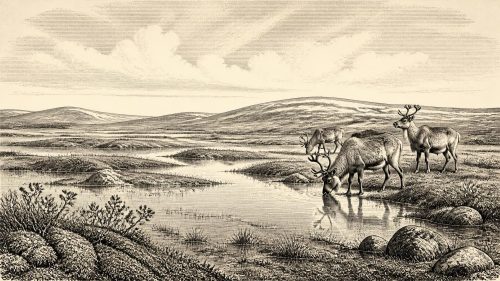
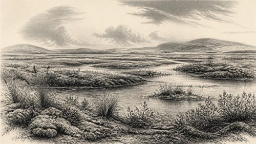
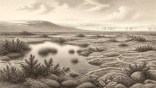
The plant and animal remains recovered from the Derryvree sediments point to a treeless, periglacial landscape rather than to woodland or the familiar green Ireland of recent millennia. Mosses, sedges and cold-adapted flowering plants occur in the assemblage, alongside aquatic or waterside species including bogbean and water-milfoil. Finds reported from the deposit also include dwarf willow, juniper, mountain avens and other plants capable of enduring short growing seasons, exposed ground and cold soils. Together, they support the interpretation of open tundra-like vegetation around shallow freshwater and wet mossy ground.
That is evidence, not a complete reconstruction. Plant macrofossils establish that particular species or plant groups grew near the sedimentary basin; they do not reveal every slope, valley or coast across Ireland. Nor should the word ‘tundra’ conjure an unchanging polar desert. The Derryvree record includes water plants and wetland vegetation, showing that liquid water and a productive summer season existed locally. Yet frost action, sparse tree cover, strong seasonality and exposed terrain would have limited soils, shelter and the length of time available for plant growth.
The area around modern Maguiresbridge was therefore not a timeless wasteland but a changing cold-country mosaic: sedge margins, mossy ground, shallow pools, mineral-rich silts and open herb vegetation. Seasonal melting and freezing would have governed the availability of water and forage. Animals able to use open landscapes could pass through or exploit such ground, while the wetland itself accumulated the tiny biological remains through which its existence can now be recognised.
Ice in Motion, Not a Fixed Blanket
At this time Ireland lay on the approach to the Last Glacial Maximum rather than at a single, island-wide moment of maximum ice. Recent reconstructions of the British–Irish Ice Sheet indicate that ice was building rapidly after about 31,000 years ago, while stressing that early stages of this advance are constrained by relatively sparse and uncertain evidence. Their preferred models show ice accumulating in Northern Ireland and other upland areas, with small ice masses in south-west Ireland, before wider expansion. The implications for a date around 30,225 BCE must remain cautious: different regions could have had very different conditions, and margins shifted through time.
Derryvree itself demonstrates that Ireland’s glacial history was episodic. The lower till records an earlier incursion of ice; the organic silts preserve a subsequent environmental window; the upper till signals another advance. The sequence does not prove that all of Ireland was simultaneously open country. Conversely, growing ice elsewhere does not mean that every Irish valley was buried at once. A responsible picture is of regional change: glaciers and ice caps expanding across some highlands and northern sectors, while pockets of lowland or sheltered ground could, at other times, sustain water, vegetation and animal life.
Sea level was much lower globally than today because enormous quantities of water were held in ice sheets. Nevertheless, it would be misleading to draw a firm land bridge or coastline for this named year. The Irish Sea basin, ice margins and exposed shelf areas were changing, and evidence for the precise routes available to animals or people is incomplete. Faunal movement proves that crossings occurred during broad Pleistocene intervals; it does not identify a single route, season or migration event in 30,225 BCE.
Animals and the Cave Record
Castlepook Cave, near Doneraile in north County Cork, is directly relevant because it has yielded one of Ireland’s richest Pleistocene faunal collections. Material recovered there includes remains attributed to woolly mammoth, reindeer, brown bear, spotted hyaena, fox, hare and small cold-climate mammals. These animals show that Ireland was connected ecologically, at least intermittently, to the wider north-west European world. They also demonstrate that caves can preserve a record of predators, scavengers, prey and natural deaths that has vanished from the open landscape.
But cave collections require care. Castlepook’s deposits accumulated over more than one phase of the Ice Age, and many bones were excavated in the early twentieth century before modern recording standards. A fossil from the cave cannot automatically be made contemporary with the Derryvree wetland, nor can it be used to populate every Irish district. Carnivores may have carried carcass parts into caves; water, sediment disturbance and earlier excavation can also alter associations. The strongest conclusion is that a varied cold-stage fauna reached or survived in Ireland over substantial periods, not that all these species stood together in one scene in 30,225 BCE.
The Human Question
The most provocative evidence is a reindeer femur from Castlepook, re-examined by the palaeozoologist Ruth Carden. It has been reported as approximately 33,000 radiocarbon years old and bears a deep linear modification interpreted as damage made by a stone tool while the bone was fresh. If that interpretation is sustained, it may indicate Upper Palaeolithic carcass processing in Ireland far earlier than the long-established evidence for later hunter-gatherers.
It does not, however, establish a settlement in 30,225 BCE. The measured age is the age of the animal bone, not an exact date for the incision; a radiocarbon age also requires calibration before conversion into calendar years. Most importantly, Castlepook has not yet supplied a securely associated hearth, stone-tool assemblage, dwelling floor, burial, occupation surface or stratified camp of this antiquity. One modified bone, even if genuinely cut-marked, could represent a brief visit by one or more people rather than continuous residence. The National Museum of Ireland consequently remains appropriately cautious about claiming demonstrable Palaeolithic settlement on the island.
For this reason, there can be no responsible account of Irish rulers, diplomacy, warfare, law, language, organised religion or formal learning in this year. There are no named communities, monuments, graves, houses, exchange goods or inscriptions from which to infer them. Nor is there evidence for an Irish economy in the later historical sense. At most, if people did reach the island during the wider period, their subsistence would have depended on highly mobile hunting, gathering and opportunistic use of animal and plant resources. That remains an inference from wider Upper Palaeolithic lifeways, not a demonstrated social system in Ireland.
What Can Be Said Responsibly
Ireland around the notional date of 30,225 BCE was shaped above all by climatic instability and shifting ice. Derryvree provides tangible evidence that freshwater, wetland plants and open cold-country vegetation existed during a broad interval encompassing this date range. Castlepook preserves evidence that Ice Age animals moved through parts of the island, while a single reindeer bone raises an important but unresolved question about very early human activity. These are significant discoveries precisely because they are limited: they replace the false certainty of an invented event with a more compelling story of a landscape repeatedly opened, inhabited by plants and animals, and then sealed beneath advancing ice.
Primary Sources
- A Middle Midlandian Freshwater Series at Derryvree, Maguiresbridge, County Fermanagh, Northern Ireland
- Figure 6.— The Subdivision of the Quaternary Period in Ireland
- The Irish Quaternary: Selected Areas in Counties Fermanagh, Tyrone and Armagh
- Growth and Retreat of the Last British–Irish Ice Sheet, 31,000 to 15,000 Years Ago: The BRITICE-CHRONO Reconstruction
- The Timing and Magnitude of the British–Irish Ice Sheet Between Marine Isotope Stages 5d and 2
- Character of Advance and Retreat of the Southwest Sector of the British-Irish Ice Sheet During the Last Glaciation
- Pleistocene Glaciations in Ireland
- The IntCal20 Northern Hemisphere Radiocarbon Age Calibration Curve (0–55 cal kBP)
- Episodic Speleothem Deposition Tracks the Terrestrial Impact of Millennial-Scale Last Glacial Climate Variability in SW Ireland
- Spatio-Temporal Dynamics of Speleothem Growth and Glaciation in the British Isles
- A Reconsideration of the Radiocarbon Dating of the Marine Isotope Stage 3 Fauna from Southern Ireland
- Heritage Artefacts of County Cork
- Castlepook Cave, Co. Cork: Excavation Report 2022
- Prehistoric Details
- Guide to the National Museum of Ireland – Natural History
- Ice Age Ireland: Cool Fossils!
- First Evidence of a Late Upper Palaeolithic Human Presence in Ireland
- New Insights on the Fauna of Ireland’s Younger Dryas and Early Holocene from Alice & Gwendoline Cave
- The Geology of Ireland: Cenozoic, Tertiary and Quaternary
- Soils of County Waterford