Elusive Toolmark31626 BCE
31,626 BCE is a modern label within Marine Isotope Stage 3, not a recorded Irish year. Evidence from Derryvree indicates cold freshwater, tundra and steppe-tundra habitats between glacial episodes, while Ireland probably comprised open ground, meltwater, frozen terrain and advancing ice. Castlepook Cave preserves a long, mixed animal record including mammoth, reindeer, giant deer and predators. A reindeer femur, dated about 33,000 years ago, bears possible stone-tool cut marks, suggesting but not proving brief Upper Palaeolithic human activity. No secure settlement, tools, hearths, burials or cultural identity are known. Ireland’s past is defined by change, fauna and uncertain human passage.
Dateline
31,626 BCE is a modern chronological label, not a year that anybody in Ireland could have named or recorded. There were no written calendars, rulers, states or dated events on the island. Archaeology cannot responsibly identify what happened during this individual year. It can, however, place it within a broad Late Pleistocene setting: roughly 33,600 years before 1950, during Marine Isotope Stage 3, an unstable interval of the last Ice Age. The most relevant Irish evidence consists of fossil bones, freshwater sediments beneath later glacial deposits, and the changing reconstruction of the British–Irish Ice Sheet. Their dates have margins of error measured in centuries or millennia, not days or years.
A Cold Phase in Deep Time
The nearest securely relevant environmental record is at Derryvree, near Maguiresbridge in County Fermanagh. Road works in 1969 exposed silts and fine sands trapped between two distinct sheets of till inside a drumlin. Till is sediment laid down by glacier ice. The sequence is therefore remarkable: it records a period when freshwater, plants and small animals occupied ground that had been glaciated earlier and would later again be overridden or sealed by ice. Its original radiocarbon determination, 30,500 +1,170/−1,030 radiocarbon years BP, is not itself a calendar date. Allowing for calibration and uncertainty, it belongs broadly in the middle-to-later part of MIS 3, approximately the 35,000–37,000 calibrated-years-BP range. That span overlaps the broad horizon represented by 31,626 BCE, rather than pinpointing it.
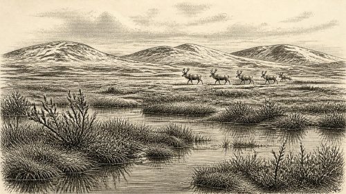
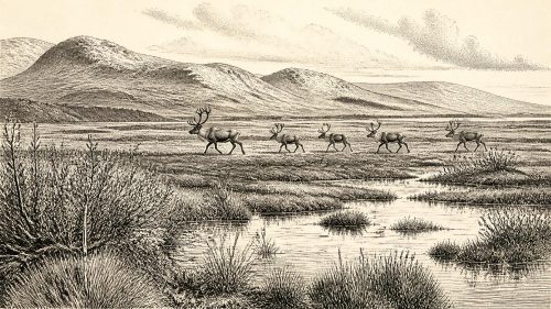
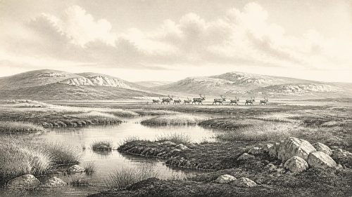
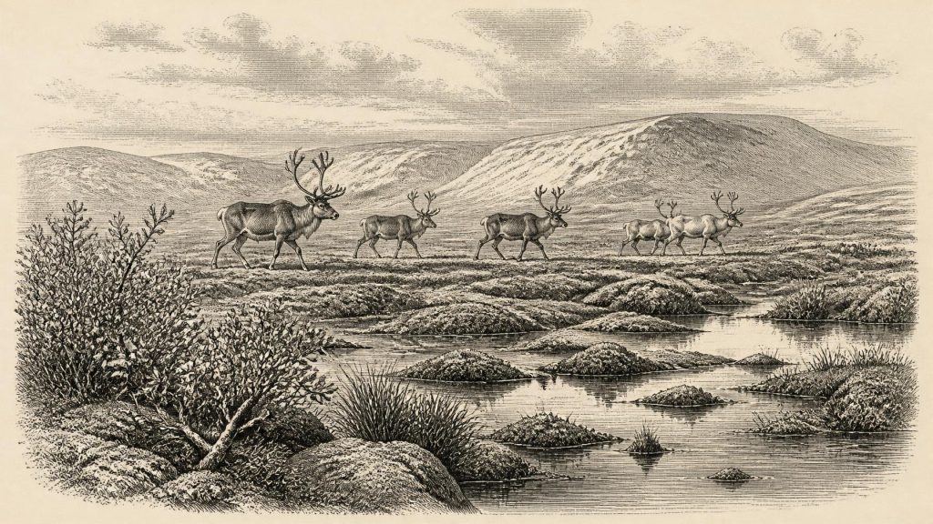
Derryvree’s organic beds have been described as a cold-phase freshwater and muskeg environment: a waterlogged landscape with open pools, plant-rich margins and mosses. Poorly preserved pollen was mainly herbaceous, while plant macrofossils and insects indicate tundra or steppe-tundra conditions rather than woodland. Fossils include cold-adapted taxa such as mountain avens, dwarf willow and arctic-alpine mosses. This does not mean that all Ireland was a single uniform tundra. It establishes what survived at one lowland site in Fermanagh, where water and sediment happened to preserve a fleeting ecological record. Local conditions could have differed greatly with altitude, proximity to ice, drainage, exposure to wind and season.
Ice, Water and Open Ground
Ireland’s physical geography was changing rapidly on geological timescales. The island lay within the wider north-west European zone affected by recurring growth and retreat of the British–Irish Ice Sheet. Modern reconstructions agree that the great ice sheet had not yet reached its maximum extent; that came much later, around 26,000 years ago. Yet they also show why a simple picture of an entirely ice-free Ireland is unsafe. Around the transition towards 31,000 years ago, ice was accumulating in northern uplands and glaciers may have occupied high ground elsewhere. Newer work also argues that significant British–Irish glaciation may have begun earlier than once thought. The extent, thickness and exact timing of ice in particular Irish regions remain contested because datable deposits are scarce.
At the horizon relevant to this article, the Irish landscape was therefore probably a mosaic. Some ground supported cold, open vegetation and freshwater habitats, as Derryvree demonstrates. Other areas, particularly uplands and northern sectors, may have been affected by icefields, advancing glaciers, frozen ground or meltwater systems. Summer growth could be brief but biologically productive; winter conditions were severe. The later ice advance destroyed, reworked or buried many earlier surfaces. This helps explain why Ireland has so few surviving Palaeolithic sites compared with parts of Britain and continental Europe. Absence of a campsite is not proof that no person ever arrived, but it does set strict limits on claims for a population.
Lower global sea levels altered coastlines and enlarged some shelves, but they did not automatically create a convenient dry land bridge from Ireland to Britain or the Continent. The Irish Sea basin, local crustal movements, changing ice margins and marine channels all complicate the question. Animal movements show that routes or crossings were possible at intervals, whether over exposed ground, marginal ice, short sea passages or changing coastal corridors. They do not demonstrate a particular route, season or human journey in 31,626 BCE. Any visitor to Ireland would have entered a difficult, shifting frontier landscape rather than a settled island connected by an assured road.
The Castlepook Evidence
The principal possible evidence for people comes from Castlepook Cave, also called Mammoth Cave, near Doneraile in north County Cork. The cave has produced more than two thousand animal bones and is Ireland’s richest known Late Pleistocene vertebrate assemblage. Its faunal record includes woolly mammoth, giant deer, reindeer, brown bear and spotted hyaena; later cold-stage deposits contain wolf, Arctic fox and lemmings. Individually dated bones span a long period, roughly 45,700 to 19,950 years BP. Castlepook is consequently an archive of repeated animal use and deposition over many millennia, not a sealed snapshot of one moment.
A reindeer femur from the old Castlepook collection has particular significance. It has been reported as dating to about 33,000 years ago and carries deep marks interpreted by zooarchaeologist Ruth Carden as cuts made by a sharp stone implement during carcass processing. If that interpretation is confirmed, it is evidence that a person used a stone edge on reindeer bone in Ireland during the Upper Palaeolithic, vastly earlier than the traditionally accepted late-glacial human evidence. Around 31,626 BCE, it provides the closest potential human trace. It may reflect the removal of meat, hide, sinew or marrow, but the precise action cannot be recovered from the mark alone.
The cave’s evidential limits matter as much as its promise. The femur was recovered from an antiquarian cave collection, not a recently excavated occupation floor with a secure suite of associated finds. A radiocarbon determination dates the death of the animal, not necessarily the instant at which a mark was made, the location where it was hunted or the duration of any human stay. Caves are complicated places: carnivores drag in bones, water moves sediment, people disturb deposits, and excavation methods have changed radically since the early twentieth century. Castlepook also contains evidence of hyaena activity, which is vital for understanding how remains accumulated.
Visitors, Not a Known Community
For these reasons, Ireland cannot yet be said to have had a demonstrated permanent human settlement at this date. There is no securely associated stone-tool assemblage, hearth, dwelling surface, grave, human bone, ornament, cave art or repeatedly occupied camp from Ireland around 31,626 BCE. Nor can the possible visitors be called Gaelic, Celtic or Irish in any ethnic, linguistic or political sense. Those later identities belong to vastly different worlds. The cautious conclusion is narrower but still important: short Upper Palaeolithic incursions into Ireland are possible, and the Castlepook femur may record one episode of reindeer processing.
Elsewhere in Europe, people of comparable age made sophisticated stone tools, travelled through cold environments, organised the sharing of large animal carcasses and, in some regions, created personal ornaments and cave art. That wider evidence makes a brief Irish visit plausible; it cannot fill the Irish gap by itself. No Irish artefact assemblage of this antiquity permits an assigned cultural label, and no local evidence identifies group size, kinship, language, seasonal routine or belief. A hunting party, scavengers exploiting a carcass, or a single small group passing through are possibilities, not established narratives.
Animals and Everyday Survival
Faunal remains nevertheless illuminate the resources and hazards of the landscape. Reindeer were mobile grazers adapted to cold, open country. Mammoths and giant deer indicate that, in suitable periods and places, Ireland could support large herbivores. Wolves and spotted hyaenas reveal an ecological community in which carcasses were contested and caves could be dens, shelters, traps or repositories. Brown bears, foxes, hares and lemmings add further evidence of environmental variety. The presence of a fossil species at Castlepook does not prove that it was widespread across the island or alive in precisely 31,626 BCE; dates must be considered specimen by specimen. Still, the combined record strongly contradicts any image of an empty, featureless frozen waste.
If people did enter, survival would have depended on knowledge rather than any known local infrastructure: reading animal movements, finding freshwater, preserving warmth, carrying portable tools and choosing temporary shelter. Reindeer would have offered meat, fat, hide, sinew and bone, but no Irish evidence reveals how a carcass was divided or shared. There is likewise no basis for identifying trade, exchange partnerships or regular seaborne traffic. Material from the Continent may supply an analogy for Upper Palaeolithic skills, but it is not evidence of commerce in Ireland.
No Politics, No Monuments
Political affairs, warfare and diplomacy cannot be reconstructed for Ireland at this date. There is no evidence for chiefs, tribes, territorial boundaries, alliances, organised conflict or formal authority. The same restraint applies to religion, learning and culture. No shrine, burial rite, monument, inscribed object or artwork is known from Ireland around this horizon. Natural caves may later invite stories of sacred places, but nothing in the Castlepook material establishes ritual use in the Late Pleistocene. The responsible history is not one of lost kingdoms beneath the ice; it is a history of fragmentary traces and carefully bounded inference.
What can be said is that this was a formative environmental chapter in the deep past of the island. At Derryvree, freshwater life and tundra plants persisted between glacial episodes. At Castlepook, animals repeatedly used or entered a limestone cave system, leaving a record that survived later climatic upheavals. One marked reindeer bone raises the possibility that people, too, briefly reached this northern edge of Upper Palaeolithic Europe. Continued excavation, redating, microscopic study of bone surfaces and analysis of undisturbed sediments may strengthen, qualify or overturn that interpretation. For now, 31,626 BCE is best understood not as a dated Irish event, but as a window onto cold open ground, mobile animals and the tantalising possibility of human passage.
Source References
Hover over a number to see the source. Select it to open the source.

- [1] A Middle Midlandian Freshwater Series at Derryvree, Maguiresbridge, County Fermanagh, Northern Ireland
- [2] A reconsideration of the radiocarbon dating of the Marine Isotope Stage 3 fauna from southern Ireland
- [3] The Irish Quaternary Fauna Project
- [4] Growth and retreat of the last British–Irish Ice Sheet, 31,000 to 15,000 years ago: the BRITICE-CHRONO reconstruction
- [5] The timing and magnitude of the British–Irish Ice Sheet between Marine Isotope Stages 5d and 2: implications for glacio-isostatic adjustment, high relative sea levels and ‘giant erratic’ emplacement
- [6] BRITICE-CHRONO maps and GIS data of the last British-Irish Ice Sheet 31 to 15 ka, including model reconstruction, geochronometric age spreadsheet, palaeotopographies and coastline positions
- [7] BRITICE Glacial Map, version 2: a map and GIS database of glacial landforms of the last British–Irish Ice Sheet
- [8] Extent and deglacial chronology of the last British–Irish Ice Sheet: implications of exposure dating using cosmogenic isotopes
- [9] Dimensions and chronology of the last ice sheet in Western Ireland
- [10] Castlepook Cave, County Geological Site Report CK032
- [11] Ice Age Ireland: Cool Fossils!
- [12] Prehistoric Details: Stone Age
- [13] Guide to the National Museum of Ireland: Natural History
- [14] Archaeology Research Excavation Grant 2022: Final Report, Castlepook Cave Project
- [15] New insights on the fauna of Ireland's Younger Dryas and Early Holocene from Alice & Gwendoline Cave
- [16] The problem of a late quaternary landbridge between Britain and Ireland
- [17] Deglaciation, Earth crustal behaviour and sea-level changes in the determination of insularity: A perspective from Ireland
- [18] Palaeoecology: Irish Quaternary Association Field Guide
- [19] Dryas octopetala in Fermanagh
- [20] Irish Cave Exploration
- [21] Pleistocene vertebrates in the British Isles
- [22] Ireland’s Palaeolithic Archaeology – Fleeting Footprints in a Frozen Land
Primary Sources
- A Middle Midlandian Freshwater Series at Derryvree, Maguiresbridge, County Fermanagh, Northern Ireland
- A reconsideration of the radiocarbon dating of the Marine Isotope Stage 3 fauna from southern Ireland
- The Irish Quaternary Fauna Project
- Growth and retreat of the last British–Irish Ice Sheet, 31,000 to 15,000 years ago: the BRITICE-CHRONO reconstruction
- The timing and magnitude of the British–Irish Ice Sheet between Marine Isotope Stages 5d and 2: implications for glacio-isostatic adjustment, high relative sea levels and ‘giant erratic’ emplacement
- BRITICE-CHRONO maps and GIS data of the last British-Irish Ice Sheet 31 to 15 ka, including model reconstruction, geochronometric age spreadsheet, palaeotopographies and coastline positions
- BRITICE Glacial Map, version 2: a map and GIS database of glacial landforms of the last British–Irish Ice Sheet
- Extent and deglacial chronology of the last British–Irish Ice Sheet: implications of exposure dating using cosmogenic isotopes
- Dimensions and chronology of the last ice sheet in Western Ireland
- Castlepook Cave, County Geological Site Report CK032
- Ice Age Ireland: Cool Fossils!
- Prehistoric Details: Stone Age
- Guide to the National Museum of Ireland: Natural History
- Archaeology Research Excavation Grant 2022: Final Report, Castlepook Cave Project
- New insights on the fauna of Ireland's Younger Dryas and Early Holocene from Alice & Gwendoline Cave
- The problem of a late quaternary landbridge between Britain and Ireland
- Deglaciation, Earth crustal behaviour and sea-level changes in the determination of insularity: A perspective from Ireland
- Palaeoecology: Irish Quaternary Association Field Guide
- Dryas octopetala in Fermanagh
- Irish Cave Exploration
- Pleistocene vertebrates in the British Isles
- Ireland’s Palaeolithic Archaeology – Fleeting Footprints in a Frozen Land