

An Incision at Castlepook31501 BCE
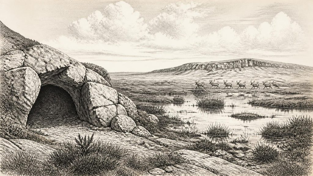
Although 31,501 BCE cannot be dated precisely in Ireland, it falls within climatically unstable Marine Isotope Stage 3. Derryvree sediments in Fermanagh indicate a local ice-free interval with cold, treeless freshwater wetlands between glacial advances, not conditions across the island. Castlepook Cave, Cork, preserves fauna including mammoth, reindeer, giant deer, predators and cold-adapted mammals, demonstrating suitable open habitats. A reindeer femur, possibly cut with a stone tool around 31,000 BCE, may indicate human butchery. However, its disturbed provenance and lack of occupation evidence preclude claims for permanent settlement. Ireland remained a changing Ice Age landscape, perhaps visited by mobile hunter-gatherers.
Dateline
31,501 BCE is a useful modern label for a point deep in the last Ice Age, but it must not be mistaken for a date that prehistoric Ireland can resolve to a single year, season or generation. There is no Irish written record, calendar or excavated occupation horizon that can be assigned to this numbered year. Read as a rough conversion, it lies near 33,450 calendar years before present (where “present” conventionally means 1950), within Marine Isotope Stage 3, a long and climatically unstable part of the Late Pleistocene. Dates from this depth of time carry substantial ranges, and the evidence illuminates intervals rather than an Irish “year”.
The appropriate historical subject is therefore not a named event but a changing Ice Age landscape: intermittent ice, treeless wet ground, mobile animal populations and one controversial object from a north Cork cave. These traces make Ireland relevant to the wider Upper Palaeolithic world, while also showing how little can responsibly be said about its human inhabitants at this early point.
Dating a Changing Landscape
Radiocarbon results are not calendar dates in themselves. They must be calibrated against changing atmospheric carbon levels, and uncertainty becomes especially important beyond 30,000 years ago. A conventional radiocarbon determination from organic sediments at Derryvree, near Maguiresbridge in County Fermanagh, was 30,500 ± 1,170 radiocarbon years BP. Later discussions place its calibrated range broadly around 36,900–31,700 calendar years BP. That range encompasses the notional position of 31,501 BCE, but it cannot pinpoint it. The Derryvree deposits are consequently the best local environmental guide to this broad period, not proof of conditions everywhere in Ireland at one instant.
The sediments lay between two tills: dense deposits left by moving glacier ice. Their sequence establishes an important minimum conclusion. At some point after an earlier glaciation and before a later advance, part of Fermanagh contained standing or slowly moving freshwater and accumulated organic silt. This was a local ice-free interval. It does not demonstrate that the whole island was ice-free, nor that ice margins remained fixed. Ireland’s record is fragmented because later glaciers eroded, redeposited or buried much of what had survived from earlier phases of the Ice Age.
Modern reconstructions of the British–Irish Ice Sheet have transformed understanding of the later part of the glacial cycle, but uncertainty remains greater before and around its major growth towards the Last Glacial Maximum. The island’s coasts, uplands and sea floor were parts of a connected glacial system with Britain. At this date, reduced global sea level exposed more of the continental shelf than exists today, yet the practical geography of movement depended on ice fronts, cold seas, rivers, permafrost and local topography. It is not responsible to picture either an uncomplicated land bridge or an island with modern shorelines.
Derryvree’s Cold Wetland
The Derryvree organic beds indicate a severe, open environment rather than woodland. Plant remains and pollen from the wider Middle Midlandian record point to a treeless wetland or muskeg, with mosses, sedges, low herbs and dwarf shrubs able to survive short growing seasons. The presence of freshwater deposits matters: even in a cold, wind-exposed landscape, local pools and marshes supported vegetation and invertebrate life. This was not a featureless sheet of snow. It was a patchwork in which wet hollows, exposed mineral ground, shallow water and frozen terrain altered with season and climate.
Such evidence supports environmental reconstruction, not an account of a community’s daily routine. There are no excavated houses, hearths, stone-tool scatters, burials, paths or food stores from Derryvree belonging to this period. We cannot identify a settlement, a population size, language, kin group or territorial boundary. Nor is it meaningful to describe kingdoms, political leaders, diplomacy or organised warfare in Ireland for 31,501 BCE. The archaeological record has not produced evidence from which any of those matters can be inferred.
The cold was also variable. Greenland ice-core records show abrupt shifts between stadial and interstadial conditions during Marine Isotope Stage 3. Irish deposits need not match every Greenland oscillation precisely, but they belong to a North Atlantic world in which temperatures, precipitation, vegetation and ice margins could change markedly over centuries or millennia. The landscape relevant to this article was therefore dynamic: an ecological opportunity in one interval could have been erased by advancing ice in another.
Castlepook’s Animal Archive
Far to the south-west, Castlepook Cave near Doneraile in County Cork preserves Ireland’s most important known collection of pre-Last Glacial Maximum mammal remains. Early twentieth-century excavations recovered bones from a cave system long known as Mammoth Cave. Subsequent dating and re-dating have shown that parts of its faunal archive belong to Marine Isotope Stage 3, although the cave’s old excavations and disturbed deposits mean that individual bones cannot automatically be treated as a single contemporary assemblage.
The animals represented include woolly mammoth, reindeer, giant deer, brown bear, wolf, Arctic fox, mountain hare, lemmings and spotted hyaena. Together they demonstrate that, during favourable intervals, southern Ireland could support a diverse cold-climate fauna. Large grazers and browsers imply productive though open habitats; predators and scavengers imply carcasses, competition and seasonal movements through those habitats. Cave hyaenas are particularly significant because a cave may have been their den or a place into which they dragged bones, rather than a neutral sample of animals living immediately outside its entrance.
This distinction is crucial. A mammoth bone, reindeer antler or hyaena tooth dates an animal or the material deposited in a cave; it does not by itself date a landscape-wide population, a hunting episode or human arrival. Improved ultrafiltration methods have also revised several older Irish bone dates substantially upwards. The Castlepook record is consequently stronger evidence for the presence of animals in broadly suitable periods than for a neatly ordered sequence of ecological change.
The Reindeer Femur
One Castlepook object is unusually close to the date used here: a reindeer femur publicised by Cork County Council as c. 31,000 BCE. Zooarchaeologist Ruth Carden has interpreted a deep incision on the bone as a fresh-bone cut or chop made with a sharp stone implement during butchery. If that interpretation is upheld, it would be striking evidence that people handled a reindeer in Ireland during the Upper Palaeolithic, tens of millennia before the long-established record of post-glacial settlement.
Yet the qualification is central to the history. The femur comes from an old cave collection rather than a modern, securely documented occupation layer. No stone tool has been recovered in direct association with it; nor is there a hearth, dwelling floor, human burial, repeated butchered assemblage or other evidence of a camp of comparable age. The bone may also have reached the cave after people processed it elsewhere, perhaps moved by scavengers or other natural processes. A marked bone can indicate one act of carcass processing, but it cannot establish permanent settlement or continuous occupation.
The careful conclusion for around 31,501 BCE is therefore that a human presence is possible and perhaps represented by the Castlepook femur, but remains unconfirmed as a wider settlement history. The claim deserves further testing through microscopic study of the mark, direct dating where possible, renewed excavation and comparison with experimentally produced cut, tooth and trampling damage. Castlepook’s 2022 investigation illustrates the value of returning to historic cave sites, even where earlier excavators removed much of the original sediment.
Society Beyond the Evidence
If people did reach Ireland during this interval, they were almost certainly highly mobile hunter-gatherers capable of using stone cutting edges and responding to a demanding northern environment. Reindeer, mammoth and other large mammals offered meat, marrow, hides, sinew, bone and antler, but none of this proves a specific Irish economy. The Castlepook evidence does not reveal whether hunters followed herds over a short distance, arrived by water, crossed seasonally available terrain or made a single exploratory visit.
There is equally no direct Irish evidence for exchange networks, ritual places, visual art, teaching, music or formal religious practice at this date. Upper Palaeolithic communities elsewhere in Europe had sophisticated technologies and rich cultural lives, but those wider facts cannot simply be imported into Ireland. The responsible interpretation is narrower: the Irish landmass formed an occasionally habitable north-western margin of a larger Ice Age world, inhabited by varied fauna and possibly visited by people. Its survival as an archaeological record rests on rare wetlands, caves and bones rather than monuments or settlements.
That is why the small incision at Castlepook matters. It is neither proof of an established “first Irish” population nor an excuse to invent an Ice Age society. It is a testable trace, set beside Derryvree’s wetland deposits and the wider glacial record, of how landscapes, animals and perhaps people repeatedly approached the edge of Ireland during a volatile prehistoric age.
Primary Sources
- A reconsideration of the radiocarbon dating of the Marine Isotope Stage 3 fauna from southern Ireland
- The Irish Quaternary Fauna Project
- New insights on the fauna of Ireland’s Younger Dryas and Early Holocene from Alice & Gwendoline Cave
- Growth and retreat of the last British–Irish Ice Sheet, 31,000 to 15,000 years ago: the BRITICE-CHRONO reconstruction
- The timing and magnitude of the British–Irish Ice Sheet between Marine Isotope Stages 5d and 2: implications for glacio-isostatic adjustment, high relative sea levels and ‘giant erratic’ emplacement
- Trimlines, blockfields and the vertical extent of the last ice sheet in southern Ireland
- A Middle Midlandian freshwater series at Derryvree, Maguiresbridge, County Fermanagh, Northern Ireland
- Freshwater organic deposits and stratified sediments between early and late Midlandian (Devensian) till sheets at Aghnadarragh, County Antrim, Northern Ireland
- Figure 6—The subdivision of the Quaternary Period in Ireland
- Irish Pleistocene biostratigraphy
- The IntCal20 Northern Hemisphere radiocarbon age calibration curve (0–55 cal kBP)
- IntCal20 issue
- A stratigraphic framework for abrupt climatic changes during the Last Glacial period based on three synchronized Greenland ice-core records: refining and extending the INTIMATE event stratigraphy
- The problem of a late quaternary landbridge between Britain and Ireland
- The Island of Ireland: Drowning the Myth of an Irish Land-Bridge?
- Deglaciation, Earth crustal behaviour and sea-level changes in the determination of insularity: A perspective from Ireland
- BRITICE-CHRONO: Aims, hypotheses and outcomes
- Archaeology Research Excavation Grant 2022: Castlepook Cave, Castlepook South, Cork
- Heritage Artefacts of County Cork
- Aghnadarragh
- Salix herbacea in Fermanagh
- Exploring controls of the early and stepped deglaciation on the western margin of the British-Irish Ice Sheet