

Doneraile’s Cutmarked Femur31516 BCE
Around 31,516 BCE, Ireland was an unstable Late Pleistocene landscape, shaped by fluctuating ice, low sea levels and changing ecological connections. Derryvree sediments in Fermanagh record an ice-free interval with freshwater wetlands, tundra vegetation and insects, later buried beneath glacier deposits. Castlepook Cave in County Cork produced remains of reindeer, mammoth, giant deer, predators and other cold-adapted animals, though bones represent episodes spanning millennia. A cutmarked reindeer femur may indicate Upper Palaeolithic butchery, but disturbed context and absent associated artefacts make human presence provisional. Evidence supports temporary habitable environments, not settled communities, political history or continuous occupation on the island.
Dateline
The label 31,516 BCE is a modern chronological convenience, not a year that anyone in prehistoric Ireland could have named, recorded or experienced as a calendar date. At this depth in time, modern calendar-year precision is not available. The point corresponds approximately to 33,500 calendar years before 1950, conventionally written as c. 33.5 ka cal BP, and belongs to the later part of Marine Isotope Stage 3, a variable interval within the last Ice Age. The responsible history of Ireland at this point is therefore not a sequence of rulers, wars or treaties. It is a carefully qualified account of changing ice, water, plants, animals and a very limited, still debated indication that people may have reached the island.
Evidence closest to this broad horizon comes chiefly from two very different places: Castlepook Cave near Doneraile in north County Cork, and Derryvree near Maguiresbridge in County Fermanagh. Neither preserves an annual chronicle. Cave bones can represent separate episodes spanning thousands of years, while buried sediments record phases of landscape formation. Radiocarbon measurements also require calibration because the amount of atmospheric carbon-14 changed through time. Their errors are especially substantial at this age. Such evidence can illuminate the kind of Ireland that existed around 31,516 BCE; it cannot securely identify the weather, a journey, a hunt or an individual event in that notional year.
An Unstable Ice-Age Island
Ireland lay on the north-western fringe of Europe during a long cold period, but it should not be imagined as a single, permanent sheet of ice. The British–Irish Ice Sheet advanced and retreated repeatedly, with its extent varying sharply by region and through time. Geological evidence from Ireland records glaciation before and after intervals in which vegetation and freshwater environments developed. Other research indicates substantial ice build-up in some sectors before the global Last Glacial Maximum, while major later expansions reached their greatest documented extent broadly between 27,000 and 23,000 cal BP. Around c. 33,500 cal BP, the island’s geography was therefore dynamic and uneven rather than uniform.
Sea level was far lower than it is today, exposing large areas of continental shelf around Ireland and Britain. Yet lower sea level does not by itself prove an easy land route from Ireland to Britain or continental Europe at this particular moment. The shape of coastlines, the persistence of marine channels, local ice margins and seasonal conditions all mattered. Animals evidently reached Ireland during parts of the Late Pleistocene, demonstrating ecological connections with the wider north-west European world. The exact routes may have involved exposed shelf, narrow water crossings, ice margins or a changing combination of these. The evidence is not strong enough to map a single migration corridor for 31,516 BCE.
Freshwater Beneath Derryvree
Derryvree offers the clearest Irish environmental archive relevant to this broad period. Roadworks in 1969 cut through a drumlin, exposing fine sands and freshwater silts trapped between two thick tills, the unsorted sediments laid down by glacier ice. The sequence establishes a compelling relative order: ice deposited the lower till; an interval followed in which water, sediments and organic matter accumulated; later ice covered the deposit with upper till. It is direct evidence that conditions in this part of Fermanagh changed profoundly during the Late Pleistocene.
Organic material from the Derryvree series yielded a conventional radiocarbon age of about 30,500 ± 1,100 radiocarbon years BP. Older determinations of this kind do not convert cleanly into a single historical year. Published calibrations place the deposit broadly within the mid-30,000s to low-30,000s cal BP, with a wide range that can encompass the horizon represented by 31,516 BCE. This is valuable contextual evidence, not proof that every plant or pool identified at Derryvree existed in that exact year. The distinction between a dated environmental phase and a dated occurrence is essential.
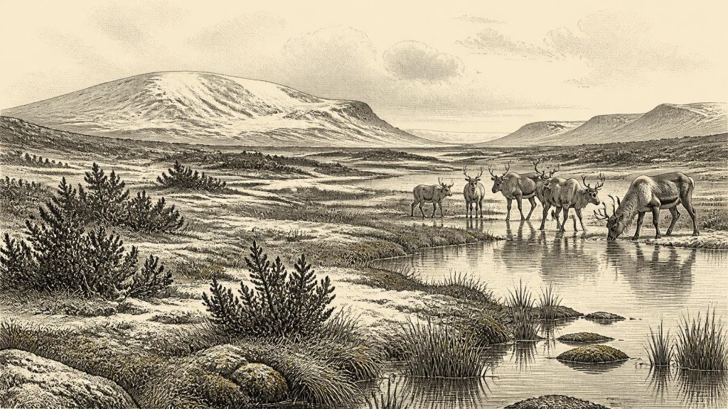
Pollen, plant macrofossils, mosses and insect remains indicate open, largely treeless ground. Grasses, sedges, juniper and hardy herbs belonged to a tundra or muskeg-like landscape: wet, mossy ground, shallow pools and plant-rich margins, shaped by severe frost and brief growing seasons. This was no familiar green, wooded Ireland. Nevertheless, it was also not a blank white wilderness. Liquid freshwater, wetland vegetation and insects show that ecological communities functioned during ice-free intervals. The Derryvree evidence supports a picture of harsh, periglacial habitats in northern Ireland, while warning against treating one buried basin as a complete portrait of the island.
The Cave at Castlepook
Castlepook Cave, also called Mammoth Cave, lies above the Awbeg valley near Doneraile. Excavations undertaken principally in the early twentieth century recovered an exceptionally important but complicated collection of animal remains. Reindeer, woolly mammoth, giant deer, brown bear, wolf, fox, hare, lemmings and spotted hyaena have been identified among material from the cave system. Modern radiocarbon reassessment has shown that some earlier dates for southern Irish cave fauna were too young, strengthening the conclusion that several species were present in Ireland during Marine Isotope Stage 3.
The fauna does not constitute a single living community photographed in time. Bones in caves can be transported by hyaenas and other carnivores, shifted by water or sediment movement, disturbed by later animals, and mixed during excavation. Different Castlepook specimens have dates separated by many millennia. Spotted hyaena remains are particularly important, because a carnivore den can create a concentrated bone deposit that resembles a food assemblage without being a human camp. Woolly mammoth remains likewise establish that this iconic cold-stage animal reached Ireland at some point in the relevant wider period; they do not establish that mammoths, reindeer, giant deer and every predator listed were together outside the cave in 31,516 BCE.
Even with those cautions, Castlepook makes the wider landscape intelligible. Reindeer and lemmings are consistent with open cold-country habitats; mammoth and giant deer indicate that large herbivores could exploit suitable forage; wolves and hyaenas occupied the upper levels of the food chain. Carcasses and scavenging opportunities would have drawn carnivores into limestone caves and fissures. The animal evidence is stronger than any claim for a settled human population. It demonstrates a changing Ice-Age ecology, not a stable village landscape.
A Possible Human Trace
The most consequential artefact-like object from this period is a reindeer femur from Castlepook reported as approximately 33,000 years old and bearing a deep linear modification interpreted as a stone-tool cut or chop mark made while the bone was fresh. If that diagnosis is sustained, it would indicate that one or more Upper Palaeolithic people processed a reindeer carcass in Ireland roughly within the broad chronological world of this article. It would be a remarkable extension of the island’s known human story.
But the conclusion must remain provisional. The bone derives from an old and disturbed cave collection rather than a recently excavated, sealed occupation surface. Its radiocarbon measurement dates the animal’s death, not automatically the mark, its maker or the location at which the carcass was processed. No securely associated lithic toolkit, hearth, dwelling, human burial, repeated butchered assemblage or settlement of comparable age has yet been recovered at Castlepook. Natural breakage, carnivore damage, sediment abrasion and excavational damage must always be distinguished from tool marks. The femur is therefore possible evidence of human activity, not evidence for a permanent colony, a named people or continuous occupation.
What Cannot Be Written
There were no Irish states, dynasties, borders or diplomatic relations that can responsibly be described for 31,516 BCE. Nor is there evidence for organised warfare, formal religion, a spoken language identifiable to modern scholarship, trade networks, art or learning on the island at this date. If visitors came, they would have belonged to mobile hunter-gatherer societies known elsewhere in Upper Palaeolithic Europe, but importing those societies wholesale into Ireland would exceed the evidence. It is reasonable to say that a successful visit would have required practical knowledge of cold landscapes, animal behaviour, stone-working and movement across difficult terrain. It is not reasonable to invent an Irish camp, ritual or seasonal route.
The central development is thus environmental possibility rather than political history. In the broad window around this date, parts of Ireland could support freshwater wetlands and cold-adapted fauna between episodes of glaciation. Castlepook’s reindeer femur raises the possibility that humans briefly entered that world. Derryvree’s silts preserve a northern wetland world later sealed by ice. Together they reveal an Ireland repeatedly transformed by climate: connected enough for animals, and perhaps people, to arrive; fragile enough for much of the resulting evidence to be buried, reworked or erased by later ice. That combination of striking survival and profound uncertainty is the true historical character of Ireland around 31,516 BCE.
Primary Sources
- A Middle Midlandian Freshwater Series at Derryvree, Maguiresbridge, County Fermanagh, Northern Ireland
- A Reconsideration of the Radiocarbon Dating of the Marine Isotope Stage 3 Fauna from Southern Ireland
- The Irish Quaternary Fauna Project
- Radiocarbon Constraints on the History of the Western Irish Ice Sheet Prior to the Last Glacial Maximum
- Growth and Retreat of the Last British–Irish Ice Sheet, 31,000 to 15,000 Years Ago: The BRITICE-CHRONO Reconstruction
- Timing and Pace of Ice-Sheet Withdrawal Across the Marine–Terrestrial Transition West of Ireland During the Last Glaciation
- Late Pleistocene Chronostratigraphy and Ice Sheet Limits, Southern Ireland
- Advance and Retreat of the Marine-Terminating Irish Sea Ice Stream into the Celtic Sea During the Last Glacial: Timing and Maximum Extent
- Oscillating Retreat of the Last British-Irish Ice Sheet on the Continental Shelf Offshore Galway Bay, Western Ireland
- Dimensions and Chronology of the Last Ice Sheet in Western Ireland
- Episodic Speleothem Deposition Tracks the Terrestrial Impact of Millennial-Scale Last Glacial Climate Variability in SW Ireland
- A Stratigraphic Framework for Abrupt Climatic Changes During the Last Glacial Period Based on Three Synchronized Greenland Ice-Core Records
- High-Resolution Record of Northern Hemisphere Climate Extending into the Last Interglacial Period
- The IntCal20 Northern Hemisphere Radiocarbon Age Calibration Curve (0–55 cal kBP)
- Radiocarbon Dates from the Oxford AMS System: Archaeometry Datelist 31
- Early Midlandian–Middle Midlandian, Pleistocene, Northern Ireland
- Figure 6: The Subdivision of the Quaternary Period in Ireland
- Archaeological Heritage of County Cork
- New Insights on the Fauna of Ireland’s Younger Dryas and Early Holocene from Alice & Gwendoline Cave
- Maximum Extent and Readvance Dynamics of the Irish Sea Ice Stream and Irish Sea Glacier Since the Last Glacial Maximum
- Pattern and Timing of Retreat of the Last British-Irish Ice Sheet
- BRITICE Glacial Map, Version 2: A Map and GIS Database of Glacial Landforms of the Last British–Irish Ice Sheet