
Derryvree’s Tundra Mosses31517 BCE
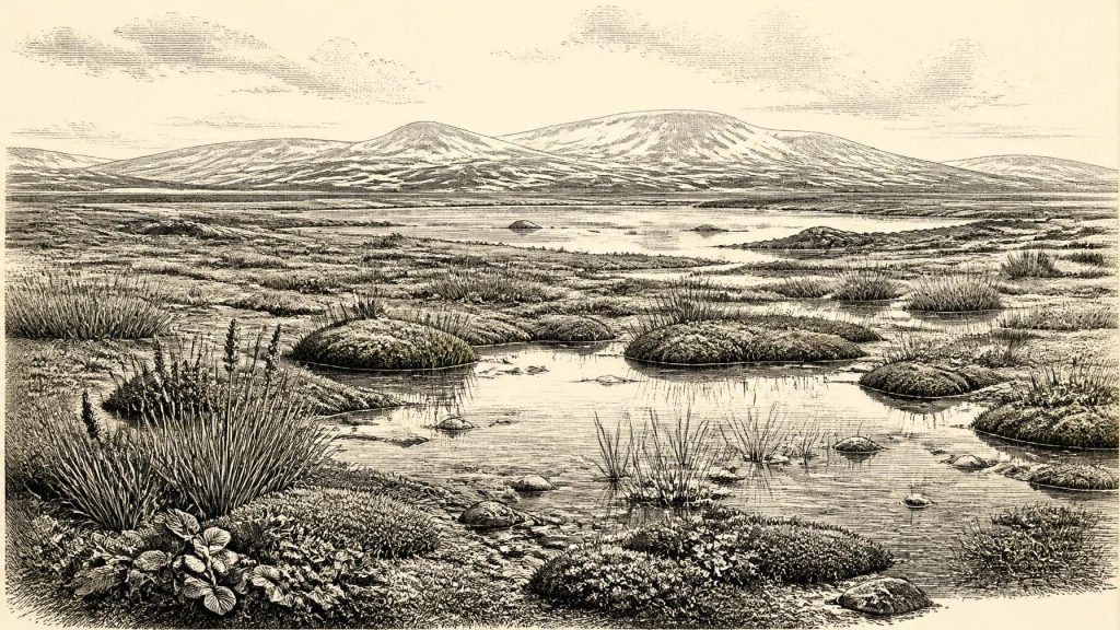
At the notional date of 31,517 BCE, Ireland cannot be described through annual events or societies, but through uncertain environmental evidence. Derryvree, County Fermanagh, preserves freshwater organic sediments dated broadly to 36,900–31,700 cal BP, showing an ice-free, periglacial tundra of mosses, wet ground and shallow water before later glaciation. MIS 3 climates fluctuated sharply, with ice conditions uncertain; Crag Cave confirms milder conditions. Castlepook Cave records cold-stage animals, though its mixed deposits require caution. A cut-marked reindeer bone may indicate human activity, not settlement. No institutions or securely dated habitation are known; plants, ice and fauna provide the firmest record.
Dateline
The label “31,517 BCE” gives a useful place in a modern timeline, but it cannot identify a recoverable year in Irish prehistory. Nobody in Ireland recorded dates, rulers or events in a calendar at this depth of time, and neither radiocarbon dating nor glacial stratigraphy can distinguish what happened in one twelve-month interval. Converted into the archaeological convention of calibrated years before 1950, the notional date is about 33,466 cal BP. It belongs to the later part of the Last Glacial Period, within Marine Isotope Stage 3 (MIS 3), an era of abrupt climatic shifts rather than a stable world.
The responsible history of Ireland at this point is therefore not an annal of kings, wars or migrations. It is a history assembled from buried freshwater silts, pollen, plant remains, cave bones, ice-sheet landforms and laboratory dates. The best evidence offers date ranges. At Derryvree, near Maguiresbridge in County Fermanagh, organic sediments between two tills have produced a calibrated range of roughly 36,900–31,700 cal BP. That broad bracket encompasses 31,517 BCE. It does not prove that every part of Ireland looked alike, nor that the deposit formed in a single moment. It does establish that north-central Ireland held an ice-free freshwater and periglacial landscape during part of this difficult interval.
A Landscape Between Ice Advances
Derryvree was exposed during road works in 1969, when a cutting passed through a drumlin. Beneath a younger sheet of glacial till lay silts and fine sands containing organic material: the remains of a former body of freshwater and its margins, later buried by advancing ice. This sequence matters because glacial erosion has destroyed or obscured much of Ireland’s older surface record. Derryvree is a rare survival from a period when the island’s climates, ice margins and ecosystems changed repeatedly.
The sediments indicate open tundra vegetation and periglacial conditions. Periglacial does not mean permanently ice-covered: it describes land affected by severe frost, seasonal freezing and thawing, sparse plant cover and ground processes associated with a cold climate. Water nevertheless stood or flowed locally. The deposit contains freshwater plants and mosses, while pollen—though poorly preserved—is dominated by herbaceous forms. Such evidence supports a picture of sedge-rich wet ground, shallow pools, exposed mineral soil and low vegetation rather than later Irish woodland or blanket bog.
Among the striking botanical finds were mosses and plants associated with cold, open habitats, including bogbean and water-milfoil. Their presence is evidence, not scenery: individual seeds, leaves and spores demonstrate that freshwater niches existed. From them, archaeologists infer a patchwork landscape in which damp hollows could be productive even when surrounding slopes were wind-scoured and treeless. Dwarf willow, juniper and other shrubby plants may have occupied sheltered places in comparable north-west European environments, but the Derryvree evidence does not licence a detailed reconstruction of every valley or coast.
Climate on an Atlantic Margin
MIS 3 was marked by rapid oscillations recorded especially clearly in Greenland ice cores. Relatively milder Greenland Interstadials alternated with colder Greenland Stadials, sometimes over timescales much shorter than traditional archaeological periods. The Derryvree range spans several possible interstadial correlations, so it should not be assigned confidently to one named warming episode. What can be said is that its organic freshwater bed belongs to a phase when conditions allowed standing water, vegetation and biological productivity before later glaciation covered the site.
Crag Cave in County Kerry offers a separate, complementary line of evidence. Speleothems—cave calcite deposited by dripping water—formed episodically during MIS 3. In a shallow cave system, their growth implies liquid water and ground conditions sufficiently mild for soil carbon dioxide and water to circulate. They do not turn south-west Ireland into a temperate refuge, but they confirm that the Irish climate responded sharply to wider North Atlantic fluctuations. Around the notional year in question, Ireland should be understood as environmentally varied and unstable: not a uniformly frozen island, but neither a reliably benign one.
Ice was also becoming a decisive force. The later British–Irish Ice Sheet would cover extensive parts of Ireland and the surrounding shelf, remaking terrain through erosion and deposition. Modern reconstructions show rapid expansion in the period after about 31,000 years ago, but its precise configuration at any earlier individual date remains uncertain and regional. Derryvree demonstrates ice-free ground in one part of Fermanagh within its dated range; it cannot be used to declare the whole island ice-free at 31,517 BCE. Coasts, uplands and western sectors may have experienced very different conditions.
Animals and the Cave Record
Southern Irish caves preserve another fragmentary archive. Castlepook Cave, near Doneraile in north County Cork, has yielded remains attributed to a cold-stage fauna including reindeer, woolly mammoth, giant deer, brown bear, wolf, Arctic fox, mountain hare, lemmings and spotted hyaena. The assemblage is important, but it is not a single living community photographed in time. Cave deposits accumulated through carnivore activity, water movement, collapse, repeated use and antiquarian excavation. Different bones can be of different ages, and old collections often lack the stratigraphic detail that a modern excavation would provide.
Recent accelerator radiocarbon work has transformed this picture. Re-dating showed that a number of older determinations from Castlepook had been too young, placing significant elements of the southern Irish fauna in MIS 3. The results suggest that giant deer and spotted hyaena may have disappeared locally before about 40,000 cal BP, while other animals survived into later phases. Reindeer, mammoth and carnivores evoke an open, mobile ecosystem, but they must not all be placed automatically beside one another in the same season, let alone on the same day.
Nevertheless, the wider implication is clear. Ireland was ecologically connected to the north-west European Ice-Age world during habitable episodes. Low global sea level altered the shape of the surrounding seas and exposed land on continental shelves, though the exact routes available at particular moments remain debated. Animals could spread, retreat or vanish as food, snow cover, sea barriers and ice margins changed. The movement of a reindeer herd was not “trade” or “diplomacy”, but it was the kind of ecological connection upon which any human journey would have depended.
The Castlepook Reindeer Question
A reindeer femur from Castlepook gives this period exceptional archaeological interest. The bone has been presented by County Cork heritage interpretation as dating to about 31,000 BCE and bears a deep linear mark identified by zooarchaeologist Ruth Carden as consistent with cutting or chopping fresh bone using a sharp stone tool. If that identification and association are sustained, it may indicate that Upper Palaeolithic people handled or butchered a reindeer in Ireland roughly within the broader era represented by this article.
That is a consequential possibility, but it is not proof of a settled population. The date measures the age of the animal, not the exact moment of the mark. The bone derives from an old cave collection rather than a sealed excavation layer containing an associated hearth, lithic assemblage, dwelling floor or repeated occupation debris. Nor do present investigations at Castlepook supply such a context: the 2022 excavation located surviving deposits but reported no cultural artefacts. A single modified bone cannot tell us whether people killed the animal, scavenged it, stripped hide or sinew, extracted marrow, or processed it elsewhere before carnivores brought remains into the cave.
Accordingly, there is no responsible basis for describing a camp, family, leader, clan territory or ritual at 31,517 BCE. If people were present, the most restrained inference is a short visit by a very small, highly mobile party equipped with a stone cutting edge and capable of exploiting large animals. Such a party might have crossed a wider landscape shared with people elsewhere in Upper Palaeolithic Europe. This remains an interpretation extrapolated from comparative archaeology, not a direct observation of Irish social life.
What Cannot Yet Be Written
There is no evidence for political institutions, chiefs, diplomacy, formal warfare, monuments, farming, villages, writing, schooling or organised religion in Ireland at this date. There are no securely dated houses, graves, toolkits or art objects that allow historians to reconstruct everyday human life. The absence of evidence is shaped partly by genuine scarcity and partly by later ice action, which removed or buried landscapes where traces might once have survived. It must not be mistaken for evidence that no person ever entered Ireland, but it does set strict limits on the narrative.
Economy and culture are best approached through the landscape. Wetland plants drew on sunlight, water and short growing seasons; herbivores converted open-country vegetation into meat, hides, bone and antler; predators and scavengers redistributed carcasses into caves. If humans briefly visited, animal resources may have been central to their subsistence, yet neither an Irish hunting economy nor regular exchange networks can be demonstrated. The principal development was environmental: Ireland contained intermittent habitable terrain within an increasingly glaciated north Atlantic region, a landscape whose plants, animals and sediments outlasted any human footprint.
For this notional year, Derryvree’s buried mosses are therefore more secure witnesses than any imagined prehistoric drama. They record a cold freshwater margin beneath a future drumlin, while Castlepook’s bones show that large mammals moved through southern Ireland in the broader MIS 3 world. Together they reveal an island—or, more precisely, a changing landmass at Europe’s north-western edge—where ice, water and animal movement set the limits within which the earliest possible human encounters occurred.
Primary Sources
- A Middle Midlandian Freshwater Series at Derryvree, Maguiresbridge, County Fermanagh, Northern Ireland
- Palaeoecology
- A Reconsideration of the Radiocarbon Dating of the Marine Isotope Stage 3 Fauna from Southern Ireland
- The Irish Quaternary Fauna Project
- New Insights on the Fauna of Ireland’s Younger Dryas and Early Holocene from Alice & Gwendoline Cave
- The Exploration of Castlepook Cave, County Cork
- 2022:564 – Castlepook Cave, Castlepook South, Cork
- Heritage Artefacts of County Cork 2021
- Episodic Speleothem Deposition Tracks the Terrestrial Impact of Millennial-Scale Last Glacial Climate Variability in SW Ireland
- The IntCal20 Northern Hemisphere Radiocarbon Age Calibration Curve (0–55 cal kBP)
- A Stratigraphic Framework for Abrupt Climatic Changes During the Last Glacial Period Based on Three Synchronized Greenland Ice-Core Records
- A 60,000 Year Greenland Stratigraphic Ice Core Chronology
- Growth and Retreat of the Last British–Irish Ice Sheet, 31,000 to 15,000 Years Ago: the BRITICE-CHRONO Reconstruction
- The Timing and Magnitude of the British–Irish Ice Sheet Between Marine Isotope Stages 5d and 2
- Pattern and Timing of Retreat of the Last British-Irish Ice Sheet
- Late Pleistocene Chrono-Stratigraphy and Ice Sheet Limits, Southern Ireland
- Maximum Extent and Dynamic Behaviour of the Last British–Irish Ice Sheet West of Ireland
- Oscillating Retreat of the Last British-Irish Ice Sheet on the Continental Shelf Offshore Galway Bay, Western Ireland
- Dimensions and Chronology of the Last Ice Sheet in Western Ireland
- Trimlines, Blockfields and the Vertical Extent of the Last Ice Sheet in Southern Ireland
- AMS Radiocarbon Dating of Ancient Bone Using Ultrafiltration
- AMS Radiocarbon Dating of Middle and Upper Palaeolithic Bone in the British Isles: Improved Reliability Using Ultrafiltration
- Quality Assurance of Ultrafiltered Bone Dating
- European Middle and Upper Palaeolithic Radiocarbon Dates Are Often Older Than They Look: Problems with Previous Dates and Some Remedies
