

Maguirebridge’s Intertill Calendar31284 BCE
31,284 BCE is a modern label rather than a recorded Irish year. Derryvree, County Fermanagh, preserves freshwater sediments between glacial tills, dated broadly to a period encompassing this date, showing an ice-free tundra wetland with mosses, sedges and insects. Castlepook Cave, County Cork, contains MIS 3 fauna, including mammoth, reindeer, giant deer, predators and smaller cold-adapted animals, accumulated over millennia. A marked reindeer femur may indicate human butchery around 33,000 years ago, but remains disputed and cannot demonstrate settlement. Evidence supports intermittently habitable, climatically changing Pleistocene landscapes, not kingdoms, permanent communities or a specific event in the nominated year itself.
Dateline
31,284 BCE is a modern chronological label, not a year that anyone in Ireland could have named, recorded or remembered. There are no annals, calendars, settlements or human remains that permit an event to be assigned to this particular year. At this depth of time, archaeology works with deposits, fossils and probability ranges. The date falls roughly 33,233 calendar years before the conventional radiocarbon reference year of 1950, within the later part of the Last Glacial Period and broadly within Marine Isotope Stage 3 (MIS 3). It should not be confused with a radiocarbon age of 33,233 BP: radiocarbon measurements must be calibrated because atmospheric carbon-14 levels have varied over time.
A Landscape Between Ice Advances
The closest well-dated Irish environmental evidence comes from Derryvree, near Maguiresbridge in County Fermanagh. Roadworks in 1969 cut through a drumlin and exposed freshwater silts and fine sands trapped between two distinct layers of glacial till. This sequence offers a clear relative history. Ice had deposited the lower till; during a later ice-free interval, water and organic sediment accumulated; then another advance of ice sealed the deposit below the upper till. It does not provide a diary of 31,284 BCE, but it demonstrates that this part of Ireland experienced dramatic alternations between glacial occupation and open ground.
Organic material from the Derryvree freshwater bed produced a conventional radiocarbon determination of 30,500 +1,170/−1,030 BP. When calibrated, the broad range commonly associated with this determination is approximately 36,900–31,700 cal BP, or about 34,950–29,750 BCE. The editorial year therefore lies inside that large range, but not at a detectable point within the deposit. The responsible conclusion is limited but important: an ice-free, freshwater environment existed at Derryvree during part of this span. It cannot establish that all of Ireland was ice-free, that every layer formed at once, or that a particular pond existed in the nominated year.
Tundra, Pools and Mosses
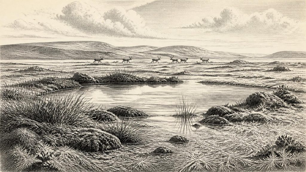
Derryvree was not the green, wooded Ireland familiar from later millennia. Its pollen, plant macrofossils and insect remains indicate open tundra and a periglacial climate: ground strongly shaped by frost, short growing seasons and long severe winters. Herbaceous pollen predominates. Mosses, sedges and wet-ground plants grew around shallow freshwater, while the wider terrain was probably sparse and exposed. Small pools, muddy margins and waterlogged patches made up a functioning ecosystem, but not a gentle lakeside landscape. In such conditions, vegetation could be locally productive in summer while remaining treeless and vulnerable to cold winds and frozen soils.
This local evidence matters because later ice movement removed, buried or disturbed much of Ireland’s older surface record. A surviving organic bed beneath till is therefore unusually valuable. It preserves not only a climate signal but signs of biological life—plants and invertebrates whose remains would rarely survive in an exposed upland setting. Comparable Fermanagh sites, including Greenagho and Hollymount, reinforce the conclusion that non-forested, cold-stage environments occurred during the Midlandian glaciation. Yet they also underline regional complexity. Ireland was not a uniform sheet of ice or a uniform grassland; glaciers, wetland basins, exposed slopes and changing coastal zones could coexist across a changing island-scale landscape.
Animals in Southern Caves
Far to the south, Castlepook Cave—also known as Mammoth Cave—near Doneraile in north County Cork provides the principal Irish record of earlier Last Glacial mammals. Its assemblage includes woolly mammoth, reindeer, giant deer, brown bear, wolf, mountain hare, lemmings and spotted hyaena. That list is striking, but it is not a single photograph of one landscape. The bones were accumulated over a long period and by several processes. Carnivores could drag prey or scavenged carcasses into caves; hyaenas could use cave chambers as dens; water, collapse and later disturbance could move or damage material. Early twentieth-century excavations also took place before modern standards of stratigraphic recording and recovery.
Modern re-dating has made Castlepook more significant and more complicated. Carden, Higham and Woodman showed that several dates from Castlepook were between about 5,000 and 12,000 radiocarbon years older than earlier results had suggested, moving crucial elements of the fauna securely into MIS 3. Their results suggest that animals including giant deer and spotted hyaena may have disappeared locally before the later Last Glacial Maximum, around 40,000 calibrated years BP. Thus the cave documents repeated cold-stage animal communities across millennia, rather than proving that mammoths, hyaenas and reindeer all stood together outside the cave during 31,284 BCE.
The presence of large grazing and browsing mammals nevertheless shows that, during favourable intervals, parts of Ireland could sustain more life than the phrase “Ice Age” implies. Reindeer point to open, cold-adapted environments; mammoths and giant deer imply substantial seasonal forage; hyaenas and wolves reveal a food web containing large carnivores and carrion. The animals must have reached Ireland through a north-west European landscape whose coastlines, sea levels and ice margins differed greatly from those of today. Exactly which routes were available at each moment remains unresolved. Lower sea levels did not automatically create a simple, continuous land bridge, and advancing ice could both open and close practical pathways.
The Reindeer Femur Question
One Castlepook object has particular importance for human history: a reindeer femur reported in 2021 as approximately 33,000 years old and bearing a deep linear mark interpreted by zooarchaeologist Ruth Carden as damage from a sharp stone tool during butchery. If that interpretation is confirmed, it would be Ireland’s earliest known indication that people handled an animal, extending the island’s possible human story far beyond the established terminal Pleistocene evidence from Alice and Gwendoline Cave in County Clare.
The qualification is essential. The femur is not a discovered camp floor, and its date is not a date for the incision alone. It dates the death of the animal within a scientific range; it does not reveal whether the carcass was hunted locally, how soon the bone was marked, or whether people stayed in the vicinity. There is no securely associated stone-tool assemblage, hearth, shelter, burial, dwelling surface or group of butchered remains at Castlepook of this age. Marks on bone require careful comparison with damage caused by teeth, trampling, breakage, sediment movement, weathering and excavation. The reported femur is therefore promising evidence of possible human activity, not proof of permanent settlement or an unbroken population in Ireland. Recent work at Castlepook is explicitly directed towards finding undisturbed deposits and testing these questions.
No Kingdoms, No Proven Trade
There is no evidence for political communities, leaders, diplomacy, warfare, territorial boundaries or formal religion in Ireland at this date. Nor is there evidence for farming, stock-keeping, metalworking, pottery, exchange networks or permanent villages. It would be misleading to turn the movements of animals—or a possible episode of carcass processing—into a story of tribes, rivalries or named peoples. The archaeological record cannot identify an Irish language, a ritual tradition, artwork or system of learning from this period.
If people did visit Ireland during this broad MIS 3 interval, the best comparison is with highly mobile Upper Palaeolithic hunter-gatherers elsewhere in north-west Europe. Their immediate concerns would have been warmth, dry shelter, fuel, safe travel, weather and access to food, not the institutions of later history. A reindeer carcass, if processed by people, could have supplied meat, marrow, hide, sinew and bone. That is a plausible interpretation of subsistence behaviour, but it remains an inference from one disputed object rather than evidence for a local economy. The cave itself may have been used principally by animals, not humans.
An Archive, Not an Anniversary
The most meaningful development around 31,284 BCE is therefore environmental rather than political. Ireland contained, at intervals, cold open habitats with freshwater wetlands in Fermanagh and a diverse large-mammal fauna in the south. It lay in a dynamic zone of repeated climatic shifts, changing ice margins and altered coastlines. The larger British–Irish Ice Sheet reached its major Late Glacial extent later, while reconstruction of its growth and retreat shows why no simple map of an eternally frozen Ireland is credible.
Derryvree’s silts and Castlepook’s bones are not monuments to a single year. They are fragile archives of processes: water flowing between glacial episodes, plants growing on frost-affected ground, animals moving through changing habitats, predators accumulating bone, and perhaps humans briefly entering the record. The absence of a dense archaeological signature is itself significant. For now, the evidence supports a Pleistocene Ireland intermittently habitable for animals and possibly visited by people, but not a demonstrable settled society. Future excavation, refined dating, taphonomic study and analysis of cave sediments may alter that judgement. Until then, this is a history best told in calibrated ranges and carefully separated possibilities.
Primary Sources
- A Middle Midlandian Freshwater Series at Derryvree, Maguiresbridge, County Fermanagh, Northern Ireland
- A Reconsideration of the Radiocarbon Dating of the Marine Isotope Stage 3 Fauna from Southern Ireland
- The Irish Quaternary Fauna Project
- The IntCal20 Northern Hemisphere Radiocarbon Age Calibration Curve (0–55 cal kBP)
- Growth and Retreat of the Last British–Irish Ice Sheet, 31,000 to 15,000 Years Ago: The BRITICE-CHRONO Reconstruction
- Late Pleistocene Chronostratigraphy and Ice Sheet Limits, Southern Ireland
- Dimensions and Chronology of the Last Ice Sheet in Western Ireland
- Trimlines, Blockfields and the Vertical Extent of the Last Ice Sheet in Southern Ireland
- Oscillating Retreat of the Last British-Irish Ice Sheet on the Continental Shelf Offshore Galway Bay, Western Ireland
- The Deglaciation of the Western Sector of the Irish Ice Sheet from the Inner Continental Shelf to Its Terrestrial Margin
- Timing and Pace of Ice-Sheet Withdrawal Across the Marine–Terrestrial Transition West of Ireland During the Last Glaciation
- First Evidence of a Late Upper Palaeolithic Human Presence in Ireland
- New Insights on the Fauna of Ireland's Younger Dryas and Early Holocene from Alice & Gwendoline Cave
- Investigating Seasonal Mobility in Irish Giant Deer Megaloceros giganteus Through Strontium Isotope Analysis
- Phylogeographic, Ancient DNA, Fossil and Morphometric Analyses Reveal Ancient and Modern Introductions of a Large Mammal: The Complex Case of Red Deer in Ireland
- Spotted Hyena Skull
- Archaeological Heritage of County Cork
- 2022:564 — Castlepook Cave, Castlepook South, Cork
- Castlepook Caves Project: Archaeology Research Excavation Grant Report
- Palaeoecology: Irish Quaternary Association Guide
- Ireland: Submerged Prehistoric Sites and Landscapes
- BRITICE-CHRONO Maps and GIS Data of the Last British-Irish Ice Sheet, 31 to 15 ka
- Ice Sheet Limits and Chronostratigraphy in the Southern Sector of the Last Irish Ice Sheet
- Ireland's Palaeolithic Archaeology – Fleeting Footprints in a Frozen Land