Mosses Under the Derryvree Drumlin31330 BCE
31,330 BCE is a notional date within the climatically unstable Late Pleistocene, not a recoverable Irish historical year. At Derryvree, County Fermanagh, freshwater silts beneath glacial till, broadly dated to 36,900–31,700 cal BP, preserve evidence of mosses, sedges, insects and open periglacial wetlands. Ireland experienced uneven glacial build-up, with ice, exposed terrain and changing coastlines varying regionally. Castlepook Cave, County Cork, contains mixed Late Pleistocene remains of mammoth, reindeer, giant deer, hyena and other fauna, demonstrating episodically viable cold-country habitats. A possibly cut-marked reindeer femur may indicate brief human activity, but cannot prove settlement. None proves agriculture or permanent population.
Dateline
31,330 BCE is a modern calendar label, not a year that can be recovered from Ireland’s prehistoric record. There were no written annals, named rulers, states or calendar systems from which an event in this particular twelve-month span could be identified. Converting the date arithmetically places it about 33,280 years before the conventional radiocarbon reference year of AD 1950, but that calculation must not be mistaken for archaeological precision. At this depth of time, evidence is expressed through radiocarbon determinations, calibrated ranges, cave deposits, fossils and glacial landforms. These normally describe long episodes, not a single year.
The appropriate setting is the Late Pleistocene, broadly within the later part of Marine Isotope Stage 3, a cold and climatically unstable phase of the last Ice Age. Ireland around this point was not the wooded, island landscape familiar from later prehistory. Nor is it safe to portray the whole island as uniformly sealed beneath the ice sheet that reached its fullest late-glacial extent later. The evidence instead indicates a country of sharply varying local conditions, repeatedly affected by advancing ice, severe cold, open vegetation and occasional habitable refuges.
A Date in Ranges
The closest well-known Irish environmental archive is Derryvree, near Maguiresbridge in County Fermanagh. Roadworks in 1969 cut through a drumlin and revealed fine sands and freshwater silts between two layers of till: unsorted material deposited by glacier ice. The sequence is important because it demonstrates that a period of sediment accumulation and biological activity separated two glacial episodes. Organic material in the freshwater deposit produced the radiocarbon determination BIRM-166, 30,500 radiocarbon years BP, with a substantial uncertainty. Calibration gives a broad calendar-age span, commonly placed around c. 36,900–31,700 cal BP. The notional year 31,330 BCE falls within that wide window, but cannot be pinned to any particular level in the deposit.
Derryvree therefore supplies a responsible local comparison rather than a date-stamped portrait of all Ireland. Its evidence is especially valuable because later glaciers scoured, buried or disturbed much of the older landscape. A freshwater deposit preserved beneath later till is an unusual survival. It tells us that, in this part of Fermanagh during one cold-stage interval, water could stand long enough for silt, plant remains and insect material to gather. It does not demonstrate that conditions were identical in Cork, Donegal, the central lowlands or the coast.
Wet Ground in a Cold Country
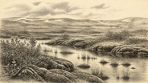
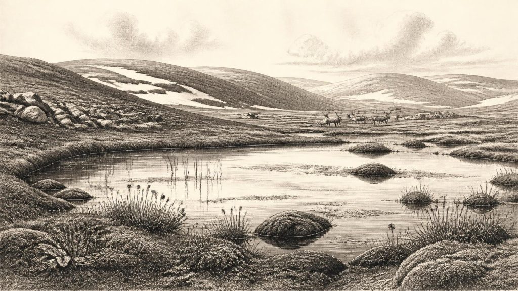
Fossil pollen, plant macrofossils and insects from Derryvree point to open tundra-like vegetation and a periglacial climate. Periglacial means a landscape strongly shaped by intense cold, freeze-thaw action and seasonally or persistently frozen ground; it does not necessarily mean that an ice margin stood immediately beside the site. The preserved flora included mosses and herbaceous plants, while the wider assemblage supports wet, plant-rich ground with shallow pools and mossy margins. Grasses, sedges, hardy herbs and juniper were better suited to this setting than forest trees.
Small quantities of pine or hazel pollen do not prove local woodland. Pollen can travel considerable distances, and ancient deposits may contain redeposited grains. The defensible interpretation is consequently one of sparse, treeless cover, waterlogged hollows and exposed ground rather than a precise plant-by-plant reconstruction. Summers may have supported brief but productive growth; winters were severe. Such environments were not empty wastes. They contained freshwater, vegetation, insects and grazing opportunities, although their resources were seasonal and vulnerable to abrupt climatic change.
Ice in Motion
Ireland’s ice history around 33,000 calendar years ago remains an active field of research. Different methods and regions have produced a complicated picture. Some radiocarbon evidence and coastal deposits suggest that substantial Irish ice existed before the later Last Glacial Maximum, while other findings show ice-free or less heavily glaciated intervals in particular areas. Modern reconstructions increasingly stress that the British–Irish Ice Sheet did not grow everywhere at the same rate. Its later, best-documented maximum advance towards the continental shelf edges occurred broadly after this date in several sectors, especially around c. 27,000–23,000 cal BP.
For 31,330 BCE, the safest conclusion is not that Ireland was wholly ice-free, nor that every valley was buried beneath the eventual maximum ice sheet. Rather, the island was within a phase of glacial build-up and fluctuation. Ice may already have occupied uplands and some western or northern sectors while wetlands and open ground persisted elsewhere at different times. The sea, too, lay in a changing Ice Age world, with lowered global sea levels and coastlines unlike those of today. Yet the available evidence cannot securely map a route by which animals or people crossed between Ireland and Britain at this exact time.
Castlepook’s Animal Archive
Nearly 400 kilometres south of Derryvree, Castlepook Cave near Doneraile in north County Cork preserves Ireland’s richest known Late Pleistocene vertebrate assemblage from before the Last Glacial Maximum. Excavations in the early twentieth century recovered more than 2,000 bones from its galleries, which were given evocative names including Hyenahall and Elephant Hall. Later radiocarbon work showed that the material represents a long and mixed accumulation, extending broadly from more than 45,000 to about 20,000 years BP. It is not the remains of one hunt, one occupation or one generation.
Nevertheless, the cave establishes that large mammals reached Ireland during this broader interval. Its fauna includes woolly mammoth, reindeer, giant deer, brown bear, wolf, Arctic fox, lemmings and spotted hyena. The combination evokes open, cold-country habitats with sufficient grazing and carrion to sustain large herbivores and their predators or scavengers. A cave accumulation also records the habits of carnivores, water movement and natural deaths, as well as human excavation practices. It cannot straightforwardly be treated as a census of animals living outside the cave on any chosen day.
The spotted hyena is particularly revealing. It was not an exotic visitor from a hot landscape: Pleistocene spotted hyenas ranged far beyond modern Africa and occupied cool Eurasian environments. At Castlepook, hyena activity may explain how some bones reached the cave. Wolves, bears and other animals may likewise have used sheltered places in different ways. The fossil record shows an ecosystem, but not a settled human community controlling it.
The Reindeer Femur Question
A reindeer femur from Castlepook has made this period unusually significant for Irish archaeology. Re-examined within the National Museum of Ireland’s collections, it has been reported as about 33,000 years old and as carrying a deep mark interpreted by palaeozoologist Ruth Carden as damage made by a sharp stone tool during butchery. The object has been publicly presented as evidence that Upper Palaeolithic people processed a reindeer in Ireland, perhaps broadly close to the date considered here.
The claim deserves attention precisely because it is so consequential, but its limits must remain clear. The dated bone is not an annual record; the commonly reported age is not a published calendar-year timestamp for an act of cutting. Castlepook has not yielded a securely associated hearth, stone-tool assemblage, dwelling floor, burial, art or preserved human remains of the same age. One marked bone cannot establish a permanent settlement, population size, language, political community or descent from later inhabitants. It may indicate a brief visit by hunters, processing of a carcass elsewhere, and subsequent transport of a bone into a carnivore-used cave.
No Kingdoms, No Diplomacy
There is no evidence for political affairs, warfare, diplomacy, institutions or organised religion in Ireland at 31,330 BCE. These are not absences that excavation has merely failed to fill with names; they are questions beyond the resolution of the surviving record. If people did reach the island, they would have belonged to mobile Upper Palaeolithic hunter-gatherer societies whose wider European contemporaries relied on close social networks, knowledge of animal movements, stone-working skill and seasonal mobility. Applying that general context to Ireland is an interpretation, not direct evidence for an Irish camp or tradition.
Economy, in the limited sense supported here, was ecological rather than agricultural. There were no farms, fields, livestock, cereal crops, pottery stores or permanent villages evidenced for this time. Reindeer and other large mammals could have offered meat, hides, sinew, bone and antler to any human visitors, but Castlepook’s record does not prove regular hunting on the island. No contemporary Irish source of worked flint tools has been securely identified. The possibility of travel, exchange or shared knowledge across the Irish Sea zone remains plausible in a broad Upper Palaeolithic sense, yet unproven for this particular period.
A Fragile Presence
The principal historical development around 31,330 BCE was environmental instability. Ireland was a place where cold wetlands could form beneath a drumlin in Fermanagh, where large mammals ranged through open country in the south, and where advancing ice repeatedly altered the prospects for life. The Derryvree silts and Castlepook bones preserve fragments of that world, not a continuous narrative. They show that Ireland possessed habitats capable of sustaining vegetation and Ice Age fauna during parts of MIS 3. The cut-marked reindeer femur may add a rare human trace, but it does not turn the period into the beginning of a documented Irish population.
For this notional year, then, the most responsible history is one of evidence and restraint: freshwater mosses and sedges under later glacial deposits; mammoth, reindeer and hyena bones in a Cork cave; and a disputed but important sign that people may have handled a reindeer. These remains illuminate an Ireland of episodic opportunity, harsh climate and profound uncertainty—long before the later post-glacial communities from which the island’s more continuous human story can be traced.
Primary Sources
- Castlepook Cave
- Heritage Artefacts of County Cork
- Spotted Hyena Skull
- The Exploration of Castlepook Cave, Co. Cork. With 3 Plates.
- Occurrence of mammalia relicts at site Castlepook Cave
- Mammoth Cave
- The Irish Quaternary Fauna Project
- Pleistocene Vertebrates in the British Isles
- Palaeoecology
- Irish Pleistocene Biostratigraphy
- Radiocarbon Constraints on the History of the Western Irish Ice Sheet Prior to the Last Glacial Maximum
- Growth and Retreat of the Last British–Irish Ice Sheet, 31,000 to 15,000 Years Ago: the BRITICE-CHRONO Reconstruction
- The Last Irish Ice Sheet: Extent and Chronology
- Late Pleistocene Chronostratigraphy and Ice Sheet Limits, Southern Ireland
- Maximum Extent and Dynamic Behaviour of the Last British–Irish Ice Sheet West of Ireland
- Stratigraphic and Palaeo-Geomorphological Evidence for the Glacial-Deglacial History of the Last British-Irish Ice Sheet in the North-Western Irish Sea
- Early Deglaciation of the British-Irish Ice Sheet on the Atlantic Shelf Northwest of Ireland Driven by Glacioisostatic Depression and High Relative Sea Level
- Timing and Pace of Ice-Sheet Withdrawal Across the Marine–Terrestrial Transition West of Ireland During the Last Glaciation
- Radiocarbon Constraints on the Age of the Maximum Advance of the British-Irish Ice Sheet in the Celtic Sea
- Trimlines, Blockfields and the Vertical Extent of the Last Ice Sheet in Southern Ireland
- New Insights on the Fauna of Ireland's Younger Dryas and Early Holocene from Alice & Gwendoline Cave
- 32564: Castlepook Cave, County Cork