

Crag Cave’s Waning Drips31331 BCE
31,331 BCE is best understood as part of later Marine Isotope Stage 3, not a recoverable year in Irish history. Derryvree sediments in Fermanagh record a cold, treeless freshwater wetland between glacial advances, supporting plants, insects and seasonal animal life. Crag Cave speleothems in Kerry indicate episodic milder conditions before cave-water deposition ceased around 32,100 years ago as climate cooled. Ice growth, lowered sea levels and shifting coastlines produced uneven regional environments. Castlepook Cave preserves cold-stage fauna and a contested possible cut-marked reindeer bone, but no secure evidence of human occupation. Ireland’s record is chiefly environmental, fragmented by later glaciation.
Dateline
The label 31,331 BCE is a modern chronological convenience, not a date at which Ireland’s past can be reconstructed year by year. No written record, settlement sequence or archaeological layer can identify an event in this particular calendar year. In relation to the conventional radiocarbon reference year of AD 1950, it falls at roughly 33,280 calendar years before present. The responsible frame is therefore a broad interval in the Late Pleistocene, within Marine Isotope Stage 3 (MIS 3), rather than a single year of Irish history.
This was an Ice Age world, but not one that can be reduced to a permanent white blanket over the whole island. Climate, vegetation, sea level and glacier margins changed sharply over millennia and, at times, much more quickly. The fullest expansion of the last British–Irish Ice Sheet lay later, chiefly during the global Last Glacial Maximum, conventionally dated to about 26,500–19,000 years ago. Around the requested point in time, evidence instead suggests a varied landscape in which cold, open ground, freshwater hollows, cave systems and growing ice masses existed in different places and at different times.
A Date Measured in Ranges
At this depth of time, even scientific dating is necessarily expressed as probability ranges. A radiocarbon age is not a calendar date: the amount of radioactive carbon in the atmosphere varied, so measurements must be calibrated against independently dated records. The modern IntCal20 calibration curve extends to 55,000 calendar years before present, but it does not transform a late-Pleistocene sample into a dateable day or year. Uncertainties in the sample, the calibration curve and the relationship between a specimen and its deposit all matter.
For Ireland, the closest important environmental comparison is Derryvree near Maguiresbridge in County Fermanagh. Organic freshwater sediment exposed in a road cutting produced the radiocarbon determination BIRM-166, 30,500 ± 1,100 radiocarbon years before present. Later calibration and modelling place the deposit broadly within later MIS 3, with discussion commonly giving a wide calendar interval of roughly 36,900–31,700 cal BP. The notional year 31,331 BCE falls inside such a range. That overlap means Derryvree can illuminate the environmental world around this date; it does not mean that its mud, plants and insects accumulated in that exact year.
Freshwater Between Ice Advances
Derryvree is valuable because of its stratigraphy. Fine sands, silts and organic material lay between two bodies of till, the unsorted debris laid down by glacier ice. The lower till records an earlier glacial episode. The intervening freshwater deposits record a period when the locality was not beneath active ice. The upper till records renewed glaciation. This is firm evidence for major environmental change: ice, then a functioning wet landscape, then ice again.
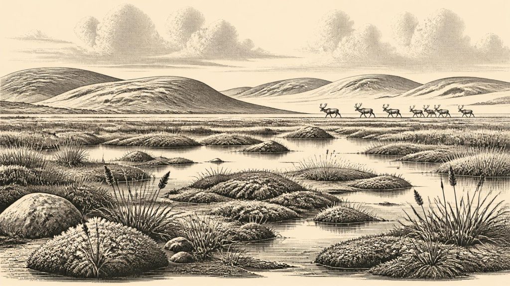
The deposit has often been described as a cold, treeless muskeg or tundra-like wetland. Plant macrofossils, pollen and insects point to pools, waterlogged ground and low vegetation rather than the dense oak, elm and hazel woods of much later Irish prehistory. Sedges, mosses and aquatic plants had habitats in the basin; bogbean is among the identifiable plants whose fossil record confirms freshwater conditions. Arctic-alpine elements indicate a severe climate with a short growing season. Yet the most secure interpretation is deliberately modest. Derryvree was one sheltered basin in Fermanagh, not a map of every valley, coast and upland in Ireland.
Its biological remains nonetheless show that cold landscapes were not lifeless. During summer, shallow water and wet ground could support plants, invertebrates and the animals that fed among them or passed through the surrounding open country. During winter, prolonged frost and snow cover were likely to have restricted growth. Repeated freezing and thawing shaped exposed soils, while wind and sparse plant cover made sediment movement more important than in wooded terrain. Such processes helped create the fragmentary record now available to archaeologists and Quaternary scientists.
Crag Cave and a Cooling Climate
Evidence from Crag Cave near Castleisland, County Kerry, provides another perspective. Speleothems – stalagmites and related cave calcite – require water to move through rock and cave passages without being persistently frozen. Uranium-thorium dating of material from Crag Cave shows that calcite formation during the last glacial period was episodic, broadly corresponding with relatively milder Greenland interstadials. A major hiatus in deposition begins at about 32,100 years ago and lasts until about 28,800 years ago.
The requested date, approximately 33,280 cal BP, sits shortly before that recorded break in growth. This does not establish the weather in Kerry in a particular year, nor does it prove that every part of Ireland was equally mild. It does, however, support an important wider conclusion: the Atlantic edge of Ireland responded to abrupt climatic instability. Conditions capable of sustaining dripping cave water had existed in south-west Ireland, but a colder phase was approaching or developing. The title image of ‘waning drips’ is therefore an interpretation of a long environmental transition, not a claim for a single observed season.
Ice, Coast and Changing Ground
Modern reconstructions of the British–Irish Ice Sheet begin their closely mapped sequence at around 31,000 years ago because older evidence is sparse and uncertain. Their optimum reconstruction includes ice accumulation centres in central Scotland, Northern Ireland and Shetland, while their minimum reconstruction allows more restricted ice on high ground. Offshore sediments indicate glacial activity near the shelf edge in some sectors by about 30,000 years ago. The point is not that one model has settled every local detail, but that ice growth was regional, dynamic and uneven.
Accordingly, Ireland at about 31,331 BCE should not be imagined either as wholly ice-free or wholly entombed beneath an ice sheet. Derryvree demonstrates a non-glacial interval in the north-western interior during the relevant broad period; Crag Cave records changing underground water conditions in the south-west; marine and geomorphological evidence records expanding ice elsewhere around the British–Irish region. Subsequent glaciers eroded and buried much of the older land surface, leaving a patchwork of surviving evidence rather than a continuous national chronicle.
Sea level was lower than today because substantial quantities of water were locked in global ice sheets. Ireland’s shoreline and coastal plains were therefore different, with parts of the continental shelf exposed or altered. But lower sea level alone does not prove a usable dry land route between Ireland and Britain at this particular time. The routes by which animals reached Ireland – whether across temporary coastal corridors, ice, narrow water crossings or changing island networks – remain difficult to recover. Fossil presence establishes that movement occurred; it does not identify one route, one season or one migration.
The Castlepook Evidence
At Castlepook Cave, also known as Mammoth Cave, near Doneraile in north County Cork, excavations and museum collections have produced Ireland’s most important pre-Last-Glacial-Maximum vertebrate assemblage. Material attributed to the broader Late Pleistocene includes reindeer, woolly mammoth, giant deer, brown bear, wolf, red fox, Arctic fox, mountain hare, collared lemming, Norwegian lemming and spotted hyaena. The assemblage makes clear that Ireland was reached, at intervals, by a striking cold-stage fauna unlike that of the modern island.
These animals should not be treated as a single herd living together on one day. Castle deposits were excavated over many years, often before modern standards of recording, and some were disturbed or mixed. Individual bones have produced different dates, demonstrating repeated episodes of accumulation. Carnivores may have carried prey or scavenged carcasses into caves; animals may also have died there naturally. A cave bone collection is thus evidence for regional fauna across time, not an exact census of the Awbeg valley in 31,331 BCE.
One reindeer femur from Castlepook has attracted exceptional attention. It has been reported as dating to around 33,000 years ago and carries a deep linear mark interpreted by Ruth Carden as possible fresh-bone cutting or chopping with a sharp stone tool. If that interpretation is confirmed through continuing analysis, it may indicate that people processed a reindeer in Ireland long before the better-attested post-glacial settlement of the island. It is an important possibility, not a settled historical fact.
No Recoverable Irish Society
There are no securely dated dwellings, hearths, occupation floors, stone-tool assemblages, burials or human remains in Ireland from around 31,331 BCE. Nor is there a securely demonstrated resident population. The Castlepook mark cannot, by itself, establish a camp, a family group, a language, a migration route or a lasting occupation. It would be especially misleading to project the well-documented Upper Palaeolithic cultures of continental Europe or Britain automatically across the sea into Ireland.
For that reason, there can be no responsible account here of political affairs, rulers, warfare, diplomacy, religion, formal learning, trade networks or artistic traditions in Ireland. There is no evidence for a polity, village, monument, ceremony or exchange system. Even if people briefly entered the island, their social identities and intentions are unknown. The absence of evidence is not proof that no human ever visited; it is a reminder that a solitary, contested trace cannot support a detailed social history.
The most substantial history of Ireland at this point is environmental. It is the history of ice margins advancing and retreating, freshwater sediment settling beneath a future drumlin, cave water gradually failing as climate cooled, and cold-adapted mammals finding or losing routes through a changing north-west European landscape. At 31,331 BCE, Ireland was not yet a historical society in the documentary sense. It was a changing Pleistocene terrain whose rare deposits preserve the ecological preconditions – and perhaps the faintest human possibility – of the much later human history of the island.
Primary Sources
- A Middle Midlandian Freshwater Series at Derryvree, Maguiresbridge, County Fermanagh, Northern Ireland
- The Irish Quaternary Fauna Project
- The Irish Quaternary Fauna Project
- Occurrence of mammalia relicts at site Castlepook Cave
- The Exploration of Castlepook Cave, County Cork
- Heritage Artefacts of County Cork
- Archaeological Heritage of County Cork
- Archaeology Research Excavation Grant 2022: Castlepook Cave Project Final Report
- Growth and Retreat of the Last British–Irish Ice Sheet, 31,000 to 15,000 Years Ago: the BRITICE-CHRONO Reconstruction
- Exploring Controls of the Early and Stepped Deglaciation of the British–Irish Ice Sheet
- The Deglaciation of the Western Sector of the Irish Ice Sheet from the Inner Continental Shelf to its Terrestrial Margin
- The Timing and Magnitude of the British–Irish Ice Sheet Between Marine Isotope Stages 5d and 2
- Spatio-temporal Dynamics of Speleothem Growth and Glaciation in the British Isles
- Episodic Speleothem Deposition Tracks the Terrestrial Impact of Millennial-Scale Last Glacial Climate Variability in SW Ireland
- Rapid Response of Climatic Conditions During the Last Glacial: Evidence from U-Series Dated Irish Speleothems
- The IntCal20 Northern Hemisphere Radiocarbon Age Calibration Curve (0–55 kcal BP)
- The IntCal20 Northern Hemisphere Radiocarbon Age Calibration Curve (0–55 cal kBP)
- Figure 6: The Subdivision of the Quaternary Period in Ireland
- Soils of Co. Waterford
- Pleistocene Vertebrates in the British Isles
- New Insights on the Fauna of Ireland's Younger Dryas and Early Holocene from Alice & Gwendoline Cave
- The Problem of a Late Quaternary Landbridge Between Britain and Ireland
- Biogeography of Ireland: Past, Present, and Future
- BSBI: Menyanthes trifoliata





