BIRM-166’s Treeless Interval31175 BCE
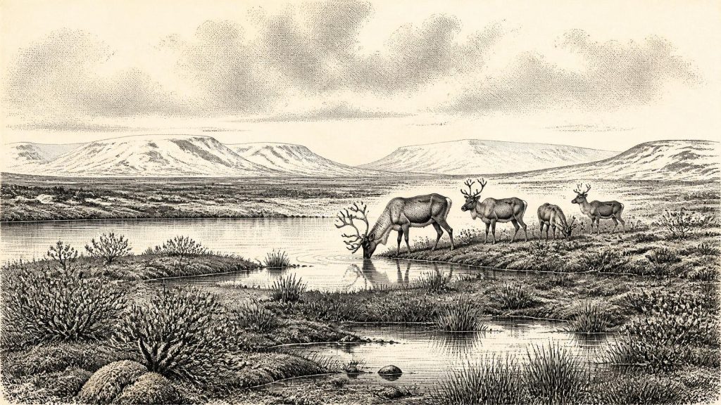
Around 31,175 BCE, Ireland lay within a changing Late Pleistocene landscape, not a recordable historical year. Derryvree in County Fermanagh preserves freshwater organic sediments between tills, dated broadly to an interval including this notional date. Its pollen, plants and insects indicate a treeless, cold wetland with tundra vegetation. Ireland was regionally varied as ice expanded towards its later maximum, while lower sea levels altered surrounding geography. Castlepook Cave yielded reindeer, mammoth, giant deer and predators, showing connections with wider European ecosystems. A possibly cut-marked reindeer bone suggests human presence, but cannot prove permanent settlement or occupation. Evidence therefore documents change.
Dateline
The label “31,175 BCE” is a modern chronological convenience, not a date that people in Ireland could have recognised or recorded. There is no annual historical record for this depth of time: no named community, ruler, battle, treaty, settlement or calendar. At best, the notional year falls roughly 33,100 years before AD 1950, within the later part of the Late Pleistocene and Marine Isotope Stage 3. The responsible history of Ireland at this point must therefore be written in broad calibrated ranges, geological sequences and cautiously interpreted animal remains.
A Date Within a Range
The nearest securely relevant Irish evidence is not a document or artefact but a buried freshwater deposit at Derryvree, near Maguiresbridge in County Fermanagh. Roadworks in 1969 cut through a drumlin and revealed silts and fine sands containing organic remains between two separate layers of till, the unsorted sediment left by glacier ice. The order of events is clear: ice deposited a lower till; an interval without local glacier cover allowed water and vegetation to accumulate sediment; then a later ice advance laid down an upper till and sealed the earlier landscape.
Organic material from the Derryvree deposit, laboratory sample BIRM-166, produced a conventional radiocarbon determination of about 30,500 radiocarbon years before present, with a substantial uncertainty. Modern calibration places the result broadly between about 36,900 and 31,700 calibrated years before present, approximately 34,950–29,750 BCE. The year considered here falls within that broad span, but cannot be pinpointed to a layer, season or event. BIRM-166 does not tell us what happened in Ireland in one numbered year; it establishes that, during part of this interval, north-central Ireland included an ice-free freshwater environment.
This distinction matters. A radiocarbon result dates the death of organic material within a probability range; calibration converts it into a further range of possible calendar ages. It is not a timestamp for an entire landscape. Nor does an organic bed beneath later till prove that every part of Ireland was open ground at once. Ice margins, uplands, coasts, lakes and lowlands responded differently to changing snowfall, temperature, sea level and the movement of the developing British–Irish Ice Sheet.
Fermanagh’s Cold Wetland
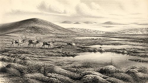
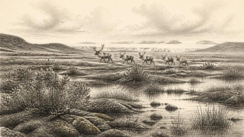
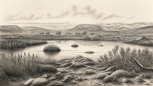
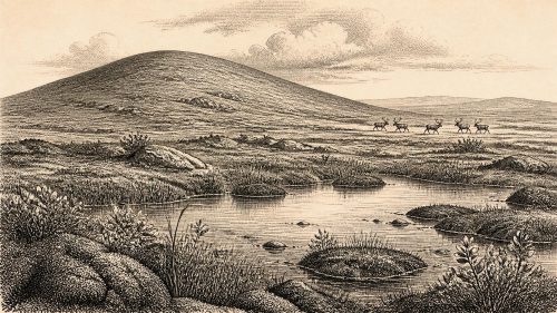
Derryvree is nonetheless an unusually vivid environmental archive. Pollen, plant macrofossils and insect remains from the freshwater silts point to a treeless, severe periglacial setting sometimes described as muskeg: wet, peaty or mineral-rich ground with pools, sedges, mosses and low-growing tundra plants rather than forest. The evidence includes taxa suited to cold, open conditions, among them dwarf willow, mountain-avens, Arctic clubmoss and aquatic plants. Their presence does not supply a picturesque snapshot of a particular day, but it demonstrates that life persisted in and around fresh water between episodes of glaciation.
The landscape was likely patchy. Water collected in hollows and shallow basins; saturated ground alternated with exposed mineral soil; frost, snow cover, thaw and seasonal runoff continually remade the surface. Such places could be biologically productive in a cold climate, sustaining plants, invertebrates and animals even while the wider region faced intensifying climatic instability. The Derryvree sequence is especially valuable because later ice did not merely pass nearby: it buried the wetland, preserving traces that would otherwise have been eroded or dispersed.
Farther west in Fermanagh, organic deposits at Greenagho also demonstrate ice-free conditions in part of the region earlier in the last glacial cycle. Together, these records rule out a simple picture of Ireland as continuously entombed beneath one unchanging ice sheet. They instead show a long and uneven history of glacier advances, retreats or stagnation, open-water habitats and renewed burial beneath ice.
Before the Greatest Ice Expansion
At roughly this horizon, the last Irish ice sheet was growing but had not yet reached the later maximum documented across much of Ireland and the surrounding continental shelf. Current reconstructions indicate a major build-up from about 30,000 years ago, with different sectors reaching maximum positions broadly between about 27,000 and 24,000 years ago. The timing was regional rather than uniform. Ice in the Irish Sea sector, for example, had its own advances, flow changes and margins, while inland Irish ice developed according to a different topography and supply of snow.
For around 31,175 BCE, then, the safest description is neither “Ireland was ice-covered” nor “Ireland was ice-free”. The evidence instead supports an island-region in transition. Some localities had been, or were, capable of supporting freshwater tundra environments; elsewhere ice could have occupied uplands or moved through basins. Over subsequent millennia, the last major glaciation would erase much of the exposed ground, alter drainage and redistribute sediments on a vast scale.
Sea level was far lower than it is today because immense quantities of water were held in global ice sheets. Coastlines around north-west Europe consequently lay beyond their modern positions, and the geography of the Irish Sea and Atlantic shelves was profoundly different. Yet it would be unsafe to draw a precise shoreline or assert a particular land bridge for this specific year. Lower sea level could facilitate animal dispersal across changing coastal landscapes, but local sea passages, ice fronts and rivers remained dynamic obstacles.
Castlepook’s Animal World
The principal complementary evidence comes from Castlepook Cave, also known as Mammoth Cave, near Doneraile in north County Cork. Excavated principally in the early twentieth century and now the subject of renewed investigation, it has yielded Ireland’s richest major assemblage of late cold-stage mammal remains. The collection includes reindeer, woolly mammoth, giant deer, brown bear, wolf, foxes, Arctic fox, lemmings and spotted hyaena. The National Museum of Ireland rightly treats Castlepook as a site of exceptional importance for the island’s Ice Age fauna.
These animals should not be imagined as one herd or one perfectly simultaneous community. Cave collections can mix material deposited over long periods, and early excavations often lacked the stratigraphic methods expected today. Modern redating has shown that some earlier radiocarbon results from Castlepook require revision, with certain animals proving considerably older than once thought. The faunal record therefore establishes repeated occupation or passage through Ireland during favourable intervals, rather than a census of the island in 31,175 BCE.
Even so, the assemblage transforms our understanding of the possible landscape. Reindeer and lemmings are consistent with cold, open environments; mammoth and giant deer indicate a much richer large-mammal fauna than later Ireland possessed; hyaenas and wolves reveal predators and scavengers within the same wider ecological network. Their arrival required intermittent terrestrial connectivity, or at least routes through landscapes no longer visible above modern seas. Ireland was not biologically isolated in the way its later island geography might suggest.
The Human Question
A reindeer femur from Castlepook has been presented as bearing an incision consistent with a sharp stone tool and has been associated with an age of roughly 33,000 years ago. If that interpretation is sustained, it may be evidence that a person processed an animal in Ireland during this general phase of the Ice Age. It is an important possibility, but it must remain proportionate to the evidence. A dated animal bone and a possible cut mark do not establish a permanent population, a camp, a hunting territory or a named cultural tradition.
No securely associated house floor, hearth, lithic assemblage, cemetery, art panel or stratified butchery area of comparable antiquity has yet been recovered in Ireland. The point is not to deny the possibility of Upper Palaeolithic visitors. Groups elsewhere in north-west Europe possessed sophisticated knowledge, stone-working traditions and social worlds. Rather, the Irish evidence cannot yet show which groups, if any, crossed to the island, how often they came, or whether their visits continued beyond a single episode. Any claim about boats, clothing, family life or seasonal reindeer hunts in Ireland at this date would be informed conjecture, not direct history.
What History Can and Cannot Say
There are no recoverable political affairs for Ireland around this point: no polities, diplomacy, warfare, law, territorial boundaries or leaders. Nor is there evidence for religion, formal learning, language, trade partnerships, monuments or artistic traditions on the island at this time. Agriculture, livestock keeping and settled village life lay many millennia in the future. The economy visible in the evidence is ecological rather than human: plants colonising exposed ground, animals moving through available habitat, predators exploiting prey, and ice repeatedly reshaping access to land and water.
The most important development is therefore environmental. BIRM-166 records a living freshwater tundra wetland in Fermanagh during a broad interval that includes the modern date label 31,175 BCE. Castlepook records an Irish Ice Age fauna connected to wider European ecosystems. The expanding ice sheet provides the larger setting, both creating and destroying habitable terrain. Together these traces reveal not an annual chronicle but a changing, treeless Ireland: wet ground and cold pools under open skies, large mammals on shifting ranges, and a fragile archive soon to be overridden by ice.
Primary Sources
- A Middle Midlandian Freshwater Series at Derryvree, Maguiresbridge, County Fermanagh, Northern Ireland
- Trimlines, Blockfields and the Vertical Extent of the Last Ice Sheet in Southern Ireland
- The Evolution of the Terrestrial-Terminating Irish Sea Glacier During the Last Glaciation
- Maximum Extent and Readvance Dynamics of the Irish Sea Ice Stream and Irish Sea Glacier Since the Last Glacial Maximum
- A Reconsideration of the Radiocarbon Dating of the Marine Isotope Stage 3 Fauna from Southern Ireland
- The Irish Quaternary Fauna Project
- Spotted Hyena Skull
- Occurrence of Mammalia Relicts at Site Castlepook Cave
- Castlepook Cave, Co. Cork, 2022 Excavation Report
- Archaeology Research Excavation Grant 2022: Castlepook Cave Final Report
- Irish Pleistocene Biostratigraphy
- Figure 6: The Subdivision of the Quaternary Period in Ireland
- Middle Midlandian Interstadial Deposits at Greenagho, Near Belcoo, County Fermanagh, Northern Ireland
- Freshwater Organic Deposits and Stratified Sediments Between Early and Late Midlandian (Devensian) Till Sheets, at Aghnadarragh, County Antrim, Northern Ireland
- Radiocarbon Constraints on the History of the Western Irish Ice Sheet Prior to the Last Glacial Maximum
- The Deglaciation of the Western Sector of the Irish Ice Sheet from the Inner Continental Shelf to its Terrestrial Margin
- Timing and Pace of Ice-Sheet Withdrawal Across the Marine–Terrestrial Transition West of Ireland During the Last Glaciation
- First Evidence of a Late Upper Palaeolithic Human Presence in Ireland
- New Insights on the Fauna of Ireland’s Younger Dryas and Early Holocene from Alice & Gwendoline Cave
- Prehistoric Details