Castlepook’s Spotted Hyena31176 BCE
Around 31,176 BCE, Ireland experienced unstable Late Pleistocene conditions rather than a datable historical year. Derryvree, County Fermanagh, preserves organic sediments between glacial tills, indicating episodic ice-free cold wetlands with tundra vegetation, freshwater and insects. Castlepook Cave, County Cork, accumulated mixed animal remains over millennia, including mammoth, reindeer, giant deer, wolves and spotted hyenas, demonstrating changing links to wider European faunas. A reported stone-tool incision on a reindeer femur, approximately 33,000 years old, may indicate brief human butchery, but remains unconfirmed. No settlements, institutions or continuous population are evidenced. Later ice expansion substantially reshaped and obscured this fragile prehistoric record.

Dateline
Modern calendar-year precision is not available for Ireland in 31,176 BCE. The label is a convenient point on a deep prehistoric timescale, not a year that anyone could have recorded or recognised. In the conventional archaeological system of years before AD 1950, it falls about 33,125 years BP, within the Late Pleistocene and Marine Isotope Stage 3. The closest relevant Irish evidence comes from dated ranges, not annual events: above all, a cold freshwater deposit at Derryvree near Maguiresbridge, County Fermanagh, and the long-accumulated animal remains of Castlepook Cave near Doneraile, County Cork.
What can responsibly be described is an Ireland subject to sharp climatic fluctuations, local ice-free ground and an increasingly powerful glacial regime. It was not the wooded, settled island of later prehistory. Nor is there evidence for a political community, named people, language, religion, settlement network or trade system. The material record instead reveals changing habitats, animal movements and the remote possibility of brief human visits at Europe’s north-western edge.
A Date Within a Range
The principal chronological difficulty is that radiocarbon years are not calendar years. The most important dated deposit for this broad horizon is the organic freshwater layer found beneath a drumlin at Derryvree. Road works in 1969 exposed fine sands and silts, including organic material, trapped between two distinct tills: sediments left by separate episodes of glacial action. The original radiocarbon determination, Birm-166, was 30,500 radiocarbon years BP, with a substantial laboratory uncertainty of +1,170/−1,030 years. Calibration against modern atmospheric curves converts such a measurement into a broad calendar range rather than a single date.
Recent glacial chronology modelling treats Derryvree as evidence for ice-free conditions around 33.5 ± 1.2 thousand calendar years BP. That range can illuminate the world around 31,176 BCE, but it cannot prove that a particular pool, herd or human party occupied the site in that numbered year. The same caution applies throughout this period. The apparent neatness of a BCE date should not conceal the uncertainty inherent in radiocarbon calibration, old excavations and deposits altered by later ice.
Derryvree Between the Tills
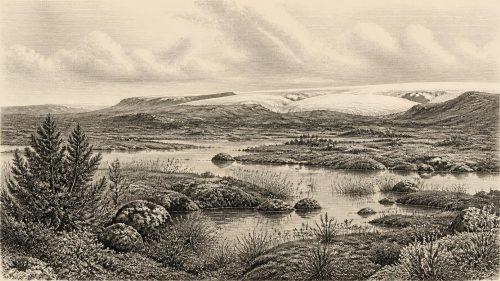
Derryvree offers unusually direct environmental evidence. The organic layer lay between a lower till and a later upper till, demonstrating a local sequence of glacial coverage, an interval in which freshwater sediment could accumulate, and renewed ice advance. It does not establish that all Ireland was ice-free at once. Rather, it documents one northern locality in which water, vegetation and insects persisted during a severe phase of the last glacial cycle.
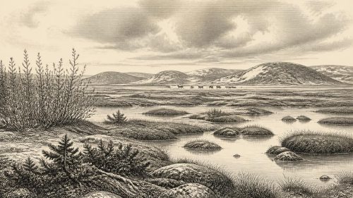
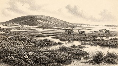
Pollen, plant macrofossils, mosses and insect remains indicate open, treeless terrain. Grasses, sedges, herbs and juniper belonged to a cold tundra or muskeg-like landscape, with wet ground, decaying plant matter and shallow pools. Aquatic and waterside plants, including bogbean and water-milfoil, show that fresh water was available at least seasonally. The evidence is therefore more varied than a simple image of an unbroken white wilderness. There were productive wet hollows and a short growing season, but no basis for imagining dense forest, cultivated fields or permanent villages.
Periglacial conditions shaped this setting. The term does not mean that Derryvree lay under glacier ice; it describes ground affected by intense frost, freezing and thawing, sparse cover and proximity to glacial climates. Winters were harsh, summers brief, and vegetation low-growing. Insects reinforce that reading. Their remains point to wet, mossy ground and cold conditions rather than a temperate woodland. Such evidence gives Ireland’s far past texture: sedge margins, shallow water and exposed open country where organic mud could gather before later ice sealed it below the drumlin.
Castlepook’s Animal World
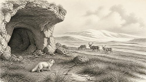
Nearly 300 kilometres to the south, Castlepook Cave preserves a different kind of archive. Also known as Mammoth Cave, it lies in limestone near Doneraile in north County Cork. Excavated principally in the early twentieth century, it produced more than 2,000 bones from a complicated network of galleries and chambers. Its named spaces — including Hyaena Hall and Elephant Hall — reflect the striking animals found there, but they should not be mistaken for a single living landscape or one excavated occupation floor.
Radiocarbon dates show that the cave received remains over a long span, roughly 45,700 to 19,950 radiocarbon years BP. Water movement, carnivore activity, natural deaths, disturbance and early excavation all mixed or obscured parts of the sequence. Castlepook is therefore a repository of many episodes. It cannot be read as a census of animals living together in one century, still less in 31,176 BCE. Yet it is Ireland’s richest known pre-Last Glacial Maximum vertebrate site and is indispensable for understanding the range of life available in the broad period.
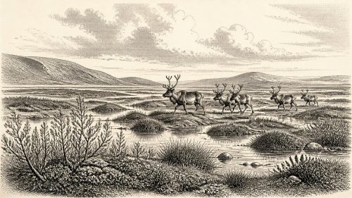
The assemblage includes woolly mammoth, giant deer, reindeer, brown bear, wolf, Arctic fox, mountain hare, collared lemming, Norwegian lemming and spotted hyena. Some species signal cold, open habitats; others demonstrate that conditions and fauna altered through time. The spotted hyena is particularly significant. Its presence at Castlepook is Ireland’s best evidence for a large social scavenger and predator now absent from Europe. Hyenas could accumulate bones in dens, complicating the interpretation of any individual specimen while also revealing an ecosystem with sizeable herbivores and enough carrion or prey to sustain formidable carnivores.
Reindeer, mammoth and giant deer should not be treated as symbols of an eternal ‘Ice Age Ireland’. Their remains record opportunities for movement and survival during changing climatic windows. Large herbivores could range across open ground, while predators followed or exploited them. The cave evidence shows that southern Ireland was connected ecologically to wider north-west European faunas at intervals, although it does not establish a continuously occupied land bridge or a fixed route from Britain or the Continent. Sea level was lower than today, but ice extent, local topography and changing coastlines made access variable and difficult to reconstruct.
The Human Question
The most consequential archaeological issue concerns a reindeer femur from Castlepook. In 2021, analysis publicised a deep mark on the bone as a probable incision made by a stone tool during butchery; the bone was reported as about 33,000 years old. If that interpretation is confirmed, it may be the earliest indication that people handled an animal in Ireland, vastly earlier than the well-established Mesolithic settlement of the early Holocene.
That is an important possibility, but it must remain a possibility. A date on bone establishes when the animal lived or died, not necessarily the precise moment when a surface mark was made. Identifying a cut mark requires taphonomic judgement: researchers must distinguish deliberate stone-tool damage from carnivore teeth, trampling, breakage, abrasion and other natural processes. Castlepook has not yielded a securely associated stone-tool assemblage, hearth, dwelling, burial, human bone or artwork from this horizon. Nor does one potentially butchered reindeer demonstrate continuous population, a named migration, language, kin group or territorial claim.
If people did reach Ireland in this broad period, the wider European comparison suggests highly mobile Upper Palaeolithic hunter-gatherers, travelling in small groups and using animal resources, shelter and seasonal knowledge. That is interpretation based on better-documented societies elsewhere, not a description of a proven Irish camp. A responsible account therefore separates the direct evidence — an animal bone, its reported mark and its age — from the larger hypothesis of a brief visit or carcass-processing episode.
No States, No Diplomacy
Political affairs, warfare, diplomacy and formal religion leave no identifiable trace in Ireland at this depth of time. There were no known kingdoms, monuments, farms, roads, writing systems or institutions. It would be misleading to fill those absences with imagined tribal politics. Likewise, there is no evidence for exchange networks, although animal movements and lower sea levels indicate that Ireland was part of a changing north-west European environmental zone rather than an isolated world.
Everyday life can be approached only conditionally. Derryvree proves that freshwater habitats and plant communities existed; Castlepook proves that large mammals and predators occurred over the wider interval. Together they show ecological potential amid severe constraints. They do not prove that humans lived beside the Fermanagh pools or sheltered regularly in the Cork caves. Later ice-sheet growth would erase, bury and rework much of the earlier landscape, helping to explain why the archaeological record is so sparse.
An Iceward Landscape
In the longer environmental story, this was an iceward interval. Ireland had not yet reached the Last Glacial Maximum, when the British–Irish Ice Sheet attained its greatest extent, broadly between about 27,000 and 21,000 years ago in a widely used model. Around the Derryvree horizon, conditions were already cold and unstable, but the evidence for freshwater deposits confirms that ice cover was episodic and regionally varied. Later expansion of ice radically reshaped the island, excavating basins, depositing till and destroying or concealing older surfaces.
For 31,176 BCE, then, the most meaningful Irish history is not an invented event but a fragile record. Beneath a Fermanagh drumlin, organic silts retain the evidence of a cold wetland; in a Cork cave, bones preserve traces of an animal community that included reindeer, mammoth and spotted hyena. A debated reindeer incision raises the prospect of a fleeting human encounter. These are not the foundations for an annual chronicle, but they are profound evidence that Ireland’s human and environmental past reaches far beyond the later worlds of farmers, monuments and recorded history.
Primary Sources
- A Middle Midlandian Freshwater Series at Derryvree, Maguiresbridge, County Fermanagh, Northern Ireland
- Irish Pleistocene Biostratigraphy
- The Irish Quaternary Fauna Project
- The Exploration of Castlepook Cave, County Cork
- Castlepook Cave: County Geological Site Report
- Spotted Hyena Skull
- 2022:564 – Castlepook Cave, Castlepook South, Cork
- Occurrence of Mammalia Relicts at Site Castlepook Cave
- Growth and Retreat of the Last British–Irish Ice Sheet, 31,000 to 15,000 Years Ago: the BRITICE-CHRONO Reconstruction
- Extent and Timing of the Last Glacial Maximum in Britain and Ireland: a Review
- Pattern and Timing of Retreat of the Last British-Irish Ice Sheet
- Stratigraphic and Palaeo-Geomorphological Evidence for the Glacial-Deglacial History of the Last British-Irish Ice Sheet in the North-Western Irish Sea
- The IntCal20 Northern Hemisphere Radiocarbon Age Calibration Curve (0–55 cal kBP)
- IntCal Publications
- Figure 6: The Subdivision of the Quaternary Period in Ireland
- Fermanagh Field Guide: Intertill Deposits at Derryvree and Maguiresbridge
- New Data for the Last Glacial Maximum in Great Britain and Ireland
- Early Deglaciation of the British-Irish Ice Sheet on the Atlantic Margin
- Exploring Controls of the Early and Stepped Deglaciation on the Western Margin of the British-Irish Ice Sheet
- Trimlines, Blockfields and the Vertical Extent of the Last Ice Sheet in Southern Ireland
- The Archaeological Heritage of County Cork
- Irish Pleistocene Biostratigraphy
- The Mesolithic in Ireland: When Was It?
- New Insights on the Fauna of Ireland's Younger Dryas and Early Holocene from Alice & Gwendoline Cave