

Derryvree’s Intertill Moss Bed31222 BCE
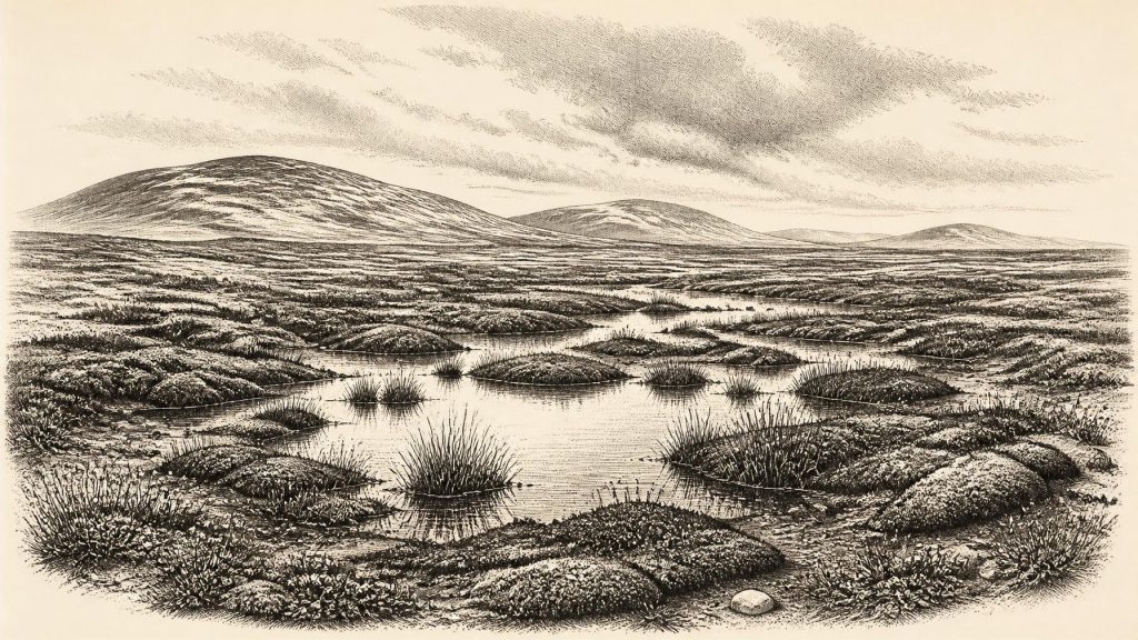
About 31,222 BCE, Ireland lay in the unstable later stages of Marine Isotope Stage 3, approaching expansion of the British–Irish Ice Sheet. Derryvree, County Fermanagh, preserves a freshwater organic bed between tills, recording a brief ice-free periglacial wetland with tundra plants, mosses, insects and sparse vegetation. Southern caves, notably Castlepook in County Cork, yielded diverse cold-climate fauna, including mammoth, reindeer, giant deer and carnivores, though remains accumulated over long periods. A possibly cut-marked reindeer bone suggests fleeting human visitation around 33,000 years ago, not permanent settlement. Renewed glaciation eventually buried habitats, causing local ecological displacement or extinction before later recolonisation.
Dateline
The label 31,222 BCE cannot denote a known event in Ireland. No people in Ireland then kept a calendar, no written record survives, and archaeological dating at this depth of time cannot resolve a single modern calendar year. Used as a filing point, it corresponds only approximately to 33,170 years before 1950. The responsible historical setting is therefore a broad one: later Marine Isotope Stage 3, within the last glacial cycle, perhaps broadly c. 34,000–32,000 calibrated years before present. Even that range should be treated as a guide rather than a date for one season or generation.
Ireland at this point lay on Europe’s north-western edge during a time of climatic instability and growing ice. It was not yet the fully ice-drowned Ireland of the Last Glacial Maximum, which came later, but it was moving towards that transformation. Evidence from fossil-bearing sediments, caves, glacial landforms and radiocarbon dating offers glimpses of a severe, open and changing landscape. It does not provide a year-by-year narrative of settlements, rulers or battles. The clearest story is environmental: how plants and animals occupied temporary habitable ground, and how advancing ice would eventually erase or bury much of that world.
A Date Beyond Calendar Precision
Converting 31,222 BCE into archaeological time requires care. Radiocarbon laboratories report ages in radiocarbon years before present, with “present” conventionally fixed at 1950. Those results then require calibration against independent records of past atmospheric carbon. A radiocarbon determination is also expressed with an uncertainty range, and the relationship between radiocarbon and calendar years is not a simple subtraction. The date used here should consequently not be matched to an individual bone, campsite or climatic shift.
For Ireland, the relevant evidence belongs to a wider Middle Midlandian or mid-last-glacial interval. The terminology reflects a regional geological tradition, while Marine Isotope Stage 3 is the broader international climatic framework. During this long period, temperatures varied sharply on millennial scales. Some intervals allowed tundra, wetlands and grazing animals to spread across exposed land; colder phases brought permafrost, sparse plant cover, stronger frost action and ice expansion. It is safer to describe 31,222 BCE as lying close to the onset of the final major growth of the British–Irish Ice Sheet than to claim that one precise glacier margin stood at one precise place.
The Derryvree Evidence
The most evocative Irish local archive for this general period lies at Derryvree near Maguiresbridge in County Fermanagh. Road works in 1969 cut through a drumlin and revealed freshwater silts and fine sands trapped between two thick tills: sediments laid down by ice, below and above the organic bed. The intervening deposit contained plant remains, pollen, mosses, seeds and insects, preserving a short-lived ice-free episode before later glaciation covered it.
An early radiocarbon determination from the Derryvree organic material was 30,500 radiocarbon years before present, with a substantial error margin. It cannot be converted into an exact contemporary calendar year, but it places the deposit within the cold middle part of the last glacial cycle and makes it directly relevant to the broad world considered here. Its flora points to open tundra and wet ground rather than woodland. Mosses, sedges and cold-adapted flowering plants survived around shallow water, saturated soil and patches of bare mineral ground. Pollen was scarce and badly preserved, itself a reminder that plant cover was thin and that this is a fragmentary record, not a complete census.
Derryvree matters because it corrects two misleading pictures. First, Ice Age Ireland was not always a single uninterrupted ice sheet. Second, an ice-free interval was not necessarily mild, green or hospitable in a modern sense. The site suggests a periglacial wetland: ground affected by intense freeze-and-thaw, with standing water in summer, seasonal snow, exposed sediment and a short growing season. The later till above it records the loss of that habitat beneath renewed ice.
Open Country in the South
Cave deposits in the south show that Ireland supported a striking large-mammal fauna during parts of Marine Isotope Stage 3. Castlepook Cave near Doneraile, County Cork, is particularly important. Antiquarian excavations there recovered thousands of bones, including remains attributed to mammoth, reindeer, giant deer, brown bear, cave hyena, hare, fox, lemming and wolf. Nearby and comparable southern sites, including Shandon and Foley caves, extend the evidence beyond one locality.
These caves must not be read as ordinary living floors or as a simultaneous animal community. Bones could enter through fissures, be dragged in by carnivores, accumulate over thousands of years, be moved by water or sediment, and be disturbed by the early excavations that removed much of the original stratigraphy. Modern re-dating has demonstrated that some older radiocarbon measurements underestimated the antiquity of the southern Irish fauna. The strongest conclusion is thus deliberately modest: before the Last Glacial Maximum, at different times, parts of Ireland were accessible to a varied cold-climate fauna with continental European connections.
Reindeer and mammoth evoke a grass-rich, largely treeless setting, but their presence does not mean that all Ireland was uniform steppe. Derryvree’s wet mossy hollows and Castlepook’s limestone cave country represent different parts of a varied landscape. Rivers, lake margins, thin soils, exposed rock and sheltered valleys would have created local niches. Carnivores such as hyena and wolf imply food chains sustained by herbivores, while bears also used caves. Yet animal bones alone cannot tell us how numerous any species was, how long it persisted in one valley, or whether it occupied the island continuously.
People: A Possibility, Not a Population
The question of people is the most arresting and the most uncertain. A reindeer bone from Castlepook has been reported with a mark interpreted as made by a sharp stone tool, and direct dating has placed it broadly around 33,000 years ago. If that interpretation is sustained, it would indicate a fleeting Upper Palaeolithic human presence in Ireland long before the better-known Mesolithic settlement after the last ice age. It would not demonstrate a permanent colony, a village, or an Irish population continuing through the glacial maximum.
The evidential burden is high. A cutmark must be distinguished from damage caused by excavation, trampling, carnivore teeth, sediment movement or natural fracture. A single marked bone, separated from its original archaeological context by old excavation and cave processes, cannot reveal the number, language, identity or intentions of any visitors. No securely associated hearth, house, tool-making floor, burial or structured refuse deposit is known for Ireland at this date. The cautious formulation is that hunters may have reached or briefly used parts of the island during a pre-maximum window; sustained occupation remains unproven.
That caution governs political history too. There is no evidence for polities, leaders, territory, diplomacy or organised warfare in Ireland around 31,222 BCE. If people did enter this landscape, they would have done so as small, mobile foraging groups within wider north-west European networks, not as inhabitants of a recognisable later Irish society. Nor is there evidence for trade in the later sense. Movement of people and animals could have occurred when lower sea levels exposed broad coastal plains and reduced marine barriers, but the exact routes between Ireland, Britain and continental Europe remain debated.
Subsistence Without Settlements
A possible human visit would have depended on the seasonal geography of game, fresh water and shelter. Reindeer could offer meat, hide, sinew, antler and bone; other animals had different potential value. Caves, however, were often carnivore dens or natural traps rather than human homes. The archaeological record does not permit a reconstruction of camps, clothing, hunting methods or food-sharing practices in Ireland itself. Such details are known from Upper Palaeolithic sites elsewhere in Europe, but applying them wholesale to Ireland would turn analogy into fact.
There is likewise no evidence here for farming, herding, pottery, metalworking, monuments or written learning. Religion and artistic culture are beyond direct recovery for this particular Irish horizon. People elsewhere in Europe made ornaments, images and complex stone tools during the Upper Palaeolithic, but none can responsibly be assigned to Ireland in 31,222 BCE. The culture best documented on the island is instead that of non-human life: moss spores and seeds in silt, animal bones in caves, and the geological imprint of ice.
Approaching the Ice Threshold
Regional change gives this period its importance. Large reconstructions of the British–Irish Ice Sheet indicate widespread growth from about 31,000 years ago, although the precise timing, thickness and limits varied between sectors and remain subject to revision as new dates emerge. Offshore evidence shows that ice later reached far across the Atlantic shelf west of Ireland, while landforms such as drumlins, moraines and streamlined sediments preserve the movement of ice over the island. By the global Last Glacial Maximum, conventionally c. 26,000–19,000 calibrated years ago, ice had transformed almost every Irish region.
For the plants and animals represented at Derryvree and Castlepook, the consequences were profound. Habitats narrowed, shifted or vanished. Local populations may have retreated, become isolated or died out; the cave record cannot always distinguish these outcomes. The eventual recolonisation of Ireland after ice retreat was not simply a restoration of an old ecosystem. It produced new combinations of species and, much later, the securely evidenced human settlement of the island.
Thus the most truthful account of Ireland around 31,222 BCE is not a chronicle of named events but a landscape at a threshold. Fermanagh’s freshwater moss bed records an exposed, bitter wetland between episodes of ice. Cork’s caves retain bones from a larger, connected Ice Age fauna and perhaps a tantalising trace of human activity. Together they reveal an Ireland that was environmentally alive but precarious: a northern peninsula-like world of tundra, wetlands and roaming animals, soon to be overtaken by the expanding ice sheet.
Primary Sources
- A Middle Midlandian Freshwater Series at Derryvree, Maguiresbridge, County Fermanagh, Northern Ireland
- The Irish Quaternary Fauna Project
- A Reconsideration of the Radiocarbon Dating of the Marine Isotope Stage 3 Fauna from Southern Ireland
- Growth and Retreat of the Last British–Irish Ice Sheet, 31,000 to 15,000 Years Ago: the BRITICE-CHRONO Reconstruction
- Pattern and Timing of Retreat of the Last British-Irish Ice Sheet
- Early Deglaciation of the British-Irish Ice Sheet on the Atlantic Shelf Northwest of Ireland Driven by Glacioisostatic Depression and High Relative Sea Level
- Maximum Extent and Dynamic Behaviour of the Last British–Irish Ice Sheet West of Ireland
- Oscillating Retreat of the Last British-Irish Ice Sheet on the Continental Shelf Offshore Galway Bay, Western Ireland
- Landform Modification by Palaeo-Ice Streams in East-Central Ireland
- Irish Pleistocene Biostratigraphy
- Palaeoecology: Field Guide 16
- Sedimentary Ancient DNA Reveals Late Pleistocene Faunal Connectivity Between Ireland and Eurasia
- New Insights on the Fauna of Ireland’s Younger Dryas and Early Holocene from Alice & Gwendoline Cave
- Occurrence of Mammalia Relicts at Site Castlepook Cave
- The Exploration of Castlepook Cave, County Cork
- Archaeology Research Excavation Grant 2022: Final Report
- Castlepook Cave Assemblage
- The Colonization of Ireland: A Human Ecology Perspective
- Recent Progress on Combining Geomorphological and Geochronological Data with Ice Sheet Modelling, Demonstrated Using the Last British–Irish Ice Sheet
- The Exploration of the Caves of County Clare: Introduction, Remarks on Animal Remains and Summary of Results