BIRM-166’s Fermanagh Waterline31221 BCE
Around 31,221 BCE, Ireland was in the unstable MIS 3 phase of the Late Pleistocene, not a period permitting year-specific history. At Derryvree, County Fermanagh, the BIRM-166 deposit records a freshwater, vegetated interval between glacial advances, broadly dated to 36,900–31,700 cal BP. Its pollen, plants and insects indicate cold, open wetland habitats rather than continuous ice cover. Cave remains in County Cork show varied Ice Age fauna. A marked reindeer femur may indicate human butchery around 33,000 years ago, but cannot prove settlement or society. Expanding ice later destroyed or buried much evidence, leaving a fragmentary environmental record of change.

Dateline
“31,221 BCE” is a modern chronological label, not a year from which Ireland preserves an event, ruler, settlement or written memory. It corresponds arithmetically to about 33,170 calendar years before AD 1950, the conventional radiocarbon ‘present’, but that conversion must not be mistaken for archaeological precision. At this depth in time, dates are expressed as calibrated ranges and environmental phases. The closest Irish evidence comes from deposits that accumulated across generations or centuries, not on a named day. Ireland lay in the Late Pleistocene, within Marine Isotope Stage 3, a climatically unstable part of the last Ice Age before the fullest expansion of the British–Irish Ice Sheet.
A Date Within a Long Interval
The key record is at Derryvree, near Maguiresbridge in County Fermanagh. Roadworks exposed a remarkable sequence in a drumlin: glacial till below, freshwater sands, silts and organic material in the middle, and a later till above. Till is unsorted debris laid down by glacier ice. The sequence therefore demonstrates a local succession of ice, an ice-free interval during which water and living things occupied the site, and renewed glaciation that buried the evidence. It does not establish that all Ireland was ice-free simultaneously, still less that Derryvree’s wetland existed in the exact modern year 31,221 BCE.
Organic material from the intervening deposit, laboratory number BIRM-166, returned a radiocarbon age of 30,500 ± 1,100 radiocarbon years BP. Radiocarbon years are not calendar years: the proportion of atmospheric carbon-14 has varied through time, and the result must be calibrated against independently constructed curves. The original error range is substantial, while calibration at this age produces broad and sometimes discontinuous calendar possibilities. Scholarship consequently places the Derryvree deposit broadly in the later Middle Midlandian, conventionally correlated with MIS 3; calibrated discussions commonly give a span of roughly 36,900–31,700 cal BP. The nominal year here falls within that wide horizon, but cannot be attached to a particular layer, season or organism.
A Wetland Between Glaciers
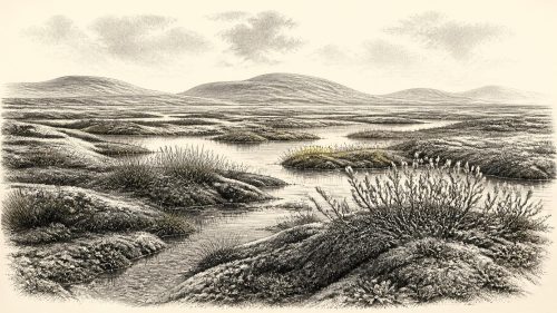
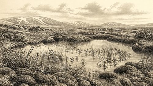
Derryvree is important because it rules out a simple image of an island continuously entombed beneath ice throughout the last glacial cycle. For part of the wider interval, at least one Fermanagh locality had exposed ground, shallow or slow-moving freshwater, wet soils and vegetation. Pollen, plant macrofossils, mosses and insect remains point to an open, treeless, periglacial landscape. Sedges, grasses, herbs, dwarf willow, mountain-avens, lesser clubmoss and aquatic plants including bogbean and alternate water-milfoil indicate a patchwork of damp ground, mossy vegetation and pools rather than woodland or a sterile white wasteland.
Older descriptions use the word muskeg for this type of wet, organic-rich ground. It should not conjure a modern bog unchanged for 33 millennia. The deposit instead records a cold freshwater margin in which plant litter accumulated, insects lived and water supported aquatic species. Summers may have briefly encouraged growth around sheltered pools and channels; winters were severe enough for frost processes to dominate much of the landscape. The evidence supports local ecological variety. It does not yield a reliable island-wide temperature, annual snowfall total or map of every valley.
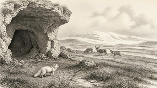
Regional contrast is central to any responsible account. Caves in the limestone country of north Cork, especially Castlepook Cave near Doneraile, preserve a very different kind of archive: animal bones, some accumulated by carnivores. The broader Irish Quaternary fauna record shows that sizeable mammals reached Ireland during portions of the period between at least about 45,000 and 20,000 years ago. At Castlepook, dated remains include reindeer, woolly mammoth, spotted hyaena, brown bear, wolf, Arctic fox, hare and lemmings. Such evidence shows that suitable routes and habitats existed intermittently for animals. It does not mean that every species coexisted at one place at one moment, or that a single cave was an ordinary picture of the surrounding countryside.
Animals, Carnivores and a Possible Human Trace
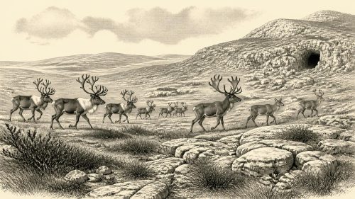
Reindeer are especially evocative, but their presence is evidence of fauna before it is evidence of people. They could have moved through open country in response to forage and seasonal conditions, while carnivores could drag carcasses or bones into caves. Castlepook’s fossil assemblage was largely recovered in antiquarian excavations, and the mixing, disturbance and recovery history of cave deposits require caution. A bone’s radiocarbon date establishes when the animal died, not automatically when a surface mark was made or how the bone reached its final resting place.
One reindeer femur from Castlepook has nevertheless transformed the question of Ireland’s early human past. Re-examined in the early 2020s, it was radiocarbon dated to around 33,000 years ago and bears a deep mark interpreted by zooarchaeologist Ruth Carden as having been made on fresh bone by a stone tool during butchery. If that interpretation is sustained through further taphonomic study, it indicates a human visit to Ireland in the broad interval close to this article’s notional date—far earlier than the securely dated terminal Palaeolithic bear-bone evidence from Alice and Gwendoline Cave, County Clare, at about 12,810–12,590 cal BP.
The distinction between evidence and interpretation matters. The femur is not a house floor, hearth, stone-tool assemblage, grave, boat or repeated camp. It cannot identify the number, language, ancestry, social organisation or route of any visitors. Nor can it demonstrate a permanent population. Its strongest possible reading is narrow but profound: a person may have processed a reindeer in Ireland during MIS 3. Even that claim depends on the diagnosis of the incision and must remain open to reassessment. No year-specific human action can responsibly be placed in 31,221 BCE.
No Polities, No Proven Diplomacy
There is no evidence for political communities, named leaders, territories, warfare, diplomacy, institutions or religious observance in Ireland at this point. Such subjects are not merely unknown in detail; the surviving record does not permit them to be reconstructed. There are likewise no demonstrated settlements, domestic structures, burials, cultivated fields, monuments, metalwork, pottery or trade goods. Terms such as ‘tribe’, ‘chiefdom’ or ‘Irish people’ would import much later social categories into a world for which they have no evidential basis.
If humans did briefly reach the island, they would have belonged to the wider Upper Palaeolithic world of north-west Europe, where mobile foragers possessed sophisticated knowledge of animals, stone raw materials, seasonal landscapes and social connections. That comparison provides a possible context, not a description of Ireland. The Irish record has not yielded the material evidence needed to show whether visitors carried flint tools, crossed open water, travelled over exposed coastal shelves or arrived from Britain by another changing route. Lower sea levels altered the geography of the Irish Sea region, but Ireland was not thereby proven to have been joined to Britain by a dependable land bridge at this particular time.
Approaching Greater Ice
The wider environmental trajectory was towards more extensive glaciation. Reviews of the British–Irish Ice Sheet place its principal build-up after roughly 35–32 ka and its maximum extent later, during MIS 2, broadly around 27–21 ka. Those are regional models rather than a single clock striking everywhere at once. At approximately 33 ka, ice margins, sea level, permafrost and viable habitats could alter markedly over centuries and millennia. Some Irish landscapes may have remained exposed while other sectors were influenced by expanding local or marine-based ice.
Later glaciers also help explain the sparseness of the record. Ice erodes bedrock, reworks soils, redistributes sediment and can remove the open-air traces on which archaeologists depend. Derryvree survived precisely because its freshwater deposits were enclosed between tills; Castlepook’s caves sheltered bones, though not necessarily their original associations. Absence of a camp-site is therefore not proof that nobody ever visited. Equally, destruction of evidence cannot be used to turn possibility into certainty.
An Irish Landscape Before History
The most defensible picture for around 31,221 BCE is consequently environmental rather than narrative: parts of Ireland lay in a cold, dynamic North Atlantic landscape, with local ice-free terrain and freshwater wetlands during at least part of a broad MIS 3 interval. Open tundra-like plant communities supported insects and grazing animals; caves record predators and scavengers as well as their prey. A reindeer femur from north Cork raises the serious possibility of an exceptionally early human presence, but does not yet furnish an Irish society or a calendar of events.
This is not an empty prelude to ‘real’ history. The Fermanagh silts, mosses, seeds and beetles, and the Cork cave bones, are historical evidence in their own right. They show an island repeatedly reshaped by ice, water, animal movement and climatic fluctuation long before farms, monuments, kingdoms or writing. Around this notional year, the most important development was not a political turning point but the fragile persistence of habitable ecological niches on the north-west edge of Europe—niches that later ice would conceal, disturb and, in rare places, preserve.
Primary Sources
- Irish Pleistocene Biostratigraphy
- A Middle Midlandian Freshwater Series at Derryvree, Maguiresbridge, County Fermanagh, Northern Ireland
- The Irish Quaternary Fauna Project
- First Evidence of a Late Upper Palaeolithic Human Presence in Ireland
- New Insights on the Fauna of Ireland's Younger Dryas and Early Holocene from Alice & Gwendoline Cave
- Heritage Artefacts of County Cork
- Ireland's Palaeolithic Archaeology – Fleeting Footprints in a Frozen Land
- Extent and Timing of the Last Glacial Maximum (LGM) in Britain and Ireland: A Review
- Dimensions and Chronology of the Last Ice Sheet in Western Ireland
- Last Glacial Maximum Cirque Glaciation in Ireland and Implications for Reconstructions of the Irish Ice Sheet
- Pattern and Timing of Retreat of the Last British-Irish Ice Sheet
- Sedimentology and Chronology of the Advance and Retreat of the Last British-Irish Ice Sheet on the Continental Shelf West of Ireland
- Early Deglaciation of the British-Irish Ice Sheet on the Atlantic Shelf Northwest of Ireland Driven by Glacioisostatic Depression and High Relative Sea Level
- The Timing and Magnitude of the British–Irish Ice Sheet Between Marine Isotope Stages 5d and 2
- Stratigraphic and Palaeo-Geomorphological Evidence for the Glacial-Deglacial History of the Last British-Irish Ice Sheet in the North-Western Irish Sea
- Exposure-Age Constraints on the Extent, Timing and Rate of Retreat of the Last Irish Sea Ice Stream
- IntCal20 Northern Hemisphere Radiocarbon Age Calibration Curve (0–55 cal kBP)
- A 57,000-Year Oxygen Isotope Record from the Greenland Ice Core Project (GRIP)
- Lesser Clubmoss (Selaginella selaginoides) in Fermanagh
- Bogbean (Menyanthes trifoliata) in Fermanagh