

Derryvree, Greenagho, Castlepook31115 BCE
At approximately 31,115 BCE, Ireland was a climatically unstable Late Pleistocene landscape rather than a society with recorded events. Derryvree, County Fermanagh, preserves freshwater sediments between glacial tills, indicating cold, open tundra wetlands during an ice-free interval; Greenagho offers comparable, earlier evidence. Sea levels were lower, but no secure land route or regular human crossing can be demonstrated. Castlepook Cave, County Cork, contains diverse cold-adapted fauna, including reindeer, mammoth and hyaena, accumulated over time. A possibly cut-marked reindeer femur may indicate brief human activity, but proves neither settlement nor resident population. Later glaciation buried, reshaped and fragmented these environmental archives.
Dateline
The label 31,115 BCE is a modern chronological convenience, not a year that anyone in Ireland could have named, recorded or experienced as a fixed date. It equates approximately to 33,064 years before AD 1950, the reference point used for “before present” dating. At this depth of time, modern calendar-year precision is unavailable. There are no written records, settlements with annual sequences, named rulers or securely dated events. The responsible history of Ireland at this point is therefore a history of ice, water, animals, caves and sparse traces whose dates are measured in broad calibrated ranges.
This was the Late Pleistocene, within the latter part of Marine Isotope Stage 3, an unstable phase of the last Ice Age. Ireland was not yet the familiar green, wooded island of later prehistory. Nor should it be imagined as uniformly entombed beneath ice. The growth of the British–Irish Ice Sheet was regional and episodic, while climatic shifts altered glaciers, sea level, vegetation and animal habitats over centuries and millennia. The strongest evidence relevant to this date comes from buried freshwater deposits in County Fermanagh and faunal remains from limestone caves in north Cork.
A Date Within Ranges
Radiocarbon results are not calendar dates. The amount of radioactive carbon available in the atmosphere has changed through time, so a laboratory measurement must be calibrated against independently dated records. At more than 30,000 years ago, even improved calibration curves produce substantial probability ranges. Stratigraphy adds another qualification: a sediment layer may have accumulated over a period, while an animal bone dates the animal’s death rather than every later event in the history of that object.
The key Fermanagh sequence at Derryvree, near Maguiresbridge, produced a conventional radiocarbon age of about 30,500 radiocarbon years before present, with a large laboratory uncertainty. Published calibration places it broadly at about 36,900–31,700 calibrated years before present. The modern label 31,115 BCE, approximately 33,064 calibrated years before present, falls within that wide interval. This does not demonstrate that a particular pond, plant or insect existed in that precise twelve-month period. It does establish that the Derryvree deposits are among the closest Irish environmental evidence for conditions around this deep-time horizon.
Water Between the Tills
Derryvree was revealed by roadworks in 1969, which cut through a drumlin north-east of Maguiresbridge. Beneath the drumlin lay a remarkable sequence: a lower sheet of till, organic-rich freshwater silts and fine sands, and an upper sheet of till. Till is unsorted sediment deposited by glacial ice. The order of the deposits records an earlier glacial phase, followed by an ice-free interval in which freshwater sediment and organic matter accumulated, then a subsequent advance of ice that buried and protected the evidence.
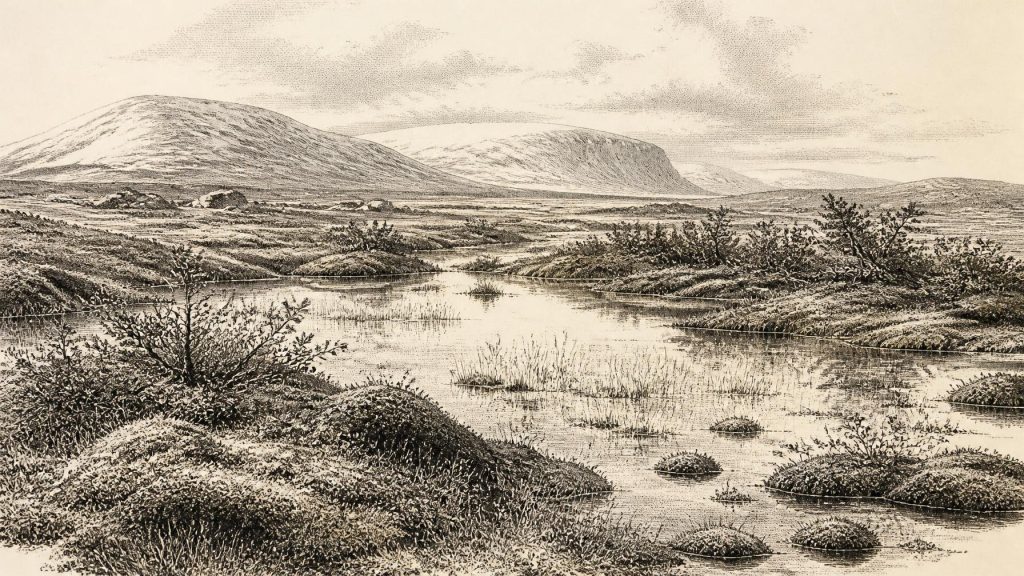
The flora and fauna preserved in the intervening sediments indicate open tundra vegetation and a periglacial regime: a landscape strongly affected by freezing and thawing, but not necessarily itself covered by a glacier. Freshwater mosses and sedges grew around shallow water; remains also include plants associated with cold, open ground, among them lesser clubmoss. Insect evidence had a northern, cold-adapted character. The site has sometimes been described as a muskeg-like environment, a useful indication of wet, organic ground and pools, but it must not be turned into a modern landscape in miniature. Conditions would have been severe, the growing season restricted and local drainage shaped by frost, thaw and permafrost-like ground conditions.
Derryvree is especially valuable because it shows biological activity where later ice might otherwise seem to have erased all evidence. Yet it is a local archive rather than a weather report for every Irish region. Its wetland was one patch in a changing landscape. The later glacier that sealed it beneath till also shows how quickly the available habitat could be transformed. In practical terms, the defining force in Ireland around this period was not a human political order but climatic volatility and the advance or retreat of ice margins.
Nearby Greenagho, near Belcoo in County Fermanagh, provides an important comparison. Organic material from a lacustrine deposit beneath later till has yielded a legacy radiocarbon age of about 32,460 BP, conventionally calibrated to roughly 37,200–35,700 cal BP. The date has cautions attached, including its status as a minimum age, and it is earlier than the nominal year considered here. Nevertheless, Greenagho and Derryvree together demonstrate that north-central Ireland contained freshwater environments and ice-free ground during parts of the Middle Midlandian, before major later glaciation overwhelmed or remodelled much of the island.
An Island Approaching Greater Ice
At 31,115 BCE, Ireland lay within a wider north-west European zone of sharp climatic oscillation. The eventual Last Glacial Maximum is commonly placed later, broadly around 26,500–19,000 years ago globally, although the timing and extent of individual Irish ice lobes remain subjects of active reconstruction. Evidence from marine sediments, landforms, exposure dating and buried organic horizons indicates that the British–Irish Ice Sheet did not behave as a single, static blanket. Some sectors expanded early; other areas retained ice-free or seasonally milder intervals.
That complexity matters for coasts and connections. Sea level was lower than today because much water was stored in continental ice sheets, exposing broader shelf landscapes in places. But lower sea level alone does not prove a continuous dry-land route between Ireland, Britain and continental Europe at this particular date. Sea passages, changing ice margins and local topography all mattered. The Irish evidence does not allow a secure reconstruction of a single travel corridor, nor does it show that people regularly crossed one. It does show a landmass whose shorelines, habitats and access routes differed greatly from later Ireland.
Castlepook’s Faunal Record
In north Cork, Castlepook Cave near Doneraile—historically called Mammoth Cave—preserves another window on this broad period. Its older excavations recovered a rich assemblage accumulated over a long span and through more than one process: carnivores could drag prey into caves, animals could die naturally, water could move material, and early twentieth-century excavation did not record contexts to modern standards. The cave therefore cannot be read as a single campsite or a single moment.
Re-dating has nevertheless shown that parts of the Castlepook fauna belong to Marine Isotope Stage 3 and are substantially older than some earlier determinations suggested. The assemblage includes reindeer, woolly mammoth, giant deer, brown bear, wolf and spotted hyaena, as well as smaller cold-adapted animals. These species support the wider picture of open, cold landscapes capable of sustaining grazing herds, predators and scavengers during suitable intervals. They do not prove that all these animals met one another at the cave, or that each lived in Ireland in 31,115 BCE. The secure conclusion is temporal breadth: south-western Ireland was repeatedly accessible to a varied Pleistocene fauna before the Last Glacial Maximum.
Spotted hyaena is particularly revealing. At Castlepook it is represented by bones, teeth and coprolites, and the cave’s galleries may have served as a carnivore den at times. Such evidence reminds us that caves were not naturally human refuges. They were active parts of an animal landscape, used intermittently and often dangerously by large predators and scavengers. A cave deposit may preserve bones exceptionally well, but its contents must be disentangled carefully before claims about behaviour can be made.
The Human Question
A reindeer femur from Castlepook has been reported to bear a deep incision interpreted by zooarchaeologist Ruth Carden as a sharp stone-tool mark made during carcass processing. County Cork heritage material presents the object as Palaeolithic and broadly circa 31,000 BC. If that interpretation is sustained, it is potentially Ireland’s earliest evidence for human handling of an animal, and it makes this date unusually significant.
Its limits are as important as its promise. The femur comes from an old cave collection rather than a modernly excavated occupation floor. No securely associated hearth, stone-tool assemblage, dwelling, burial, butchered bone concentration or food store demonstrates a camp at Castlepook at this age. A radiocarbon result dates the animal’s death within a range; it does not independently date the incision, identify its maker or reveal where the animal was killed. The mark is best treated as evidence for a possible brief human episode, not proof that Ireland had a resident population.
If people did visit, they may have been a small and mobile Upper Palaeolithic party exploiting a reindeer carcass during a short incursion. Reindeer could provide meat, fat, hide, sinew, antler and bone, but the Irish specimen alone cannot demonstrate which resources were taken or how a group travelled. It cannot tell us their language, kinship, cultural affiliation or destination. Continental and British evidence confirms that people lived elsewhere in north-west Europe during this broad period, but those better-attested societies cannot simply be projected across the sea into Ireland.
No Polities, No Proven Religion
There is no evidence for political affairs, diplomacy, warfare, chiefs, territories or institutions in Ireland in 31,115 BCE. Nor can archaeology responsibly identify an Irish religion, artistic tradition, formal learning system or trade network at this date. The possible cut-marked femur may point to practical knowledge of stone tools and animal anatomy, but it does not establish a local craft tradition. Similarly, the movement of animals into Ireland indicates ecological connectivity, not commerce or organised exchange.
Everyday life is equally difficult to recover. There is no securely demonstrated settlement from which to describe houses, clothing, families or seasonal rounds. The most defensible social conclusion is negative but important: any human presence was, at most, sparse and transient in the evidence now available. The enduring inhabitants disclosed by the record are plants, insects and animals adapted to an unstable cold environment.
Landscape Rather Than Chronicle
The year label therefore conceals more than it reveals. Around 31,115 BCE, Ireland was a changing Late Pleistocene landscape in which freshwater wetlands could exist in Fermanagh between phases of glaciation, while cold-adapted mammals ranged through suitable habitats in Cork. Derryvree provides the clearest environmental anchor; Greenagho widens the regional picture; Castlepook raises a compelling but unresolved question about people. The later growth of ice would bury, scour and fragment this world. What survives is not an annual chronicle, but a handful of extraordinary archives from which a cautious history can still be made.
Primary Sources
- A Middle Midlandian Freshwater Series at Derryvree, Maguiresbridge, County Fermanagh, Northern Ireland
- Early Midlandian–Middle Midlandian, Pleistocene, Northern Ireland
- Middle Midlandian Interstadial Deposits at Greenagho, Near Belcoo, County Fermanagh, Northern Ireland
- Trimlines, Blockfields and the Vertical Extent of the Last Ice Sheet in Southern Ireland
- Growth and Retreat of the Last British–Irish Ice Sheet, 31,000 to 15,000 Years Ago: The BRITICE-CHRONO Reconstruction
- Growth and Retreat of the Last British–Irish Ice Sheet, 31,000 to 15,000 Years Ago: The BRITICE-CHRONO Reconstruction
- A Reconsideration of the Radiocarbon Dating of the Marine Isotope Stage 3 Fauna from Southern Ireland
- New Insights on the Fauna of Ireland's Younger Dryas and Early Holocene from Alice & Gwendoline Cave
- Heritage Artefacts of County Cork
- 2022:564 – Castlepook Cave, Castlepook South, Cork
- The Irish Quaternary Fauna Project
- Figure 6.— The Subdivision of the Quaternary Period in Ireland
- References and Recommended Reading
- Episodic Speleothem Deposition Tracks the Terrestrial Impact of Millennial-Scale Last Glacial Climate Variability in SW Ireland
- Radiocarbon Constraints on the History of the Western Irish Ice Sheet Prior to the Last Glacial Maximum
- Late Pleistocene Chronostratigraphy and Ice Sheet Limits, Southern Ireland
- The IntCal20 Northern Hemisphere Radiocarbon Age Calibration Curve (0–55 cal kBP)
- The Timing and Magnitude of the British–Irish Ice Sheet Between Marine Isotope Stages 5d and 2
- Dimensions and Chronology of the Last Ice Sheet in Western Ireland
- Radiocarbon Constraints on the Age of the Maximum Advance of the British–Irish Ice Sheet in the Celtic Sea
- Ireland Through Geological Time
- Quaternary Geomorphology