

Derryvree’s Sealed Waterline30974 BCE
Around 30,974 BCE, Ireland experienced unstable late-Pleistocene conditions during Marine Isotope Stage 3, rather than a precisely datable historical year. At Derryvree, County Fermanagh, freshwater sediments sealed between glacial tills preserve evidence of cold, open tundra wetland, supporting sedges, mosses, arctic-alpine plants and invertebrates during an ice-free interval. Castlepook Cave, County Cork, reveals a diverse fauna including reindeer, mammoth, giant deer, predators and scavengers, though deposits span long periods. A marked reindeer bone may indicate human butchery around 31,000 BCE, but permanent settlement remains unproven. These sites illuminate local ecosystems, not a national society, before renewed glaciation transformed the landscape.
Dateline
“30,974 BCE” is a modern chronological label, not a year that can be recovered from an Irish calendar, a written record or a dated human event. In archaeological terms it is approximately 32,923 years before AD 1950, the conventional “before present” reference point. That numerical conversion is useful only for orientation. At such depth in time, radiocarbon measurements require calibration and normally yield broad probability ranges rather than annual precision. The most responsible account of Ireland at this point therefore concerns a late-Pleistocene interval whose surviving deposits overlap the date, not a supposed episode that happened within one particular year.
A Cold-Phase Ireland
The relevant setting is Marine Isotope Stage 3, part of the last glacial cycle and, in Irish terminology, the Midlandian. This was not the Last Glacial Maximum itself. The greatest expansion of the British–Irish Ice Sheet came later, although its timing and extent varied greatly between regions. Around the notional date in question, Ireland was subject to pronounced climatic instability: colder stadial conditions alternated with comparatively milder interstadial episodes across the North Atlantic world. The island’s terrain, coastlines, drainage and ice margins did not necessarily resemble their modern forms, and no single reconstruction can safely stand for every valley or county.
The best Irish environmental evidence close to this horizon comes from Derryvree, near Maguiresbridge in County Fermanagh. Roadworks in 1969 cut through a drumlin and exposed silts, fine sand and organic material lying between two thick tills: unsorted sediments deposited by glacier ice. The sequence is especially valuable because it establishes relative order. A phase of glaciation produced the lower till; an interval in which freshwater sediment accumulated followed; and a later ice advance buried the deposit beneath upper till. Derryvree is not a settlement site, but it preserves an unusually local record of a living landscape that later ice sealed from view.
The Limits of the Date
Organic material from the Derryvree freshwater series produced a conventional radiocarbon determination of 30,500 years BP, with substantial laboratory uncertainty. Published calibration has placed the deposit broadly at about 36,900–31,700 calibrated years BP, approximately 34,950–29,750 BCE. The requested date lies within that long interval. It does not follow that any one seed, insect, moss stem or silt layer can be assigned to 30,974 BCE, still less that conditions observed at Derryvree prevailed throughout Ireland in that year. Calibration curves, including IntCal20, are essential because atmospheric radiocarbon concentrations have changed through time; they improve chronology but cannot turn an Ice Age deposit into an annual diary.
Older descriptions sometimes called Derryvree an interstadial deposit, suggesting a notably milder break within glacial conditions. The fossils themselves require a more restrained formulation. They indicate that ice was not overriding that particular Fermanagh locality while the freshwater bed formed, and that plants and small animals occupied a cold, open environment. They do not demonstrate a warm, wooded Ireland, a nationwide thaw, or a stable climate lasting for a known number of generations. The later till above the organic bed is a powerful reminder that the apparent environmental opportunity was eventually ended or transformed by renewed glaciation.
Wetland on Open Tundra
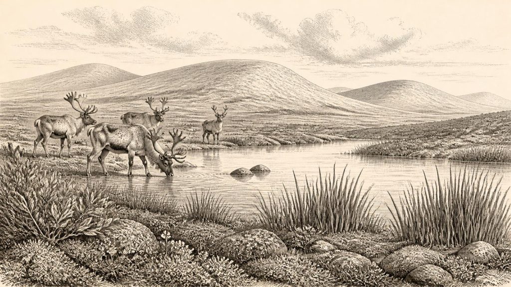
Derryvree’s pollen, plant macrofossils, mosses and insect remains indicate tundra-like, periglacial surroundings. The evidence includes sedges, mosses and plants associated with shallow water and wet ground, alongside arctic-alpine species such as mountain-avens and dwarf willow. Bogbean and alternate water-milfoil are particularly revealing: they point to freshwater and damp margins rather than an entirely dry, barren plain. In combination, the material suggests a mosaic of pools, silty shallows, saturated ground and open herb-rich vegetation, with little or no tree cover in the immediate area.
This was a demanding but not lifeless landscape. Seasonal freezing and thawing, short growing seasons, exposed ground and changing water levels would have shaped every habitat. Yet the freshwater record demonstrates that plants, invertebrates and other small organisms found viable niches. It is better imagined as patchy cold-country wetland than as a uniform sheet of snow. Equally, it should not be romanticised as a modern nature reserve transported into the past. The assemblage survives from one basin under exceptional geological circumstances; it offers a close view of its locality, not a complete inventory of Irish life.
Animals and the Cave Record
Far to the south, Castlepook Cave near Doneraile in north County Cork provides a different kind of evidence. Reassessment and improved radiocarbon dating of cave fauna have shown that several Irish animal remains once thought much younger belong in Marine Isotope Stage 3. The cave’s wider Pleistocene assemblage includes reindeer, woolly mammoth, giant deer, brown bear, wolf, fox, hare, lemmings and spotted hyaena. These species were not necessarily all present together, nor should every bone be treated as evidence for the precise year under discussion. Cave deposits can combine material accumulated across long periods and altered by carnivores, water, collapse, frost and early excavation.
Even so, Castlepook confirms that Ireland was ecologically connected to the wider cold-stage world of north-west Europe. Reindeer and lemmings indicate severe, open-country conditions; mammoth and giant deer evoke the large herbivores capable of ranging through suitable grass-, herb- and shrub-rich terrain; hyaena, wolf and bear show that predators and scavengers were part of the food web. A cave is not a transparent sample of the surrounding countryside. Carnivores may have carried carcass parts into it, and bones may have been reworked. Its principal value is to show the possible breadth of fauna, while Derryvree supplies the sharper environmental picture.
A Possible Human Trace
Castlepook also holds the most consequential, but still limited, evidence relevant to people. A reindeer femur from the cave has been publicly dated to roughly 31,000 BCE and bears a deep mark interpreted by palaeozoologist Ruth Carden as damage made by a sharp stone tool during butchery. If that interpretation is sustained, it would indicate that Upper Palaeolithic people processed a reindeer in Ireland during this broad pre-maximum glacial period. It would substantially extend the island’s known human story beyond the better-established terminal-Pleistocene and Mesolithic records.
The qualification matters. The bone came from an old cave collection, not from a modern excavation of an intact occupation floor. No securely associated hearth, lithic assemblage, dwelling, burial, repeated camp surface or food store has yet established a permanent human community in Ireland at this age. A date on the animal bone is not automatically a date for the incision, although analysis of fresh-bone modification is central to the interpretation. The responsible conclusion is that brief human visitation or carcass processing is plausible and important, but that settlement, population size, routes of arrival and continuity of occupation remain unknown.
No Politics, No Proven Trade
There is therefore no evidence from Ireland around this horizon for political institutions, named groups, diplomacy, territorial rule, warfare, formal religion, monuments, writing or organised learning. Nor can trade be demonstrated. A mobile hunter-gatherer party, if people were indeed present, might have depended on skills familiar elsewhere in Upper Palaeolithic Europe—stone-tool use, clothing, shared knowledge of animals and seasonal movement—but those are continental comparisons, not Irish facts. Ireland has not yielded the tools, ornaments, structures or art needed to show that such practices occurred here at this date.
Everyday life must be approached through the same distinction. The fauna and wetland flora establish available environments and potential resources, not meals, households or social identities. Reindeer, other large mammals, freshwater settings and plant-rich ground may have offered opportunities for mobile foragers, but archaeology has not yet demonstrated a local economy. The most important historical development is consequently environmental: some places supported cold-adapted ecosystems before later ice rearranged the land and obscured much of the evidence.
A Landscape, Not a Nation
Ireland at this remote point was neither an empty abstraction nor a known human society awaiting a national history. It was a changing Pleistocene landscape of wetlands, open tundra vegetation, mobile animals and encroaching or retreating ice. Derryvree’s buried freshwater sediments establish that cold ecological communities could persist locally between glacial episodes. Castlepook suggests that a surprisingly diverse fauna ranged in the south and preserves a provocative possible sign of human action. Together, the sites demand both imagination and restraint: they illuminate an Ice Age Ireland, but they do not permit a year-by-year narrative, a map of peoples or a story of permanent settlement for 30,974 BCE.
Primary Sources
- A Middle Midlandian Freshwater Series at Derryvree, Maguiresbridge, County Fermanagh, Northern Ireland
- Middle Midlandian Interstadial Deposits at Greenagho, Near Belcoo, County Fermanagh, Northern Ireland
- Freshwater Organic Deposits and Stratified Sediments Between Early and Late Midlandian (Devensian) Till Sheets, at Aghnadarragh, County Antrim, Northern Ireland
- A Reconsideration of the Radiocarbon Dating of the Marine Isotope Stage 3 Fauna from Southern Ireland
- The Irish Quaternary Fauna Project
- New Insights on the Fauna of Ireland’s Younger Dryas and Early Holocene from Alice & Gwendoline Cave
- Growth and Retreat of the Last British–Irish Ice Sheet, 31,000 to 15,000 Years Ago: the BRITICE-CHRONO Reconstruction
- The Timing and Magnitude of the British–Irish Ice Sheet Between Marine Isotope Stages 5d and 2
- Oscillating Retreat of the Last British-Irish Ice Sheet on the Continental Shelf Offshore Galway Bay, Western Ireland
- Trimlines, Blockfields and the Vertical Extent of the Last Ice Sheet in Southern Ireland
- The Last Eurasian Ice Sheets – a Chronological Database and Time-Slice Reconstruction, DATED-1
- The IntCal20 Northern Hemisphere Radiocarbon Age Calibration Curve (0–55 cal kBP)
- Palaeoecology
- Archaeological Heritage of County Cork
- Heritage Artefacts of County Cork
- Menyanthes trifoliata
- Dryas octopetala
- Salix herbacea
- Myriophyllum alterniflorum
- Our Ancient Landscapes: Hunter-Gatherers in Ireland
- Ireland’s Palaeolithic Archaeology – Fleeting Footprints in a Frozen Land
- Aghnadarragh