Sperrin Ice in Ascent30467 BCE
Around 30,467 BCE, a modern label rather than a recoverable date, Ireland was entering expanding British–Irish Ice Sheet conditions during Marine Isotope Stage 3. Ice accumulated across northern and upland regions, while shifting margins left patchy periglacial terrain, altered coastlines and uncertain travel routes. Derryvree deposits in Fermanagh preserve evidence of cold, wet, treeless freshwater habitats with mosses, sedges, dwarf willow and aquatic plants. Castlepook Cave in Cork contains time-mixed remains of mammoth, giant deer, reindeer and predators, indicating intermittent cold-climate fauna. A possibly cut-marked reindeer bone suggests potential human presence, but no securely dated settlement or society survives archaeologically.

Dateline
“30,467 BCE” is a useful modern label, not a date that can be recovered from the Irish archaeological record. No person in prehistoric Ireland counted years in this way, and neither radiocarbon measurements nor ice-sheet deposits can resolve a particular calendar year so far back. In calendar terms this point is roughly 32,400 years before the conventional radiocarbon reference year of 1950, but that arithmetic must not be confused with a radiocarbon age. For this depth of time, evidence is normally expressed as calibrated ranges, with margins of uncertainty, rather than as an anniversary.
Ireland at this approximate point belonged to the later part of the Last Glacial Period, conventionally Marine Isotope Stage 3, and stood on the threshold of much more extensive glaciation. It was not an Ireland of fields, villages, kingdoms or named peoples. What can be responsibly described is a changing physical world: ice accumulating over uplands, exposed or recently exposed ground beyond its margins, cold-water basins, sparse tundra vegetation and mobile animal populations. The surviving evidence is fragmentary because later glaciers repeatedly eroded and buried older landscapes. Its very incompleteness is central to the history.
A Growing Ice Landscape
Recent reconstructions of the British–Irish Ice Sheet indicate that ice was building across Ireland and Britain between about 31,000 and 26,000 years ago. By c. 31 ka, a substantial ice cap is modelled over north-western and northern Ireland, extending from the Derryveagh Mountains towards the Sperrins, while smaller ice fields or glaciers occupied several other uplands, including the Wicklows, Mournes, Dartry Mountains, MacGillycuddy’s Reeks and Knockmealdown Mountains. By c. 30 ka, these separate masses had expanded and merged into the developing British–Irish Ice Sheet.
That reconstruction is an informed model, constrained by landforms, sediment sequences, dated material and ice-sheet physics; it is not a photograph of the island in 30,467 BCE. Its one-thousand-year time slices are especially important here. They demonstrate a broad trend of ice growth, but cannot tell us whether a particular valley was snow-covered or open on one notional calendar year. Nor was the advance uniform. High ground, northern districts, western coasts and southern lowlands had different histories. At this date, Ireland should be envisaged as a region of shifting ice margins and periglacial environments rather than as a single, uniformly frozen island.
Lower global sea levels altered the surrounding geography, exposing wider shelves and changing coastlines, but Ireland’s precise connections and separations from neighbouring land remain difficult questions. A lower sea level did not automatically create an easy, continuous land route for people or animals. Ice, marine channels, tides, topography and the changing position of glaciers mattered as much as the height of the sea. For the period considered here, there is no securely documented Irish route of travel, and no evidence from which to reconstruct regular crossings, exchange networks or diplomacy with communities elsewhere.
Water, Moss and Open Ground
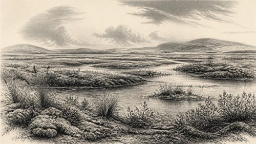
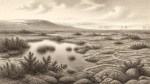
The most vivid direct environmental evidence comes from deposits that are not precisely contemporary with 30,467 BCE but illuminate the same cold-stage world. At Derryvree near Maguiresbridge in County Fermanagh, organic silts and fine sands were preserved between two layers of glacial till. The sequence produced plant remains associated with a treeless, wet, tundra-like or muskeg environment. Fossils included bogbean (Menyanthes trifoliata), dwarf willow, sedges, aquatic plants, mosses and other cold-tolerant taxa. They show that even in a severe climate, shallow freshwater, saturated ground and seasonal plant growth could persist where conditions allowed.
An older conventional radiocarbon determination from this organic horizon, BIRM-166, is often cited as about 30,500 radiocarbon years BP. It is a crucial chronological clue, but it must be handled cautiously. A radiocarbon age is not a BCE date, and its calibrated calendar range is considerably older and broader; it cannot identify conditions in the named year. Furthermore, the deposit records a local basin at a particular stage in an unstable glacial history. It does not prove that all of Ireland was a boggy tundra, nor that every plant found there grew together in the same season. It does, however, firmly establish that pockets of freshwater vegetation existed in northern Ireland before later ice sealed the deposits beneath till.
The Derryvree evidence corrects a simple image of an entirely lifeless ice age. The landscape could be austere without being barren. Short summers may have supported low herbs, mosses, sedges and willow close to water, while winter frost, snow cover and frozen ground imposed strict limits. Such environments were patchy. Their extent would have depended on altitude, drainage, proximity to ice and changing temperatures. A green margin beside a pool does not imply woodland, reliable pasture or a stable resource base for permanent human settlement.
Animals Before the Maximum
Irish cave deposits provide another line of evidence, although they too require careful interpretation. Castlepook Cave near Doneraile in north Cork is the island’s richest known archive for vertebrate life leading up to the Last Glacial Maximum. More than 2,000 bones have been recovered from its passages and chambers. The assemblage includes woolly mammoth, giant deer, reindeer, brown bear, wolf, Arctic fox, spotted hyaena and lemmings. Taken together, these animals demonstrate that Ireland supported, at intervals, components of a cold-climate fauna familiar across north-western Europe.
Yet Castlepook was not a census of a living countryside. A limestone cave accumulated remains through many processes: carnivores brought in carcass parts, animals died or sheltered there, water moved bone, sediments were disturbed, and the principal excavations took place before modern recovery and recording methods. Individual specimens have returned dates spanning a very long interval. Improved laboratory pretreatment has also shown that several older Irish cave radiocarbon results require reassessment. The cave therefore supports the existence of particular animals in broad periods, but it cannot prove that mammoths, hyaenas, reindeer and people all occupied one place at the same moment.
The fauna nevertheless suggests an ecological mosaic of open country and seasonal movement. Reindeer and lemmings fit cold, largely treeless environments; mammoth and giant deer point towards productive patches within wider open landscapes; wolves, Arctic foxes and spotted hyaenas indicate predators and scavengers exploiting those herbivore populations. Their presence was contingent. Animals could arrive during favourable climatic phases and disappear when ice advanced, vegetation changed or routes were closed. There is no basis for calculating herd sizes, hunting territories, annual migrations or a stable ‘Irish mammoth steppe’ for this particular year.
The Human Question
One Castlepook reindeer femur has attracted exceptional attention because a deep linear mark has been interpreted as the result of chopping or butchery with a sharp stone tool. Public accounts have associated the bone with an age of about 33,000 years ago. If the mark is anthropogenic and contemporary with the death of the animal, it would offer an early indication that Upper Palaeolithic people reached Ireland long before the better documented post-glacial settlement. It would be evidence of an episode of carcass processing, not evidence for an established population.
For 30,467 BCE specifically, the responsible conclusion is more restrained: there is no securely stratified settlement, hearth, stone-tool assemblage, dwelling, burial, artwork or human skeletal remain that can be assigned to this calendar point. The reindeer bone does not identify its maker, reveal how many people were involved, or demonstrate a permanent camp. It cannot be used to assign Ireland to the Aurignacian, Gravettian or another continental archaeological tradition. Nor can it furnish evidence for language, kinship, ritual, political authority, warfare or trade.
Absence of such evidence is not proof that no human ever crossed the region in this long interval. Small, short-lived visits by mobile hunters are inherently difficult to detect, especially where glaciers later removed surfaces and deposits. But historical writing must distinguish that possibility from what is demonstrated. At present, Ireland around this date is better documented as a changing animal and ice-age environment than as a human society.
No Polities, Only Processes
Accordingly, the usual headings of political affairs, conflict, diplomacy, religion, culture and learning have little direct content for this period. There were no recorded polities, territories, rulers, treaties, markets or institutions in Ireland. No ritual site or symbolic object of this age has been securely recovered. If people visited, their social practices remain archaeologically invisible here. It would be misleading to fill the silence with imagined hunter bands, shamanic ceremonies or conflicts around game.
Economy, too, can only be discussed environmentally. Plants and animals were potential resources, but no Irish evidence shows how they were gathered, hunted, shared, stored or exchanged at this date. Settlement was shaped first by climate and ice dynamics: places able to sustain freshwater, forage and traversable ground may have existed temporarily, while other regions were being overtaken by ice or rendered inhospitable by frost and sparse vegetation. The central historical development was not a human event but a regional transformation—the growth of ice that would increasingly overwrite the landscapes in which any earlier traces might have survived.
That is why the evidence from Fermanagh and Cork matters so much. Buried organic silts at Derryvree preserve a narrow view of cold-season wetlands; Castlepook preserves a time-mixed archive of animals using, or carried into, a cave. Together they reveal an Ireland that was ecologically active but climatically precarious. Around 30,467 BCE, modern calendar precision is unavailable. What scholarship can support is a cautious portrait of Ireland entering the great expansion of the British–Irish Ice Sheet: a land of advancing upland ice, scattered watery tundra habitats and intermittently present cold-adapted fauna, with the human story still uncertain.
Primary Sources
- Growth and retreat of the last British–Irish Ice Sheet, 31,000 to 15,000 years ago: the BRITICE-CHRONO reconstruction
- Growth and retreat of the last British–Irish Ice Sheet, 31,000 to 15,000 years ago: the BRITICE-CHRONO reconstruction
- Pattern and timing of retreat of the last British-Irish Ice Sheet
- Timing and pace of ice-sheet withdrawal across the marine–terrestrial transition west of Ireland during the last glaciation
- Maximum extent and readvance dynamics of the Irish Sea Ice Stream and Irish Sea Glacier since the Last Glacial Maximum
- Radiocarbon constraints on the age of the maximum advance of the British–Irish Ice Sheet in the Celtic Sea
- Late Pleistocene chronostratigraphy and ice sheet limits, southern Ireland
- New data for the Last Glacial Maximum in Great Britain and Ireland
- Dimensions and chronology of the last ice sheet in Western Ireland
- Maximum extent and dynamic behaviour of the last British–Irish Ice Sheet west of Ireland
- A reconsideration of the radiocarbon dating of the Marine Isotope Stage 3 fauna from southern Ireland
- The Irish Quaternary Fauna Project
- Castlepook Cave, County Cork: County Geological Site Report
- Figure 6: The subdivision of the Quaternary Period in Ireland
- Irish Association for Quaternary Research Field Guide 16
- The colonization of Ireland: A human ecology perspective
- New insights on the fauna of Ireland’s Younger Dryas and Early Holocene from Alice & Gwendoline Cave
- New insights on the fauna of Ireland’s Younger Dryas and Early Holocene from Alice & Gwendoline Cave
- The IntCal20 Northern Hemisphere Radiocarbon Age Calibration Curve (0–55 cal kBP)
- Menyanthes trifoliata: fossil record in Fermanagh
- The problem of a late Quaternary landbridge between Britain and Ireland
- Stoats (Mustela erminea) provide evidence of natural overland colonization of Ireland
- Archaeological Heritage of County Cork
- Heritage Artefacts of County Cork