

Fermanagh Pools, Cork Hyenas30945 BCE
Around 30,945 BCE, Ireland was part of a climatically unstable Late Pleistocene landscape, not a recoverable historical year. At Derryvree in Fermanagh, organic freshwater deposits between glacial tills record cold, treeless wetlands supporting mosses, sedges, aquatic plants, insects and tundra-like vegetation. Castlepook Cave in Cork yielded mammoth, reindeer, giant deer, bear, fox, hare, lemming and spotted hyaena remains, indicating diverse cold-stage fauna. Dates from both sites span broad ranges, not a single year. A modified reindeer bone may indicate early human activity, but no secure evidence establishes permanent settlement. Shifting ice, sea levels and habitats governed access and survival locally.
Dateline
The label 30,945 BCE is a modern chronological convenience, not a recoverable Irish calendar year. It lies roughly 32,894 years before the conventional archaeological reference point of AD 1950, within the Late Pleistocene and Marine Isotope Stage 3 (MIS 3). No writing, named people, political units or dated events survive from Ireland at this depth of time. Nor can the evidence identify the weather, a journey or an encounter in one particular year. Radiocarbon determinations must be calibrated into calendar ranges and carry sizeable uncertainty; deposits and bone assemblages therefore illuminate a broad horizon rather than a single year.
A Cold Interval, Not a Chronicle
For Ireland, the responsible frame is the later Middle Midlandian, the regional name often applied to part of this fluctuating glacial period. The island was not simply an unbroken white wilderness, nor was it the wooded country familiar from later prehistory. Its environments changed with climate, ice margins, drainage and sea level. The British–Irish Ice Sheet was already an important force, but its growth was regionally uneven and its ultimate maximum lay later. Reconstructions place complete ice cover of Ireland and its continental shelf during the Last Glacial Maximum, broadly c. 27,000–23,000 calibrated years BP. That later episode would erase, bury or disturb much older evidence.
Around this nominal date, therefore, the central historical development was environmental instability. Ice expanded and retreated over long timescales; exposed ground could support plants and animals in some districts, while other areas were glaciated, periglacial or rendered inhospitable by severe cold. The surviving record is necessarily patchy. Northern Fermanagh and north Cork matter not because they describe all Ireland at once, but because they preserve two unusually valuable and very different windows onto conditions before the ice sheet’s fullest spread.
Derryvree Between the Tills
The clearest environmental archive is Derryvree, near Maguiresbridge in County Fermanagh. Road works in 1969 exposed organic-rich freshwater silts and fine sands trapped between two separate till sheets: compact glacial sediment below, a wetland sequence, then later glacial sediment above. The sequence establishes an important fact. After the earlier ice had deposited its till, local conditions allowed standing or slow-moving freshwater, plants, insects and fine sediment to accumulate; a renewed advance later sealed that record beneath another till.
The organic layers produced radiocarbon determination BIRM-166, conventionally dated to 30,500 radiocarbon years BP, with an uncertainty of +1,170 and −1,030 years. Calibration does not convert this into an exact BCE date. Published treatments place the deposit broadly within the middle and later thirty-thousands of calibrated years BP, approximately 36,900–31,700 cal BP. That wide interval overlaps the horizon represented by 30,945 BCE, but it cannot demonstrate that Derryvree’s pools existed in that numbered year. It is evidence for a type of Irish landscape and climate, not a dated episode.
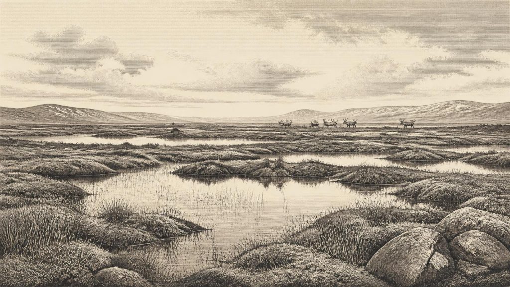
Its contents are nevertheless vivid. Plant remains, pollen and insects indicate cold, open, treeless country around freshwater. Mosses and sedges grew in wet ground; aquatic plants show the presence of pools or quiet water. Juniper, grasses and herbs belonged to a vegetation mosaic more akin to northern tundra and muskeg than to modern Irish pasture or woodland. Insect evidence likewise points towards a northern, cold-adapted setting. This was not lifeless terrain. It was a low-productivity but functioning wetland ecosystem, shaped by short growing seasons, prolonged winters and ground affected by frost.
Animals at Castlepook
Castlepook Cave, also called Mammoth Cave, near Doneraile in north County Cork provides the complementary faunal record. The cave has yielded one of Ireland’s richest Pleistocene bone collections, including woolly mammoth, reindeer, giant deer, brown bear, fox, hare, lemmings and spotted hyaena. A mammoth bone has produced a conventional radiocarbon age of 33,500 ± 1,200 BP, while a spotted-hyaena bone was dated to 34,300 ± 1,800 BP. These determinations make the assemblage directly relevant to the broad period, even though they cannot be assigned to 30,945 BCE.
The collection must be handled carefully. Cave deposits can accumulate over very long periods. Carnivores may drag in remains; water, excavation and disturbance can mix material; and older investigations often left limited contextual information. Castlepook is thus not a snapshot of one herd, one hunt or one season. It does show, however, that southern Ireland at times supported a diverse cold-stage fauna. Mammoth and reindeer suggest open landscapes with substantial grazing; hyaena demonstrates the presence of a major scavenger and predator. The National Museum of Ireland retains a Castlepook spotted-hyaena skull, a tangible reminder that animals now associated with African grasslands once ranged in Pleistocene Cork under very different climatic conditions.
The Human Question
Human presence is the most tempting and the most uncertain subject. A reindeer femur from Castlepook, recovered during earlier cave work and re-examined with modern methods, has been reported as about 33,000 years old and as bearing a deep linear modification interpreted by some researchers as a cut made with a sharp stone tool while the bone was fresh. If that interpretation is upheld, it could indicate a brief Upper Palaeolithic human visit to Ireland far earlier than the previously accepted evidence.
It does not yet establish a settled community. No securely associated stone-tool assemblage, hearth, dwelling, burial ground or occupation surface has been demonstrated for this horizon at Castlepook. The bone’s old excavation context also limits what can be inferred. A cautious conclusion is that people may have reached Ireland and processed an animal during the pre-Last Glacial Maximum period; a stronger claim of permanent occupation, a named hunting band or a regular migration route would go beyond the evidence. Recent excavations at the cave, supported by the Royal Irish Academy, are important precisely because undisturbed deposits may allow such questions to be tested rather than answered by assumption.
Society Beyond Recovery
There is no evidence from Ireland around this date for political affairs, diplomacy, leaders, warfare, law or territorial states. If humans did visit, they would have belonged to small, mobile hunter-gatherer communities of the wider north-west European Upper Palaeolithic world, but that is an inference from comparable societies and cannot identify an Irish group. Hunting may have involved cooperation and seasonal knowledge of animal movement, yet no Irish campsite from this time permits a reconstruction of family life, gender roles, language or social organisation.
For the same reason, religion and learning remain beyond direct observation. Cave bones do not demonstrate ritual, mythology, art, music or formal teaching. Nor is there evidence of farming, herding, metalworking, pottery, weaving, trade networks or exchange between communities. The most defensible ‘economy’ is ecological: animals grazed, browsed, hunted, scavenged and competed across open ground and wetlands; any humans present would have depended on mobile resources, fuel and shelter in a demanding environment. This is a landscape of subsistence possibilities, not a documented economy.
Routes, Coasts and an Approaching Ice Age
Lower global sea levels altered the geography around Ireland, exposing wider shelf lands in places, but that fact alone does not prove a dry land bridge or an easy crossing from Britain or continental Europe. Local relative sea level was affected by the weight of nearby ice, while glaciers, cold seas, river systems and changing coastlines shaped access. The British–Irish Ice Sheet was itself dynamic during MIS 3. Modern reviews find evidence for advance–retreat behaviour before the Last Glacial Maximum, but also stress that the chronology of these earlier phases remains less securely resolved than the later retreat.
Regional contrast is therefore essential. Derryvree records freshwater wetland in Fermanagh between ice advances. Castlepook records animals in a Cork limestone cave over a prolonged and probably mixed timespan. Neither permits the conclusion that all of Ireland was open tundra, ice-free, occupied or connected by a traversable route at once. The island’s history at this point is best understood as a shifting mosaic, in which suitable habitat may have appeared temporarily and then been lost as climate deteriorated and ice expanded.
What This Date Can Mean
30,945 BCE cannot supply the conventional landmarks of a year-by-year history. Its importance lies instead in the evidence that Ireland was part of the wider Ice Age ecology of north-west Europe before later glaciation reached its greatest extent. Derryvree preserves cold freshwater life beneath the drumlins of Fermanagh; Castlepook preserves the bones of grazing animals and carnivores in Cork; one marked reindeer bone raises, but does not settle, the possibility of very early human activity. Those traces are fragmentary, yet they are more historically meaningful than an invented event: they reveal an Ireland in which water, frost, animals and advancing ice determined the limits of life.
Primary Sources
- A Middle Midlandian Freshwater Series at Derryvree, Maguiresbridge, County Fermanagh, Northern Ireland
- Early Midlandian–Middle Midlandian, Pleistocene, Northern Ireland
- Irish Pleistocene Biostratigraphy
- The Irish Quaternary Fauna Project
- Freshwater Organic Deposits and Stratified Sediments Between Early and Late Midlandian (Devensian) Till Sheets, at Aghnadarragh, County Antrim, Northern Ireland
- Middle Midlandian Interstadial Deposits at Greenagho, Near Belcoo, County Fermanagh, Northern Ireland
- Growth and Retreat of the Last British–Irish Ice Sheet, 31,000 to 15,000 Years Ago: the BRITICE-CHRONO Reconstruction
- The Timing and Magnitude of the British–Irish Ice Sheet Between Marine Isotope Stages 5d and 2
- Pattern and Timing of Retreat of the Last British-Irish Ice Sheet
- Reconstructing the Last Irish Ice Sheet 2: a Geomorphologically-Driven Model of Ice Sheet Growth, Retreat and Dynamics
- Trimlines, Blockfields and the Vertical Extent of the Last Ice Sheet in Southern Ireland
- Maximum Extent and Dynamic Behaviour of the Last British–Irish Ice Sheet West of Ireland
- Ireland: Submerged Prehistoric Sites and Landscapes
- The IntCal20 Northern Hemisphere Radiocarbon Age Calibration Curve (0–55 cal kBP)
- Archaeology Research Excavation Grant 2022: Castlepook Cave Project Final Report
- Castlepook Cave, Co. Cork, 2022 Excavation Report
- Spotted Hyena Skull
- New Insights on the Fauna of Ireland’s Younger Dryas: a Multi-Proxy Study from Alice and Gwendoline Cave, County Clare
- Ireland’s Palaeolithic Archaeology – Fleeting Footprints in a Frozen Land
- Irish Caves Database: Mammoth Cave