
The Derryvree Fossil Flora30954 BCE
30,954 BCE is a modern label for a Late Pleistocene interval, rather than a recorded Irish year. Derryvree, County Fermanagh, preserves freshwater sediments beneath glacial till, radiocarbon dated broadly to 36,900–31,700 cal BP. Its pollen, plants and insects reveal locally ice-free, open tundra-like wetland with pools, sedges, herbs, juniper and severe periglacial conditions. Castlepook Cave, County Cork, contains time-mixed remains of mammals, demonstrating intermittent ecological connections with north-west Europe, but not simultaneous populations. A marked reindeer bone may indicate early human butchery, yet lacks secure archaeological context. No evidence supports settled communities; environmental change and later ice dominate Ireland’s record.
Dateline
The label 30,954 BCE is a modern filing device, not a recoverable Irish calendar year. No people in Ireland then recorded years, and no archaeological deposit can be dated to this particular season or generation. In conventional scientific terms, the date falls roughly 32,900 calendar years before AD 1950, within the Late Pleistocene and Marine Isotope Stage 3 (MIS 3), a fluctuating phase of the last Ice Age. The responsible history of Ireland at this depth of time is therefore a history of deposits, calibrated ranges and carefully limited conclusions rather than of named rulers, battles or events.
The closest evidence is not an annal but a buried wetland at Derryvree, near Maguiresbridge in County Fermanagh. It provides an exceptional, though local, glimpse of an Irish environment broadly relevant to this notional date. Farther south, Castlepook Cave near Doneraile in County Cork preserves a time-mixed collection of animal remains, including animals that crossed into Ireland during different cold-stage episodes. Together these sites show a landscape of open ground, freshwater pools, severe winters and intermittent ecological connections with north-west Europe. They do not provide proof of a settled human population.
Dating a Landscape, Not an Event
Radiocarbon ages are not identical to calendar ages. Atmospheric carbon-14 has varied through time, so laboratory results must be calibrated against independently dated environmental records. The current IntCal20 Northern Hemisphere curve reaches back to 55,000 calendar years before present, but uncertainty is substantial at this antiquity. A conventional radiocarbon date may consequently translate into a wide calibrated interval rather than a single year.
At Derryvree, road works in 1969 cut through a drumlin and exposed organic silts and fine sands between two thick sheets of glacial till. The lower till was laid down by an earlier ice advance. Then, when ice no longer occupied that locality, water and organic sediment accumulated in a freshwater setting. A later advance deposited the upper till, sealing the older wetland beneath the drumlin. Organic material from the freshwater series produced a radiocarbon determination of 30,500 +1,170/−1,030 radiocarbon years BP. Calibration places its broad age within approximately 36,900–31,700 cal BP, a range that includes the modern point conventionally called 30,954 BCE.
That range must be handled honestly. It does not prove that every Derryvree fossil lived in 30,954 BCE, nor does it reveal the exact date at which a pool formed or froze. It does, however, establish that a biologically active, locally ice-free environment existed in south Fermanagh during a cold interval broadly comparable with this one. The sequence is especially valuable because later ice covered, compressed and preserved it.
Wet Ground Beneath the Drumlin
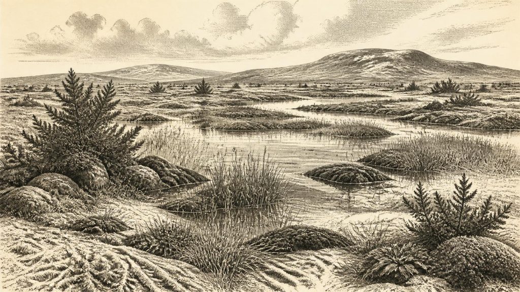
The Derryvree fossils replace the popular image of an Ice Age Ireland as an unbroken, featureless sheet of snow. Pollen, plant macrofossils, mosses and insect remains indicate open, largely treeless country under periglacial conditions. The vegetation included grasses, sedges, herbs, juniper and cold-tolerant mosses. Fossil finds of bogbean (Menyanthes trifoliata), water-milfoil and mountain avens are particularly informative: they point to shallow freshwater, wet margins and nearby open ground rather than dense woodland.
This was probably a patchwork landscape. Low hollows and pools held water during favourable seasons. Mossy and sedgy ground bordered them, while exposed surfaces had sparse cover and poorly developed soils. The insect assemblage supports the interpretation of harsh, northern conditions and a muskeg-like environment: waterlogged, organic-rich ground with open pools and plant material. Winter freezing, strong winds, short growing seasons and frost-disturbed soils would have shaped daily life for every organism in it.
There is an important geographical qualification. Derryvree is evidence for one locality in what is now County Fermanagh, not a complete map of Ireland. Conditions could differ sharply with altitude, distance from ice, coastal exposure and local water supply. The island’s position on the edge of the North Atlantic made its climate sensitive to shifts in oceanic and atmospheric circulation. Nevertheless, the Derryvree sequence makes one conclusion secure: parts of Ireland supported freshwater and tundra-like ecosystems before the later expansion of the last Irish Ice Sheet.
Animals and Changing Connections
Castlepook Cave, near Doneraile in north County Cork, is the principal Irish archive for large mammals from the long interval before and during the approach to the Last Glacial Maximum. Its collections include remains attributed to woolly mammoth, reindeer, giant deer, brown bear, wolf, fox, hare, lemming and spotted hyaena. These species demonstrate that Ireland was, at intervals, part of a wider north-west European ecological zone. Cold-adapted animals reached the island, found usable habitat and sometimes died or were accumulated in caves.
The cave is not a snapshot of one year. Much of its material was recovered in antiquarian excavations, often without the recording standards now expected, and the deposits were affected by water, carnivores and later disturbance. Direct radiocarbon dating has shown that its bones belong to episodes spread across many millennia. Earlier work dated a mammoth bone and a spotted-hyaena bone to around 33,500 and 34,300 radiocarbon years BP respectively; later reassessment has warned that some older cave-bone determinations require caution because radiocarbon pretreatment methods have improved.
It would therefore be misleading to picture mammoths, giant deer, hyaenas and reindeer all occupying one Cork valley at precisely the same moment. The defensible conclusion is narrower but still striking: southern Ireland repeatedly supported varied Late Pleistocene fauna before the climatic and glacial changes of the Last Glacial Maximum transformed much of the island. Cave assemblages are records of animal movement, carnivore behaviour, death and preservation; they are not population censuses.
Lower global sea levels changed the geography around Ireland. Much of the present sea floor was dry land or shallow coastal plain at different stages of the Ice Age, reducing distances and altering routes between Ireland, Britain and continental Europe. Yet lower sea level did not automatically create a simple, continuous land bridge available at every moment. Relative sea level, ice margins, rivers and local topography also mattered. The arrival of mammals is firm evidence of ecological connection at intervals; the precise routes and timings remain subjects for investigation.
The Human Question at Castlepook
The most consequential human clue near this broad period is a reindeer femur from Castlepook Cave. It has been reported as roughly 33,000 years old and bears a deep mark interpreted by the palaeozoologist Ruth Carden as damage made by a sharp stone tool during butchery. If this interpretation is confirmed, it would represent extraordinarily early evidence that people handled a reindeer in Ireland during the Upper Palaeolithic—far earlier than the securely documented post-glacial settlement record.
But the distinction between evidence and interpretation is decisive. The bone is real, its direct date is important, and the mark warrants serious study. Yet it was not recovered from a recently excavated hearth, occupation floor or sealed living surface. No associated stone-tool assemblage, dwelling, human bone, grave or securely contemporary fire has been found at Castlepook. The cave’s deposits contain material from multiple periods, and its excavation history complicates contextual reconstruction. A marked bone can support the possibility of a brief human incursion or carcass processing episode; it cannot demonstrate a permanent community, a camp at the cave or continuous occupation of Ireland.
This uncertainty is unsurprising. Later ice advances eroded landscapes, buried sediments and disturbed or destroyed many places where people might once have stopped. Coastal plains that could have offered routes or hunting grounds are now largely submerged. Absence of known camps is not proof that no person ever entered Ireland, but neither may the gaps be filled with imagined villages, migrations or hunting territories.
Society, Belief and Economy: What Cannot Be Claimed
There is no evidence from Ireland around this date for political institutions, diplomacy, warfare, chiefs, named groups, farming, trade networks, formal religion, art, language or teaching. There are no houses, fields, monuments, graves, pottery, metalwork or written records. It would be anachronistic to invent an Ice Age Irish society with fixed borders or tribal leadership simply because Upper Palaeolithic communities elsewhere in Europe made tools, ornaments and images.
If people did reach Ireland, the most plausible interpretation is of small, mobile hunter-gatherer parties operating in a demanding seasonal landscape, perhaps drawn by animal movements and the resources of open country. That is an inference from the wider European Upper Palaeolithic and from the possible Castlepook butchery mark, not a demonstrated description of Irish social life. Even a successful hunt would not establish residence. At present, the best-documented inhabitants of Ireland at this horizon remain its plants, insects and mammals.
The principal development was environmental. Derryvree records fresh water, mosses, sedges and herbs in an open periglacial setting; Castlepook records a wider world of large mammals and predators; glacial geology records an island moving towards a major reorganisation of ice, coast and habitat. Around 30,954 BCE, Ireland was not yet a historical community with a year-by-year story. It was a changing Ice Age landscape whose fragile evidence sets both the possibilities and the limits of its earliest human past.
Primary Sources
- A Middle Midlandian Freshwater Series at Derryvree, Maguiresbridge, County Fermanagh, Northern Ireland
- The Irish Quaternary Fauna Project
- A Reconsideration of the Radiocarbon Dating of the Marine Isotope Stage 3 Fauna from Southern Ireland
- Growth and Retreat of the Last British–Irish Ice Sheet, 31,000 to 15,000 Years Ago: the BRITICE-CHRONO Reconstruction
- The Deglaciation of the Western Sector of the Irish Ice Sheet from the Inner Continental Shelf to its Terrestrial Margin
- Trimlines, Blockfields and the Vertical Extent of the Last Ice Sheet in Southern Ireland
- The IntCal20 Northern Hemisphere Radiocarbon Age Calibration Curve (0–55 cal kBP)
- Early Midlandian–Middle Midlandian, Pleistocene, Northern Ireland
- Quaternary
- Palaeoecology
- The Subdivision of the Quaternary Period in Ireland
- Irish Pleistocene Biostratigraphy
- Conserving Quaternary Geoheritage in Northern Ireland
- Aghnadarragh
- New Insights on the Fauna of Ireland’s Younger Dryas and Early Holocene from Alice & Gwendoline Cave
- New Insights on the Fauna of Ireland’s Younger Dryas and Early Holocene from Alice & Gwendoline Cave
- Archaeological Heritage of County Cork
- Heritage Artefacts of County Cork
- Castlepook Cave, County Cork, 2022 Excavation Report
- Archaeology Research Excavation Grant 2022: Final Report
- Menyanthes trifoliata L.
- Dryas octopetala L.
- Scientific Dating of Pleistocene Sites: Scientific Dating Methods
- The Last Glacial Maximum British–Irish Ice Sheet: a Reconstruction Using Digital Terrain Mapping
