BIRM-166’s Tundra Calendar30821 BCE
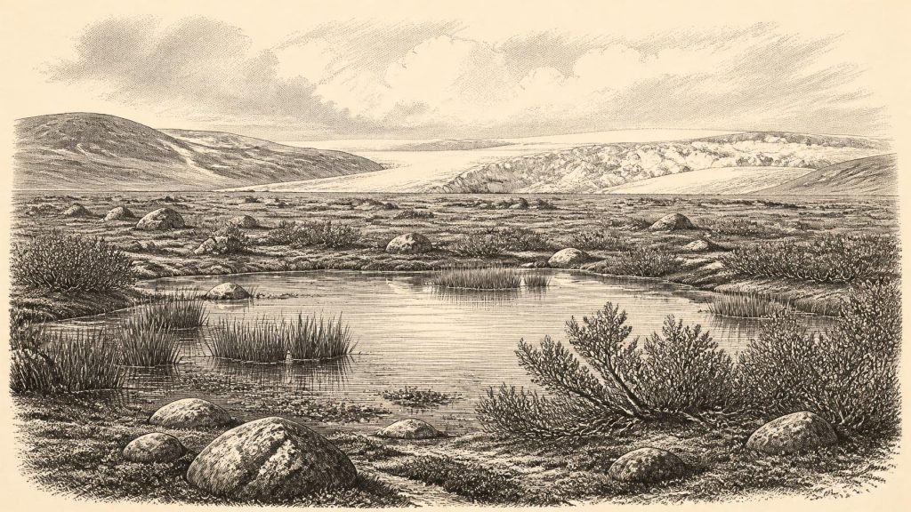
30,821 BCE is a modern label for an uncertain Late Pleistocene Irish environment during MIS 3, before the Last British–Irish Ice Sheet reached its fullest extent. Ireland comprised changing mosaics of ice, exposed ground, wetlands and altered coastlines. Derryvree, County Fermanagh, preserves freshwater sediments between till layers, indicating cold, open tundra-like conditions, plants and insects during an interval between glaciations. Cave remains, notably at Castlepook, County Cork, show mammals including reindeer, mammoth, giant deer and hyaena. A modified reindeer bone may indicate brief human activity, but remains disputed and cannot establish settlement. Evidence supports intermittent habitability, not settlement or chronicle.
Dateline
A date such as 30,821 BCE is useful only as a modern filing label. It does not identify an Irish year that can be recovered from the ground. There are no annals, named peoples, seasonal camp-sites or securely dated events from this depth of time, and radiocarbon results cannot be translated into a precise calendar year. In conventional archaeological terms, the label falls about 32,770 years before AD 1950, within the Late Pleistocene, Marine Isotope Stage 3 (MIS 3), and shortly before the fullest growth of the last British–Irish Ice Sheet. The responsible history of Ireland at this point is therefore a history of dated ranges, sediments, bones and uncertainty.
A Point Within a Long Cold Stage
MIS 3 was not a single unchanging Ice Age landscape. Across the North Atlantic, Greenland ice cores record abrupt swings between colder stadials and relatively milder interstadials. Ireland lay at the western edge of that unstable climatic world. Conditions around the notional date were cold, generally treeless and highly seasonal, but this does not mean that the entire island was a featureless sheet of ice. The evidence instead indicates shifting mosaics: glacier ice and ice-marginal ground in some regions, exposed terrain in others, and, at times, wetlands and freshwater pools capable of sustaining plants, insects and animals.
The later Last Glacial Maximum belongs mostly to a subsequent period. Reconstructions of the British–Irish Ice Sheet indicate major expansion after roughly 35,000–32,000 years ago, with maximum extent varying by sector and generally falling later, around 27,000–21,000 years ago. Thus 30,821 BCE belongs to a phase in which the island’s physical geography was already being transformed by advancing ice, yet before the best-established maximum of that ice sheet. Coastlines were also very different because global sea level was lower, but the exact configuration of land, sea, ice and passable routes around Ireland cannot be projected from a single date.
Derryvree’s Buried Wetland
The most illuminating Irish environmental evidence for this broad interval was found at Derryvree townland near Maguiresbridge, County Fermanagh. Road works in 1969 cut through a drumlin and exposed silts and fine sands enclosed between two substantial till sheets. This was an extraordinary survival: an organic freshwater sequence, later known by its laboratory sample number Birm-166, had been sealed between deposits left by separate episodes of glaciation.
The original radiocarbon result was 30,500 radiocarbon years BP, with a large uncertainty of +1,170/−1,030 years. That is a conventional radiocarbon age, not a calendar age. Modern calibration methods convert radiocarbon measurements through curves that themselves carry uncertainty, especially at this antiquity. It is safest to treat Derryvree as evidence for a cold phase broadly in the mid-30,000s calibrated years BP, rather than to claim that its plants grew in 30,821 BCE itself. Nevertheless, it offers the closest securely studied Irish environmental window onto the world represented by that label.
The silts contained a flora and fauna of full-glacial character. Mosses, sedges, dwarf willow, mountain-avens, lesser clubmoss and aquatic plants including bogbean and alternate water-milfoil point to open ground, wet hollows and shallow freshwater rather than woodland. Insects and other small remains reinforce the impression of a periglacial environment: cold ground subject to frost action, short growing seasons and sparse cover. “Tundra” is a helpful shorthand, provided it is not mistaken for a perfect modern analogue. Derryvree records a local basin within a changing ice-age landscape, not an inventory of all Ireland.
Its position between tills is the crucial fact. Before the wetland accumulated, ice had deposited one layer of debris; after it formed, another ice advance buried and preserved it. The deposit therefore demonstrates environmental opportunity between glacial episodes, while also conveying how temporary that opportunity was. The drumlin that carries the record is itself a monument to landscape remaking: sediments laid down, overridden, deformed and sealed by ice beyond any human timescale of memory.
An Animal Landscape
Cave collections add a second, less continuous but vivid body of evidence. Castlepook Cave, also called Mammoth Cave, lies in the Awbeg valley near Doneraile, County Cork. Excavations in the late nineteenth and early twentieth centuries produced a remarkable assemblage, though much of the original sediment was disturbed and many specimens lack the exact stratigraphic contexts that modern excavation would require. Direct radiocarbon dating has consequently been essential.
Studies of Ireland’s Quaternary fauna show that an array of large mammals and smaller cold-adapted animals occurred on the island during MIS 3. At Castlepook and other Irish caves, the wider pre-Last Glacial Maximum record includes reindeer, woolly mammoth, giant deer, brown bear, foxes, hares, lemmings and spotted hyaena. Not every species was present everywhere or at the same time. Nor should the list be turned into a single imagined herd moving across Cork on this particular year. It establishes instead that Ireland participated ecologically in the north-west European mammoth-steppe world during portions of the period.
Predators matter as much as prey. Hyaenas could accumulate and modify bones in caves; bears could use caves; water, gravity and later digging could move material. A bone in a cave is therefore not automatically a hunting remnant or proof of a living animal’s local death. The faunal record does, however, show that open habitats had enough productivity to support substantial herbivores and carnivores. Reindeer, in particular, fit an exposed, cold and seasonal terrain in which lichens, sedges, herbs and dwarf shrubs could be exploited across wide ranges.
The Castlepook Human Question
The possibility of people in Ireland is the most consequential and most carefully qualified aspect of this era. A reindeer femur from Castlepook, recovered during historic excavations and subsequently examined by zooarchaeologist Ruth Carden, has been reported as dating to about 33,000 years ago and bearing a deep linear modification interpreted as a stone-tool cut or chop made while the bone was fresh. If that interpretation is sustained, it would represent evidence of Upper Palaeolithic human activity far earlier than Ireland’s long-accepted late-glacial settlement record.
That conditional language is essential. The specimen is compelling but isolated. It does not come with a securely associated hearth, stone-tool assemblage, dwelling floor, burial, art panel or food-processing area. Early excavations had disturbed the cave deposits, and a cut-like mark must be distinguished from carnivore damage, breakage, excavation damage or other processes. More recent fieldwork has located surviving deposits and Pleistocene faunal material at Castlepook, but the 2022 excavation recovered no cultural artefacts. Research continues precisely because new stratified finds, direct dates and microscopic study are needed to test the claim.
The most defensible conclusion is modest but important: Ireland may have been visited by people during MIS 3, perhaps in brief episodes linked to favourable environmental windows and animal movements. It is not yet possible to demonstrate a resident population, a settled community or an uninterrupted ancestry from such visitors to later Irish people. The later expansion of ice would in any case have made survival of any local human occupation extraordinarily difficult.
Society Beyond the Evidence
Where human presence remains unconfirmed at settlement scale, political history cannot responsibly begin. There is no evidence for chiefs, territories, alliances, warfare, diplomacy, law or institutions in Ireland around this date. Nor can archaeology identify languages, ethnic names or kin groups. Assigning later Irish identities to Upper Palaeolithic visitors would be an anachronism by tens of millennia.
If people did reach Ireland, comparison with contemporary Upper Palaeolithic societies elsewhere in north-west Europe suggests small, mobile hunter-gatherer groups using stone, bone, hide and wood, following seasonal resources and sharing practical knowledge across social networks. But this is comparative interpretation, not direct Irish evidence. No Irish tool kit of this age has yet defined their technology; no hearth reveals their domestic routines; no ornament, image or burial reveals their beliefs. A cave bone with a possible cut mark can support a question about butchery, not a detailed portrait of religion or culture.
For the same reason, economy and trade must be framed negatively. There is no evidence for farming, herding, metalworking, stored grain, markets, exchange systems or seaborne trade in Ireland at this date. The only plausible subsistence activity raised by the Castlepook femur is opportunistic processing of an animal carcass, and even that depends on the interpretation of a single modified bone. Movement between Ireland, Britain and continental Europe may have occurred under changing low-sea-level conditions, but the route, frequency and means of travel remain unknown.
A Landscape Before Later Ireland
What can be said with confidence is environmental. Ireland’s later wooded valleys, enclosed fields, towns and political regions did not exist. The island was part of a climatic frontier repeatedly reshaped by ice, meltwater, frost, sediment and changing sea level. Derryvree preserves a small freshwater refuge in that severe setting; Castlepook preserves traces of an animal world that included species now absent or extinct. Together they show that cold did not mean lifelessness.
Thirty millennia later, Ireland’s earliest secure post-glacial communities would make camps, work stone and establish new relationships with an altered island. Around 30,821 BCE, however, the archive is more fragmentary and more profound: buried wetland mud, cave bones and a disputed mark on reindeer bone. They do not yield an annual chronicle. They reveal a vulnerable, intermittently habitable Ireland on the threshold of more extensive glaciation—and the beginnings of a question about whether people were already there.
Primary Sources
- A Middle Midlandian Freshwater Series at Derryvree, Maguiresbridge, County Fermanagh, Northern Ireland
- The Irish Quaternary Fauna Project
- Phylogeographic, Ancient DNA, Fossil and Morphometric Analyses Reveal Ancient and Modern Introductions of a Large Mammal: the Complex Case of Red Deer (Cervus elaphus) in Ireland
- Late Pleistocene Chronostratigraphy and Ice Sheet Limits, Southern Ireland
- Extent and Timing of the Last Glacial Maximum (LGM) in Britain and Ireland: a Review
- Growth and Retreat of the Last British–Irish Ice Sheet, 31,000 to 15,000 Years Ago: the BRITICE-CHRONO Reconstruction
- Pattern and Timing of Retreat of the Last British-Irish Ice Sheet
- Maximum Extent and Dynamic Behaviour of the Last British–Irish Ice Sheet West of Ireland
- Timing and Pace of Ice-Sheet Withdrawal Across the Marine–Terrestrial Transition West of Ireland During the Last Glaciation
- Irish Pleistocene Biostratigraphy
- The Subdivision of the Quaternary Period in Ireland
- The IntCal20 Northern Hemisphere Radiocarbon Age Calibration Curve (0–55 cal kBP)
- A Stratigraphic Framework for Abrupt Climatic Changes During the Last Glacial Period Based on Three Synchronized Greenland Ice-Core Records: Refining and Extending the INTIMATE Event Stratigraphy
- Irish Quaternary Vertebrates
- 2022:564 – Castlepook Cave, Castlepook South, Cork
- Archaeology Research Excavation Grant 2022: Castlepook Cave, Co Cork
- Ireland's Palaeolithic Archaeology – Fleeting Footprints in a Frozen Land
- Cenozoic: Tertiary and Quaternary (Until 11,700 Years Before 2000)
- Dating Constraints on the Last British-Irish Ice Sheet: a Map and Database
- Trimlines, Blockfields and the Vertical Extent of the Last Ice Sheet in Southern Ireland
