Derryvree’s Periglacial Pools30811 BCE
Around 30,811 BCE, Ireland lay within the climatically unstable Late Pleistocene. Derryvree, County Fermanagh, preserves freshwater silts between glacial tills, dated broadly to 36,900–31,700 years before present. Its plants and insects reveal cold, treeless tundra, shallow pools, marshy ground and seasonal ecological productivity during an ice-free interval. Lower sea levels and uneven ice-sheet growth altered coasts and access, without proving a land bridge. Castlepook Cave records a mixed-age cold-stage fauna, including mammoth, reindeer and predators. A possibly tool-marked reindeer bone suggests brief human activity, but no settled population or society. The period chiefly documents intermittent habitability amid recurring glaciation cycles.
Dateline
30,811 BCE is a modern chronological label, not a year for which Ireland preserves an event, ruler, battle or named community. No calendar used by people of the time can be recovered, and neither documentary nor archaeological evidence permits year-by-year precision. The responsible setting is the later part of the Late Pleistocene, within Marine Isotope Stage 3 (MIS 3), when climates in the north Atlantic region fluctuated sharply and the British–Irish Ice Sheet was growing unevenly. The date falls within the broad calibrated span of c. 36,900–31,700 calibrated years before present proposed for the Derryvree freshwater deposits in County Fermanagh. That range, rather than an exact day or season, is the proper chronological frame.
What can be said with confidence is that parts of the island now called Ireland contained cold, open and locally wet landscapes during this broad interval, while other districts were affected by ice or stood vulnerable to renewed glaciation. The evidence comes chiefly from sediments, fossil plants and insects, cave bones, radiocarbon determinations, cave mineral deposits and glacial landforms. These are powerful records of environment, but they do not reveal an Irish people, an Irish language, political frontiers or a continuous population. Modern county names are used here only to locate the evidence.
Dating an Uncertain Landscape
The most useful local chronological anchor is the Derryvree sequence near Maguiresbridge. Road works in 1969 cut through a drumlin and exposed freshwater silts and fine sands sealed between two substantial layers of glacial till. Organic material from the deposit returned a conventional radiocarbon determination of 30,500 years before present, with a large uncertainty of +1,170/−1,030 years. Later calibration places the deposit broadly between about 36,900 and 31,700 calendar years before present, approximately correlating with several Greenland interstadials. This makes Derryvree relevant to 30,811 BCE, but it does not prove that every layer, plant and animal there belonged to that single numbered year.
The distinction matters. Radiocarbon dates measure the decay of carbon in organic material; calibration translates those measurements against independently built curves, producing ranges rather than a precise historical date. A date for sediment or plant material is also not a daily thermometer reading for the whole island. Derryvree records one freshwater locality at one interval in a long, climatically unstable period. It nevertheless establishes something important: before later ice crossed the site, north-western Ireland could support open tundra vegetation, shallow water and wet ground.
Water Between the Tills
Derryvree’s middle layer is an unusually vivid environmental archive because the lower and upper tills bracket it. The lower till marks an earlier episode of glacier action; the freshwater and organic beds show that ice had withdrawn or was absent locally long enough for a basin to develop; the upper till demonstrates later overriding by ice. The sequence therefore records change rather than a timeless frozen wilderness. Fine sediment settled in standing or slow-moving water, while organic matter accumulated along wet margins. The landscape was cold, but it was not lifeless.
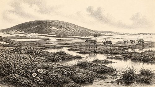
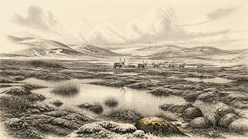
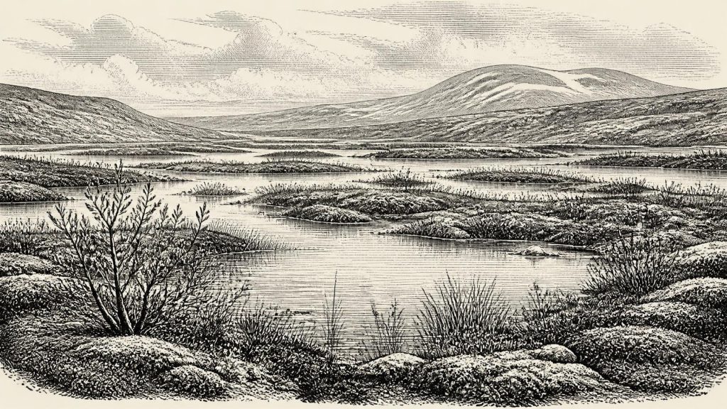
Plant and insect remains indicate an open, treeless, periglacial environment. Mosses, sedges and aquatic or waterside plants point to pools, marshy edges and waterlogged soils. Finds associated with bogbean, water-milfoil, clubmosses, dwarf willow, mountain avens and other cold-tolerant plants support a mosaic of shallow freshwater, damp ground and sparsely vegetated terrain rather than closed forest. Such evidence should not be turned into a picturesque certainty: individual species identify habitats close to the deposit, while the exact appearance of the wider landscape remains reconstructed. Yet the central conclusion is firm. Local fresh water persisted amid severe seasonal cold.
This was a demanding environment. Winters were likely long, with frozen ground and restricted plant growth; summers were short but could permit a rapid burst of herbs, sedges and insect activity. The older term “muskeg” has been used for the Derryvree setting: a wet, organic-rich terrain with pools and mossy ground. It conveys the importance of water, though no modern wetland is a perfect analogue for an Ice Age landscape influenced by permafrost, fluctuating ice margins and a different animal community.
Ice, Coast and Regional Difference
Ireland around this time was not yet simply the island seen on a modern map, nor was it uniformly ice-covered. Global sea levels were lower than today, exposing more of the continental shelf and changing the outlines of coasts, estuaries and sea passages. At the same time, ice-sheet growth was underway but asynchronous. Modern reconstructions of the British–Irish Ice Sheet show substantial advances between roughly 31,000 and 15,000 years ago, with different sectors attaining their greatest extents at different times. Derryvree’s ice-free interval is therefore compatible with a wider world in which glaciers were advancing elsewhere, retreating locally, or changing their flow and thickness.
For people or animals, access to Ireland was consequently a geographical problem with no simple answer. Lower sea level did not automatically create a permanent dry land bridge from continental Europe. Routes would have depended on the changing configuration of sea, ice, river valleys and exposed shelf, as well as on the ability of travellers to cross water or ice margins. The evidence supports ecological connections between Ireland and north-west Europe; it cannot reconstruct a single migration route for this particular date.
Castlepook’s Animal Archive
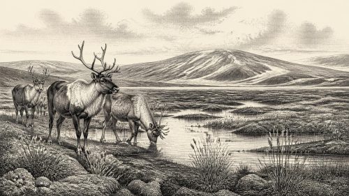
Southern cave evidence supplies a complementary, though differently dated, view. Castlepook Cave near Doneraile in County Cork—also known as Mammoth Cave—has yielded one of Ireland’s richest pre-Last Glacial Maximum vertebrate collections. Its bones include woolly mammoth, giant deer, reindeer, brown bear, spotted hyaena, wolf, Arctic fox and lemmings. Revised accelerator radiocarbon dating has demonstrated that the assemblage accumulated over a long stretch of time, rather than representing a single living animal community. Some specimens belong to MIS 3; others are considerably younger or older. It would be wrong to place every listed species beside the Derryvree pools in 30,811 BCE.
Even so, the Castlepook record confirms that Ireland could sustain, at intervals before the Last Glacial Maximum, a cold-stage fauna characteristic of open northern European environments. Large herbivores required extensive forage and moved through broad landscapes; carnivores and scavengers followed animal populations and could drag or accumulate bones in caves. Castlepook was not a neutral sample of the countryside. Hyaenas, bears, natural traps, water movement and later excavation disturbance all affected what entered the galleries and what survived. The cave is best understood as a long-lived repository of animal remains, not as a single hunting camp or a census of one season.
The Human Question
A reindeer femur from Castlepook has made this period especially significant. The bone has been associated with an age of roughly 33,000 years ago and bears a deep modification interpreted by zooarchaeologist Ruth Carden as a mark made on fresh bone with a sharp stone tool during carcass processing. If that interpretation is sustained, it could indicate that Upper Palaeolithic people handled a reindeer in Ireland during the broader climatic interval relevant to this article. It would be evidence for a visit or brief activity, not proof of permanent settlement.
The limits are as important as the possibility. The bone came from a historically excavated cave collection, not from a newly excavated, sealed occupation floor with tools, hearths and food waste in place. No securely associated Palaeolithic stone-tool assemblage, dwelling, burial or repeated camp of this age has been identified in Ireland. The date concerns the animal bone, not a calendar date for the mark; specialist analysis must distinguish a human modification from carnivore damage, breakage, sediment abrasion, excavation damage or later handling. A cautious conclusion is that human presence is possible and potentially momentous, but not yet a basis for describing a settled society.
What Society Leaves Unsaid
There is no evidence for political affairs, diplomacy, organised warfare, institutions, farming, permanent villages, religious practice, art or formal learning in Ireland at this date. Nor can trade be demonstrated. If people did reach the island, they would have belonged to mobile Upper Palaeolithic hunter-gatherer worlds known elsewhere in Europe, but that wider comparison is interpretation, not direct testimony from Ireland. A single possible butchered bone cannot tell us how many people travelled, which language they spoke, whether they hunted the animal or scavenged it, how long they remained, or whether they returned.
The most defensible “economy” visible here is ecological. Wetland plants captured sunlight during a short growing season; herbivores converted that vegetation into meat, bone and hide; predators and scavengers followed opportunities; water carried sediment into basins; ice repeatedly reshaped routes and habitats. For any visitors, food, shelter, fuel and safe passage would have been immediate practical concerns. Those are reasonable inferences from the setting, not recovered details of daily life.
Thus Ireland around 30,811 BCE is not a story of named ancestors or early kingdoms. It is a record of intermittent habitability on Europe’s Atlantic edge: shallow pools between glacial episodes at Derryvree, open tundra vegetation, changing coasts, and a southern cave preserving traces of animals—and perhaps one human act—across many millennia. The great historical development was not political but environmental: a landscape poised between brief ecological openings and the renewed expansion of ice.
Primary Sources
- A Middle Midlandian Freshwater Series at Derryvree, Maguiresbridge, County Fermanagh, Northern Ireland
- A Middle Midlandian Freshwater Series at Derryvree, Maguiresbridge, County Fermanagh, Northern Ireland
- The Irish Quaternary Fauna Project
- A reconsideration of the radiocarbon dating of the Marine Isotope Stage 3 fauna from southern Ireland
- Castlepook Cave: County Geological Site Report
- Heritage Artefacts of County Cork
- First Evidence of a Late Upper Palaeolithic Human Presence in Ireland
- New Insights on the Fauna of Ireland's Younger Dryas and Early Holocene from Alice & Gwendoline Cave
- Growth and Retreat of the Last British–Irish Ice Sheet, 31,000 to 15,000 Years Ago: the BRITICE-CHRONO Reconstruction
- BRITICE Glacial Map, Version 2: A Map and GIS Database of Glacial Landforms of the Last British–Irish Ice Sheet
- Dimensions and Chronology of the Last Ice Sheet in Western Ireland
- Exploring Controls of the Early and Stepped Deglaciation on the Western Margin of the British-Irish Ice Sheet
- Early Deglaciation of the British-Irish Ice Sheet on the Atlantic Shelf Northwest of Ireland Driven by Glacioisostatic Depression and High Relative Sea Level
- Episodic Speleothem Deposition Tracks the Terrestrial Impact of Millennial-Scale Last Glacial Climate Variability in SW Ireland
- Palaeoecology: Irish Quaternary Association Field Guide
- Irish Pleistocene Biostratigraphy
- Ireland Before 3000 B.C.
- Selaginella selaginoides
- County Geological Heritage Audit Reports
- Castlepook South, Cork, Excavation Report 2016