BIRM-166’s Open Tundra30810 BCE
30,810 BCE is an artificial label, best understood within Late Pleistocene MIS 3 rather than as a recoverable Irish year. Derryvree, County Fermanagh, preserves freshwater sediments dated to 36,900–31,700 calibrated years BP, indicating an ice-free, treeless tundra wetland later buried by glacial tills. Ireland’s climate, ice cover, coastlines and habitats shifted. Crag Cave records milder conditions, while Castlepook Cave documents diverse cold-adapted fauna, though not one contemporaneous ecosystem. A marked reindeer bone may indicate human activity, but no settlement exists. Evidence supports a landscape of wetlands, roaming animals, growing ice and possible transient human passage, not identifiable societies or events.
Dateline
An Artificially Precise Year
“30,810 BCE” is a modern chronological label, not a year that can be recovered from Ireland’s archaeological record. There were no written calendars, named rulers or dated events on the island at this depth of time, and no excavated Irish site can presently be assigned to that individual year. In radiocarbon practice, “before present” means before AD 1950; the nominal year therefore sits at about 32,760 years before present. Yet that conversion should not be mistaken for precision. Radiocarbon determinations have statistical uncertainty, and their conversion to calendar ages requires calibration against changing atmospheric carbon levels. Responsible history here must use ranges, deposits and probabilities rather than a year-by-year narrative in the ordinary sense.
The relevant broad setting is the Late Pleistocene, during Marine Isotope Stage 3 (MIS 3), an unstable portion of the last Ice Age. Ireland was not consistently either an ice-covered blank or a temperate refuge. Its landscapes changed as climate fluctuated, ice grew and retreated locally, sea level fell, and plant and animal communities expanded or contracted. Evidence from County Fermanagh, County Cork and County Kerry allows a cautiously detailed reconstruction of parts of that world, while also demonstrating how much has been erased, buried or mixed by later glaciation.
Derryvree’s Buried Wetland
The most important environmental evidence close to this horizon comes from Derryvree townland, near Maguiresbridge in County Fermanagh. Road works in 1969 cut through a drumlin and exposed organic silts and fine sands lying between two thick tills: sediment deposited beside freshwater during an ice-free interval, later sealed beneath renewed glacier ice. The famous radiocarbon measurement, BIRM-166, was reported as 30,500 radiocarbon years BP, with a substantial uncertainty of +1,170 and −1,030 years. Modern calibration places the deposit broadly in the later part of MIS 3, approximately 36,900–31,700 calibrated years BP. That range encompasses the notional date, but does not date an identifiable event in 30,810 BCE.
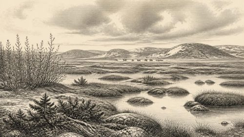
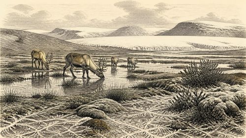
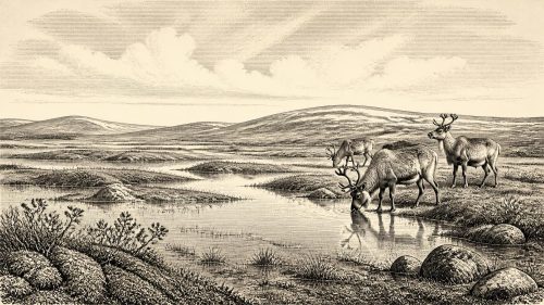
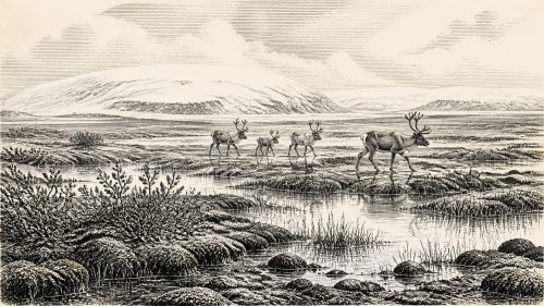
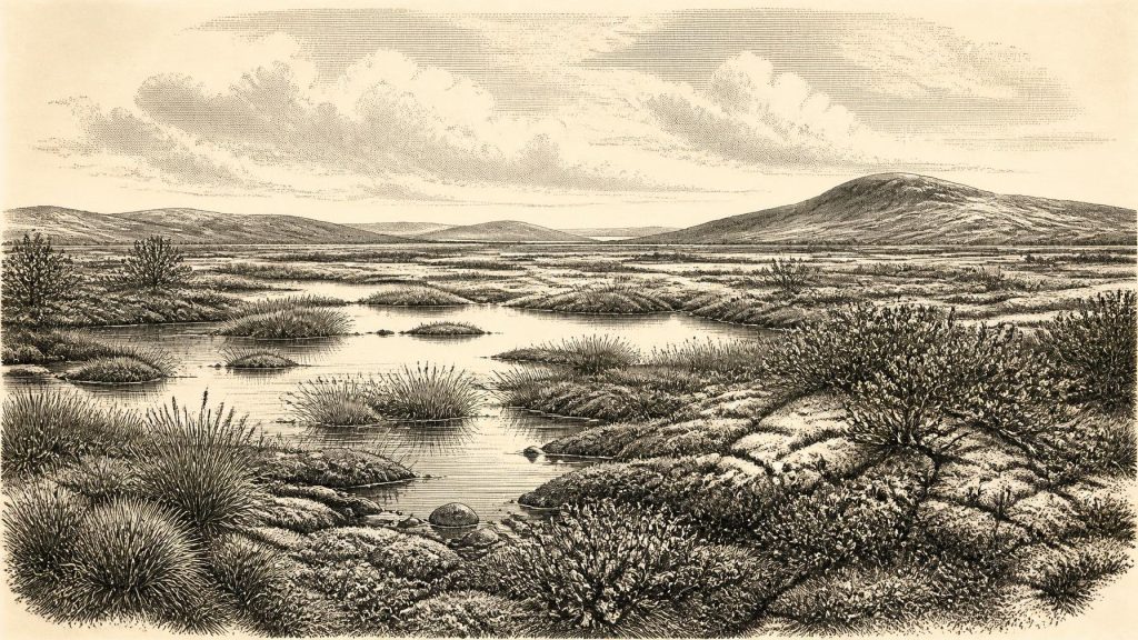
The fossils within the Derryvree sediments are unusually valuable because later ice sheets removed or disturbed so many older Irish surfaces. Pollen was dominated by herbs, while plant macrofossils, mosses and insect remains revealed a cold, open environment. The evidence supports a treeless tundra or muskeg-like wetland: shallow freshwater, sedgy and mossy ground, low herbs and sparse vegetation on drier areas. Periglacial conditions — repeated freezing and thawing in ground near an ice margin or in a severe cold climate — shaped this landscape. This was not a uniform white wilderness. Pools, wet hollows, exposed mineral soils and sheltered patches would have created varied habitats, although the growing season was short and winters severe.
Derryvree does not prove that the whole island looked the same. It is a local deposit preserved in exceptional circumstances. A few grains of tree pollen, for example, do not demonstrate Irish woodland: pollen can travel far, and the wider plant assemblage indicates open ground. Nor can the sequence establish the exact position of an ice margin in one calendar year. Its firm contribution is more modest and more important: at some point within its dated interval, biologically active, ice-free freshwater terrain existed in south Fermanagh before a later advance laid down the enclosing tills.
A Changing Ice-Age Island
At the scale of Ireland and the surrounding shelves, the landscape was in transition. Recent British–Irish Ice Sheet reconstructions model substantial ice growth from about 31,000 years ago, with ice caps and mountain glaciers in several Irish uplands. The full extent, thickness and timing of Irish ice remain debated, particularly because different methods record different aspects of glaciation and because local conditions could change quickly. The point relevant to 30,810 BCE is not that one map supplies a final answer, but that Ireland lay within a dynamic zone of accumulating ice, exposed ground, lower sea levels and altered coastlines.
Crag Cave in County Kerry provides a complementary climatic record. Uranium-series dates from broken and reworked speleothems show that calcite sometimes grew in the cave during relatively milder episodes of the last glacial period. Such growth requires liquid water moving through the karst system and is unlikely under pervasive permafrost or thick local ice. The cave record does not tell us what happened in Fermanagh or Cork in any single year, but it confirms that south-western Ireland responded sharply to millennial-scale climate shifts. Ireland’s Ice Age was therefore punctuated by phases in which conditions improved sufficiently for water to circulate underground, followed by colder episodes that interrupted growth.
This instability matters for the history of settlement and movement. Lower sea level changed the geography of the Irish Sea region, but the evidence does not permit a simple claim that a permanent land bridge existed at this precise date, or that people and animals crossed by one known route. Connections with Britain and continental Europe were clearly sufficient at intervals for mammals to reach Ireland. Their movements may have involved exposed shelf landscapes, narrow water crossings, seasonal ice or combinations that cannot now be reconstructed securely.
Castlepook’s Animal Archive
In north County Cork, Castlepook Cave near Doneraile — also known as Mammoth Cave — preserves Ireland’s richest cave assemblage of mammals from before the Last Glacial Maximum. Excavations beginning in the early twentieth century produced remains attributed to woolly mammoth, reindeer, giant deer, brown bear, wolf, Arctic fox, mountain hare, lemmings and spotted hyaena. The National Museum of Ireland holds important material from the site, including a spotted-hyaena skull. Taken together, the assemblage shows that Ireland supported, or was visited by, a striking range of large herbivores, carnivores and cold-adapted small mammals during portions of the Late Pleistocene.
However, Castlepook must not be treated as a photograph of one moment. Cave deposits can accumulate over long periods; bones may be moved by scavengers, water, people, excavation and later disturbance. Different species need not have lived together, and an animal found in a cave need not have died there. The assemblage establishes recurrent ecological connections and a varied Ice Age fauna, not a single perfectly contemporaneous “mammoth-steppe” scene for 30,810 BCE. Hyaenas especially remind us that caves could be carnivore dens and bone-accumulation places, rather than human shelters.
A reindeer femur from Castlepook has attracted particular attention because a deep mark has been interpreted as damage made by a sharp stone implement while fresh bone was being processed. If that interpretation and its chronological association are confirmed, it would be evidence for brief Upper Palaeolithic human activity in Ireland around this broad period — perhaps the butchery of a reindeer by a small travelling party. It would not prove a settled population, a village, repeated occupation, a named culture or an Irish hunting territory. No securely associated hearth, stone-tool assemblage, dwelling, burial or substantial butchered-food deposit of comparable antiquity has yet been recovered. The responsible conclusion is that human presence is possible and highly significant, but remains far less securely documented than the environmental and faunal record.
No Polities, No Proven Communities
Political affairs, diplomacy and organised conflict cannot be described for Ireland at this date. There is no evidence for chiefs, states, tribal names, boundaries, alliances or warfare. Nor can archaeologists responsibly reconstruct religion, ritual, art, language or formal learning. Ireland has no securely dated cave art, portable art, shrine, grave or symbolic object from this period. It would be misleading to import the celebrated art and elaborate Upper Palaeolithic technologies of France, Iberia or central Europe into Ireland merely because people elsewhere in Europe possessed them.
The same restraint applies to society and everyday life. If people were present, their lives may have depended on mobile hunting, gathering and knowledge of seasonal animal behaviour, weather and safe routes through cold country. But this is an inference from wider Upper Palaeolithic contexts, not direct evidence from an Irish camp. We do not know the size of any group, its kinship arrangements, clothing, dwellings, food-sharing practices or duration of stay. Nor is there evidence for trade in the ordinary archaeological sense: no exchange network, imported worked object or resource-distribution system can be identified in Ireland around this horizon.
The Major Development: Environmental Precarity
The central development represented by 30,810 BCE was environmental, not political. Ireland contained, at least in some regions and periods, open cold-country habitats with freshwater wetlands and a fauna capable of moving across a wider north-west European landscape. At the same time, climatic deterioration and the growth of the British–Irish Ice Sheet increasingly constrained those habitats. Later ice would scour rock, alter drainage, redistribute sediments and conceal or destroy much of the evidence.
Derryvree’s silts survive because they were buried between tills; Castlepook’s bones survive because a cave protected some of them; Crag Cave’s broken calcite preserves a record because mineral layers endured underground. These are chance survivals rather than a balanced archive. They show that Late Pleistocene Ireland was neither empty of life nor legible as a conventional historical society. Around the broad interval represented by this artificial year, it was a cold, changing western landscape of wet tundra, roaming animals, intermittent ecological connections and, perhaps, fleeting human passage.
Primary Sources
- A Middle Midlandian Freshwater Series at Derryvree, Maguiresbridge, County Fermanagh, Northern Ireland
- Irish Pleistocene Biostratigraphy
- The Irish Quaternary Fauna Project
- Palaeoecology
- Growth and Retreat of the Last British–Irish Ice Sheet, 31,000 to 15,000 Years Ago: The BRITICE-CHRONO Reconstruction
- BRITICE-CHRONO Maps and GIS Data of the Last British-Irish Ice Sheet 31 to 15 ka
- The Timing and Magnitude of the British–Irish Ice Sheet Between Marine Isotope Stages 5d and 2
- Dimensions and Chronology of the Last Ice Sheet in Western Ireland
- Late Pleistocene Chronostratigraphy and Ice Sheet Limits, Southern Ireland
- Last Glacial Maximum Cirque Glaciation in Ireland and Implications for Reconstructions of the Irish Ice Sheet
- Oscillating Retreat of the Last British-Irish Ice Sheet on the Continental Shelf Offshore Galway Bay, Western Ireland
- Radiocarbon Constraints on the Age of the Maximum Advance of the British–Irish Ice Sheet in the Celtic Sea
- The IntCal20 Northern Hemisphere Radiocarbon Age Calibration Curve (0–55 cal kBP)
- IntCal History
- Episodic Speleothem Deposition Tracks the Terrestrial Impact of Millennial-Scale Last Glacial Climate Variability in SW Ireland
- Spatio-Temporal Dynamics of Speleothem Growth and Glaciation in the British Isles
- Spotted Hyena Skull
- 2022:564 – Castlepook Cave, Castlepook South, Cork
- Castlepook Caves
- The Mammoth Caves of Castlepook, Near Doneraile
- Heritage Artefacts of County Cork
- The Colonization of Ireland: A Human Ecology Perspective