
Greenland Stadial Six30836 BCE
30,836 BCE is a reference point within Greenland Stadial 6, a cold MIS 3 interval, rather than a precisely datable Irish year. Ireland experienced regionally varied glaciation, frost, meltwater and sparse vegetation. Derryvree, County Fermanagh, preserves freshwater sediments between tills, documenting tundra-like wetland plants, insects and pools during cold episode. Castlepook Cave, County Cork, contains MIS 3 fauna including mammoth, reindeer, giant deer and hyaena, although its deposits span uncertain periods. No secure evidence places humans, settlements, institutions or later identities in Ireland then. The fragmentary record instead charts environmental change, animal movement and landscapes reshaped by ice and water.
Dateline
“30,836 BCE” is a useful modern filing label, not a date at which Irish history can be resolved to a particular year, season or event. There were no written records, settlements or securely dated activity horizons from which to construct an annal. At this depth of time, even radiocarbon results produce ranges rather than single calendar years, while deposits may represent accumulated centuries. The responsible subject is therefore Ireland during a broad late Middle Midlandian interval of the Last Glacial period, conventionally part of Marine Isotope Stage 3 (MIS 3).
In the Greenland ice-core chronology, a nominal date around 30,836 BCE broadly corresponds to about 32.8 thousand years before AD 2000, within Greenland Stadial 6. This was a cold phase beginning about 33,360 years before AD 2000 and ending with the onset of Greenland Interstadial 5.2 about 32,500 years before AD 2000. Those figures are valuable for correlating North Atlantic climate records, but they do not mean that an Irish bog, cave or animal bone can be dated to the same precision. The year should be read as a point within a cold climatic interval, not as an anniversary in an Irish calendar.
A Cold Island in a Changing Ice Age
Ireland lay on the far north-western edge of Europe, exposed to repeated and sometimes abrupt shifts in climate, sea level and ice extent. The last British–Irish Ice Sheet was growing during the wider period around 31,000 years ago, but its advance was neither a single event nor geographically uniform. Modern reconstructions show that the ice sheet expanded rapidly towards the continental shelf edge in some sectors around 30,000 years ago. That does not license a simple picture of an island entirely sealed under ice in every locality at exactly 30,836 BCE. Ireland’s glacial history was regionally varied, and evidence from northern inland sediments demonstrates that at least some areas had previously experienced ice-free or less heavily glaciated intervals.
For the nominal date in question, the wider climatic setting was cold. Greenland Stadial 6 was one of the sharp North Atlantic oscillations that punctuated MIS 3. Such events involved major changes in temperature and atmospheric circulation on timescales far shorter than traditional geological periods. In Ireland, cold conditions meant a landscape shaped by frost, sparse vegetation, meltwater and unstable ground wherever ice did not cover it. Yet it would be mistaken to portray the whole country as a uniform white desert. The evidence instead points to shifting mosaics: ice margins and glacial sediments in some regions; open, treeless ground, wet hollows and shallow freshwater in others; and changing coastal and shelf landscapes beyond today’s shore.
Derryvree’s Buried Wetland
The clearest Irish environmental window relevant to this deep past comes from Derryvree townland near Maguiresbridge, County Fermanagh. Road works in 1969 cut through a drumlin and exposed fine sands and freshwater silts trapped between two thick till sheets. The discovery was exceptional: organic material normally survives poorly in repeatedly glaciated landscapes, while the later ice helped to seal this deposit. Its conventional radiocarbon determination, 30,500 radiocarbon years before present, has a substantial uncertainty and cannot be treated as an exact calibrated equivalent of 30,836 BCE. Nevertheless, it places the deposit broadly within the Middle Midlandian/MIS 3 world relevant to this article.
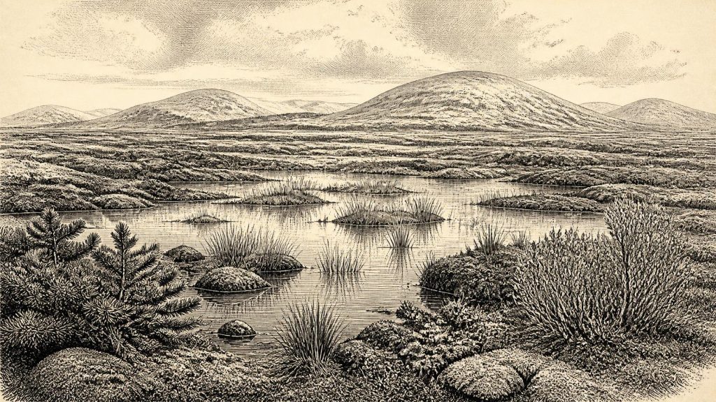
The Derryvree fossils describe an open, cold landscape rather than a forest. Pollen was poorly preserved, but plant macrofossils, mosses and invertebrate remains supplied a richer record. Grasses and sedges, juniper, dwarf willow, mountain-avens, bogbean and aquatic plants occurred in or near the freshwater setting. Mosses and insect evidence indicate wet, organic-rich ground with pools and channels: a periglacial wetland sometimes characterised as muskeg. The presence of water plants is especially important. It proves that, during formation of the sediment, this locality was not simply buried beneath permanent ice or reduced to bare rock.
That is direct evidence for a particular habitat near Maguiresbridge, not a complete map of Ireland. Fossils establish that certain organisms lived in or were transported into this small basin; they do not demonstrate identical plant cover across Cork, Clare, the western seaboard and the uplands. Nor should a freshwater bed between tills be converted into evidence for a mild or stable climate. The Derryvree assemblage is best understood as an ecological refuge or episode within a glacially active region, inhabited by hardy plants able to exploit short growing seasons, shallow water and saturated ground.
Caves, Bones and Moving Animals
Southern Irish caves offer a different kind of evidence. Castlepook Cave, also called Mammoth Cave, near Doneraile in County Cork, has yielded the principal Irish collection of mammal remains from the last cold stage. Its fauna includes such species as woolly mammoth, reindeer, giant deer, brown bear, wolf, Arctic fox, collared lemming and spotted hyaena. The National Museum of Ireland’s Castlepook collections preserve the material evidence for a much less familiar Ireland: an island or peninsula-edge landscape capable, at different times, of supporting large herbivores and carnivores now absent from Europe or Ireland.
However, the cave is not a snapshot of one day, decade or even necessarily one climatic episode. Bones accumulated through natural deaths, carnivore activity, water movement and cave processes, then were excavated early in the twentieth century. Recent redating has shown that several older radiocarbon determinations from Castlepook were too young, in some cases by thousands of radiocarbon years. The revised work supports the presence of some mammals in Ireland during MIS 3 and suggests that giant deer and spotted hyaena may have disappeared locally before the Last Glacial Maximum. It also makes chronological caution more necessary, not less.
Thus, it is reasonable to say that Ireland formed part of a north-west European zone through which cold-adapted mammals could disperse during portions of MIS 3. It is not responsible to claim that a particular mammoth herd, hyaena clan or reindeer band was present at Castlepook in 30,836 BCE. Nor can animal bones alone establish whether an exposed continental shelf, lowered sea levels, sea crossings or temporary land connections enabled every movement. Geography changed dramatically as water was locked in ice, but routes varied through time and required more evidence than a single fossil assemblage can provide.
People: Evidence and Silence
There is no securely established settlement, hearth, stone-tool assemblage, dwelling floor, burial or human bone from Ireland that can be assigned to this nominal year. Accordingly, no named community, leader, language or population can be placed in Ireland around 30,836 BCE. The island’s first widely accepted direct evidence for human presence remains far later: a cut-marked brown-bear patella from Alice and Gwendoline Cave, County Clare, independently radiocarbon dated to about 12,810–12,590 and 12,810–12,685 calibrated years before present. Even that terminal-Pleistocene evidence concerns a very different climatic and geographical world.
Upper Palaeolithic people certainly lived elsewhere in Europe during MIS 3. They made sophisticated stone and bone technologies, used animal resources, travelled across large territories and produced forms of symbolic culture. But none of this permits an Irish reconstruction by analogy alone. It is possible that people occasionally reached or surveyed parts of the Irish region during favourable phases, yet possibility is not proof. Without securely associated artefacts or modified remains, hunting camps, family groups and crossings to Ireland at this date remain unverified.
No Polities, No Trade Network
The usual categories of a year-by-year history have clear limits here. There is no evidence for political institutions, territorial states, diplomacy, organised warfare, formal religion, literacy, schools, farming, domestic stock, metalworking or trade in Ireland around this date. There are likewise no grounds for invoking Celtic, Gaelic or any later Irish identity. Such labels belong to immensely later periods and would obscure the scale of the chronological gap.
Everyday life can only be described through the non-human environment. If people were ever present in the broader Irish landscape during this cold stage, they would have depended on mobile hunting-and-gathering strategies and intimate knowledge of seasonal resources; but that is a conditional inference from wider Upper Palaeolithic Europe, not an excavated Irish social history. The securely observable economy at Derryvree was ecological: plants colonising wet ground, insects occupying local niches, and freshwater sediments accumulating between phases of glaciation.
An Archive Rather Than an Annal
The most important development represented by 30,836 BCE is therefore not a human event but a climatic setting. Around this point in the Greenland chronology, Ireland stood within a rapidly changing glacial North Atlantic. The Fermanagh record demonstrates that cold-stage Ireland could include open tundra-like wetlands with pools, mosses, sedges and dwarf shrubs. Castlepook demonstrates that Irish cave deposits retain evidence of a Pleistocene fauna whose chronology is still being refined. Together they replace two misleading extremes: neither an empty, featureless ice sheet nor a known human homeland can be projected onto the island.
For Ireland at this date, archaeology and palaeoecology offer a disciplined kind of history: evidence of sediments, plants, insects and animals; calibrated and uncalibrated ranges rather than anniversaries; and interpretations that must remain proportionate to their sources. The surviving record is fragmentary, but it preserves an essential truth. Long before later peoples named Ireland, the land was already being repeatedly remade by ice, water, vegetation and animal movement.
Primary Sources
- A Middle Midlandian Freshwater Series at Derryvree, Maguiresbridge, County Fermanagh, Northern Ireland
- Palaeoecology
- Landscapes and Environments of the Last Glacial-Interglacial Transition: A Time of Amazingly Rapid Change in Ireland
- A Reconsideration of the Radiocarbon Dating of the Marine Isotope Stage 3 Fauna from Southern Ireland
- The Irish Quaternary Fauna Project
- Spotted Hyena Skull
- First Evidence of a Late Upper Palaeolithic Human Presence in Ireland
- New Insights on the Fauna of Ireland's Younger Dryas and Early Holocene from Alice & Gwendoline Cave
- The Colonization of Ireland: A Human Ecology Perspective
- The IntCal20 Northern Hemisphere Radiocarbon Age Calibration Curve (0–55 cal kBP)
- A Stratigraphic Framework for Abrupt Climatic Changes During the Last Glacial Period Based on Three Synchronized Greenland Ice-Core Records: Refining and Extending the INTIMATE Event Stratigraphy
- Growth and Retreat of the Last British–Irish Ice Sheet, 31,000 to 15,000 Years Ago: The BRITICE-CHRONO Reconstruction
- The Timing and Magnitude of the British–Irish Ice Sheet Between Marine Isotope Stages 5d and 2
- Stratigraphic and Palaeo-Geomorphological Evidence for the Glacial-Deglacial History of the Last British-Irish Ice Sheet in the North-Western Irish Sea
- Maximum Extent and Dynamic Behaviour of the Last British–Irish Ice Sheet West of Ireland
- The Deglaciation of the Western Sector of the Irish Ice Sheet from the Inner Continental Shelf to Its Terrestrial Margin
- Sedimentary and Foraminiferal Records of Late Quaternary Environmental Change West of Ireland and Implications for the Last British–Irish Ice Sheet
- Introduction to the Late Quaternary and Holocene of Northern Ireland
- Dryas octopetala
- The IntCal20 Northern Hemisphere Radiocarbon Age Calibration Curve (0–55 cal kBP)
- Marine20—The Marine Radiocarbon Age Calibration Curve (0–55,000 cal BP)
- Cenozoic: Tertiary and Quaternary
