
Castlepook’s Mammoth Landscape30754 BCE
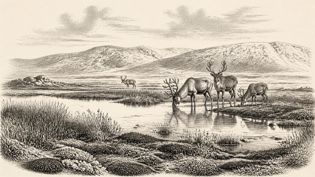
Around 30,754 BCE, Ireland lay within the climatically unstable Late Pleistocene, approaching major glaciation. Conditions varied regionally, but cold, periglacial landscapes, low sea levels and sparse vegetation predominated. Derryvree, County Fermanagh, preserves freshwater sediments between tills, indicating treeless tundra wetland with mosses, sedges and low herbs. Castlepook Cave, County Cork, yielded reindeer, mammoth, giant deer, predators and other fauna, accumulated over time rather than as one scene. A marked reindeer femur may indicate stone-tool butchery and an early human visit, but cannot prove settlement. Natural archives reveal a precarious ecological frontier, while secure evidence of human activity is far later.
Dateline
30,754 BCE is a modern chronological label, not a date that people in prehistoric Ireland could have recognised. It corresponds approximately to 32,703 years before AD 1950, the conventional “present” used in radiocarbon reporting. That conversion is useful for placing the entry in a sequence, but it does not give us calendar-year precision. No excavated Irish layer, animal bone or human trace can responsibly be assigned to this particular year. The most appropriate setting is the Late Pleistocene, within Marine Isotope Stage 3 (MIS 3), a long, climatically volatile part of the last Ice Age. Evidence relevant to Ireland is dated in broad ranges, often with substantial uncertainties, and reconstructs environments rather than historical episodes.
An Island Approaching Glaciation
Ireland at about 32,700 calibrated years before present stood close to a major environmental threshold. Research on the British–Irish Ice Sheet indicates that ice was expanding rapidly around and after 32,000 years ago, before reaching its far greater Last Glacial Maximum extent roughly between 27,000 and 23,000 calibrated years ago. Yet the preceding history was not a simple progression from ice-free land to complete ice cover. Marine records, raised shorelines, landforms and sediment sequences point to earlier, shifting phases of glaciation and retreat during MIS 3. Consequently, it is not possible to draw one secure map for all of Ireland in 30,754 BCE: conditions varied between regions and changed across generations.
What can be said is that this was not the familiar wooded island of later millennia. The climate was cold, and much of the available evidence indicates periglacial conditions: ground affected by persistent frost, short growing seasons, sparse vegetation and seasonal meltwater. Sea level was substantially lower than today, changing coastlines and narrowing marine barriers. Animals had reached Ireland during parts of the Pleistocene, so movement from Britain or the European mainland must at times have been possible, whether across exposed terrain, temporary connections, ice-margin settings or short sea passages. The exact routes, timing and conditions remain disputed. Animal presence proves dispersal occurred; it does not identify a particular corridor in a particular year.
Derryvree’s Freshwater Evidence
The most informative Irish environmental archive for this broad interval lies at Derryvree, near Maguiresbridge in County Fermanagh. Road works in 1969 exposed a drumlin containing freshwater silts and fine sands between two thick sheets of glacial till. The position of the deposit is important: it records a period when water, plants and small animals occupied a basin after one phase of ice deposition and before a later advance buried the evidence. Its conventional radiocarbon determination, BIRM-166, was 30,500 radiocarbon years before present, with a large uncertainty of plus 1,170 and minus 1,030 years. Calibration does not turn this into a precise historical date; it places the deposit broadly in the later part of MIS 3, approximately within the wider range relevant to this entry.
Derryvree demonstrates a local freshwater environment amid a cold, open landscape. Fossil pollen was poorly preserved, which limits identifications, but herbaceous plants predominated. Moss macrofossils were particularly valuable, while a seed of bogbean (Menyanthes trifoliata) and pollen attributed to alternate-flowered water-milfoil indicate shallow or wet ground. The assemblage supports an interpretation of tundra or tundra-like wetland, with mossy margins, sedges and low herbs rather than forest. A few grains attributed to trees or shrubs cannot be used to populate Fermanagh with woodland: pollen may travel long distances, be redeposited, or represent plants growing far from the basin. The firm conclusion is treeless, periglacial wetland; the finer texture of the surrounding vegetation remains interpretative.
This is important regional history, even though it is not human history in the ordinary sense. Later ice and meltwater destroyed, reworked or concealed many deposits of this age. Derryvree is therefore an unusually rare survival from an Ireland that was neither continuously buried beneath the maximum ice sheet nor hospitable in the later agricultural sense. Its sediments show that vegetation and freshwater ecosystems endured locally during an unstable cold stage. They cannot tell us whether people visited the basin, whether hunters crossed Fermanagh, or how long any ice-free interval lasted beyond the accumulation of this particular deposit.
Castlepook and the Faunal World
Nearly 300 kilometres to the south-west, Castlepook Cave near Doneraile in north County Cork supplies a different kind of evidence. Excavations in its limestone passages recovered an extraordinary but complex collection of Pleistocene animal remains. Reindeer were abundant, and the wider assemblage includes woolly mammoth, giant deer, brown bear, wolf, Arctic fox, lemmings and spotted hyaena. Together these animals evoke an open, cold-adapted ecosystem with grazing animals and formidable predators. However, Castlepook is not a sealed photograph of one season. Caves accumulate material through carnivore activity, natural deaths, water movement and later disturbance; bones from one passage need not be contemporary with one another.
The hyaena evidence is especially revealing. Gnawed and broken bones, alongside remains of hyaenas of differing ages, make the cave a plausible den or scavenging place. In that scenario, carnivores carried portions of carcasses into the cave from the surrounding landscape. Mammoth or reindeer remains therefore demonstrate that these animals were present in the broader region at some points during the Late Pleistocene, but do not prove that humans hunted them, nor that mammoths and hyaenas always occupied Cork at the same moment. The word “mammoth landscape” is best understood as a reconstruction from a time-depth assemblage, not as a claim that every species shared one visible scene in 30,754 BCE.
The Reindeer Femur Question
One Castlepook object has made this period particularly significant: a reindeer femur carrying a deep linear mark interpreted by zooarchaeologist Ruth Carden as damage made by a sharp stone implement while the bone was fresh. County Cork heritage material associates it with an age around 31,000 BCE, while public reporting described the bone as roughly 33,000 years old. If the mark is correctly identified as a stone-tool butchery trace and belongs to the animal’s Pleistocene history, it may be Ireland’s earliest indication of human handling of an animal. It would suggest a brief Upper Palaeolithic encounter with a reindeer carcass, perhaps during a favourable interval before the fullest growth of the ice sheet.
That possibility must be kept distinct from established settlement. No securely associated hearth, stone-tool assemblage, dwelling floor, human burial, butchered bone concentration or repeatedly used occupation surface of comparable age has been recovered at Castlepook. The cave’s antiquarian collection history further restricts what can be inferred from context. A date on bone establishes when the animal lived, not necessarily the exact time at which a surface mark was made; one modified bone cannot reveal group size, language, ancestry, season, route of arrival or continuity of occupation. The cautious conclusion is therefore not that Ireland had a resident Palaeolithic population, but that a tantalising and still limited clue may point to a very early human visit.
Society Beyond the Evidence
There is no responsible basis for describing political authority, diplomacy, organised warfare, named peoples, religious rites, art, formal learning, trade networks or permanent settlements in Ireland at this date. Nor can the Castlepook femur establish a hunting economy, although processing a carcass would be consistent with the subsistence practices of Upper Palaeolithic groups elsewhere in north-west Europe. The best securely dated evidence of human activity in Ireland remains much later: cut marks on a brown-bear kneecap from Alice and Gwendoline Cave in County Clare, dated to about 12,810–12,590 calibrated years before present. That more than twenty-thousand-year gap is a warning against filling 30,754 BCE with imagined camps or communities.
The year is thus illuminated chiefly by natural archives. Derryvree records cold freshwater tundra in Fermanagh; Castlepook preserves the bones of animals adapted to a harsh, open world in Cork; ice-sheet research shows a landscape entering a phase of profound transformation. These sources make Ireland at this point legible as an ecological frontier, potentially reachable but precarious for people. They do not yield a chronicle. Its real historical importance lies in that restraint: beneath later ice, soils and settlements survive fragments of a far older Ireland, sufficient to show life in a changing Ice Age landscape, but not enough to convert possibility into a year-specific human story.
Primary Sources
- A Middle Midlandian Freshwater Series at Derryvree, Maguiresbridge, County Fermanagh, Northern Ireland
- Palaeoecology
- Figure 6.— The Subdivision of the Quaternary Period in Ireland
- Growth and Retreat of the Last British–Irish Ice Sheet, 31,000 to 15,000 Years Ago: The BRITICE-CHRONO Reconstruction
- The Timing and Magnitude of the British–Irish Ice Sheet Between Marine Isotope Stages 5d and 2
- Response of the Irish Ice Sheet to Abrupt Climate Change During the Last Deglaciation
- Timing and Pace of Ice-Sheet Withdrawal Across the Marine–Terrestrial Transition West of Ireland During the Last Glaciation
- The Deglaciation of the Western Sector of the Irish Ice Sheet From the Inner Continental Shelf to Its Terrestrial Margin
- Dimensions and Chronology of the Last Ice Sheet in Western Ireland
- Trimlines, Blockfields and the Vertical Extent of the Last Ice Sheet in Southern Ireland
- Early Deglaciation of the British-Irish Ice Sheet on the Atlantic Shelf Northwest of Ireland Driven by Glacioisostatic Depression and High Relative Sea Level
- The IntCal20 Northern Hemisphere Radiocarbon Age Calibration Curve (0–55 cal kBP)
- The Exploration of Castlepook Cave, County Cork
- Heritage Artefacts of County Cork
- Archaeological Heritage of County Cork
- New Insights on the Fauna of Ireland’s Younger Dryas and Early Holocene From Alice & Gwendoline Cave
- First Evidence of a Late Upper Palaeolithic Human Presence in Ireland
- BSBI: Menyanthes trifoliata
- BSBI: Myriophyllum alterniflorum
- Archaeological Excavations at Killuragh Cave, Co. Limerick: A Persistent Place in the Landscape From the Early Mesolithic to the Late Bronze Age
- Anthropogenic Changes to the Holocene Nitrogen Cycle in Ireland
- Could Brown Bears (Ursus arctos) Have Survived in Ireland During the Last Glacial Maximum?
