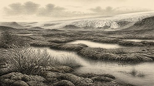
Derryvree’s Tundra Margin30732 BCE
Around 30,732 BCE, Ireland’s history is reconstructed from environmental evidence rather than precise annual records. Derryvree, County Fermanagh, preserves freshwater sediments between glacial tills, dated broadly to 36,900–31,700 cal BP. Pollen, seeds, mosses and animal remains indicate open treeless tundra, marshes and pools during an ice-free interval within a harsh periglacial climate. Southern caves demonstrate episodic access by cold-stage animals, although their remains need not be contemporary. A possibly butchered reindeer bone from Castlepook may suggest brief human contact, but no secure settlement exists. Ireland’s landscape, fauna, ice margins and possible travel routes changed repeatedly before the Last Glacial Maximum.
Dateline
30,732 BCE is a modern calendar label, not a date at which an Irish event can be placed with year-by-year certainty. No written record, indigenous calendar, named community or securely dated settlement allows that precision. In archaeological terms, this notional year lies about 32,681 years before the conventional radiocarbon baseline of AD 1950, during the Late Pleistocene and Marine Isotope Stage 3. The responsible question is therefore not what happened in Ireland in this particular year, but what evidence can illuminate the island during the surrounding millennia.
The strongest local guide is not a monument or a human artefact but a buried wetland at Derryvree, near Maguiresbridge in County Fermanagh. Its evidence suggests a cold, open and living landscape in at least part of Ireland before the great expansion of the Last Glacial Maximum ice sheet. It also demonstrates the limits of the record. The closest dated deposits span a broad calibrated range, and Ireland at this time was shaped above all by fluctuating climate, ice, water and animal movement rather than by institutions whose history can be reconstructed.
A Date Beyond Calendar Precision
The useful chronological language here is calibrated years before present, or cal BP, in which “present” means AD 1950. The Derryvree organic sediments produced a conventional radiocarbon determination of 30,500 BP, with a substantial error range. When calibrated, it has been discussed as broadly c. 36,900–31,700 cal BP: approximately 34,950–29,750 BCE. The notional date of 30,732 BCE falls within that wide span, but the range is far too large to connect the deposit to a single year, season or generation.
This distinction matters because radiocarbon years are not identical to calendar years. Atmospheric radiocarbon has varied through time; results also depend on the material dated, laboratory methods and statistical calibration. The Derryvree determination is a valuable anchor, not a stopwatch. Its real importance is stratigraphic. Roadworks in 1969 cut through a drumlin and exposed organic freshwater silts and fine sands enclosed between two thick layers of till, the unsorted sediment laid down by glacier ice. The sequence records a non-glacial interval between episodes of glaciation, later protected beneath renewed ice-borne debris.
The Fermanagh Wetland
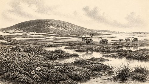
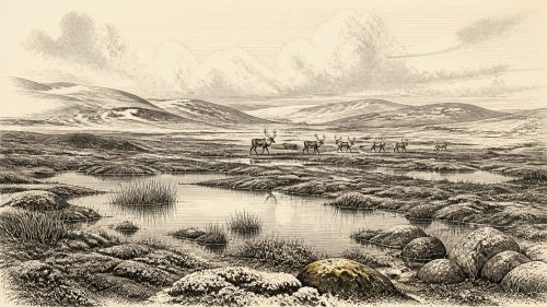
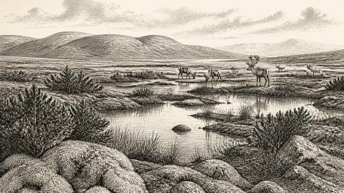
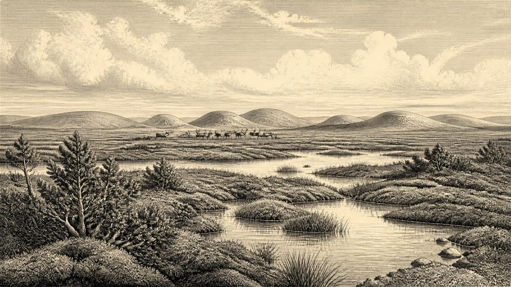
Derryvree offers Ireland’s clearest environmental archive close to this period. The freshwater sediments contained pollen, plant macrofossils, mosses and animal remains of pronounced cold-stage character. Grasses, sedges, herbs and juniper indicate open ground rather than closed forest. Mosses, aquatic evidence and the seed of bogbean point to wet hollows, shallow water and marshy margins. Alternate water-milfoil provides another indication that freshwater pools existed. The landscape was therefore not simply an endless white expanse: local water, thawed ground and vegetation created ecological niches within a severe climate.
Nevertheless, it was a harsh periglacial world. Periglacial means that the ground lay in a cold climate associated with nearby or recurrent glaciation, where frost action and seasonal thaw strongly influenced soils and drainage. The Derryvree flora is consistent with treeless tundra and wet muskeg-like ground. Sparse tree pollen cannot safely be turned into evidence for local woodland, since pollen can travel long distances or be redeposited. Summer growth may have briefly made sedges, herbs and mossy wetlands productive; long winters, wind exposure and frozen ground would have sharply constrained the year’s biological output.
The deposits also reveal regional change. They show that this part of Fermanagh was ice-free while the wetland accumulated, though it had previously been glaciated and would later be overridden or enclosed by ice-related sediment. That local history cautions against a single map of “ice-covered Ireland” for every point in the Ice Age. The British–Irish Ice Sheet advanced and retreated in different sectors at different times. Research on its pre-Last Glacial Maximum history remains contested, but Derryvree is direct evidence that at least a northern inland locality supported freshwater life during a Middle Midlandian cold interval.
An Island of Shifting Routes
Ireland’s geography was unlike that of the modern island. Global sea level was generally lower during the Ice Age, exposing or narrowing areas now covered by the Irish Sea and Atlantic shelf. Yet it would be misleading to imagine a permanent, simple land bridge from continental Europe. Relative sea level around Ireland was affected by local crustal loading and rebound as well as global ocean volume; ice margins, rivers, coastal plains and stretches of water changed through time. The arrival of mammals demonstrates that routes existed at intervals, but not exactly when every route was passable, nor whether people could have followed one at the date represented here.
In the broader north-west European context, abrupt climatic swings recorded in Greenland ice cores mattered greatly. Around 32,700 years ago, the ice-core sequence lay amid one of the unstable warm-to-cold transitions characteristic of Marine Isotope Stage 3. Such records cannot be mechanically translated into a Fermanagh weather forecast, but they explain why Irish landscapes could shift rapidly between relatively less severe phases and more intensely cold, ice-expanding conditions. Derryvree’s wetland was part of this changing North Atlantic borderland, not an isolated pocket of nature.
Cork Caves and Cold-Stage Fauna
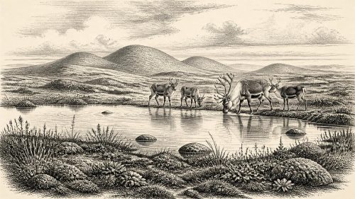
Southern Irish cave collections add a different kind of evidence. Castlepook Cave, near Doneraile in County Cork, has produced remains attributed to animals including woolly mammoth, reindeer, giant deer, brown bear, wolf, hare, Arctic fox, lemming and spotted hyaena. Such animals show that Ireland could be reached by, and at times support, a varied cold-stage fauna. Reindeer in particular fit an open, seasonal landscape in which grazing herds could travel across broad territories. Carnivores and scavengers, meanwhile, help explain why caves accumulated bones: a cave assemblage may record dens, dragged carcasses, water movement and repeated disturbance, not a single contemporary animal community.
That warning has become more important with improved dating. Modern re-dating has shown that several older radiocarbon determinations from Castlepook and other southern caves were appreciably too young, owing partly to advances in bone pretreatment. The revised evidence places some fauna much earlier in Marine Isotope Stage 3, and suggests that giant deer and spotted hyaena may have disappeared locally before about 40,000 cal BP. It is consequently unsafe to picture every species recovered at Castlepook grazing or hunting together in County Cork in 30,732 BCE. The cave is a long and complicated archive, not a snapshot.
A reindeer femur from Castlepook has been publicly presented as bearing a deep mark made during fresh-bone butchery with a sharp stone tool, and has been associated with an age of roughly 33,000 years. If that interpretation is confirmed through full specialist publication and comparison with natural damage, it would be momentous evidence for a brief Upper Palaeolithic human presence in Ireland. It would indicate carcass processing, however, not a settlement. A radiocarbon measurement dates the animal’s death within a range, not the incision itself or the duration of human activity.
People: Possibility, Not Population History
No securely excavated camp, hearth, house floor, stone-tool assemblage, burial, human skeleton or artwork of this age has been established in Ireland. Castlepook’s early excavations removed much material before modern recording standards, and its deposits were affected by carnivores and sediment movement. Recent investigations have sought surviving Pleistocene deposits, but the evidence currently available cannot identify a population, language, kin group or enduring occupation. It cannot tell us whether any people who handled a reindeer had crossed from Britain, travelled through a temporary coastal landscape, or stayed on the island beyond a short visit.
Accordingly, there is no evidence for Irish political affairs, diplomacy, chiefs, territorial boundaries or organised warfare in this year. Nor is there evidence for religion in the archaeological sense of shrines, graves or ritual objects. The absence of such evidence does not prove that visiting people had no beliefs, social bonds or knowledge. Upper Palaeolithic communities elsewhere in Europe possessed sophisticated skills, social networks and cultural practices. But those wider facts cannot responsibly be projected onto Ireland without local finds.
If people did reach the island, their immediate economy would have concerned mobility and survival: locating game, water, shelter, fuel and workable stone in a cold, exposed terrain. Reindeer may have supplied meat, hide, sinew, fat and bone; wetlands could have offered freshwater and seasonal plant resources. These are reasonable possibilities derived from the environment, not demonstrated Irish activities. There is no evidence for farming, permanent villages, craft specialisation, trade institutions or regular maritime exchange. Any connection with neighbouring lands was ecological and geographical before it can be called economic or diplomatic.
What This Year Can Mean
The most defensible image of Ireland around this date is therefore of a changing Ice Age landscape rather than a humanly documented country. Fermanagh held cold freshwater pools and sedge-rich wet ground within open tundra vegetation. Elsewhere, especially in the south, animal remains show episodic access by large herbivores and carnivores during Marine Isotope Stage 3, although their exact overlap in time must not be assumed. Ice had already transformed the terrain and would again become a dominant force as the Last Glacial Maximum approached.
Derryvree’s value lies in its modesty as well as its rarity. A layer of silts, mosses, pollen and seeds cannot narrate a battle, crown a ruler or name a people. It can show that life persisted in an Irish cold-stage wetland; that glacier ice did not cover every place at every time; and that the island belonged to a wider world of unstable climate and moving fauna. The tentative Castlepook reindeer mark adds a challenging possibility of human contact, but not yet a settled human history. For 30,732 BCE, that careful distinction between evidence and interpretation is the history.
Primary Sources
- A Middle Midlandian Freshwater Series at Derryvree, Maguiresbridge, County Fermanagh, Northern Ireland
- Palaeoecology
- The Subdivision of the Quaternary Period in Ireland
- A Reconsideration of the Radiocarbon Dating of the Marine Isotope Stage 3 Fauna from Southern Ireland
- The Irish Quaternary Fauna Project
- The Timing and Magnitude of the British–Irish Ice Sheet Between Marine Isotope Stages 5d and 2: Implications for Glacio-Isostatic Adjustment, High Relative Sea Levels and ‘Giant Erratic’ Emplacement
- Exploring Controls of the Early and Stepped Deglaciation on the Western Margin of the British–Irish Ice Sheet
- Pattern, Style and Timing of British–Irish Ice Sheet Advance and Retreat Over the Last 45,000 Years: Evidence from NW Scotland and the Adjacent Continental Shelf
- Dimensions and Chronology of the Last Ice Sheet in Western Ireland
- Trimlines, Blockfields and the Vertical Extent of the Last Ice Sheet in Southern Ireland
- Stratigraphic and Palaeo-Geomorphological Evidence for the Glacial-Deglacial History of the Last British-Irish Ice Sheet in the North-Western Irish Sea
- Phylogeographic, Ancient DNA, Fossil and Morphometric Analyses Reveal Ancient and Modern Introductions of a Large Mammal: The Complex Case of Red Deer (Cervus elaphus) in Ireland
- First Evidence of a Late Upper Palaeolithic Human Presence in Ireland
- New Insights on the Fauna of Ireland’s Younger Dryas and Early Holocene from Alice & Gwendoline Cave
- Prehistoric Details
- Heritage Artefacts of County Cork 2021
- 2022:564 – Castlepook Cave, Castlepook South, Cork
- Archaeology Research Excavation Grant 2022: Castlepook Cave Final Report
- A Stratigraphic Framework for Abrupt Climatic Changes During the Last Glacial Period Based on Three Synchronized Greenland Ice-Core Records: Refining and Extending the INTIMATE Event Stratigraphy
- Independent Tephrochronological Evidence for Rapid and Synchronous Oceanic and Atmospheric Temperature Rises Over the Greenland Stadial-Interstadial Transitions Between ca. 32 and 40 ka b2k
- Greenland Ice Core Chronology 2005 (GICC05) Holocene Section
- Myriophyllum alterniflorum
- Menyanthes trifoliata