Derryvree’s Muskeg Interval30738 BCE
Dateline
“30,738 BCE” is a modern chronological label, not a recoverable year in Ireland’s human or environmental past. No written calendar, annual deposit or securely dated archaeological episode permits an event to be assigned to that precise point. Expressed in the convention used by radiocarbon specialists, it lies approximately 32,700 calendar years before AD 1950. That places it within the Late Pleistocene, during Marine Isotope Stage 3 (MIS 3), a long and climatically unstable phase of the last Ice Age. The responsible history of Ireland at this depth of time is therefore not a narrative of rulers or battles, but a cautiously assembled picture from buried sediments, fossil plants and insects, animal bones, caves and evidence of moving ice.
Dating a Landscape, Not a Year
Radiocarbon ages are not calendar dates. They measure remaining radioactive carbon and must be calibrated against independently dated records; beyond 30,000 years ago, the resulting calendar ranges are necessarily broad. The key Irish deposit for this approximate horizon was exposed in 1969 at Derryvree townland, about two kilometres north-east of Maguiresbridge in County Fermanagh. Roadworks cut through a drumlin, revealing freshwater silts and fine sands with organic material trapped between two thick sheets of glacial till. The order of the deposits is clear: ice laid down one till, an ice-free interval allowed water and organic sediment to accumulate, and a later glacier covered the site with another till.
The organic beds returned a conventional radiocarbon determination of 30,500 +1,170/−1,030 years BP (Birm-166). Modern calibration has been used to place them broadly in the range c. 36,900–31,700 calibrated years BP, or roughly 34,950–29,750 BCE. The nominal year considered here falls within that long interval, but it cannot be fixed to a particular layer, season or episode at Derryvree. Nor can a record from one Fermanagh hollow be converted into a weather report for every Irish region. Its importance lies precisely in what it securely shows: at some point within that range, this locality was free of glacier ice long enough to sustain shallow freshwater, vegetation and insects before ice again crossed the ground.
Water Between the Tills
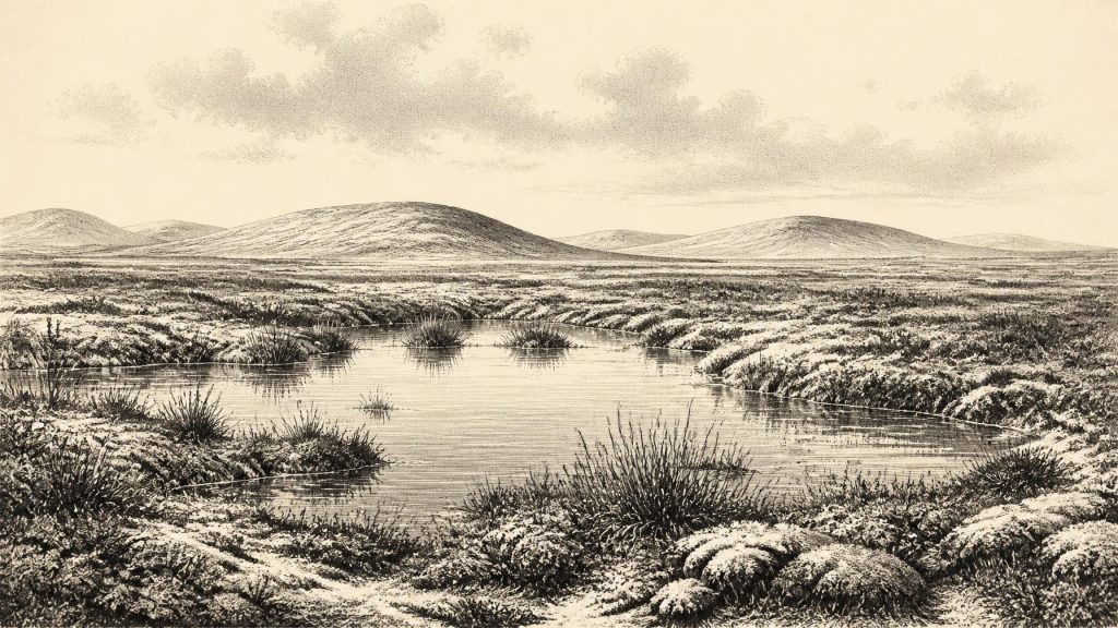
Derryvree’s fossil assemblage indicates open tundra and a periglacial regime: severe cold, seasonal freezing and ground conditions shaped by frost, rather than a forested landscape. Mosses, sedges, grasses and other low-growing plants occupied wet ground around pools rich in decaying vegetation. Insect evidence points to a muskeg-like environment, with open water and waterlogged organic surfaces amid mossy cover. The word “muskeg” should not conjure an unchanging modern bog. It is a useful ecological comparison for a cold, saturated landscape, not a claim that the precise vegetation or hydrology of present-day northern wetlands existed unchanged in the Pleistocene.
These deposits demonstrate biological activity in an exposed northern landscape. They also record vulnerability. Water could pond where local topography and frozen or compacted ground impeded drainage; later ice could erode, deform or bury the same terrain. The apparent quietness of the silts is therefore deceptive. Ireland was part of a wider north-west European zone in which climate could shift sharply over centuries and millennia. The main expansion of the last British–Irish Ice Sheet lay ahead, but ice was already a decisive agent in the island’s geography. It changed drainage, scoured older ground and, in later advances, removed much of the evidence that might otherwise tell a fuller story.
An Uneven Ice-Age Island
It would be misleading to describe all Ireland in 30,738 BCE as either wholly ice-covered or wholly open. The surviving record is too incomplete, and conditions varied greatly between uplands, lowlands, coasts and areas near ice margins. Modern reconstructions of the British–Irish Ice Sheet show major growth from about 31,000 years ago, followed by maximum expansion later, chiefly during MIS 2. But such reconstructions are regional models with margins and uncertainties, not maps capable of identifying the state of every valley in a single calendar year. Derryvree establishes local ice-free conditions during a broad interval; it does not prove that Cork, Connacht, Leinster and Ulster shared one simultaneous climate or ice limit.
Sea level was substantially lower than it is today, and the surrounding shelves, coastlines and ice margins differed markedly from the familiar map of Ireland. Yet lower seas alone do not prove a permanent, dry and easily traversed land bridge to Britain or continental Europe at this exact date. The physical routes available to animals and any people altered with sea level, ice, rivers and terrain. What is clear is that Ireland was not ecologically sealed for the whole Ice Age: animals reached it at different times. How, exactly when, and under what conditions each population arrived remain questions of palaeogeography rather than facts that can be settled by one numbered BCE year.
Castlepook’s Long Animal Record
The principal southern counterpart to Derryvree is Castlepook Cave, also known as Mammoth Cave or Doneraile Cave, near Doneraile in north County Cork. Its deep limestone passages have produced Ireland’s richest known pre-Last Glacial Maximum vertebrate assemblage. More than 2,000 bones have been recovered, including remains attributed to woolly mammoth, giant deer, reindeer, brown bear, spotted hyaena, wolf, Arctic fox and lemmings. Older radiocarbon dates on a mammoth and a spotted hyaena fall around 34,000 radiocarbon years BP, broadly placing important parts of the assemblage in the Middle Midlandian, or MIS 3, world relevant to this article.
But Castlepook is not a census taken in 30,738 BCE. The cave acted as a repository over a long span; animals, carnivores, water movement, collapse and early excavations all affected how its contents accumulated and survived. Some remains may have been transported into the cave or modified by scavengers. The fauna nonetheless establishes an important point: parts of Ireland could support, or were reached by, a far more varied cold-stage mammal community than the island’s later historic fauna. Mammoth and reindeer evoke open country with substantial grazing resources, while hyaena and wolf signal predation and scavenging within a food web. Yet it is unsafe to illustrate every listed species as living together in one herd at one place or moment.
People: A Possibility, Not a Settlement
No securely excavated house, hearth, lithic assemblage, grave, human skeleton or occupation layer in Ireland can be assigned to this date. The evidence therefore does not allow the identification of a resident community, population size, language, territory or seasonal round. A reindeer femur from Castlepook has been publicised as bearing a deep mark that may have been made on fresh bone with a sharp stone implement, and the specimen has been associated with an age of about 33,000 years. If that interpretation is confirmed through full publication and independent scrutiny, it would provide striking evidence that Upper Palaeolithic hunter-gatherers may have reached Ireland during MIS 3.
For now, however, the prudent formulation is weaker. A single potentially modified bone is not the same as a settlement, and it cannot establish continuous occupation. The cave’s complicated depositional history makes context especially important. It may hint at a brief human encounter with an animal carcass or at a transient visit to Ireland’s western edge; it cannot tell us whether visitors lived nearby, travelled in groups, returned regularly or crossed from a particular region. Later, securely dated evidence demonstrates human activity in Ireland near the end of the Pleistocene, but that cannot be projected backwards to this much earlier interval.
What Cannot Be Recovered
There is no evidence on which to build a history of political affairs, diplomacy, warfare, law or institutions in Ireland at this time. There are likewise no grounds for claiming agriculture, herding, pottery, metalworking, monuments, trade networks, formal religious places, art or literacy. In practical terms, even the economy and everyday life of any possible visitors remain unknown. If hunter-gatherers did enter Ireland, their subsistence would plausibly have involved knowledge of animals, plants, weather and seasonal movement, as elsewhere in Upper Palaeolithic Europe; that is an inference from the wider human world, not direct Irish evidence.
The cultural record is equally silent. No Irish cave art or portable art belongs securely to the Derryvree–Castlepook horizon, and no artefact can responsibly reveal belief, ceremony or learning. The absence of evidence is partly a product of preservation. Later glaciation repeatedly eroded surfaces and redeposited sediment, while acidic soils and long exposure destroy many organic materials. Limestone caves and sealed wetland deposits are exceptional survival zones, which is why a small number of places dominate the evidence. Ireland around this point in time is known chiefly through what ice failed to erase.
A Fragmentary but Vital Record
The most important development around this nominal date was not political but environmental: the shifting relationship between ice, water, exposed ground and life. Derryvree preserves a local freshwater tundra interval between glacial advances. Castlepook preserves traces of an Ice-Age fauna that included large herbivores and carnivores. Together they overturn any image of a permanently empty or uniformly frozen Ireland. At the same time, they impose firm limits. The island’s past at c. 32,700 calibrated years BP is a mosaic reconstructed from evidence with different dates, different locations and different degrees of certainty. Its history is not a chronicle of a single year, but an archaeological lesson in climate instability, survival and loss.
Primary Sources
- A Middle Midlandian Freshwater Series at Derryvree, Maguiresbridge, County Fermanagh, Northern Ireland
- The IntCal20 Northern Hemisphere Radiocarbon Age Calibration Curve (0–55 cal kBP)
- The Irish Quaternary Fauna Project
- Castlepook Cave: Cork County Geological Site Report
- The Cave Deposits of Castlepook, County Cork
- Pleistocene Vertebrates in the British Isles
- Figure 6.— The Subdivision of the Quaternary Period in Ireland
- South Fermanagh, Northern Ireland: Irish Quaternary Association Field Guide 16
- Quaternary Data and Maps
- An All-Ireland Quaternary Map
- The Last Irish Ice Sheet: Extent and Chronology
- Growth and Retreat of the Last British–Irish Ice Sheet, 31,000 to 15,000 Years Ago: the BRITICE-CHRONO Reconstruction
- BRITICE-CHRONO Maps and GIS Data of the Last British-Irish Ice Sheet 31 to 15 ka
- Timing, Pace and Controls on Ice Sheet Retreat: an Introduction to the BRITICE-CHRONO Transect Reconstructions of the British–Irish Ice Sheet
- The Timing and Magnitude of the British–Irish Ice Sheet Between Marine Isotope Stages 5d and 2
- Maximum Extent and Dynamic Behaviour of the Last British–Irish Ice Sheet West of Ireland
- Trimlines, Blockfields and the Vertical Extent of the Last Ice Sheet in Southern Ireland
- Episodic Speleothem Deposition Tracks the Terrestrial Impact of Millennial-Scale Last Glacial Climate Variability in SW Ireland
- New Insights on the Fauna of Ireland's Younger Dryas and Early Holocene from Alice & Gwendoline Cave
- 2022:564 – Castlepook Cave, Castlepook South, Cork
- Ireland's Palaeolithic Archaeology – Fleeting Footprints in a Frozen Land
- Field Guides
