
Derryvree’s Open-Water Tundra30773 BCE
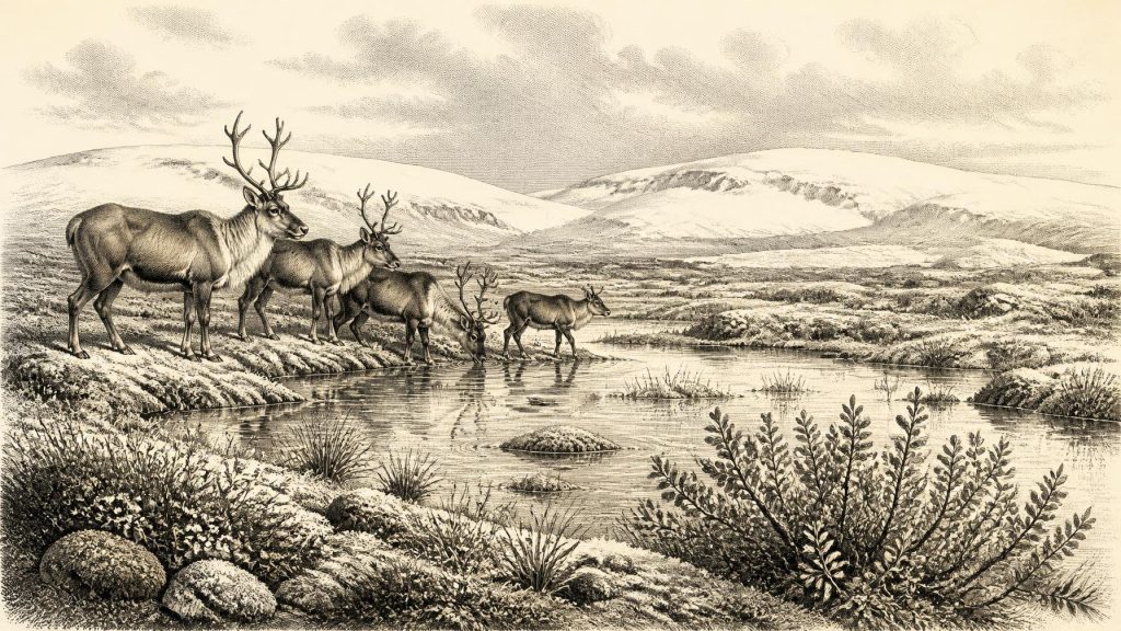
About 30,773 BCE, Ireland’s evidence belongs to a broad MIS 3 horizon rather than a datable year. At Derryvree, County Fermanagh, organic deposits between glacial tills record an ice-free freshwater wetland, supporting sedges, mosses, dwarf willow, mountain avens, bogbean and aquatic plants in a cold, treeless periglacial landscape. Ice behaviour preceded maximum glaciation. Cave deposits at Castlepook, County Cork, indicate cold-stage fauna, including mammoth, reindeer, giant deer and predators, though remains are mixed. A cut-marked reindeer bone suggests human activity, but no settlement evidence exists. Sea levels altered coasts, while routes to Ireland remain uncertain. Environmental change dominates the record.
Dateline
The label 30,773 BCE is a modern chronological convenience, not a date for which Ireland preserves an event, a ruler, a settlement or a named community. It is approximately 32,722 years before AD 1950, the conventional ‘present’ of radiocarbon dating. At this depth in time, however, neither archaeology nor palaeoenvironmental science can identify a single calendar year. The responsible frame is a broad span within the Late Pleistocene, during Marine Isotope Stage 3 (MIS 3), when climates around the North Atlantic changed sharply and repeatedly. Ireland must be understood through deposits, fossils and landforms rather than through annals or biographies.
A Date Within a Broad Horizon
The closest and most informative Irish evidence comes from Derryvree, near Maguiresbridge in County Fermanagh. Road works in 1969 cut through a drumlin and exposed silts, sands and organic sediment trapped between two thick layers of glacial till. The sequence preserves a simple but powerful relative history: ice had occupied the ground and laid down the lower till; an ice-free hollow then held freshwater and accumulated organic material; later ice advanced again, depositing the upper till over the buried wetland.
A sample from the organic layer, known as Birm-166, produced a conventional radiocarbon determination of 30,500 years BP, with a large uncertainty. That is not equivalent to 30,500 BCE. Radiocarbon years must be calibrated because atmospheric carbon-14 levels have varied through time, and the uncertainty becomes substantial so far into the past. Published discussion places the Derryvree deposit broadly within approximately 36,900–31,700 calibrated years BP. Thus 30,773 BCE falls within the wide chronological horizon to which the deposit may relate, but cannot be assigned to a particular layer, pond-edge, season or living organism.
This distinction is essential. Derryvree does not show that every district of Ireland looked alike, nor that its wetland was continuously present across five millennia. It does show that, at some point during this interval, part of Fermanagh was not beneath glacier ice and supported a functioning freshwater environment in a very cold, largely treeless landscape. That local survival is more historically meaningful than any attempt to manufacture a yearly narrative.
Water Between the Tills
Derryvree was not a precursor of modern green Fermanagh. Its fossil plants, pollen, insects and sediment indicate open tundra or muskeg: wet, peaty ground with pools, sedges, mosses and low-growing herbs, shaped by severe cold and repeated freezing and thawing. Macrofossils include mountain avens, dwarf willow and bogbean; the latter is especially revealing, since it implies shallow freshwater or wet margins even in a cold setting. Water-milfoil and other aquatic evidence similarly indicate pools or quiet water. Such plants should not be treated as a complete photograph of the surrounding countryside, but together they provide unusually direct evidence for a periglacial wetland.
‘Periglacial’ does not mean permanently ice-covered. It describes a landscape affected by frost, seasonal thaw, sparse vegetation and ground instability near or beyond an ice margin. In such country, a shallow pool could become a refuge for aquatic plants and insects, while exposed ground nearby supported hardy herbs, sedges and dwarf shrubs. Winter conditions were harsh; summers were short but sufficiently productive to maintain a growing season. The Derryvree evidence therefore complicates the simple image of Ice Age Ireland as an unbroken white wilderness. It was cold and climatically severe, but locally alive.
The surrounding physical landscape was also unstable on timescales far beyond a human lifetime. During MIS 3, the British–Irish Ice Sheet was not a fixed mass with a single, easily mapped edge. Recent synthesis points to earlier growth and changing advance–retreat behaviour before the later maximum of the last glaciation. The great maximum extent of ice across Ireland and its continental shelf came later, principally around 27,000–23,000 calibrated years BP. At the date represented here, large areas may already have been affected by ice or its proximity, but it would be wrong to project the later maximum backwards over the whole island.
Animals in a Fragmentary Record
Southern cave deposits show that Late Pleistocene Ireland could sustain a striking mammal fauna during overlapping portions of MIS 3. Castlepook Cave, near Doneraile in north County Cork, is the best-known site. Its old excavations produced remains attributed to woolly mammoth, reindeer, giant deer, brown bear, wolf, fox, Arctic fox, mountain hare, lemmings and spotted hyena. These animals evoke open country rather than closed woodland: herbivores requiring broad feeding grounds, predators and scavengers following them, and smaller cold-adapted mammals occupying the same severe world.
Yet cave assemblages must be read with caution. Bones may have been carried in by carnivores, reworked by water, mixed during earlier digging or derived from deposits formed centuries or millennia apart. The Castlepook collection is invaluable, but it is not a neatly sealed census for one moment in time. Revised radiocarbon work has also demonstrated the importance of improved collagen preparation and of reassessing older determinations. The sound conclusion is that a varied cold-stage fauna occupied Ireland across this long interval; it is not that mammoth, hyena, reindeer and every other recorded species necessarily stood together at Castlepook in 30,773 BCE.
Animals were the principal visible movers across this landscape. Reindeer could exploit open tundra vegetation; giant deer and red deer are represented in Irish Late Pleistocene material from different contexts; mammoths imply at least intermittent access to extensive grass- and herb-rich terrain. Carnivores could turn caves into dens or feeding places. Their activity helps explain why bones accumulated in limestone passages, and why an assemblage of bones alone cannot be assumed to represent a human kill-site. In ecological terms, Ireland was part of the north-west European margin, not an isolated environmental universe.
The Human Question
The possibility of people in Ireland during this phase deserves attention precisely because the evidence is so slight. A reindeer femur from the Castlepook collection has been interpreted as bearing a deep mark made by a sharp stone tool while the bone was fresh. The bone has been publicly associated with an age around 33,000 years ago, broadly close to the chronological setting of this article. If the interpretation is upheld, it would represent evidence that one or more Upper Palaeolithic people processed a reindeer in Ireland far earlier than the island’s long-established post-glacial archaeological record.
But a single marked bone is not proof of a settled population. No securely associated hearth, dwelling, stone-tool assemblage, burial, art site, harbour or repeated camp of comparable age has been recovered in Ireland. Nor can the bone establish whether people hunted the animal, scavenged a carcass, removed hide or sinew, processed meat elsewhere, travelled in a small party, or returned on another occasion. The cave itself may have been used by carnivores rather than humans. Archaeologically, the prudent phrase is possible human activity, not permanent occupation or a named first community.
Consequently, political affairs, warfare, diplomacy and institutions cannot responsibly be reconstructed. There are no chiefs, territories, alliances or conflicts visible in the Irish evidence. Likewise, there is no direct evidence for ritual, language, teaching, art or formal trade. If people did reach the island, they would have entered a demanding coastal and terrestrial environment in which movement, food and shelter were immediate concerns; that is an inference from the climate and fauna, not a documented social history. The absence of surviving camps may partly reflect poor preservation: later ice, erosion and changing shorelines have destroyed, buried or submerged many ancient surfaces. Absence is therefore not absolute proof of absence, but it limits what can be claimed.
Coasts, Movement and the Coming Ice
Sea level was considerably lower than it is today, exposing parts of the continental shelf and shifting coastlines far beyond their modern positions in some places. Nonetheless, it is unsafe to imagine a permanent, straightforward land bridge into Ireland. The exact relationship of land, sea, ice and seasonal sea ice changed repeatedly, and a lower sea level does not itself demonstrate a walkable route from Britain or continental Europe. Any human arrival, if the Castlepook evidence records one, remains an unresolved question of route as well as date.
There was no economy in the later historic sense: no farming, metalworking, markets or long-distance exchange network can be demonstrated. The only securely visible ‘economy’ is ecological—plants using a brief growing season, herbivores finding forage across open ground, and predators exploiting mobile prey. At Derryvree, shallow water and wet vegetation would have supported small organisms and attracted animals, while the broader tundra provided seasonal resources. This was a landscape of movement and patchy opportunity, not settled agricultural territory.
The deepest historical development around 30,773 BCE was therefore environmental change. Derryvree’s organic bed records an interval of open freshwater life between episodes of glaciation; the tills above and below it record that this opportunity was bounded by ice. In later millennia, more extensive glaciation would scour, rearrange and bury much of Ireland’s earlier landscape. What survives from this period is not a national story with protagonists, but a rare archive of a cold wetland, roaming fauna and an unresolved human trace at Europe’s Atlantic edge.
Primary Sources
- A Middle Midlandian Freshwater Series at Derryvree, Maguiresbridge, County Fermanagh, Northern Ireland
- The Irish Quaternary Fauna Project
- A reconsideration of the radiocarbon dating of the Marine Isotope Stage 3 fauna from southern Ireland
- Pleistocene Vertebrates in the British Isles
- Irish Pleistocene Biostratigraphy
- Phylogeographic, ancient DNA, fossil and morphometric analyses reveal ancient and modern introductions of a large mammal: The complex case of red deer (Cervus elaphus) in Ireland
- New insights on the fauna of Ireland's Younger Dryas and Early Holocene from Alice & Gwendoline Cave
- Growth and Retreat of the Last British–Irish Ice Sheet, 31,000 to 15,000 Years Ago: the BRITICE-CHRONO Reconstruction
- The Timing and Magnitude of the British–Irish Ice Sheet Between Marine Isotope Stages 5d and 2: Implications for Glacio-Isostatic Adjustment, High Relative Sea Levels and ‘Giant Erratic’ Emplacement
- Maximum Extent and Dynamic Behaviour of the Last British–Irish Ice Sheet West of Ireland
- Radiocarbon Constraints on the Age of the Maximum Advance of the British-Irish Ice Sheet in the Celtic Sea
- Ireland: Submerged Prehistoric Sites and Landscapes
- The IntCal20 Northern Hemisphere Radiocarbon Age Calibration Curve (0–55 cal kBP)
- Castlepook Cave, Castlepook South, Cork: 2022:564
- Heritage Artefacts of County Cork
- Irish Quaternary Association
- Dryas octopetala L.
- Salix herbacea L.
- Menyanthes trifoliata L.
- Myriophyllum alterniflorum DC.
