
Maguirebridge’s Sub-Till Flora30772 BCE
At roughly 36,900–31,700 calibrated years BP, Derryvree near Maguiresbridge preserved freshwater sediments and organic remains between glacial tills. These record a local ice-free interval during MIS 3, followed by renewed glaciation. Mosses, bogbean, grasses, sedges, juniper and cold-adapted plants indicate wet, open tundra-like terrain with shallow pools and severe seasonality. Castlepook Cave fossils show that mammoth, giant deer, reindeer and predators occurred in Ireland during this broad period, though not necessarily together. No secure evidence identifies people, settlements, trade or beliefs at this date. Repeated glaciation and later sea-level rise obscured evidence. The record reveals local environments, not precise history.
Dateline
Modern calendar-year precision is not available for Ireland in 30,772 BCE. No person recorded a date, no settlement can be assigned to that year, and the surviving evidence cannot distinguish one winter from another. This label corresponds roughly to 32,721 years before AD 1950, the conventional archaeological “present”. It belongs within the later part of the Late Pleistocene, during Marine Isotope Stage 3 (MIS 3), a climatically unstable phase of the last Ice Age. The responsible subject is therefore an interval rather than an annual chronicle: Ireland in the broad range illuminated by deposits dated at about 36,900–31,700 calibrated years before present.
The closest and most informative evidence comes from Derryvree townland, about two kilometres north-east of Maguiresbridge in County Fermanagh. Road works in 1969 cut through a drumlin and revealed a remarkable sequence: freshwater silts and fine sands, including organic material, trapped between two thick layers of till. Till is the unsorted debris left by glacier ice. The sequence demonstrates an earlier glacial occupation, followed by a local interval when ice was absent and water, plants and small animals could inhabit the basin, and then a later advance that sealed the deposit beneath fresh glacial sediment.
A Date Range, Not a Dated Year
The Derryvree organic deposit returned a conventional radiocarbon age of 30,500 years before present, with a substantial uncertainty of +1,170/−1,030 years (Birm-166). Radiocarbon years are not calendar years: atmospheric carbon levels have varied over time, and the result must be calibrated against independent chronologies. Modern calibration places the determination broadly in the range c. 36,900–31,700 cal BP. The requested year falls near, but not securely inside, the late end of that wide range. It would be misleading to say that its pool, bogbean or mosses were alive in precisely 30,772 BCE. What the result responsibly supports is a picture of a cold, locally ice-free Fermanagh landscape during the middle-to-later part of MIS 3.
This caution is important because the old Irish terms once used for glacial phases, including “Middle Midlandian” and “Derryvree Cold Phase”, are useful descriptions of field evidence but do not provide a neat island-wide timetable. Recent reconstructions of the British–Irish Ice Sheet show that its growth and maximum extent involved regional variation, advances and changing margins. Ireland was not simply either “covered by ice” or “ice-free” at every moment. At Derryvree, the deposits prove an ice-free interlude at that locality; they do not prove that every coast, upland and valley across the island was open country at the same time.
Cold Pools Beneath Future Drumlins
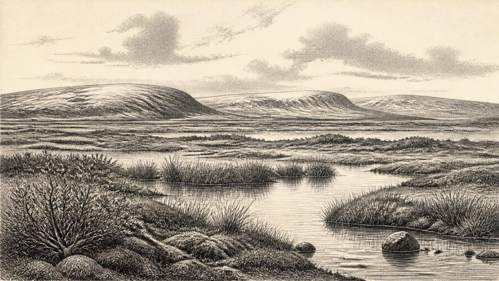
The Derryvree flora gives this otherwise remote period unusual texture. Pollen was poorly preserved, yet the surviving herb pollen, mosses and plant macrofossils point towards open tundra or muskeg-like terrain rather than closed forest. Grasses, sedges, herbs and juniper occurred with a specialised moss flora. A fossil seed of bogbean (Menyanthes trifoliata) is particularly eloquent: it confirms shallow freshwater or saturated wet ground in the basin. Other recorded plants include mountain avens, dwarf willow and lesser clubmoss, species well suited to cold, exposed or alpine conditions.
The direct evidence is the physical presence of those fossil remains in a former wetland. The wider reconstruction is an interpretation: a mosaic of shallow pools, mossy margins, sedge-rich hollows and sparsely vegetated, frost-affected ground. It should not be imagined as a featureless snow desert. In summer, low ground could have supported productive plant growth and insect life, while water collected sediment and organic matter. But neither should it be turned into a benign meadow. Severe seasonality, frozen ground, wind exposure and repeated thawing would have constrained soil development and vegetation. Trees may have been absent locally or extremely sparse; isolated tree pollen grains do not demonstrate nearby woodland, since pollen can travel far or be reworked.
The basin itself was temporary on geological timescales. It accumulated freshwater sediment only because ice had withdrawn or failed to occupy that spot. Its eventual burial tells of renewed glaciation. The drumlin landscape for which Fermanagh is now known was not yet a settled pattern of green fields and loughs, but a terrain repeatedly altered by ice, meltwater, frost and sediment. The Derryvree record preserves an interlude precisely because a later glacier covered it.
Animals on an Unstable Land
County Fermanagh has supplied the clearest local environmental archive, but caves in southern Ireland provide complementary evidence for the animal world of roughly the same broad period. Castlepook Cave, near Doneraile in County Cork, is the richest Irish site for pre-Last Glacial Maximum vertebrate remains. Its old cave collections include woolly mammoth, giant deer, reindeer, brown bear, wolf, Arctic fox and spotted hyaena, alongside smaller cold-adapted mammals. A mammoth bone and a spotted-hyaena bone have produced radiocarbon results in the mid-30,000s radiocarbon years BP, broadly relevant to the environmental horizon represented at Derryvree.
These fossils show that Ireland was accessible to a varied Pleistocene fauna before the Last Glacial Maximum. They do not provide a census for 30,772 BCE. Cave deposits accumulated over long periods, may combine material of different ages, and were often excavated before modern standards of recording. Castlepook was probably a carnivore-used cave and a natural bone trap or repository as well as a place affected by sediment movement. Thus it is sound to say that large herbivores and predators inhabited, or periodically reached, Ireland during this phase; it is not sound to place a particular mammoth herd beside the Derryvree wetland in the nominated year.
Nevertheless, the implications are considerable. Open vegetation, wet basins and seasonal grass-and-sedge resources could sustain grazing animals, while carnivores followed or scavenged them. The animal evidence also reveals a landscape unlike later historic Ireland: mammoth and spotted hyaena belong to an Ice Age ecosystem that subsequently vanished from the island. The apparently patchy distribution of fossils is partly ecological, but also a result of preservation. Limestone caves in Cork and Waterford retained bones; glaciers and later erosion destroyed or buried many open-air deposits elsewhere.
No Recoverable Human Society
There is no secure evidence for a human community, camp, hearth, tool-making floor, burial, dwelling or artwork in Ireland at this date. Accordingly, there can be no responsible account of Irish political affairs, chiefs, warfare, diplomacy, religion, learning, trade or domestic routine in 30,772 BCE. The evidence does not support them. There were no states or named peoples in the later historical sense, but even the presence of small Upper Palaeolithic hunting parties cannot presently be demonstrated for this part of the Irish record.
This absence should not be treated as proof that no human ever entered Ireland before the Last Glacial Maximum. Ireland lay at Europe’s north-western edge and conditions sometimes permitted animal movement. Sea level was much lower than today, reshaping the Irish Sea basin and expanding land around the coasts, although a simple, continuously usable land bridge to Britain should not be assumed. Any human visit would have depended on the changing geography, weather and ecology of the time. Repeated glaciation, however, has scoured landscapes, while later sea-level rise submerged possible coastal corridors and camps. Both processes severely reduce the chance that ephemeral visits will survive archaeologically.
The strongest published evidence for a Palaeolithic human incursion into Ireland is much later: cut marks on a brown-bear kneecap from Alice and Gwendoline Cave, County Clare, dated to about 12,810–12,590 cal BP. Ireland’s earliest incontrovertible evidence for sustained settlement comes later still, in the Mesolithic, at Mount Sandel in County Londonderry, occupied around 10,290–9,790 cal BP. Those findings establish that humans eventually reached and settled the island; they must not be projected backwards some twenty thousand years to populate Derryvree without evidence.
Movement Without Trade Networks
For the same reason, economy and trade cannot be described in human terms. There are no known Irish commodities, exchange networks, mined materials or imported artefacts from this horizon. The meaningful “movement” visible in the evidence is ecological and geological: animal dispersal into suitable territory; water transporting silt into a basin; and ice advancing across ground that had briefly supported tundra vegetation. If people did make rare exploratory journeys in the wider region, they left no identifiable Irish material culture at this time.
There is also no evidence from which to infer ritual landscapes or beliefs. Natural caves and wet places may seem suggestive to modern readers, but their later cultural significance does not demonstrate Palaeolithic religion in Ireland. The palaeoenvironmental record can reveal climate, water, vegetation and fauna far more securely than it can reveal ideas. Its silence on society is therefore an important historical result, not an empty gap to fill with legend.
An Island in Formation
Around this notional date, Ireland’s most important history was environmental change. Derryvree preserves a cold freshwater interval between glacial advances; Castlepook preserves a fragmentary fauna from a wider Ice Age world; and the modern chronology of the ice sheet explains why both records are incomplete. These sources make it possible to describe a treeless, wet and seasonally severe landscape in parts of Ireland, occupied by plants and animals adapted to cold conditions. They do not allow an annual narrative, a map of island-wide conditions, or a human history of named communities.
The perspective is humbling. Later Ireland would be shaped by seafarers, hunter-gatherers, farmers, monuments, kingdoms and written memory. In this deep Pleistocene interval, the surviving Irish archive is instead one of silts, seeds, mosses, bones and ice. Its greatest significance lies in showing that the island was neither timeless nor uniformly frozen: even before the Last Glacial Maximum, local wetlands and open ground could appear between episodes of glaciation, only to be buried and preserved for discovery tens of millennia later.
Primary Sources
- A Middle Midlandian Freshwater Series at Derryvree, Maguiresbridge, County Fermanagh, Northern Ireland
- Palaeoecology: The Middle Midlandian Palaeoenvironment of South Fermanagh
- The Subdivision of the Quaternary Period in Ireland
- Menyanthes trifoliata: Bogbean, Fermanagh Fossil Record
- The Irish Quaternary Fauna Project
- Castlepook Cave, Cork County Geological Site Report
- Irish Pleistocene Biostratigraphy
- Pleistocene Vertebrates in the British Isles
- Occurrence of Mammalia Relicts at Site Castlepook Cave
- Episodic Speleothem Deposition Tracks the Terrestrial Impact of Millennial-Scale Last Glacial Climate Variability in SW Ireland
- Exploring Controls on the Distribution of Ice-Marginal Landforms in the Marine-Terminating Sectors of the Last British–Irish Ice Sheet
- The Last Irish Ice Sheet: Extent and Chronology
- Pattern and Timing of Retreat of the Last British-Irish Ice Sheet
- Growth and Retreat of the Last British–Irish Ice Sheet, 31,000 to 15,000 Years Ago: the BRITICE-CHRONO Reconstruction
- The IntCal20 Northern Hemisphere Radiocarbon Age Calibration Curve (0–55 cal kBP)
- A Stratigraphic Framework for Abrupt Climatic Changes During the Last Glacial Period Based on Three Synchronized Greenland Ice-Core Records
- Ireland: Submerged Prehistoric Sites and Landscapes
- First Evidence of a Late Upper Palaeolithic Human Presence in Ireland
- New Insights on the Fauna of Ireland’s Younger Dryas and Early Holocene from Alice & Gwendoline Cave
- The Colonization of Ireland: A Human Ecology Perspective
- The Mesolithic in Ireland: When Was It?
- Quaternary Site Descriptions
- Castlepook Cave Excavation Report, 2022
