Sedges Under Fermanagh Ice30721 BCE
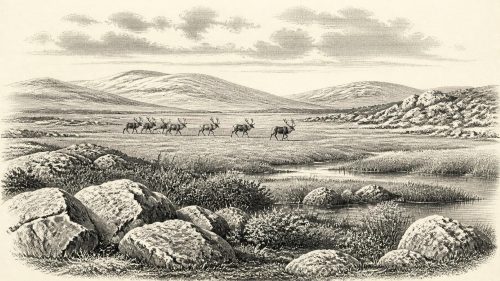
Around 30,721 BCE, Ireland cannot be described through precise annual dating or named human events. Derryvree, County Fermanagh, preserves a freshwater wetland buried between glacial tills, indicating treeless tundra, sedges, mosses, aquatic plants and locally functioning ecosystems during a cold Middle Midlandian phase. Castlepook Cave, County Cork, contains mixed remains of mammoth, reindeer, giant deer, predators and smaller cold-adapted animals, demonstrating diverse fauna but not a synchronous community. A possibly cut-marked reindeer bone suggests brief Upper Palaeolithic visits, yet permanent settlement remains unproven. Advancing ice shaped, buried and destroyed evidence, leaving a varied landscape rather than settled or lifeless island.
Dateline
The label 30,721 BCE gives a useful point of reference for a modern chronology, but it must not be mistaken for a date that people in prehistoric Ireland could have recognised, or that archaeology can resolve to a single year. In scientific terms it is roughly 32.7 thousand calendar years before AD 1950, within the later part of the Pleistocene and broadly within Marine Isotope Stage 3. The evidence for Ireland at this depth of time is sparse, uneven and often difficult to date. It records habitats, animals, ice and water much more clearly than it records human lives. The responsible history of this moment is therefore not a narrative of named communities or events, but an account of a changing northern landscape and the few archives that survived later glaciation.
A Date Beyond Calendar Precision
No annual event can responsibly be assigned to Ireland in 30,721 BCE. Radiocarbon ages are not calendar years: they require calibration against changing atmospheric carbon levels, and their probability ranges may span centuries or millennia. The relevant Irish deposits were also formed during a period of abrupt North Atlantic climatic oscillation. A date from a bone records, at best, when the animal died; a date from organic mud records when its carbon entered the deposit; neither automatically dates an action by people or conditions across the whole island.
The closest illuminating evidence comes from sites whose dates bracket or approach this broad interval. Chief among them is Derryvree, near Maguiresbridge in County Fermanagh, where roadworks in 1969 exposed a buried layer of freshwater silts and fine sands trapped between two substantial till sheets. The organic deposit produced the conventional radiocarbon determination Birm-166, 30,500 +1,170/−1,030 radiocarbon years BP. Its calibrated range is necessarily broad, rather than a precise equivalent in BCE. Derryvree should therefore be used as an environmental archive for the wider Middle Midlandian cold stage, not as proof of conditions in every part of Ireland in this one nominal year.
A Wetland Between Ice Advances
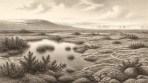
Derryvree’s importance lies in the fact that it was not simply barren ground. The sediments preserve pollen, plant macrofossils, mosses and small animal remains from a freshwater setting which existed between episodes of glaciation. The original investigators interpreted the assemblage as evidence for open tundra vegetation and a periglacial climate. Later summaries have described the setting as a treeless muskeg: saturated, organic-rich ground with shallow water, mossy margins and intermittent pools.
The individual plants make that reconstruction more tangible. Sedges and mosses grew around the wet ground. Bogbean and alternate water-milfoil indicate freshwater habitats, while mountain-avens, dwarf willow and lesser clubmoss are compatible with exposed, cold-climate terrain. These were not the oak woods, enclosed fields or blanket bogs of later Irish history. They suggest a low, patchy cover of vegetation, constrained by severe winters, short growing seasons and frost-affected soils. The presence of aquatic and wetland plants also cautions against depicting the whole country as a single unbroken ice-sheet: at least locally, there were water, sediment, plants and animal life.
That conclusion must remain regional. Derryvree was a small basin in what is now Fermanagh, and its preservation was exceptional because subsequent ice sealed it beneath till. It does not demonstrate that all of Ireland was simultaneously open, green or habitable. Elsewhere, glacier margins, snow cover, wind exposure, relief and drainage could have produced sharply different local conditions. Yet the deposit is decisive evidence against a simple image of a lifeless frozen island. In its short summer season, this was a functioning wetland ecosystem, not an empty void.
Large Animals on the Western Margin
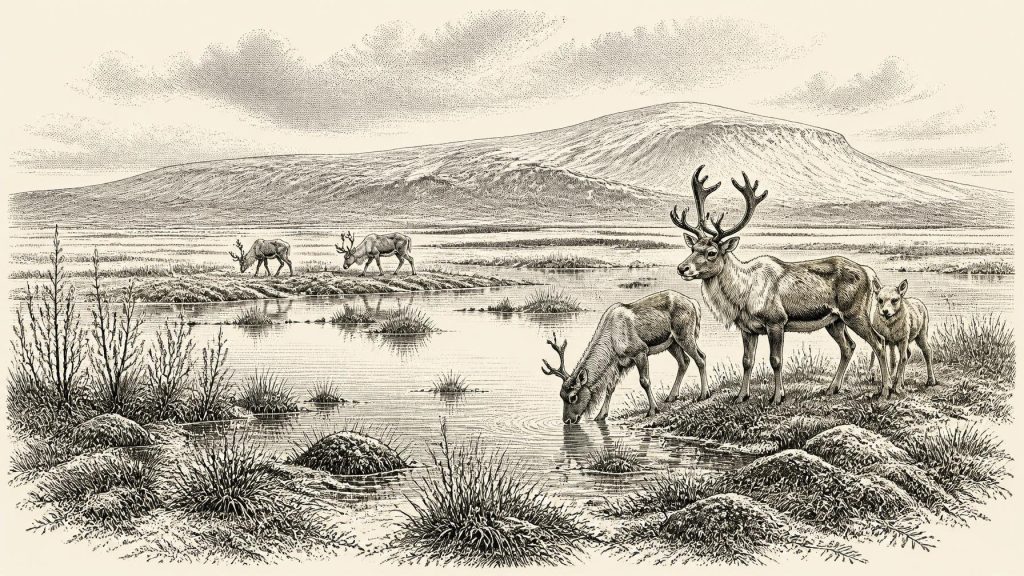
County Cork provides a second kind of evidence. Castlepook Cave, near Doneraile, is Ireland’s richest known cave archive for vertebrate remains from before and around the Last Glacial Maximum. Excavated principally in the early twentieth century, its galleries yielded more than 2,000 bones. The identified Ice Age fauna includes woolly mammoth, reindeer, giant deer, brown bear, wolf, Arctic fox, mountain hare, Arctic and Norway lemmings, and spotted hyaena. This is a strikingly different animal world from modern Ireland.
It would be misleading, however, to imagine every one of these animals sharing a single valley on a single day. Castlepook accumulated remains over a long period. Water disturbance, collapse, old excavation methods and the activities of carnivores all mixed or complicated deposits. Spotted hyaenas may themselves have carried bones into the cave. Modern redating has shown that several earlier radiocarbon measurements from southern Irish caves were substantially too young, reminding us that inherited dates and collections need constant re-examination. Castlepook proves that a varied cold-stage fauna reached Ireland during the wider MIS 3 interval; it is not a photograph of one perfectly synchronous community.
Nevertheless, the fauna gives the Derryvree landscape ecological depth. Reindeer and lemmings suit cold, open country. Mammoths, giant deer and reindeer imply expanses capable, at least seasonally, of sustaining large grazers and browsers. Wolves and hyaenas indicate predators and scavengers feeding within those food webs. Animal movement also shows that Ireland was not ecologically isolated in the absolute sense. Species reached this far-western territory at various times, although the exact routes remain uncertain.
Lower global sea levels exposed land now submerged around north-west Europe, but that fact does not establish a simple or permanent walkable land bridge between Ireland and Britain. Ice margins, deep marine basins and changing coastlines made the geography complicated. Geological and biogeographical research has long questioned whether a substantial enduring Irish land bridge existed even in later phases of the last glaciation. The arrival of a mammal demonstrates a successful movement; it does not identify its route, season, frequency or ease.
The Human Question
The possibility of people in Ireland around this broad period rests on a far narrower evidential base. A reindeer femur from Castlepook has been reported as bearing a deep mark interpreted as damage made by a sharp stone implement during butchery. Public reporting associated the directly dated bone with an age of about 33,000 years ago. If the modification is confirmed as human-made, it would be exceptionally early evidence that Upper Palaeolithic people handled a reindeer in Ireland.
Its significance should not be inflated. The object does not come from a securely excavated occupation floor with a hearth, stone-tool concentration, dwelling structure or repeated sequence of butchered animals. The date belongs to the bone and carries a range; it does not create an exact calendar date for the cut mark. Nor can one damaged bone establish whether people killed the animal, scavenged it, processed it in the cave, or deposited it before another agent moved it. Recent Castlepook excavations were explicitly designed to seek intact deposits, improved dating and further evidence such as charcoal, lithics and modified bone. This is active research, not a settled historical verdict.
The most that can presently be said is that brief human visits to Ireland in the wider period are possible and increasingly worthy of investigation. Permanent settlement in 30,721 BCE is unproven. There is no securely dated Irish camp from which to reconstruct population size, seasonal mobility, domestic life, hunting methods or technology. Comparison with contemporary Upper Palaeolithic groups elsewhere in Europe may suggest small mobile foraging parties, skilled in reading weather and animal movements, but that is an informed analogy, not direct Irish evidence.
No Polities, No Recorded Beliefs
There is no evidence for political institutions, leaders, warfare, diplomacy, trade systems, named peoples, language, religion, art or formal learning in Ireland at this date. There are no farms, fields, pottery, graves, houses, shrines or monuments that can responsibly be assigned to this horizon. It would be anachronistic to project later Irish identities, Celtic labels or medieval origin traditions into an age separated from them by more than thirty millennia.
Society is visible only indirectly, and only if the Castlepook marks ultimately prove anthropogenic. Such an interpretation would imply practical knowledge: a sharp stone edge, an animal carcass, and people able to survive a severe and variable environment. It would not reveal their names, kinship, speech, spiritual beliefs or political relationships. In the absence of secure settlement evidence, the principal economy visible in Ireland is ecological rather than human: wetland plants drawing nutrients from silts, grazers using open ground, predators exploiting prey and carrion, and ice and meltwater repeatedly transforming the terrain.
An Unstable Irish World
The most important development around this point in deep time was climatic and glacial change. The later Last Glacial Maximum, when the British–Irish Ice Sheet reached its greatest extent, still lay ahead, but ice growth was becoming an increasingly powerful influence on Irish landscapes. Successive advances would scour surfaces, shift sediments and erase or bury older traces. The scarcity of evidence is partly a result of that destructive geological history.
Derryvree survived precisely because its freshwater sediments were buried between tills. Castlepook survived because limestone passages collected and protected animal remains, even while complicating their interpretation. Together they offer a disciplined picture of Ireland around 30,721 BCE: not a settled nation, and not an empty abstraction, but a cold, regionally varied land of wet hollows, sparse tundra vegetation, large mammals and advancing ice. Whether human beings were occasional visitors to that world remains one of the most important unanswered questions in Irish prehistory.
Primary Sources
- A Middle Midlandian Freshwater Series at Derryvree, Maguiresbridge, County Fermanagh, Northern Ireland
- A Reconsideration of the Radiocarbon Dating of the Marine Isotope Stage 3 Fauna from Southern Ireland
- The Irish Quaternary Fauna Project
- The Exploration of Castlepook Cave, County Cork
- Castlepook Cave: County Geological Site Report
- Archaeology Research Excavation Grant 2022: Castlepook Cave Final Report
- 2022:564 – Castlepook Cave, Castlepook South, Cork
- Palaeoecology
- The Subdivision of the Quaternary Period in Ireland
- Growth and Retreat of the Last British-Irish Ice Sheet, 31,000 to 15,000 Years Ago
- Early Deglaciation of the British-Irish Ice Sheet on the Atlantic Shelf Northwest of Ireland Driven by Glacioisostatic Depression and High Relative Sea Level
- Timing and Pace of Ice-Sheet Withdrawal Across the Marine–Terrestrial Transition West of Ireland During the Last Glaciation
- Radiocarbon Constraints on the Age of the Maximum Advance of the British-Irish Ice Sheet in the Celtic Sea
- The IntCal20 Northern Hemisphere Radiocarbon Age Calibration Curve (0–55 cal kBP)
- The Problem of a Late Quaternary Landbridge Between Britain and Ireland
- Origin of British and Irish Mammals: Disparate Post-Glacial Colonisation and Species Introductions
- Stoats (Mustela erminea) Provide Evidence of Natural Overland Colonization of Ireland
- Dryas octopetala
- Selaginella selaginoides
- Mammoth Cave, Castlepook South, County Cork