

Fermanagh’s Subglacial Herbarium30614 BCE
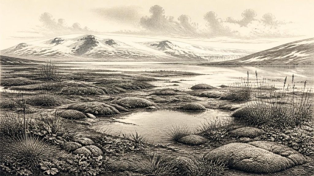
Thirty thousand six hundred and fourteen BCE is not an exact Irish historical year but falls within a broad Late Glacial radiocarbon range. Derryvree, County Fermanagh, preserves freshwater silts between tills, recording a cold, treeless tundra wetland with mosses, sedges, grasses and Arctic-alpine plants during an interval between ice advances. Castlepook Cave, County Cork, contains remains of mammals including reindeer, mammoth and hyaena, though mixed deposits prevent reconstruction of a single community. A cut-marked reindeer bone suggests possible human butchery, not settlement. Evidence chiefly documents changing ice, water, vegetation, animal movement and temporary habitats before the overall Last Glacial Maximum.
Dateline
30,614 BCE is a modern chronological label, not a recoverable year in Ireland’s own archaeological record. Nobody on the island left a calendar, writing, named settlement, ruler or event that can be tied to it. In radiocarbon practice, the date lies roughly 32,563 years before AD 1950, but that arithmetic conversion must not be mistaken for ancient calendar precision. At this depth in time, the evidence consists of sediments, pollen, plant remains, insects, animal bones and glacial landforms, dated in broad ranges. The most responsible account is therefore of Ireland during the later part of the Last Glacial Period, within Marine Isotope Stage 3, rather than a narrative of one year.
A Date Within a Long Range
The closest unusually informative Irish sequence is at Derryvree, near Maguiresbridge in County Fermanagh. Roadworks in 1969 cut through a drumlin and exposed freshwater silts and fine sands enclosed between two thick layers of till: unsorted material deposited directly by glacier ice. Organic material from the freshwater bed produced the radiocarbon determination Birm-166, conventionally reported as 30,500 +1,170/−1,030 radiocarbon years BP. Published calibrations have expressed this as a broad calendar interval of approximately 36,900–31,700 cal BP, or roughly 34,950–29,750 BCE. The nominal date of 30,614 BCE falls within that wide window, but cannot be identified with a particular season, sediment layer, generation, animal or human action.
The sequence nevertheless establishes an important order of events. Ice had laid down the lower till; a period followed in which freshwater, silt, vegetation and small animals accumulated; then ice returned or advanced over the locality, sealing the organic deposit beneath the upper till. Derryvree is consequently a rare environmental archive from an Irish interval between glacial episodes. It is not a map of the whole island. The later ice sheets greatly disturbed, buried or removed older deposits, and conditions could differ sharply between uplands, lowlands, coasts and cave districts.
Wet Ground at the Ice Margin
The plant and animal evidence from Derryvree indicates open tundra and a periglacial climate: severe, seasonally frozen ground rather than forest. Mosses, sedges, grasses and Arctic-alpine plants grew around shallow or slow-moving freshwater. Aquatic and waterside species show that the landscape included pools, wet hollows and muddy margins, not an unbroken expanse of ice or bare stone. In this setting, low-growing vegetation could take advantage of short growing seasons while meltwater and summer thaw supported wetland life.
This was a hard landscape, but not necessarily lifeless. The buried flora suggests ecological variety on a small scale: exposed mineral ground, damp sedge-rich edges, patches of open water and perhaps sheltered places where dwarf shrubs survived. Such evidence is especially valuable because it records living communities directly, rather than merely inferring climate from the shape of the terrain. It also cautions against a simple picture of a permanently frozen Ireland. The island’s Late Pleistocene environments changed repeatedly as temperature, precipitation, sea level, ice cover and drainage altered over centuries and millennia.
Greenland ice-core chronologies demonstrate that the North Atlantic world experienced abrupt stadial and interstadial shifts during this broad period. They provide an essential regional climatic framework, but should not be treated as a weather diary for Fermanagh. Nor can a Greenland event automatically be equated with a particular Irish layer. The Derryvree record demonstrates local freshwater and tundra conditions during a cold-stage interval; wider ice-sheet reconstructions show that the British–Irish Ice Sheet was growing and changing, with its fullest Last Glacial Maximum development still to come, broadly after this period.
Animals and Moving Landscapes
Evidence from Castlepook Cave near Doneraile, County Cork, gives a different but complementary view of Ice-Age Ireland. The cave has yielded a remarkable Late Pleistocene faunal collection, including reindeer, woolly mammoth, giant deer, brown bear, wolf, Arctic fox, lemmings and spotted hyaena. These remains show that Ireland was intermittently connected to the wider north-west European animal world. During periods of lower sea level, changing shorelines and ice-bound or exposed routes altered the possibilities for animal movement between Ireland, Britain and the continent.
Yet Castlepook must be read with care. Much of its material was excavated in the early twentieth century, before modern standards of stratigraphic recording, and cave deposits can be mixed by water, frost, collapse, scavengers and carnivores. Bones from different times and circumstances may accumulate in the same galleries. A list of species is therefore not evidence that every animal lived together in County Cork in 30,614 BCE, still less that it inhabited the Fermanagh wetland. It establishes that these species reached Ireland at points in the broader Late Pleistocene, not a complete food web for one imagined year.
The animal assemblages do, however, make the likely scale of environmental change vivid. Reindeer were adapted to open northern landscapes; mammoth and giant deer point to different mixtures of open habitat and forage; predators and scavengers followed prey or used caves as dens and refuges. The movements of such animals were governed by climate, vegetation, terrain and access, rather than by human boundaries. The distinctions between a wet Fermanagh basin, a limestone cave in north Cork and ice-covered terrain elsewhere in Ireland were as consequential as any island-wide pattern.
The Human Question
There is no securely excavated settlement, hearth, stone-tool assemblage, burial, artwork or human skeleton from Ireland that can be assigned to this date. No political communities, leaders, alliances, warfare, diplomacy, religious institutions or learned traditions can responsibly be reconstructed. Nor is there evidence for houses, farms, exchange networks, boats or regular trade. The absence of such evidence does not prove that no person ever crossed into Ireland during the interval; it means that historians cannot turn possibility into a settled account of occupation.
One object makes that caution especially important. A reindeer femur from Castlepook has been interpreted by zooarchaeologist Ruth Carden, and presented in County Cork heritage material, as bearing a deep mark made by a sharp stone tool on fresh bone. The bone has been publicly associated with about 31,000 BCE. If the interpretation is sustained, it would indicate that someone processed a reindeer carcass in Ireland during the Upper Palaeolithic, vastly earlier than the island’s formerly well-established terminal-Pleistocene evidence for people. It could represent cutting meat, hide or sinew, or opening part of a limb for marrow.
That is a significant possibility, but it remains a narrow inference. The mark is not a settlement floor, and the bone’s age does not itself date the exact moment at which the incision was made. The cave has not produced a securely associated toolkit, hearth, dwelling, human remains or concentrated butchery deposit of this age. Even if people were present, the strongest permissible interpretation is of a brief visit by a small, mobile party able to use a sharp lithic edge and exploit a large animal. It cannot establish a permanent population, a named culture, an ancestral link to later inhabitants or a society spanning the island.
Life Without a Historical Record
For ordinary life, the evidence is environmental rather than biographical. If humans did visit, survival would have depended upon mobility, knowledge of animal behaviour, warm clothing, fire and reliable cutting tools; these are inferences from Upper Palaeolithic lifeways elsewhere in Europe, not finds from a documented Irish camp. The more certain inhabitants of the landscape were the plants, insects and animals represented in deposits. Their lives were organised around seasonality: thaw and freeze, moving water, scarce winter forage, shelter, predation and migration.
There is likewise no evidence from which to infer ceremonies, sacred places, language, kinship systems or artistic culture in Ireland at this date. Caves such as Castlepook are archaeological repositories, but their faunal deposits do not demonstrate ritual use. The appropriate cultural history is instead one of knowledge recovered through science: pollen and seeds identifying vegetation, insect remains refining local conditions, radiocarbon providing ranges rather than exact years, and glacial strata recording the advance and withdrawal of ice.
Before the Maximum Ice
The central development illuminated by 30,614 BCE is thus environmental instability. Derryvree preserves a cold, treeless wetland interval bracketed by glacial deposits. Castlepook preserves fragments of a wider fauna whose members entered Ireland at different times. Later reconstructions indicate that the British–Irish Ice Sheet expanded to its greatest overall extent thousands of years afterwards, during the Last Glacial Maximum. That later advance would reshape drainage, scour landforms and make extensive parts of Ireland inhospitable or inaccessible.
Rather than supplying an annual chronicle, Ireland around this date offers a deep-time history of temporary habitats. Water lay between ice episodes in Fermanagh; tundra plants rooted in saturated silt; large mammals moved through changing north-west European corridors; and a single marked reindeer bone raises, but does not settle, the possibility of human presence. The surviving record is fragmentary, but it is not empty. It reveals an Ireland whose most important historical forces were ice, water, plants, animals and the shifting opportunities they created.
Primary Sources
- A Middle Midlandian Freshwater Series at Derryvree, Maguiresbridge, County Fermanagh, Northern Ireland
- IQUA Field Guide 16: Derryvree and Maguiresbridge
- The Irish Quaternary Fauna Project
- The Exploration of Castlepook Cave, County Cork, Being the Third Report from the Committee Appointed to Explore Irish Caves
- Heritage Artefacts of County Cork
- Archaeology Research Excavation Grant 2022
- Occurrence of Mammalia Relicts at Site Castlepook Cave
- Dublin Radiocarbon Dates II
- New Insights on the Fauna of Ireland’s Younger Dryas and Early Holocene from Alice & Gwendoline Cave
- Growth and Retreat of the Last British–Irish Ice Sheet, 31,000 to 15,000 Years Ago: the BRITICE-CHRONO Reconstruction
- The Timing and Magnitude of the British–Irish Ice Sheet Between Marine Isotope Stages 5d and 2
- Trimlines, Blockfields and the Vertical Extent of the Last Ice Sheet in Southern Ireland
- New Age Constraints for the Maximum Extent of the Last British-Irish Ice Sheet (NW Sector)
- New Data for the Last Glacial Maximum in Great Britain and Ireland
- The IntCal20 Northern Hemisphere Radiocarbon Age Calibration Curve (0–55 cal kBP)
- IntCal Publications
- A Stratigraphic Framework for Abrupt Climatic Changes During the Last Glacial Period Based on Three Synchronized Greenland Ice-Core Records
- North GRIP – Greenland Ice Core Chronology 2005 (GICC05) 60,000 Year, 20 Year Resolution
- The Mesolithic in Ireland: When Was It?
- The Late Quaternary History of East-Central Ireland





