Derryvree’s Interstadial Fen30615 BCE
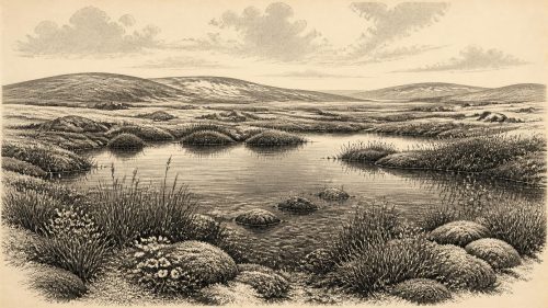
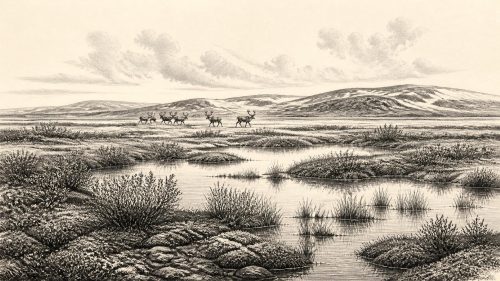
Labelled 30,615 BCE, the Derryvree evidence represents a broad Late Pleistocene interval rather than a datable year. At Maguiresbridge, County Fermanagh, organic freshwater sediments between two glacial tills record an ice-free wetland during Marine Isotope Stage 3. Mosses, sedges, aquatic plants and Arctic-alpine species indicate cold, treeless pools, saturated ground and sparse vegetation. Castlepook Cave, County Cork, preserves faunal remains including mammoth, reindeer, giant deer, hyaena and Arctic fox, demonstrating ecological links with north-west Europe. A possibly cut-marked reindeer bone suggests fleeting human activity, but no settlement is known. Later glaciation buried and fragmented these exceptional environmental archives in Ireland.
Dateline
30,615 BCE is a modern chronological label, not a date that people then living in Ireland could have recognised or recorded. At this depth in time, archaeology cannot responsibly identify events within a single calendar year. The most useful evidence instead comes from calibrated date ranges, sediment layers and fossil assemblages. This notional year falls within the broad span represented by an exceptional buried wetland at Derryvree near Maguiresbridge, County Fermanagh: a rare glimpse of an ice-age Irish landscape that existed between separate advances of glacier ice.
A Date Within a Range
In radiocarbon practice, “before present” means before AD 1950. The key Derryvree determination, BIRM-166, produced a conventional age of 30,500 ± 1,100 radiocarbon years BP from organic material in moss-rich mud. It cannot be converted mechanically into one BCE year, because atmospheric radiocarbon levels varied markedly in the past. Calibrated estimates place the deposit broadly around 36,900–31,700 calendar years BP. In other words, 30,615 BCE, approximately 32,565 years before AD 1950, lies towards the younger end of a wide scientific range rather than at a pinpointable moment in the deposit’s history.
The broad setting was Marine Isotope Stage 3, a long and climatically unstable phase of the Late Pleistocene. It preceded the Last Glacial Maximum, when ice later covered much, perhaps almost all, of Ireland between roughly 26,500 and 19,000 calendar years BP. Ireland at the date considered here was therefore not the familiar green island of later millennia, nor necessarily a land entirely entombed by ice. Its environments changed repeatedly as ice margins advanced, retreated and altered drainage, while cold, open habitats spread across ice-free ground.
A Wetland Between Ice Advances
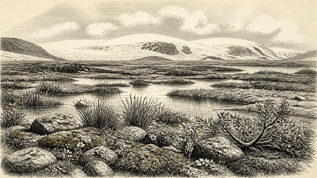
Derryvree is important because its geology supplies an unusually clear sequence. Roadworks through a drumlin exposed a lower glacial till, an intervening body of freshwater silts and fine sands containing organic matter, and a later upper till. The order matters more than any single numerical date. First, moving ice laid down the lower till. Then the place stood ice-free long enough for standing or slowly moving freshwater, vegetation, invertebrates and fine sediment to accumulate. Finally, a renewed ice advance or ice-related sedimentation buried the wetland beneath another glacial deposit.
That evidence does not prove that all Ireland was ice-free at once. Derryvree records conditions in one sheltered Fermanagh basin, not a complete map of the island. Yet it decisively complicates any simple picture of uninterrupted glaciation. At some point during the wider cold phase, the Fermanagh interior included a low-lying wetland environment. Older classifications called this the Derryvree Cold Phase or Derryvree Interstadial. The latter word should not be allowed to suggest woodland warmth: the biological record indicates a treeless, severe environment, with muskeg-like wet ground rather than forest.
Plants at the Cold Water’s Edge
The organic silts preserve plant remains that are especially valuable because they describe habitat directly. Mosses, sedges and aquatic plants indicate shallow fresh water and saturated margins. Finds reported from the deposit include bogbean, water-milfoil, dwarf willow, mountain-avens, rosy saxifrage and other plants now associated with cold or alpine conditions. Their combination points to a mosaic of pools, seepages, sedge-rich ground and stony, sparsely vegetated slopes. Summer growth was possible, but the wider climate was too harsh for closed woodland.
This was not empty ground. In the brief growing season, water plants and mosses occupied the basin while low shrubs and herbs sheltered close to the soil beyond it. Such a landscape would have changed markedly through the year. Thawwater, frost heave, snow cover and seasonal flooding mattered more than the stable rivers, pasture and field boundaries of historic Ireland. The Derryvree sediments also preserve traces of small animals and insects, reminders that even a cold, treeless landscape sustained a food web. The wetland was a local refuge of moisture and vegetation within a wider periglacial world.
Cork Caves and Ice-Age Fauna
County Cork provides a second, very different window onto Ireland during this broad pre-Last Glacial Maximum era. Castlepook Cave, near Doneraile in the Blackwater catchment, yielded a remarkable old collection of animal bones. Modern redating has demonstrated that some remains are substantially older than earlier laboratory results suggested. The cave assemblage includes evidence for woolly mammoth, reindeer, giant deer, brown bear, spotted hyaena, wolf, Arctic fox, hare and lemmings, though the animals did not necessarily occupy the cave, or even live in the surrounding countryside, at the same time.
The distinction is essential. Caves are powerful archives but imperfect diaries. Carnivores could drag bones inside; water could move sediments and mix material; early excavations did not meet modern recording standards. Direct radiocarbon dates establish the ages of particular bones, not a neatly ordered living community. Nevertheless, the Castlepook material establishes that Ireland supported, or was reached by, a varied mammoth-steppe and tundra fauna during parts of Marine Isotope Stage 3. Reindeer and cold-adapted small mammals fit the open conditions indicated at Derryvree, while mammoth and hyaena demonstrate ecological links with the larger north-west European world.
The Human Question
One Castlepook reindeer femur has been interpreted as bearing a cut or chop mark made by a sharp stone tool while the bone was fresh. County Cork heritage work places the specimen broadly around 31,000 BCE, close to the period represented by this article. If that interpretation withstands further testing, it would be extraordinarily important: it would suggest that people reached Ireland and processed a reindeer far earlier than the long-established terminal-Pleistocene evidence for human activity on the island.
It remains a promising but limited claim, not proof of a settled population. The bone comes from an old and complicated cave collection rather than a securely excavated camp floor. No associated hearth, stone-tool assemblage, dwelling, human burial or substantial processing area of comparable age has been recovered in Ireland. Nor can one marked bone identify the hunters, show whether they killed the animal, establish how long they stayed, or demonstrate repeated visits. The responsible conclusion is that human presence around this broad period is possible and potentially evidenced, but not securely documented as a permanent occupation.
Society Beyond Recovery
There is consequently no basis for describing an Irish polity, leaders, diplomacy, warfare, territorial boundaries, religion or artistic tradition in 30,615 BCE. No settlement is known from this time, and no language, personal name, kin group or ritual site can be recovered. Equally, there is no evidence for farming, herding, metalworking, trade goods or organised exchange within Ireland. These are absences in the present record, not evidence that every human visitor elsewhere in the region lacked social or cultural complexity.
If people did enter Ireland, their most plausible activity was highly mobile hunting, scavenging or carcass processing within a cold-season landscape shared with dangerous predators. That is an interpretation based on the reindeer bone and on comparable Upper Palaeolithic lifeways elsewhere in Europe, not a directly excavated Irish campsite. The dependable evidence is more modest: large herbivores and predators moved through Irish environments; water and vegetation occupied at least some ice-free basins; and any human trace remains exceptionally sparse.
An Island Connected by Ecology
Ireland’s precise physical connection to Britain and continental Europe at particular moments in this period remains debated. Sea level was much lower than today, but lowered seas do not automatically demonstrate a dry land bridge or a particular route of movement. The presence of large mammals shows that animal dispersal occurred in the wider Late Pleistocene, yet it cannot by itself specify exactly how, when or along which corridor each species arrived. The Irish Sea basin, changing ice margins and fluctuating sea levels all shaped possibilities.
What can be said is that Ireland was not ecologically isolated in the absolute sense. Its cold-adapted plants and animals belonged to wider north-west European patterns. Fermanagh’s buried fen and Cork’s cave faunas preserve different parts of that shared world: one a local freshwater landscape, the other a long-accumulated record of animal presence. Both survived largely because later ice and sediment sealed them, even as glacial erosion erased much of the surface evidence that might otherwise have revealed camps, tracks or open-air hunting places.
What This Year Represents
The best historical image for 30,615 BCE is therefore not an invented episode but a landscape in transition. In Fermanagh, cold freshwater lay among sedges, mosses and low Arctic-alpine plants during an ice-free interval. In southern Ireland, large mammals inhabited or passed through open country during the same broad climatic age, leaving bones that later entered caves. Glaciers would return and bury some of these environments, ensuring both their preservation and their fragmentation.
That fragmentation defines the period. Derryvree supplies a calibrated environmental window, not an annual chronicle. Castlepook offers compelling faunal evidence and a tentative indication of human action, not a confirmed settlement. Around this date, Ireland’s history is the history of ice, water, plants and animals, with the possibility of fleeting human footsteps at the edge of what the evidence can securely show.
Primary Sources
- A Middle Midlandian Freshwater Series at Derryvree, Maguiresbridge, County Fermanagh, Northern Ireland
- Exploring Controls of the Early and Stepped Deglaciation on the Western Margin of the British Irish Ice Sheet
- A Reconsideration of the Radiocarbon Dating of the Marine Isotope Stage 3 Fauna from Southern Ireland
- The Irish Quaternary Fauna Project
- Late Pleistocene Chronostratigraphy and Ice Sheet Limits, Southern Ireland
- The IntCal20 Northern Hemisphere Radiocarbon Age Calibration Curve (0–55 cal kBP)
- The IntCal20 Approach to Radiocarbon Calibration Curve Construction: A New Methodology Using Bayesian Splines and Errors-in-Variables
- Marine20—The Marine Radiocarbon Age Calibration Curve (0–55,000 cal BP)
- Figure 6: The Subdivision of the Quaternary Period in Ireland
- The Stratigraphic Position and Age of the Gortian Interglacial Deposits
- Late Pleistocene Chronostratigraphy and Ice Sheet Limits, Southern Ireland
- Construction of an Evolutionary Deglaciation Model for the Last British-Irish Ice Sheet
- The Deglaciation of the Western Sector of the Irish Ice Sheet from the Inner Continental Shelf to its Terrestrial Margin
- Trimlines, Blockfields and the Vertical Extent of the Last Ice Sheet in Southern Ireland
- The Role of Ocean and Atmospheric Dynamics in the Marine-Based Collapse of the Last Eurasian Ice Sheet
- Dating Constraints on the Last British-Irish Ice Sheet: A Map and Database
- Heritage Artefacts of County Cork
- New Insights on the Fauna of Ireland's Younger Dryas and Early Holocene from Alice & Gwendoline Cave
- First Evidence of a Late Upper Palaeolithic Human Presence in Ireland
- Our Ancient Landscapes: Hunter-Gatherers in Ireland