Mossy Fen30583 BCE
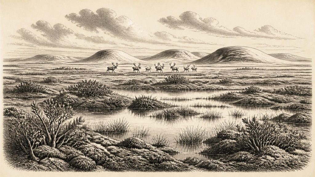
About 30,583 BCE, Ireland cannot be described through a single dated event, but Derryvree Fen in County Fermanagh offers evidence for the wider Late Pleistocene environment. Deposited during an ice-free interval around 36,900–31,700 cal BP, its organic silts preserve freshwater plants, sedges, mosses and alpine vegetation, indicating open, cold tundra-steppe with pools and wet ground. Cave finds show that mammals including reindeer, mammoth, hyaena and wolves periodically reached Ireland. A possibly cut-marked reindeer bone suggests human visits, not confirmed settlement. Later expansion of the British–Irish Ice Sheet buried and destroyed much evidence, making Derryvree a rare pre-glacial environmental archive valuable.
Dateline
The modern label 30,583 BCE cannot identify an event in Ireland. No calendar, written record, named community or securely dated settlement permits history at that resolution. In archaeological terms, it falls about 32,532 calibrated years before present (cal BP, where “present” is 1950), within the Late Pleistocene and Marine Isotope Stage 3. Evidence can illuminate broad intervals, rather than a single year: the most relevant Irish environmental record, the Derryvree deposit near Maguiresbridge in County Fermanagh, has been calibrated to roughly 36,900–31,700 cal BP. It therefore provides an unusually close, though still time-averaged, view of Ireland around this notional date.
A Fen Buried by Ice
Derryvree was revealed in 1969 when roadworks cut through a drumlin, one of the streamlined hills moulded by moving glacier ice that are so characteristic of Fermanagh. Beneath one mass of glacial till and above another lay a sequence of fine sands and organic silts: the remains of freshwater and wet ground that existed during an ice-free interval before a later advance buried it. This is the central fact for Ireland at this date. The island was not uniformly sealed beneath the ice sheet familiar from the height of the last glaciation. At least in this part of Fermanagh, there was exposed land, standing or slow-moving water, vegetation, and animal life.
The original radiocarbon measurement from the organic material, Birm-166, was 30,500 radiocarbon years BP, with a substantial statistical uncertainty. Calibration converts that conventional radiocarbon determination into a much broader calendar range, approximately 36.9–31.7 thousand cal BP. Such calibration is essential: radiocarbon years are not identical to calendar years, because atmospheric carbon-14 has varied over time. The result does not mean that the Derryvree fen formed continuously throughout those five millennia, or that every plant and animal from it lived together. It means that the deposit securely places a cold, ice-free Fermanagh landscape in the same broad climatic world as 30,583 BCE.
Open Ground, Cold Water
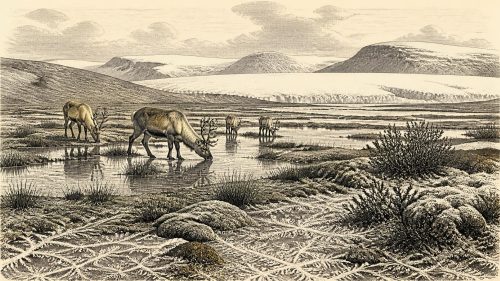
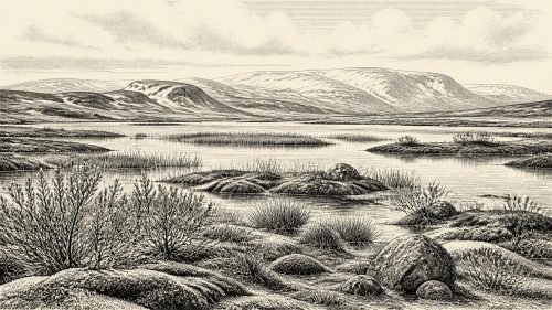
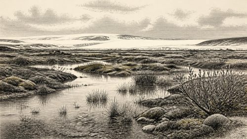
The plants preserved in the silts give the clearest picture. They include mosses, sedges and aquatic species, alongside cold-adapted or alpine plants such as mountain-avens, dwarf willow and alpine sandwort. Bogbean and water-milfoil indicate freshwater habitats. Taken together, pollen, seeds and other macrofossils support an interpretation of open tundra or tundra-steppe, broken by wet hollows, pools and sedge-rich margins. This was not modern Ireland with its Atlantic woods, hedgerows and pasture. Tree cover, if present locally at all, was extremely limited; the ecological emphasis was on low vegetation able to withstand cold, wind, seasonal freezing and a short growing season.
Yet “tundra” should not be mistaken for an empty frozen plain. Derryvree’s aquatic and marsh plants show that water remained available during part of the year. Summer thaw, shallow pools and saturated ground made particular places biologically productive. The landscape was heterogeneous: exposed mineral ground and frost-disturbed slopes lay near damp mossy ground, sedgebeds and small freshwater basins. Permafrost or intensely seasonal frost was likely important, but the evidence does not justify assigning a precise temperature, snowfall total or annual weather pattern to 30,583 BCE.
Regional comparison reinforces this cautious reading. Speleothems in south-west Irish caves formed episodically during Marine Isotope Stage 3, suggesting repeated changes in moisture and climate rather than a stable, uniformly severe environment. Meanwhile, the later Last Glacial Maximum was still ahead. Modern reconstructions show that the British–Irish Ice Sheet grew and shifted in complex, regionally uneven ways between about 31,000 and 15,000 years ago. Derryvree records a landscape that would eventually be overridden by ice, but it must not be treated as a simple snapshot of the whole island.
Animals on the Atlantic Edge
Animal bones from Irish caves demonstrate that Late Pleistocene Ireland supported a far richer fauna than the island does today. The Irish Quaternary Fauna Project dated specimens from cave collections and found that a range of mammals reached Ireland between at least about 45,000 and 20,000 years ago. Castlepook Cave, near Doneraile in north County Cork, is especially important. Its old excavated collections include mammoth, reindeer, spotted hyaena, wolf, fox, hare and other remains; other Irish localities add evidence for species such as red deer and lemmings.
These cave assemblages require careful handling. Most were recovered in nineteenth- and early twentieth-century excavations, often before modern standards of stratigraphic recording, and they accumulated over long periods through carnivore activity, natural deaths, water movement and human disturbance. A mammoth bone or hyaena skull from Castlepook cannot be made to describe the precise conditions of one year in Fermanagh. Nonetheless, the dated fauna establishes that Ireland was periodically accessible to large mammals and their predators during this part of the last Ice Age. Reindeer are particularly compatible with the open, cold-ground environments suggested by Derryvree; hyaenas and wolves indicate predator–scavenger systems able to exploit substantial herbivore populations.
The geography of access remains an important uncertainty. Lower sea levels changed the shape of the Irish Sea basin and exposed more continental shelf than today. Ireland was closer, in geographical and ecological terms, to Britain and north-western Europe, but research does not establish a simple, permanent dry-land corridor at every point in this period. Animals and, if present, people may have crossed shifting combinations of coastal plain, sea ice, narrow channels or temporary land connections. The evidence is stronger for repeated movement into Ireland than for any one route.
The Castlepook Human Question
The most consequential possible human evidence is a reindeer femur from Castlepook Cave. Public reports and County Cork heritage material describe a deep mark on the bone as consistent with cutting or chopping by a stone tool, and report an age of about 33,000 years ago for the animal. If the mark is confirmed as human-made and contemporaneous with the fresh bone, it would be Ireland’s earliest known indication that people processed an animal, many millennia before the well-established post-glacial settlement record.
Its significance should not be exaggerated. The bone is not part of a newly excavated, sealed occupation floor accompanied by a hearth, stone-tool assemblage, dwelling, human remains or a sequence of food refuse. The radiocarbon date establishes when the animal died, not the exact moment when a surface mark was made. Nor does a single marked bone prove a resident population, a named culture, or continuous occupation. Around 30,583 BCE, the responsible conclusion is that Ireland may have been visited by Upper Palaeolithic people within the wider Late Pleistocene interval, but a settled human presence cannot yet be demonstrated.
No Polities, No Proven Trade
There is no evidence for political institutions, rulers, diplomacy, warfare between communities, religious monuments, formal burial grounds, art, language or learning in Ireland at this date. This is not a deficiency of imagination; it is a limit imposed by the surviving record. Even if small mobile groups occasionally reached the island, their social organisation, beliefs and identities are unknown. Analogies with contemporaneous hunter-gatherers elsewhere in Europe may suggest that cooperation, kin networks, seasonal movement and detailed environmental knowledge mattered, but those are interpretations, not facts demonstrated for Ireland.
Likewise, trade cannot responsibly be reconstructed. No securely dated Irish assemblage of exchanged materials, tools or ornaments belongs to this interval. What can be said is more modest: large mammals, predators and perhaps people occupied a north-west European zone whose coastlines and ice margins were changing. Ireland was not historically isolated in the modern sense, but neither can its connections be mapped as routes of commerce or diplomacy.
A Landscape Before the Maximum
The most important development around this notional year was environmental, not political. Derryvree preserves evidence that northern Ireland contained an open, cold, freshwater-influenced landscape during Marine Isotope Stage 3. Castlepook and other fossil sites show that Ice Age animals entered the island over a long span. A possible cut-marked reindeer bone raises the prospect of very early human activity, while also demonstrating why evidential standards matter.
Within several thousand years, the last British–Irish Ice Sheet would expand to cover much, and perhaps nearly all, of Ireland at its maximum. That later ice did more than reshape the land: it eroded, transported and buried deposits, drastically reducing the chances that campsites, hearths or footprints from this earlier interval survived. The Derryvree fen is therefore valuable precisely because it escaped complete destruction long enough to be sealed beneath till. It is not a chronicle of a single year, but a rare archive of a living Irish Ice Age landscape before the advancing ice transformed it.
Source References
Hover over a number to see the source. Select it to open the source.

- [1] A Middle Midlandian Freshwater Series at Derryvree, Maguiresbridge, County Fermanagh, Northern Ireland
- [2] The Irish Quaternary Fauna Project
- [3] Growth and Retreat of the Last British–Irish Ice Sheet, 31,000 to 15,000 Years Ago: The BRITICE-CHRONO Reconstruction
- [4] Timing, Pace and Controls on Ice Sheet Retreat: An Introduction to the BRITICE-CHRONO Transect Reconstructions of the British–Irish Ice Sheet
- [5] Pattern and Timing of Retreat of the Last British-Irish Ice Sheet
- [6] Dimensions and Chronology of the Last Ice Sheet in Western Ireland
- [7] Radiocarbon Constraints on the Age of the Maximum Advance of the British–Irish Ice Sheet in the Celtic Sea
- [8] New Data for the Last Glacial Maximum in Great Britain and Ireland
- [9] Reconstructing the Last Irish Ice Sheet 2: A Geomorphologically-Driven Model of Ice Sheet Growth, Retreat and Dynamics
- [10] Periglacial Trimlines and the Extent of the Kerry-Cork Ice Cap, SW Ireland
- [11] Character of Advance and Retreat of the Southwest Sector of the British-Irish Ice Sheet During the Last Glaciation
- [12] Extent and Retreat History of the Barra Fan Ice Stream Offshore Western Scotland and Northern Ireland During the Last Glaciation
- [13] Episodic Speleothem Deposition Tracks the Terrestrial Impact of Millennial-Scale Last Glacial Climate Variability in SW Ireland
- [14] Irish Red Deer: Phylogeographic, Genetic and Phenotypic Analyses Reveal Their Complex History
- [15] Archaeological Heritage of County Cork
- [16] Ireland’s Palaeolithic Archaeology – Fleeting Footprints in a Frozen Land
- [17] Reindeer Bone Found in Cork Cave Shows Human Activity in Ireland 33,000 Years Ago
- [18] Pleistocene Vertebrates in the British Isles
- [19] The Late Quaternary History of East-Central Ireland
- [20] British-Irish Ice Sheet Research: BRITICE-CHRONO
Primary Sources
- A Middle Midlandian Freshwater Series at Derryvree, Maguiresbridge, County Fermanagh, Northern Ireland
- The Irish Quaternary Fauna Project
- Growth and Retreat of the Last British–Irish Ice Sheet, 31,000 to 15,000 Years Ago: The BRITICE-CHRONO Reconstruction
- Timing, Pace and Controls on Ice Sheet Retreat: An Introduction to the BRITICE-CHRONO Transect Reconstructions of the British–Irish Ice Sheet
- Pattern and Timing of Retreat of the Last British-Irish Ice Sheet
- Dimensions and Chronology of the Last Ice Sheet in Western Ireland
- Radiocarbon Constraints on the Age of the Maximum Advance of the British–Irish Ice Sheet in the Celtic Sea
- New Data for the Last Glacial Maximum in Great Britain and Ireland
- Reconstructing the Last Irish Ice Sheet 2: A Geomorphologically-Driven Model of Ice Sheet Growth, Retreat and Dynamics
- Periglacial Trimlines and the Extent of the Kerry-Cork Ice Cap, SW Ireland
- Character of Advance and Retreat of the Southwest Sector of the British-Irish Ice Sheet During the Last Glaciation
- Extent and Retreat History of the Barra Fan Ice Stream Offshore Western Scotland and Northern Ireland During the Last Glaciation
- Episodic Speleothem Deposition Tracks the Terrestrial Impact of Millennial-Scale Last Glacial Climate Variability in SW Ireland
- Irish Red Deer: Phylogeographic, Genetic and Phenotypic Analyses Reveal Their Complex History
- Archaeological Heritage of County Cork
- Ireland’s Palaeolithic Archaeology – Fleeting Footprints in a Frozen Land
- Reindeer Bone Found in Cork Cave Shows Human Activity in Ireland 33,000 Years Ago
- Pleistocene Vertebrates in the British Isles
- The Late Quaternary History of East-Central Ireland
- British-Irish Ice Sheet Research: BRITICE-CHRONO