Derryvree’s Coldwater Mosaic30536 BCE
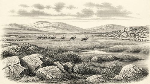
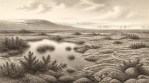
Around 30,536 BCE, a modern and imprecise label, Ireland was a cold, changing Upper Palaeolithic landscape rather than a documented human society. At Derryvree, County Fermanagh, freshwater silts between glacial tills preserve evidence of ice-free intervals: pools, mosses, sedges, herbs and tundra-like plants in a periglacial mosaic. Growing ice later buried these deposits, preceding major British-Irish Ice Sheet expansion. Cave fauna from County Cork, including mammoth, reindeer and predators, shows intermittent ecological connections with Europe. A possibly cut-marked reindeer bone suggests human passage, but no secure settlements, tools or communities are known. Environmental evidence, not national history, defines this period.
Dateline
30,536 BCE is a modern calendar label, not a date that can be recovered from Irish Ice Age evidence with anything like year-by-year precision. It corresponds approximately to 32,485 years before AD 1950, the conventional baseline for “cal BP” dating. At this depth of time, the responsible history of Ireland is reconstructed from sediments, fossil plants, insect remains, cave bones, ice-sheet models and radiocarbon measurements with wide uncertainties. There are no Irish settlements, tools, graves, names or political traditions securely dated to this notional year. What can be described is a changing northern landscape near the threshold of a major climatic shift.
A Date Within a Long Climate Record
The date falls within the Upper Palaeolithic and the later part of Marine Isotope Stage 3, a long cold interval punctuated by abrupt warmings and returns to harsher conditions across the North Atlantic. Greenland ice-core chronologies place the start of Greenland Interstadial 5.2 at about 32,500 years before AD 2000, very close to the modern numerical equivalent of this entry. That is useful as a broad climatic reference point, not as proof that Ireland altered on the same day, year or even generation. Ice cores record Greenland conditions; Ireland’s response depended on its own ice margins, terrain, weather and sea levels.
Radiocarbon evidence requires still more care. A laboratory result in radiocarbon years is not a calendar date because atmospheric carbon-14 has varied through time. Calibration using the IntCal20 curve translates measurements into calendar-age probability ranges, but it cannot turn a sample more than 30,000 years old into an annual historical date. The uncertainty of the dated material, its archaeological context and the calibration curve all matter. At this scale, phrases such as “around 30,536 BCE” should mean a broad interval, never a precise episode in the lives of people or animals.
Fermanagh’s Buried Freshwater Bed
The clearest Irish environmental evidence relevant to this broad period comes from Derryvree, near Maguiresbridge in County Fermanagh. Road works in 1969 cut through a drumlin and revealed organic silts and fine sands trapped between two thick deposits of glacial till. This sequence mattered because it showed that, after an earlier glaciation had laid down the lower till, the site became ice-free long enough for freshwater sediments and vegetation to accumulate before a later ice advance buried them.
Organic matter from the moss-rich bed produced the conventional radiocarbon determination BIRM-166: 30,500 radiocarbon years BP, with an uncertainty of roughly a millennium. The result is a legacy measurement rather than a modern, high-precision date, and it is not a direct date for 30,536 BCE. Its calibrated equivalent is necessarily broad, reaching into the mid-to-late 30,000s cal BP. Nonetheless, Derryvree provides robust local evidence for the kind of cold, open and intermittently wet landscape that had existed in inland Ulster before the last great expansion of the British–Irish Ice Sheet. It is an environmental archive, not a camp site.
Pools, Mosses and Open Ground
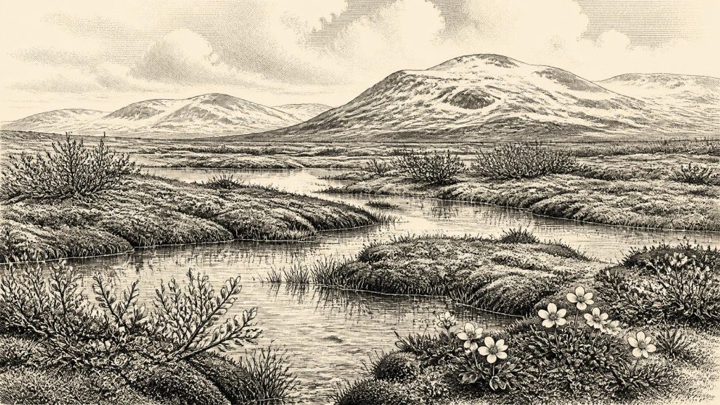
The Derryvree deposit preserves pollen, seeds, mosses and insect evidence. Together they point to a treeless, periglacial setting: ground affected by severe cold, seasonal freezing and thawing, and sparse plant cover rather than forest. Grasses and sedges, juniper and assorted herbs were recorded, while plant macrofossils included alpine and wetland species. Mountain avens, dwarf willow, bogbean and water-milfoil are especially informative. Their presence does not mean that every part of Ireland resembled a modern Arctic landscape, but it does show that sheltered freshwater margins could support a varied plant community despite a generally rigorous climate.
The best reconstruction is therefore a mosaic. There were open pools and shallow water, mossy and sedgy margins, wet hollows rich in decaying vegetation, and more exposed mineral ground where vegetation was thin. Such places may have been particularly important to insects and grazing animals, while also preserving organic remains that would usually perish. The evidence does not support a wooded Ireland, cultivated land, permanent villages or a familiar modern coastline. It supports a cold landscape in which local topography and water created small ecological refuges.
Ice Was Growing, Not Yet All-Defining
Ireland was approaching the period in which the last British–Irish Ice Sheet grew dramatically. BRITICE-CHRONO research indicates major ice-sheet development from about 31,000 to 26,000 years ago, followed by maximum ice volume later, around 23,000 years ago. At the horizon represented by this entry, it is misleading to picture the entire island as a single unbroken white cap, yet it would be equally misleading to imagine a stable ice-free country. Ice masses, cold-based ground, proglacial drainage and changing sea levels were reshaping the wider region.
The later glacier that crossed Derryvree sealed the freshwater bed beneath till. That stratigraphic fact is powerful: it records an ice-free environmental interval followed by renewed glaciation. It does not identify the precise extent of ice across every Irish county at one calendar date. Reconstructions of the ice sheet are models assembled from landforms, sediments and geochronological measurements. They are indispensable, but their mapped margins should be read as evidence-based ranges rather than exact boundary lines.
Animals of the Southern Caves
County Cork caves provide another view of pre-Last Glacial Maximum Ireland. Castlepook Cave, near Doneraile and also known as Mammoth Cave, has yielded bones of woolly mammoth, reindeer, giant deer, brown bear, wolf, Arctic fox and spotted hyaena, alongside smaller cold-adapted mammals. Modern reassessment and redating have demonstrated that at least part of this fauna belongs to Marine Isotope Stage 3, although the old excavations and disturbed cave deposits make individual associations difficult to untangle. Bones recovered from nineteenth- and early twentieth-century digging cannot automatically be treated as one undisturbed assemblage or one moment in time.
Even so, the fauna establishes an essential point: Ireland was not biologically isolated from north-western Europe during every phase of the Late Pleistocene. Large mammals reached the island during favourable windows, presumably across changing land and sea routes in a world of lower sea levels and shifting ice barriers. Their occurrence indicates habitats capable of sustaining grazers, browsers, predators and scavengers. It does not establish annual migrations, herd sizes, a particular route from Britain, or a continuous animal population in every region.
The Human Question
Castlepook is also central to the much more tentative question of people. A reindeer femur from the cave has been reported as bearing a deep mark consistent with the use of a sharp stone tool on fresh bone. The bone has been presented as approximately 33,000 years old and, if the modification is confirmed as human butchery and is securely associated with the bone’s age, it would be evidence that Upper Palaeolithic people handled a reindeer in Ireland tens of millennia before the formerly accepted post-glacial human record.
That conditional language is vital. A single possible butchery mark is not a settlement, a lithic industry, a house floor, a burial ground or proof of a resident population. Cave assemblages can be affected by carnivores, water, collapse, excavation methods and later disturbance. No securely dated tools or occupation surface demonstrate a community in Ireland at 30,536 BCE. The sound conclusion is narrower but still significant: people may have made brief visits to, or passed through, an island that supported cold-stage fauna; their presence at this particular point in time remains unproven.
Society Beyond Recovery
For that reason, political affairs, diplomacy, organised conflict, named leaders, religion and trade cannot be written as Irish history for this date. No evidence identifies a polity, territory, alliance, language, ritual site or exchange network. It is reasonable to note that Upper Palaeolithic hunter-gatherers elsewhere in Europe possessed sophisticated stone technologies, social networks and symbolic traditions. It is not reasonable to transfer those practices wholesale to Ireland merely because a reindeer bone may preserve human modification.
Everyday life can likewise be approached only through ecological possibility. If people were present, their immediate concerns would probably have included mobility, shelter, fire, animal resources and the risks of a cold and exposed environment. These are inferences from human biology and comparative archaeology, not discoveries from an Irish household. Ireland’s direct record is quieter: the Derryvree pools and mosses, the buried tills, and the animal remains in southern caves.
An Environmental, Not National, Past
The most meaningful development around this notional year was environmental instability. Freshwater habitats and tundra-like vegetation demonstrate that parts of Ireland could be ice-free and ecologically productive during the wider cold stage. Yet the accumulating power of the British–Irish Ice Sheet would later erase, bury or rework much of the landscape, helping to explain why the archaeological record is so slight. Around 30,536 BCE, Ireland is best understood not as a nation waiting for its first history, but as a dynamic Pleistocene landscape whose fossil archives preserve fleeting evidence of water, plants, animals, ice and perhaps human passage.
Primary Sources
- A Middle Midlandian Freshwater Series at Derryvree, Maguiresbridge, County Fermanagh, Northern Ireland
- Palaeoecology: Irish Quaternary Association Field Guide
- The Subdivision of the Quaternary Period in Ireland
- Growth and Retreat of the Last British–Irish Ice Sheet, 31,000 to 15,000 Years Ago: The BRITICE-CHRONO Reconstruction
- BRITICE-CHRONO Maps and GIS Data of the Last British-Irish Ice Sheet 31 to 15 ka
- The Timing and Magnitude of the British–Irish Ice Sheet Between Marine Isotope Stages 5d and 2
- A Reconsideration of the Radiocarbon Dating of the Marine Isotope Stage 3 Fauna from Southern Ireland
- The Irish Quaternary Fauna Project
- New Insights on the Fauna of Ireland’s Younger Dryas and Early Holocene from Alice & Gwendoline Cave
- The Exploration of Castlepook Cave, County Cork
- Occurrence of Mammalia Relicts at Site Castlepook Cave
- Castlepook Cave Excavation, County Cork, 2022
- Mammoth Cave, County Cork
- Heritage Artefacts of County Cork
- Menyanthes trifoliata
- Dryas octopetala
- The IntCal20 Northern Hemisphere Radiocarbon Age Calibration Curve (0–55 cal kBP)
- Radiocarbon Dating and Chronological Modelling
- A Stratigraphic Framework for Abrupt Climatic Changes During the Last Glacial Period Based on Three Synchronized Greenland Ice-Core Records
- Consistently Dated Atlantic Sediment Cores Over the Last 40 Thousand Years
- Trimlines, Blockfields and the Vertical Extent of the Last Ice Sheet in Southern Ireland
- Exploring Controls of the Early and Stepped Deglaciation on the Western Margin of the British-Irish Ice Sheet