Derryvree’s Intertill Chronicle30525 BCE
Around 30,525 BCE, Ireland lay within a volatile Late Pleistocene glacial margin. Derryvree in County Fermanagh preserves freshwater sediments between tills, showing a locally ice-free interval with wetland plants, insects and open, treeless periglacial habitats. Radiocarbon evidence dates the organic deposit broadly to 36,900–31,700 calibrated years BP, precluding annual precision. Later ice reshaped and sealed this record. Cave fauna indicate Ice Age mammals, although assemblages are complex. A modified reindeer bone at Castlepook may indicate human activity, but no secure habitation evidence exists. The period had no settlements, farming, states or written history; it remains a cold, fragmentarily recoverable landscape.
Dateline
“30,525 BCE” is a useful point on a modern chronological grid, but it cannot denote a recorded Irish year. No calendar, settlement sequence or historical event can be fixed to that precise date. This article therefore concerns Ireland in the broad interval around it: the later part of Marine Isotope Stage 3, long before the Last Glacial Maximum. The nearest substantial Irish environmental archive is at Derryvree, near Maguiresbridge in County Fermanagh, where freshwater sediments were preserved between two layers of glacial till. A conventional radiocarbon determination from the organic deposit, BIRM-166, was 30,500 radiocarbon years before present, with a large uncertainty. Modern calibration places it broadly within about 36,900–31,700 calibrated years BP. The nominal year 30,525 BCE, roughly 32,475 years before AD 1950, lies within that broad span, but not at a precision that permits an annual narrative.
A Wetland Between Ice Advances
Derryvree is important because its layers record a sequence rather than a single moment. An earlier glacier deposited the lower till: dense, unsorted material containing clay, stones and debris moved by ice. Afterwards, at least locally, glacier ice no longer occupied the hollow. Fresh water accumulated, and silts, fine sands and organic matter settled on its bed. Later, ice or ice-proximal glacial processes laid down a second thick till above it, sealing the deposit within the drumlin landscape of Fermanagh.
That sequence establishes a limited but vital fact. During part of the dated interval, the Derryvree locality was not continuously buried beneath glacier ice. It does not prove that all Ireland was ice-free at once, nor that its climate was benign. It does show that an Irish freshwater setting persisted between glacial episodes, and that plants, insects and sedimentary processes were active there. The later ice advance both transformed the wider terrain and, unusually, preserved this small window into an older landscape beneath it.
At this date Ireland belonged to a volatile North Atlantic world. The great ice sheets had not yet reached their fullest Late Pleistocene extent. That maximum is generally placed much later, around 26,000–20,000 years ago, with the British–Irish Ice Sheet expanding across much of Ireland and onto the surrounding continental shelf. The island around 30,525 BCE was instead part of a changing glacial margin: cold episodes, local ice growth, ice-free intervals, seasonal meltwater and abrupt climatic reversals all belong to the proper scale of explanation.
Cold Open Country
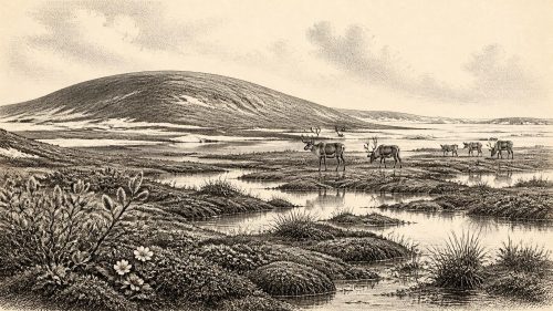
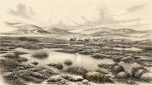
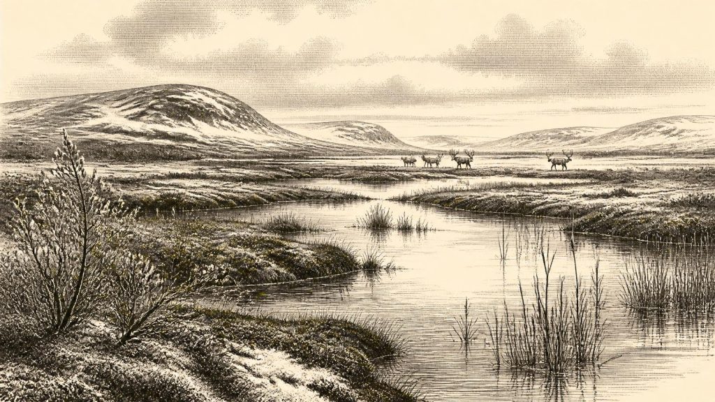
Plant macrofossils, pollen and insect remains from the Derryvree freshwater series have been interpreted as evidence for an open, treeless and strongly periglacial environment. Mosses, sedges, grasses, herbs and small shrubs occupied wet ground around shallow water. Among the plants identified or inferred from the record are taxa suited to cold, exposed or waterlogged conditions, including bogbean, dwarf willow, mountain avens and water-milfoil. Their presence should not be turned into a photographic reconstruction of one day or one season. Deposits accumulate over time, and the catchment supplying them may be wider than the pond itself. Nevertheless, the combined evidence is powerful: this was not the wooded Ireland familiar from later prehistory.
“Tundra” is a useful shorthand only if used carefully. The evidence points to a mosaic of wet hollows, sedgy margins, shallow fresh water, mossy ground, frost-disturbed surfaces and more freely drained patches, rather than an entirely uniform plain. Permafrost or deeply seasonally frozen ground may have affected drainage and vegetation. Summers could still bring a concentrated burst of plant growth, insects and open water, while winter imposed prolonged cold and exposure. The ecological rhythm was governed by seasonality, not by the mild maritime weather of modern Ireland.
The Derryvree archive also demonstrates why the later appearance of drumlins should not be mistaken for a simple record of one ice advance. A drumlin can enclose sediments formed during different conditions. In this case, the rounded landform visible in the modern Fermanagh countryside incorporates a buried freshwater history. Glacial landscapes are therefore not merely scenery; they are layered records of erosion, deposition, thaw and renewed ice movement.
Animals and a Fragmentary Fauna
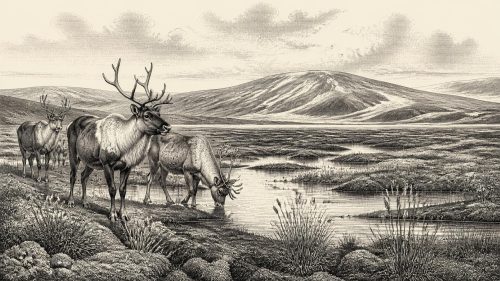
Ireland’s cave and open-air fossil record for this remote period is sparse, often disturbed by old excavations and later geological processes. It nevertheless indicates that Ice Age mammals at various times used the island or its connected landscapes. Castlepook Cave near Doneraile, County Cork, is especially important. Its deposits produced remains attributed to reindeer, horse, wolf, brown bear, arctic fox, lemmings, spotted hyaena and woolly mammoth. Not every species need have lived together at precisely the same time, and cave deposits can gather bones through carnivore activity, natural death, water movement and excavation disturbance. The assemblage should therefore be read as a long and complex faunal archive, not a single contemporary herd.
Reindeer are particularly relevant to an open cold landscape, but their presence does not make Ireland a guaranteed hunting ground in 30,525 BCE. Mobile herbivores would have followed seasonal food, snow conditions and routes across a changing territory. Carnivores could have scavenged, hunted or carried remains into caves. A population of large animals is plausible only in relation to the productivity of grassland, herbs, wetland vegetation and sheltered ground; it does not imply dense wildlife everywhere.
Sea levels were far lower than today because so much water was held in global ice sheets. Ireland’s coastlines and surrounding seas consequently differed profoundly from the modern map. Yet lower sea level should not be confused with a simple permanent land bridge to continental Europe. The geography of the Irish Sea basin, local ice extent and the timing of sea-level change mattered. Any animal or human movement to Ireland must be considered in relation to this changing, sometimes glaciated, maritime frontier rather than imagined as travel across a stable plain.
The Human Question
There is no securely excavated habitation site, hearth, house floor, human burial or stone-tool assemblage in Ireland that can be assigned to around 30,525 BCE. Political institutions, diplomatic relations, named communities, warfare and formal religion are therefore beyond the evidence. It would be misleading to invent a tribe, chiefdom or seasonal camp merely because Upper Palaeolithic hunter-gatherers were active elsewhere in north-west Europe.
One discovery makes the question worth keeping open. A reindeer femur from Castlepook Cave has been radiocarbon dated to roughly 33,000 years ago and bears a deep linear modification interpreted by its principal investigator as a possible mark made by a stone tool on fresh bone. If that interpretation is sustained, it would provide evidence that people handled or butchered a reindeer in Ireland before the Last Glacial Maximum. It would not, by itself, establish permanent settlement. Nor does the bone come from an undisturbed occupation surface with associated tools, hearths and repeated activity areas. Natural damage, carnivore action, excavation history and the exact relationship between a mark and an animal’s date are matters requiring continued scrutiny.
The responsible conclusion is consequently narrow. Human presence in Ireland around this general period is possible, and the Castlepook bone offers a significant but debated indication of it. A short-lived visit by mobile foragers would be more readily supported by such isolated evidence than a claim of established population. If people did reach the island, they would have belonged to small Upper Palaeolithic hunting and gathering groups whose social worlds, languages, beliefs and learning cannot be recovered from the Irish evidence presently available.
No States, No Trade Networks
There were no Irish kingdoms, towns, farms, written records, monuments or formal trading institutions at this time. Society, if humans were present at all, would have been organised on a scale invisible to conventional political history: kin-based travelling groups, practical knowledge of animal movement and weather, and technologies of stone, wood, hide and bone. Such statements are comparative inferences from Upper Palaeolithic Europe, not direct observations from Derryvree or Castlepook.
Likewise, there is no evidence for an Irish economy in the later prehistoric sense. No agriculture was possible because no farming communities existed here; no metalwork, pottery production or long-distance commercial network can be identified. The economy of the landscape was ecological. Plants fixed short-season energy; wetland margins concentrated growth; herbivores converted vegetation into mobile food; carnivores and scavengers participated in the same food web. For any visiting people, access to game, fuel, stone and shelter would have mattered more than ownership of land or exchange between settlements.
What This Date Can Mean
Around 30,525 BCE, the most defensible Irish story is one of environmental possibility amid severe uncertainty. Derryvree preserves evidence of fresh water, wetland plants and invertebrate life during an ice-free interval in northern Ireland, bracketed by glacial deposits. Castlepook preserves a wider but complicated record of Ice Age animals in the south, alongside a potentially important clue to human activity. Together they challenge the old picture of a featureless, permanently frozen island while also warning against easy claims of continuous habitation.
This was not a year of kings, battles or inventions. It was a phase in which the conditions for life could briefly exist in parts of Ireland before advancing ice again reshaped the terrain and erased much of what had come before. The surviving record is minute: a layer of silt, a seed, a moss fragment, an insect remain, a cave bone and a disputed incision. Their value lies precisely in their restraint. They allow Ireland’s deep past to be described not as an empty blank, but as a cold, changing and only partially recoverable world.
Primary Sources
- A Middle Midlandian Freshwater Series at Derryvree, Maguiresbridge, County Fermanagh, Northern Ireland
- The Glacial Deposits of the Maguiresbridge Area, County Fermanagh, Northern Ireland
- Exploring Controls of the Early and Stepped Deglaciation on the Western Margin of the British Irish Ice Sheet
- Growth and Retreat of the Last British–Irish Ice Sheet, 31,000 to 15,000 Years Ago: the BRITICE-CHRONO Reconstruction
- Dimensions and Chronology of the Last Ice Sheet in Western Ireland
- Late Pleistocene Chronostratigraphy and Ice Sheet Limits, Southern Ireland
- Response of the Irish Ice Sheet to Abrupt Climate Change During the Last Deglaciation
- The Timing and Magnitude of the British–Irish Ice Sheet Between Marine Isotope Stages 5d and 2
- Stratigraphic and Palaeo-Geomorphological Evidence for the Glacial-Deglacial History of the Last British-Irish Ice Sheet in the North-Western Irish Sea
- Radiocarbon Constraints on the Age of the Maximum Advance of the British-Irish Ice Sheet in the Celtic Sea
- The Irish Quaternary Fauna Project
- New Insights on the Fauna of Ireland’s Younger Dryas and Early Holocene from Alice & Gwendoline Cave
- Phylogeographic, Ancient DNA, Fossil and Morphometric Analyses Reveal Ancient and Modern Introductions of a Large Mammal: The Complex Case of Red Deer (Cervus elaphus) in Ireland
- The IntCal20 Northern Hemisphere Radiocarbon Age Calibration Curve (0–55 cal kBP)
- The Subdivision of the Quaternary Period in Ireland
- Outreach and Education Resources
- Our Ancient Landscapes: Hunter-Gatherers in Ireland
- Archaeological Heritage of County Cork
- Trimlines, Blockfields and the Vertical Extent of the Last Ice Sheet in Southern Ireland
- The Deglaciation of the Western Sector of the Irish Ice Sheet from the Inner Continental Shelf to its Terrestrial Margin