
Derryvree’s Buried Lake Margin30526 BCE
30,526 BCE is a modern reference point rather than a precisely datable Irish event. Derryvree, County Fermanagh, preserves freshwater silts between glacial tills, radiocarbon dated broadly enough to encompass this period. Its bogbean, aquatic plants, mosses and sedges indicate cold, open, wet ground during an ice-free interval, later buried by advancing ice. Ireland’s landscapes were unevenly glaciated as the British–Irish Ice Sheet grew. Cave remains, notably at Castlepook, demonstrate Pleistocene mammals including mammoth, reindeer and giant deer across a longer span. A marked reindeer bone suggests possible early human activity, but no evidence establishes permanent settlement, institutions or a community.
Dateline
“30,526 BCE” is a useful modern filing point, not a date at which an event in Ireland can be placed. No written record, calendar, ruler, settlement sequence or annually resolved archaeological layer permits that precision. In the conventional archaeological system this point lies about 32,475 years before AD 1950, in the later part of Marine Isotope Stage 3, a fluctuating interval of the last Ice Age. The responsible history of Ireland at this depth of time is therefore environmental history: a reconstruction from buried sediments, fossils, cave bones, landforms and radiocarbon measurements, rather than a narrative of named people.
A Date Within a Range
The closest Irish chronological anchor is Derryvree, near Maguiresbridge in County Fermanagh. Roadworks in 1969 exposed a drumlin sliced open by excavation. Between two separate sheets of glacial till lay freshwater silts and fine sands containing organic material. A radiocarbon determination, BIRM-166, gave an age of 30,500 ± 1,100 radiocarbon years before present. Subsequent discussion expresses its calibrated range as roughly 36,900–31,700 calendar years before present, or approximately 34,950–29,750 BCE. The requested year falls inside that broad range, but cannot be assigned to a particular bed, season or ecological episode at Derryvree.
That distinction matters. Radiocarbon ages are not calendar years, and calibration broadens rather than magically sharpens the chronology. The deposit demonstrates an ice-free freshwater interval in this part of Fermanagh sometime within a large span of late Ice Age time. It does not show that every part of Ireland was open ground simultaneously, nor that its plants and animals occupied the locality continuously. It is a valuable local record, set within an island whose ice margins, coastlines and connections changed repeatedly.
Fresh Water Beneath the Till
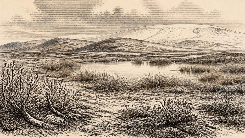
Derryvree’s buried deposit gives a rare impression of a living landscape later overridden by ice. Its fossil assemblage included remains associated with wet ground and shallow fresh water, notably bogbean (Menyanthes trifoliata), along with aquatic plants, mosses, sedges and other cold-adapted vegetation. These are direct traces of organisms that grew in or beside water; they support the interpretation of ponds, marshy margins and sluggish channels among sparsely vegetated ground. They do not justify imagining a modern bog, forest or meadow. The surrounding landscape was substantially colder, more open and more unstable than present-day Fermanagh.
Plants also set useful limits on reconstruction. Bogbean needs wet freshwater habitat, so its seed is evidence against an entirely sterile ice desert at the sampled locality. Yet a single seed cannot measure regional temperature or prove dense plant cover. Taken with pollen, mosses and other macrofossils, it indicates a patchwork: shallow water and saturated sediment in sheltered hollows, low vegetation on exposed surfaces, and ground repeatedly disturbed by frost, runoff and shifting ice margins. In such a setting, short summers could produce a conspicuous burst of growth without removing the severity of the wider climate.
Growing Ice, Uneven Country
Ireland was not simply “under ice” or “ice-free”. Research on the British–Irish Ice Sheet shows that its growth and retreat were asynchronous, varying across land and continental shelf. Around 31,000 years before present, the ice sheet was developing; its later maximum extent and volume came much later, broadly between about 27,000 and 21,000 years before present, with some reconstructions placing peak volume around 23,000 years ago. Derryvree records an earlier ice-free interval enclosed between glacial advances. The tills above and below its freshwater sediments are physical reminders that a habitable wetland could be erased and sealed by a subsequent advance.
For 30,526 BCE, then, the best regional picture is of an island-sized zone of uncertainty, not a uniform map. Some landscapes may have been glaciated or close to ice, while others retained exposed terrain, lakes, caves and river corridors. Lower global sea level altered the outlines of the Irish Sea basin and coastal plains, but the exact availability of dry crossings changed with ice, local sea level and topography. It is safer to say that routes for animals and perhaps people were episodically possible than to claim a simple, permanent land bridge.
The Animal Evidence
Cave deposits, especially in Munster, show that Ireland supported a striking Pleistocene fauna before the Last Glacial Maximum. Castlepook Cave near Doneraile, County Cork, is the richest known Irish cave archive for this period. Its bones include woolly mammoth, reindeer, giant deer, brown bear, wolf, Arctic fox, hare, lemmings and spotted hyaena. Radiocarbon dates on individual specimens extend over a long interval, rather than representing a single animal community at one moment. A mammoth rib from Elephant Hall, for example, produced a radiocarbon age of 34,100 ± 840 BP; reindeer, bear and giant-deer specimens have their own differing ages.
The fauna supports a cold, open environment capable of sustaining grazing animals and their predators, but it must be read carefully. Caves are selective archives. Carnivores could drag prey inside; animals could die naturally; water could move bones; Victorian and early twentieth-century excavation disturbed deposits; and fossils from different millennia can occur in the same gallery. Castlepook is consequently excellent evidence that such animals reached Ireland during the middle and later Ice Age, but poor evidence for a single, tidy food web in 30,526 BCE.
A Possible Human Trace
The most tantalising issue is human presence. A reindeer femur from Castlepook has been reported as bearing a deep mark interpreted by zooarchaeologist Ruth Carden as damage made while butchering with a stone tool. The bone has been presented as about 33,000 years old, potentially pushing evidence of human activity in Ireland far earlier than the terminal-Pleistocene evidence from County Clare. If the interpretation is confirmed, it would indicate that people at least handled an animal on the island during a pre-maximum Ice Age phase.
It cannot, however, sustain a story of an established Irish population in this particular year. The bone is older than the nominal 30,526 BCE point, its find context stems from early excavation, and a radiocarbon date establishes the age of the animal bone rather than automatically proving the cause of every surface mark. There is no securely associated house floor, hearth, stone-tool assemblage, burial, camp surface or sequence of occupation from Ireland dated to this interval. The evidence permits a possibility of brief human visits; it does not establish permanent settlement, population size, language, ancestry or cultural identity.
Life Beyond the Evidence
Where people may have appeared, their practical world would have been governed by mobility, weather and animal movement. Across Upper Palaeolithic north-west Europe, hunting communities used stone, bone, antler, hide and wood, moving through large territories and exploiting seasonally available resources. That wider comparison can suggest what was possible, but it must not be mistaken for evidence that Irish visitors made particular tools, built shelters, exchanged goods or followed a known route. Ireland has not yielded the material record required to describe such activities here.
Accordingly, there is no recoverable political history for this year: no chiefdoms, territories, warfare, diplomacy or institutions can responsibly be identified. Nor is there evidence for religion, ritual places, art, formal learning or long-distance trade within Ireland at this time. Caves such as Castlepook were repositories of animal remains, not demonstrated temples or settlements. Absence of evidence is not proof that no thought, kinship or custom existed among any visitors; it is a boundary on what the Irish record can say.
Settlement and Regional Change
“Settlement” should therefore mean animal occupation and environmental opportunity rather than villages. A wetland at Derryvree could have offered drinking water and summer forage. Open ground may have supported reindeer, giant deer and horse in some phases, while limestone caves provided denning places, traps for sediment and durable shelters for bones. Such local advantages were precarious. Advancing ice altered drainage, buried soils and freshwater basins, while colder conditions contracted the plant cover on which herbivores depended.
The largest development relevant to Ireland around this broad date was not human political change but the approaching reorganisation of the landscape by the growing British–Irish Ice Sheet. It would eventually overwhelm or transform much of the terrain represented by older organic horizons and cave faunas. Derryvree survives precisely because sediment and till sealed a fragment of that earlier freshwater world. Its value is not that it names an event in 30,526 BCE, but that it preserves hard evidence that Ireland’s Ice Age history contained intervals of open, watered and biologically active country before the later maximum of glaciation.
For this year, certainty lies in the method as much as in the conclusion. Fossil plants document a cold freshwater margin in Fermanagh within a calibrated range encompassing the date. Cave bones document a varied Pleistocene fauna in Ireland over a longer span. A marked reindeer bone raises the prospect of early human activity but remains insufficient to populate the island with a known community. The historical scene is compelling precisely because it is incomplete: a northern landscape of shallow water, tundra-like vegetation, large mammals and gathering ice, known through scattered archives rather than a calendar.
Primary Sources
- A Middle Midlandian Freshwater Series at Derryvree, Maguiresbridge, County Fermanagh, Northern Ireland
- The Irish Quaternary Fauna Project
- Cork County Geological Site Report: Castlepook Cave
- Growth and Retreat of the Last British–Irish Ice Sheet, 31,000 to 15,000 Years Ago: The BRITICE-CHRONO Reconstruction
- Extent and Timing of the Last Glacial Maximum (LGM) in Britain and Ireland: A Review
- The Timing and Magnitude of the British–Irish Ice Sheet Between Marine Isotope Stages 5d and 2
- Maximum Extent and Dynamic Behaviour of the Last British–Irish Ice Sheet West of Ireland
- Stratigraphic and Palaeo-Geomorphological Evidence for the Glacial-Deglacial History of the Last British-Irish Ice Sheet in the North-Western Irish Sea
- Dimensions and Chronology of the Last Ice Sheet in Western Ireland
- Trimlines, Blockfields and the Vertical Extent of the Last Ice Sheet in Southern Ireland
- Exploring Controls of the Early and Stepped Deglaciation on the Western Margin of the British Irish Ice Sheet
- Character of Advance and Retreat of the Southwest Sector of the British-Irish Ice Sheet During the Last Glaciation
- BRITICE-CHRONO Maps and GIS Data of the Last British-Irish Ice Sheet 31 to 15 ka
- BRITICE Glacial Map, Version 2: A Map and GIS Database of Glacial Landforms of the Last British–Irish Ice Sheet
- New Insights on the Fauna of Ireland's Younger Dryas and Early Holocene from Alice & Gwendoline Cave
- Castlepook Cave, Co. Cork, 2022 Excavation Report
- Archaeological Heritage of County Cork
- Learn About: The Ice Age
- Menyanthes trifoliata
- Mammoth Cave, Castlepook, County Cork
