Derryvree’s Radiocarbon Wetland30551 BCE
Around 30,551 BCE, Ireland lay within the climatically unstable late Marine Isotope Stage 3, not a recoverable historical year. Derryvree, County Fermanagh, preserves freshwater organic sediments between glacial tills, showing that an ice-free wetland interval supported tundra vegetation, aquatic plants and invertebrates before ice returned. Castlepook Cave, County Cork, contains mixed remains of mammoth, giant deer, reindeer, predators and other cold-stage fauna, demonstrating a changing ecosystem. A cut-marked reindeer femur may indicate brief Upper Palaeolithic human butchery, but cannot prove settlement. Radiocarbon ranges, disturbed contexts and subsequent glaciation limit certainty; evidence chiefly documents shifting ice, habitats and animal populations locally.

Dateline
30,551 BCE is a modern chronological label, not a date that can be recovered from an Irish event, ruler, settlement or written record. At this depth of time, calendar-year precision is unavailable. In conventional archaeological arithmetic it falls about 32,500 calendar years before 1950, but the evidence for Ireland comes in broad radiocarbon determinations, calibrated probability ranges and geological sequences accumulated over generations. The responsible subject is therefore not “what happened in this year”, but the changing late-Pleistocene world that can illuminate Ireland around it: a cold, unstable landscape in Marine Isotope Stage 3, long before the Last Glacial Maximum.
The island familiar today did not exist as a fixed political or cultural unit. No names, languages, boundaries, institutions or diplomatic relations can be identified. There is no evidence for an Irish polity, warfare, religion, farming, trade network, village or durable settlement at this date. Nor should the absence of evidence be filled with borrowed scenes from better-known Upper Palaeolithic France or central Europe. Ireland’s own record is sparse, disturbed in places, and unusually dependent on cave bones, buried wetland deposits and the marks left by ice. Its value lies precisely in what those materials can securely show.
Dating a Deep Past
The distinction between radiocarbon years and calendar years matters greatly here. Radiocarbon laboratories measure the decay of carbon-14 in organic material; the result must then be calibrated because atmospheric carbon-14 has varied through time. IntCal20, the principal Northern Hemisphere calibration curve, extends to 55,000 calibrated years before present, but a single measurement may still yield a wide probability range. “Before present” conventionally means before 1950. Thus neither a cave bone nor a silty wetland layer can demonstrate conditions on one numbered day, season or calendar year in 30,551 BCE.
The climatic frame is late Marine Isotope Stage 3, a prolonged part of the last Ice Age marked not by uniform cold but by sharp swings between colder stadials and relatively milder interstadials. Greenland ice cores record these abrupt North Atlantic shifts at high resolution. Ireland lay at the Atlantic edge of this changing system, where temperature, snowfall, sea level, drainage and the position of glacier margins could alter substantially across centuries and millennia. Irish deposits cannot always be matched confidently to one named Greenland event: their dates are less exact and their local environmental histories more complicated.
Fresh Water Under a Drumlin
The most evocative Irish evidence relevant to this broad era comes from Derryvree, near Maguiresbridge in County Fermanagh. Roadworks in 1969 cut through a drumlin, exposing a remarkable sequence: glacial till below, freshwater silts and fine sands with organic remains in the middle, and another till above. Till is the unsorted mixture of clay, stones and debris deposited directly by glacier ice. The order of these layers is decisive. Ice had occupied the locality; then an interval occurred in which fresh water and wet ground developed; later glacial action sealed the deposit beneath a further body of till.
Organic material from the freshwater horizon, laboratory sample Birm-166, returned a conventional radiocarbon age of 30,500 BP, with an uncertainty of roughly a millennium. Modern calibration places such an age broadly in the later part of MIS 3, rather than at a single point on the calendar. The deposit is therefore an important environmental analogue for the world around the requested date, but it should not be claimed as a pond observed in 30,551 BCE. Its sediments accumulated over time; individual plants and insects within them need not all have lived together. The central conclusion is local and secure: at some stage in this broad cold interval, the Derryvree locality was ice-free long enough to sustain freshwater and wetland life before ice returned.
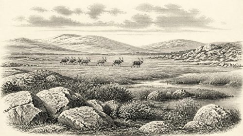
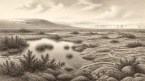
The fossils reveal a landscape far removed from later wooded Ireland. Pollen was poorly preserved, but plant macrofossils, mosses and small animal remains indicate open tundra-like vegetation and a periglacial climate: one strongly shaped by frost, thaw, short growing seasons and little or no local woodland. Finds associated with the deposit include bogbean (Menyanthes trifoliata), mountain avens (Dryas octopetala), dwarf willow, sedges, mosses and aquatic plants. Bogbean is especially telling. Its seed demonstrates freshwater or wet ground at the basin, while other fossils point to a patchwork of shallow water, muddy margins, mossy hollows, exposed mineral soils and low-growing vegetation.
That does not mean every part of Ireland resembled Derryvree. A protected Fermanagh basin cannot stand for an entire landmass. Some areas may have been buried beneath ice, others exposed as cold open ground, while local topography affected shelter, snow cover and water supply. Yet Derryvree corrects the misleading image of an entirely dead, white wilderness. In warmer months, liquid water, plants and invertebrates could make particular hollows productive, even as long winters and frozen ground imposed severe limits.
Castlepook’s Animal World
For large animals, Castlepook Cave near Doneraile in north County Cork is the crucial Irish archive. Also called Mammoth Cave or Doneraile Cave, it is a limestone cave system whose galleries were investigated from the late nineteenth century and extensively excavated between 1904 and 1918. More than 2,000 bones were recovered. Modern reassessment and redating show that its material represents a long and complex span of the middle to late Ice Age, rather than one intact occupation horizon. Individual bone dates range across tens of millennia, and water movement, carnivore activity and early excavation have mixed or obscured parts of the original context.
Even with those cautions, Castlepook establishes that Ireland supported a substantial cold-stage fauna before the Last Glacial Maximum. Its recorded animals include woolly mammoth, giant deer, reindeer, brown bear, spotted hyaena, wolf, Arctic fox, hare and lemmings. This is evidence for a functioning food web, not a list of animals that necessarily met on the same day or even in the same millennium. Reindeer and mammoth are consistent with open country capable of supporting grazing animals; predators and scavengers show that carcasses moved through ecological as well as physical processes. Hyaenas are especially important, because they could carry bones into a cave and alter them. A cave bone assemblage is therefore not automatically the remains of a human meal.
The revised radiocarbon study of southern Irish cave fauna made a broader contribution: some older dates obtained with earlier laboratory methods were shown to be unreliable, and redating pushed several Castlepook specimens substantially further back. It supports the presence of mammals in Ireland during MIS 3 and suggests that species including giant deer and spotted hyaena may have disappeared locally before the Last Glacial Maximum, around 40,000 calibrated years BP. This is a reminder that the fauna of the deep Ice Age was neither permanent nor stable. Animal populations could arrive, retreat, die out locally and return as climate and access changed.
A Possible Human Trace
Castlepook also raises the most difficult archaeological question for this era. A reindeer femur from the cave collection has been presented by zooarchaeologist Ruth Carden and by County Cork heritage authorities as bearing a deep mark made by a sharp stone tool during butchery. It has been publicised as dating to roughly 31,000 BCE or about 33,000 years ago. If the mark is correctly identified as fresh-bone human butchery, and if it belongs to the animal’s original history rather than a later disturbance, it would be extraordinarily early evidence that people handled a reindeer in Ireland during the Upper Palaeolithic.
But the conclusion must remain deliberately narrow. The cave has not yielded a securely associated hearth, dwelling floor, stone-tool assemblage, burial, art object, food store or human skeleton of comparable age. The radiocarbon result dates the animal’s death, not automatically the cutting action, the location of a kill, the duration of a visit or the size of any group involved. The bone cannot establish permanent settlement, seasonal migration, social organisation or a continuing population. It is best treated as a significant possible trace of brief human activity, not as proof of a settled Palaeolithic Ireland. Recent work at Castlepook has sought surviving stratified deposits, but it has also demonstrated how much earlier digging and later disturbance constrain interpretation.
Ice, Movement and Silence
The larger trajectory was towards the Last Glacial Maximum, conventionally defined globally as about 26,500–19,000 calendar years BP. Research on the British–Irish Ice Sheet shows that its growth, maximum extent and later retreat were asynchronous across different sectors. At 30,551 BCE, Ireland was not yet at that later maximum, but its landscapes were already subject to the pressures of expanding and reorganising ice. The Derryvree sequence preserves one local pause between glacial episodes; it does not prove that all of Ireland was simultaneously ice-free.
In human terms, therefore, this is a history of limits. Political affairs, conflict and diplomacy are unknowable because no communities can be securely reconstructed. Religion, formal learning and artistic culture leave no Irish evidence attributable to this date. Economy and trade cannot be demonstrated. If people did reach Ireland, the reindeer femur permits only the possibility of an encounter with an animal resource: meat, hide, fat, sinew, bone and antler were all potentially valuable to Upper Palaeolithic hunters elsewhere, but their use in Ireland cannot be reconstructed from this single clue.
The strongest account of Ireland around 30,551 BCE is consequently environmental. There were changing ice margins, frost-affected ground, freshwater basins, hardy vegetation, grazing animals and predators. There may also have been transient people. The silence surrounding them is not a failure of history but part of the evidence itself: later ice, erosion, cave processes and antiquarian excavation have removed or confused much of what once existed. Derryvree and Castlepook endure because they preserve fragments against that loss—enough to show an inhabited ecosystem, but not enough to turn one modern year into a prehistoric event.
Primary Sources
- A Middle Midlandian Freshwater Series at Derryvree, Maguiresbridge, County Fermanagh, Northern Ireland
- The Irish Quaternary Fauna Project
- A Reconsideration of the Radiocarbon Dating of the Marine Isotope Stage 3 Fauna from Southern Ireland
- New Insights on the Fauna of Ireland’s Younger Dryas: Excavations and Multidisciplinary Analyses at Alice and Gwendoline Cave, County Clare
- Castlepook Cave, County Geological Site Report
- 2022:564 – Castlepook Cave, Castlepook South, Cork
- Heritage Artefacts of County Cork
- Palaeoecology
- BSBI: Menyanthes trifoliata
- BSBI: Dryas octopetala
- Pattern and Timing of Retreat of the Last British-Irish Ice Sheet
- Timing and Pace of Ice-Sheet Withdrawal Across the Marine–Terrestrial Transition West of Ireland During the Last Glaciation
- Growth and Retreat of the Last British–Irish Ice Sheet, 31,000 to 15,000 Years Ago: the BRITICE-CHRONO Reconstruction
- Timing, Pace and Controls on Ice Sheet Retreat: an Introduction to the BRITICE-CHRONO Transect Reconstructions of the British–Irish Ice Sheet
- Stratigraphic and Palaeo-Geomorphological Evidence for the Glacial-Deglacial History of the Last British-Irish Ice Sheet in the North-Western Irish Sea
- The IntCal20 Northern Hemisphere Radiocarbon Age Calibration Curve (0–55 cal kBP)
- A Stratigraphic Framework for Abrupt Climatic Changes During the Last Glacial Period Based on Three Synchronized Greenland Ice-Core Records
- Archaeology Research Excavation Grant 2022: Castlepook Cave Final Report
- Dimensions and Chronology of the Last Ice Sheet in Western Ireland
- Early Deglaciation of the British-Irish Ice Sheet on the Atlantic Shelf Northwest of Ireland Driven by Glacioisostatic Depression and High Relative Sea Level