BIRM-166 Beneath Derryvree30496 BCE
Although 30,496 BCE cannot identify a discrete Irish event, the Derryvree freshwater deposits near Maguiresbridge, County Fermanagh, provide environmental context within Marine Isotope Stage 3. Organic material, trapped between two tills, produced radiocarbon date BIRM-166, calibrated broadly to 34,950–29,750 BCE. The sequence records an ice-free interval of shallow water, wetlands and treeless tundra vegetation before renewed glaciation. Castlepook Cave fauna indicates cold-habitat animals visited or inhabited parts of Ireland, but its mixed remains cannot describe one moment. A possibly cut-marked reindeer bone suggests early human visitation, not settlement. Derryvree reveals climate, ice, water and ecosystems before the Last Glacial Maximum.

Dateline
30,496 BCE is a useful modern marker, but it cannot identify a recoverable Irish event in the way that a medieval annalistic year can. No calendar, named person, settlement, political unit or dated human action from Ireland can be fixed to this single year. The evidence belongs instead to the Late Pleistocene, within Marine Isotope Stage 3: an unstable part of the last Ice Age in which ice, climate, vegetation and animal habitats changed repeatedly. The most responsible account is therefore built from broad calibrated ranges and from deposits whose formation lasted far longer than a year.
The closest major Irish environmental record is the Derryvree freshwater sequence near Maguiresbridge, County Fermanagh. Its radiocarbon range encompasses 30,496 BCE, but does not date an individual moment within that year. Its importance is substantial: it demonstrates that, before the later and more extensive growth of the British–Irish Ice Sheet, at least one north-central Irish locality experienced an ice-free interval with open water, wet ground and tundra vegetation.
A Date Within a Range
Derryvree was exposed in a road cutting through a drumlin in 1969. Investigators found freshwater silts and fine sands, including organic material, trapped between two distinct sheets of till. Till is the unsorted clay, stones and larger debris laid down by glacier ice. The order of the layers is the essential evidence. Ice had earlier affected the site; then a freshwater basin accumulated sediment during a non-glacial interval; finally, later ice buried the deposit beneath another till sheet. This is a sequence of environmental change, not a record of a single season or occurrence.
Organic material from the freshwater bed produced the conventional radiocarbon determination BIRM-166: 30,500 radiocarbon years before present, with a large uncertainty of plus 1,170 and minus 1,030 years. “Before present” conventionally means before AD 1950, while radiocarbon years are not calendar years. Changes in atmospheric carbon mean that the result must be calibrated against an internationally maintained calibration curve. Published discussions have placed this determination broadly at about 36,900–31,700 calibrated years before present, or roughly 34,950–29,750 BCE. The nominal year 30,496 BCE falls within that broad envelope, but it would be false precision to say that the Derryvree plants, insects or sediments belong specifically to it.
On Greenland ice-core timescales, this point falls amid a period of abrupt North Atlantic climatic oscillations, conventionally divided into stadials and relatively milder interstadials. Such correlations offer context, not a direct Irish weather report. Greenland ice preserves a high-resolution climate signal; Irish terrestrial deposits are rarer, patchier and differently dated. Derryvree nevertheless confirms that Ireland was not simply and continuously sealed beneath ice throughout this portion of the glacial cycle.
A Freshwater Landscape Between Glaciers
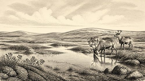
The fossils in the Derryvree silts indicate a cold, treeless and periglacial landscape. Periglacial does not necessarily mean that a glacier stood on the spot. It describes ground and ecological conditions shaped by severe cold, frost action, sparse vegetation and proximity to glacial climates. The plant record included grasses, sedges, mosses and herbaceous species, with evidence also associated with dwarf willow, juniper and Arctic-alpine plants. Aquatic and wetland remains show that shallow freshwater persisted locally. Rather than a forested Ireland, the site suggests a mosaic of pools, sedgy margins, damp mossy ground and open mineral soils.
This was not necessarily a uniformly bleak plain. Summer warmth and long daylight could have produced a brief growing season wherever snowmelt, groundwater or ponded water supplied moisture. Yet the absence of woodland is significant. Trees require more than occasional mild weather: they need sufficiently favourable summers, tolerable winters and enough uninterrupted time to mature and spread. At Derryvree, the available evidence points instead to low, open vegetation adapted to cold conditions and a landscape vulnerable to renewed ice advance.
The drumlin itself underlines a longer regional story. Drumlins are streamlined hills formed or reshaped beneath moving ice, and Fermanagh’s drumlin country is a conspicuous legacy of repeated glacial activity. At Derryvree the freshwater bed was later overridden or covered as ice returned. The wetland’s preservation was therefore accidental and fragile. Had the later ice eroded a little more deeply, its organic evidence might have been removed altogether, leaving no sign that this place had temporarily held open water and tundra plants.
Animals, Caves and Caution
Other Irish evidence broadens the picture but should not be compressed into a single simultaneous ecosystem. Castlepook Cave, near Doneraile in north County Cork, has yielded a notable Late Pleistocene animal assemblage. Remains attributed to woolly mammoth, reindeer, giant deer, brown bear, spotted hyaena, wolf, Arctic fox and smaller cold-adapted mammals show that Ireland was accessible to a varied fauna during parts of Marine Isotope Stage 3. Revised radiocarbon work has particularly emphasised the antiquity and complexity of the Castlepook material, while warning that older cave dates and mixed collections require careful reassessment.
Those bones do not mean that every listed species ranged together at Derryvree in 30,496 BCE. A cave collection can span many centuries or millennia, and cave floors can be disturbed by carnivores, water, frost, excavation and later sediment movement. Nor should a mammoth bone be treated as proof of a mammoth hunt, or a hyaena bone as evidence of a permanent hyaena den at one precisely dated moment. The defensible conclusion is narrower but still remarkable: in the broader pre-Last Glacial Maximum period, parts of Ireland supported, or were visited by, large herbivores, predators and scavengers characteristic of cold open habitats.
Reindeer are especially relevant to such habitats. Their presence implies routes through which grazing animals could move across a changing north-west European world of exposed shelves, ice margins, grasslands and tundra-steppe. Sea level was lower than today because large volumes of water were locked in ice, but that fact alone does not establish a simple, continuous land bridge into Ireland at this date. Ice, marine channels, changing shorelines and local geography all mattered. Mobility was possible for animals in some phases; the precise pathways, timing and degree of isolation remain matters for geological reconstruction rather than assumption.
The Human Question
There is no settlement, hearth, tool assemblage, dwelling, grave or art from Ireland that can responsibly be assigned to 30,496 BCE. Consequently, there is no evidence for political affairs, diplomacy, warfare, leaders, territorial institutions, religious observance, formal learning, trade or everyday domestic life in Ireland at this precise point. These are not missing chapters waiting to be filled with imagination; they are subjects for which the surviving Irish record is currently silent.
One find makes the question of human presence more interesting, but not settled. A reindeer femur from the historic Castlepook Cave collection has been reported as bearing a deep incision interpreted by zooarchaeologist Ruth Carden as a sharp stone-tool cut made during butchery. Public discussion of the specimen has connected it with a date of about 33,000 years ago. If that interpretation and association are sustained, it may indicate a very early and probably brief human visit to Ireland during the wider Middle Upper Palaeolithic. It does not demonstrate a settled population, a continuous occupation, or a community at Derryvree.
That distinction matters. The bone comes from an old cave collection, not from a modern excavation of a sealed occupation surface with a group of stone tools, food remains and hearths. The mark is a valuable lead, and it has rightly prompted renewed attention to Ireland’s Palaeolithic potential. But one modified bone, however important, cannot bear the weight of a detailed social narrative. Around the date considered here, human presence remains a possibility supported by a debated and limited line of evidence, whereas the environmental record is much firmer.
No Economy, but a Living System
It would be misleading to describe an Irish economy for this date. There is no direct evidence of hunting strategies, food sharing, seasonal camps, exchange networks or managed resources. Yet Derryvree reveals an ecological system in which energy and materials moved through water, plants, insects and animals. Sedges and mosses held wet ground together; shallow pools sustained aquatic life; grazing mammals could have exploited open vegetation; carnivores and scavengers fed upon them. Such relationships are not an economy in the human historical sense, but they explain why fleeting opportunities for animal—and perhaps human—movement might have existed.
Equally, there is no evidence for shrines, burials, monuments, language, art or inherited Irish cultural traditions. Ireland’s later archaeological landscapes—Mesolithic camps, Neolithic tombs, Bronze Age fields and early medieval settlements—belong to vastly later worlds. At 30,496 BCE the island’s recoverable history is geological and palaeoecological first: ice movement, freshwater deposition, plant survival, animal dispersal and the preservation of a thin organic layer beneath later glacial sediments.
An Island in Change
The wider trajectory gives Derryvree its force. The major maximum of the last British–Irish Ice Sheet still lay thousands of years ahead, broadly during the interval around 27,000–23,000 calibrated years before present, although its growth and extent varied by region. Later ice would substantially remodel Irish terrain and destroy many older deposits. Derryvree is therefore not merely evidence of cold; it is evidence of interruption—an interval in which a basin was ice-free long enough to accumulate freshwater sediment and sustain an open wetland community before glacial conditions returned.
For 30,496 BCE, then, the most vivid historically supportable Irish scene is not a named tribe, a battle or a royal centre. It is a cold Fermanagh basin, open to the sky, with shallow water among sedges and mosses, low shrubs on exposed ground, and the enduring possibility of animals moving through a changing landscape. Beneath the drumlin, BIRM-166 preserves that fleeting environmental chapter. Its lesson is both modest and profound: long before written history, Ireland’s past was already being made by climate, ice, water and life—and was already difficult to recover with certainty.
Primary Sources
- Middle Midlandian Freshwater Series at Derryvree, Maguiresbridge, County Fermanagh, Northern Ireland
- Middle Midlandian Freshwater Series at Derryvree, Maguiresbridge, County Fermanagh, Northern Ireland
- Figure 6.— The Subdivision of the Quaternary Period in Ireland
- ESCR Site Summary: Deposits of the Last Glaciation
- Growth and Retreat of the Last British–Irish Ice Sheet, 31,000 to 15,000 Years Ago: the BRITICE-CHRONO Reconstruction
- Growth and Retreat of the Last British–Irish Ice Sheet, 31,000 to 15,000 Years Ago: the BRITICE-CHRONO Reconstruction
- Pattern and Timing of Retreat of the Last British-Irish Ice Sheet
- A 10Be-Dated Record of Glacial Retreat in Connemara, Ireland, Following the Last Glacial Maximum and Implications for Regional Climate
- Character of Advance and Retreat of the Southwest Sector of the British-Irish Ice Sheet During the Last Glaciation
- A Reconsideration of the Radiocarbon Dating of the Marine Isotope Stage 3 Fauna from Southern Ireland
- Occurrence of Mammalia Relicts at Site Castlepook Cave
- Phylogeographic, Ancient DNA, Fossil and Morphometric Analyses Reveal Ancient and Modern Introductions of a Large Mammal: the Complex Case of Red Deer (Cervus elaphus) in Ireland
- New Insights on the Fauna of Ireland’s Younger Dryas and Early Holocene from Alice & Gwendoline Cave
- New Insights on the Fauna of Ireland’s Younger Dryas and Early Holocene from Alice & Gwendoline Cave
- Archaeological Heritage of County Cork
- Heritage Artefacts of County Cork
- Castlepook Caves
- Ireland: Submerged Prehistoric Sites and Landscapes
- The Problem of a Late Quaternary Landbridge Between Britain and Ireland
- Sea-Level Change for the Irish Sea
- A Stratigraphic Framework for Abrupt Climatic Changes During the Last Glacial Period Based on Three Synchronized Greenland Ice-Core Records: Refining and Extending the INTIMATE Event Stratigraphy
- IntCal Publications
- The IntCal20 Northern Hemisphere Radiocarbon Age Calibration Curve (0–55 cal kBP)