
Derryvree to Castlepook30448 BCE
Labelled 30,448 BCE, this period cannot be reconstructed as a single year, but belongs to a volatile Late Pleistocene interval. Derryvree, County Fermanagh, preserves freshwater organic beds between glacial tills, indicating local ice-free, tundra-like wetlands before renewed glaciation. Castlepook Cave, County Cork, yielded remains of mammoth, reindeer, giant deer, carnivores and lemmings, evidence of shifting cold-stage ecosystems. A cut-marked reindeer femur may indicate Upper Palaeolithic butchery, but cannot demonstrate permanent human settlement. No evidence supports political communities, farming, villages, trade, or recoverable beliefs. Together, the sites show a dynamic varied Ireland, where ice, water, animals and perhaps mobile people coincided.
Dateline
The label 30,448 BCE creates a false impression of precision. No community in Ireland recorded this year, and no deposit can be assigned securely to a single modern calendar year so far back in time. In simple chronological terms it falls about 32,397 years before AD 1950, the conventional baseline for “before present”; archaeologically, however, it belongs to a much broader Late Pleistocene horizon within Marine Isotope Stage 3. The most responsible account is therefore not an annual chronicle, but a reconstruction from dated sediments, fossil plants and insects, animal bones, cave deposits and the changing traces of ice.
At this depth of time, dates must be handled with care. A radiocarbon measurement is not a calendar date: atmospheric carbon-14 varied through time, and measurements require calibration against independently dated records. Even calibrated results are ranges, not pinpoints. The year-label 30,448 BCE lies close to the end of Greenland Interstadial 5.2 on widely used ice-core chronologies, but that correlation does not mean that every part of Ireland experienced the same conditions at the same moment. Ireland was a small part of a climatically volatile north-west European world, in which ice margins, vegetation and animal ranges could shift markedly over centuries and millennia.
A Wetland Between Glaciers
The strongest Irish environmental evidence relevant to this horizon comes from Derryvree, near Maguiresbridge in County Fermanagh. Roadworks in 1969 cut through a drumlin and exposed a striking sequence: glacial till below, freshwater silts and fine sands with organic material in the middle, and a later till above. Till is the poorly sorted debris laid down directly by glacier ice. The arrangement shows, beyond reasonable doubt, that ice had affected the locality; that an intervening period then allowed standing or slow-moving fresh water, sediment and living organisms to accumulate; and that ice later returned or advanced over the site.
Organic material from the middle beds produced the radiocarbon determination BIRM-166, conventionally dated to 30,500 radiocarbon years BP, with a large laboratory uncertainty of +1,170 and −1,030 years. Older published calibration discussions have expressed the associated interval very broadly as about 36,900–31,700 calibrated years BP, approximately 34,950–29,750 BCE. That wide span includes 30,448 BCE, but it does not date an event in that year. Nor does it prove that the whole island was simultaneously ice-free. What it securely establishes is a local ice-free or ice-marginal freshwater phase in Fermanagh before later glaciation sealed the evidence beneath till.
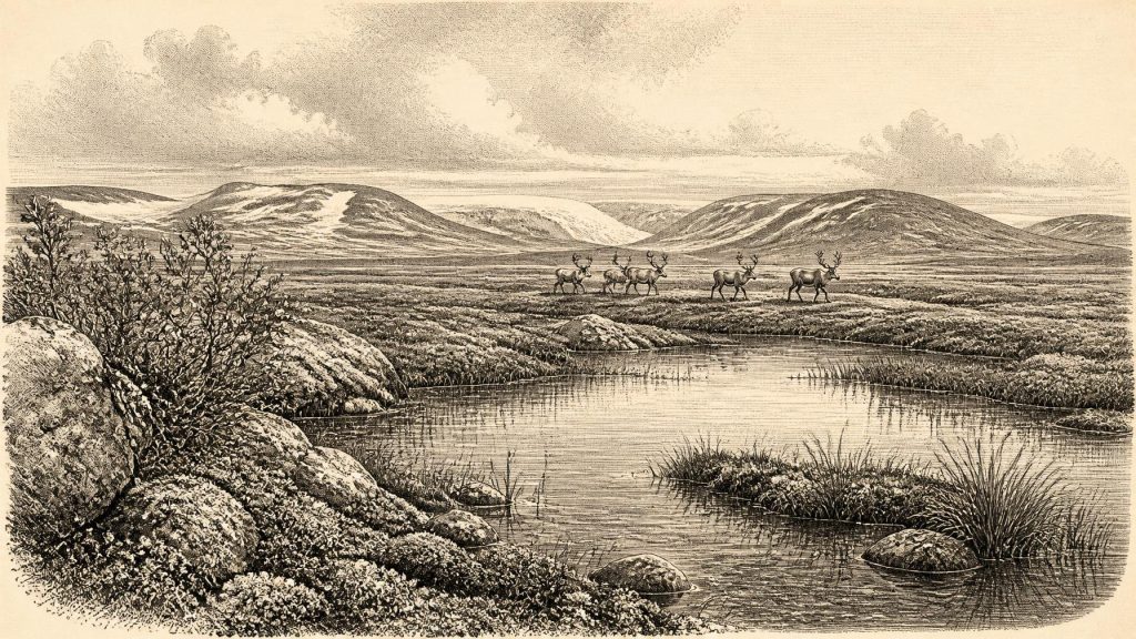
The Derryvree organic beds preserve a cold, open setting rather than woodland. Plant macrofossils and pollen include sedges, grasses, mosses, dwarf willow, mountain avens, juniper, bogbean and water-milfoil. Together they point to a patchwork of wet ground, shallow water and sparsely vegetated tundra-like terrain, with short growing seasons and severe winters. Such evidence is especially valuable because it records living communities directly: a bogbean seed or a moss fragment is not an artistic impression of Ice Age Ireland, but material that once grew at the site. Interpretation begins when archaeologists use this local assemblage to reconstruct the wider landscape, and it must remain proportionate to the evidence.
Ice, Water and Open Ground
Ireland was not yet at the fullest expansion of the last British–Irish Ice Sheet, conventionally reconstructed as occurring later, principally between roughly 26,000 and 20,000 calibrated years BP, with substantial regional variation. That later glaciation transformed and in places removed older deposits, helping to explain why the evidence for the thirty-third millennium BCE is so fragmentary. Modern reconstructions also show that the ice sheet was dynamic rather than a static white cover: upland ice centres, lobes reaching the surrounding shelf, local retreats and advances, and changing marine margins formed part of a long sequence.
For the particular date in question, it would be wrong either to picture Ireland as wholly buried beneath ice or to imagine a uniformly habitable island. Derryvree demonstrates unfrozen freshwater conditions in one northern locality during a broad preceding interval. Other records, including interstadial deposits at Greenagho near Belcoo, support the conclusion that Midlandian glaciation contained breaks and regional contrasts. Yet a wetland in Fermanagh cannot provide a map for Cork, the west coast or the central lowlands. Climate, topography and proximity to ice all mattered. The best picture is of a changing mosaic of ice, periglacial ground, cold wetlands and open habitats.
There was no settled political landscape in any meaningful sense. No state, chiefdom, boundary, treaty, diplomatic mission or named people can be recovered from Ireland at this date. Equally, there is no evidence for farms, permanent villages, fields, managed livestock or a trading system. These absences are not merely gaps in written records; they reflect the failure, so far, to find the archaeological signatures that would support such claims. At most, Ireland formed part of a wider ecological zone in which animals and, potentially, highly mobile human groups could move as conditions allowed.
Castlepook’s Faunal Record
The principal southern counterpart to Derryvree is Castlepook Cave, also known as Mammoth Cave, near Doneraile in north County Cork. Antiquarian excavations in the early twentieth century recovered a rich but complicated collection of animal remains. Later study and redating have made Castlepook central to discussion of Ireland’s Middle Midlandian fauna. The cave assemblage includes evidence for woolly mammoth, reindeer, giant deer, brown bear, wolf, fox, Arctic fox, both collared and Norway lemmings, and spotted hyaena. It reveals that, during parts of this long interval, Ireland supported or was visited by an animal community far removed from the modern island.
This list should not be converted into a single imagined scene. Cave bones can accumulate over long periods and may be brought in by predators, scavengers, water or people. Castlepook’s early excavation history also means that much material lacks the fine stratigraphic context expected from modern fieldwork. A mammoth bone from the assemblage was radiocarbon dated to about 33,400 ± 1,200 radiocarbon years BP, suggesting a broadly Middle Midlandian age for part of the fauna. Ruth Carden’s later reassessment has further stressed both Castlepook’s importance and the need to reconsider older radiocarbon determinations using improved techniques.
Nevertheless, the fauna supports a careful environmental inference. Reindeer, lemmings and Arctic fox are consistent with cold, open or treeless habitats; mammoth and giant deer indicate substantial herbivore populations during favourable phases; wolves and spotted hyaenas belonged to a predator and scavenger guild able to exploit them. Caves may have been dens or places into which carcass portions were dragged, rather than shelters occupied by people. The scene was not a single “mammoth steppe” spread unchanged across Ireland, but an unstable habitat shaped by temperature, moisture, vegetation and the reach of ice.
The Reindeer Femur Question
One Castlepook object has potentially profound implications for human history: a reindeer femur, reported by zooarchaeologist Ruth Carden and County Cork heritage publications as bearing a deep mark made by a sharp stone tool during butchery. The bone has been presented as dating to about 31,000 BCE. If that interpretation is sustained, it would indicate a human encounter with a reindeer in Ireland during the Upper Palaeolithic, many millennia before the island’s long-established post-glacial settlement record.
Its significance must be stated accurately. A single modified bone would be evidence for an act of carcass processing, not proof of a permanent population. It cannot reveal whether people killed the animal, scavenged it, removed hide or sinew, butchered it elsewhere, stayed overnight, or returned seasonally. No securely associated hearth, stone-tool assemblage, dwelling surface, burial or substantial butchered bone concentration of comparable age has yet established a settlement at Castlepook. Indeed, the bone may have reached the cave through carnivore activity after human modification. The proposition is important, but it remains narrower than claims that Ireland had a resident Ice Age society.
If people did reach the island during this broad phase, they would have been small, mobile hunter-gatherer groups comparable in broad lifeway, though not demonstrably identical, to Upper Palaeolithic populations elsewhere in north-west Europe. Their practical knowledge would have included reading animal movements, finding seasonal water, maintaining cutting edges and responding quickly to weather and ice. This is an informed comparison, not direct evidence from an Irish camp. No Irish artefacts securely dated to 30,448 BCE demonstrate technology, clothing, language, kinship, leadership, ritual or artistic practice.
Culture Without an Archive
Religion, learning and cultural expression are therefore beyond direct recovery for Ireland at this point. There are no shrines, graves, paintings, carvings, musical instruments or inscriptions that can responsibly be connected to this date. It is reasonable to suppose that any people present possessed rich social knowledge and traditions, as all known human communities do; it is not reasonable to describe what those traditions were. The same restraint applies to economy and exchange. Hunting, scavenging and use of animal materials are plausible possibilities if the cut mark is human-made, but trade networks, routes and exchanged goods are unknown.
The most important development around 30,448 BCE was environmental instability itself. Ireland’s later archaeological record was shaped by the ice sheet’s advance, which repeatedly altered rivers, coastlines, soils and habitats and erased much older surface evidence. Derryvree preserves a rare episode of freshwater tundra beneath later ice. Castlepook preserves the traces of animals, predators and perhaps a humanly handled reindeer at the opposite end of the island. Together they replace an older image of a simply empty, frozen Ireland with a more demanding one: a land that could briefly sustain complex cold-stage ecosystems, while remaining too changeable and too poorly documented to yield an annual human history.
Primary Sources
- A Middle Midlandian Freshwater Series at Derryvree, Maguiresbridge, County Fermanagh, Northern Ireland
- Middle Midlandian Interstadial Deposits at Greenagho, Near Belcoo, County Fermanagh, Northern Ireland
- A reconsideration of the radiocarbon dating of the Marine Isotope Stage 3 fauna from southern Ireland
- The Exploration of Castlepook Cave, County Cork
- The Irish Quaternary Fauna Project
- Pleistocene Vertebrates in the British Isles
- Heritage Artefacts of County Cork
- Castlepook Cave: County Geological Site Report
- 2022:564 – Castlepook Cave, Castlepook South, Cork
- Archaeology Research Excavation Grant 2022: Final Report, Castlepook Cave, Co. Cork
- The Subdivision of the Quaternary Period in Ireland
- Timing and Pace of Ice-Sheet Withdrawal Across the Marine–Terrestrial Transition West of Ireland During the Last Glaciation
- Exploring Controls of the Early and Stepped Deglaciation on the Western Margin of the British Irish Ice Sheet
- Growth and Retreat of the Last British–Irish Ice Sheet, 31,000 to 15,000 Years Ago: the BRITICE-CHRONO Reconstruction
- Radiocarbon Constraints on the Age of the Maximum Advance of the British–Irish Ice Sheet in the Celtic Sea
- New Data for the Last Glacial Maximum in Great Britain and Ireland
- Growth and Decay of a Marine Terminating Sector of the Last British-Irish Ice Sheet: a Geomorphological Reconstruction
- The Timing and Magnitude of the British–Irish Ice Sheet Between Marine Isotope Stages 5d and 2
- The IntCal20 Northern Hemisphere Radiocarbon Age Calibration Curve (0–55 cal kBP)
- IntCal: International Radiocarbon Calibration
- New Insights on the Fauna of Ireland’s Younger Dryas and Early Holocene from Alice & Gwendoline Cave
- Occurrence of Mammalia Relicts at Site Castlepook Cave
