

Maguiresbridge’s Buried Waterline30457 BCE
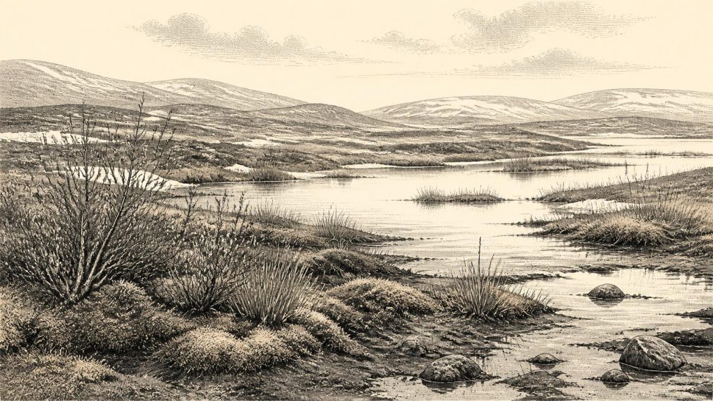
Although 30,457 BCE cannot be dated precisely, Derryvree near Maguiresbridge records an ice-free interval during Marine Isotope Stage 3. Freshwater sediments between glacial tills preserve evidence of a treeless, periglacial wetland supporting sedges, mosses, herbs, shrubs, insects and arctic-alpine plants before renewed ice advance. Ireland was environmentally varied, not uniformly ice-covered, while lower sea levels altered surrounding geography without proving migration routes. Castlepook Cave fauna demonstrates episodic cold-country habitats for mammoths, reindeer, predators and other animals. A possibly cut-marked reindeer femur may indicate human carcass processing, but cannot establish hunting, settlement or permanent population. The evidence reveals an Ice-Age landscape.
Dateline
The label 30,457 BCE suggests a precision that the evidence cannot support. No event, person or settlement can be assigned to this particular year in Ireland. In archaeological convention it falls roughly 32,400 years before present, with “present” fixed at AD 1950; but the usable evidence is dated in broad radiocarbon and calibrated ranges, often with uncertainties of centuries or millennia. The responsible subject is therefore Ireland during the later part of Marine Isotope Stage 3, a fluctuating cold phase before the largest expansion of the last Irish ice sheet.
The best evidence close to this nominal date comes not from a town, grave or tool-kit, but from a buried wetland at Derryvree near Maguiresbridge, County Fermanagh. Its organic sediments, known by the radiocarbon laboratory number BIRM-166, were found between two layers of glacial till. The sequence records a simple but momentous order of events: glacier ice affected the locality; an interval followed in which freshwater, plants and organic mud accumulated; then ice returned and sealed the deposit beneath another till. It is a fragment of landscape history, not an annual chronicle.
Freshwater Between Ice Advances
The BIRM-166 determination was reported as about 30,500 radiocarbon years before present, with a substantial uncertainty. Calibration translates this into a broad range of approximately 36,900–31,700 calibrated years before present, or roughly 34,950–29,750 BCE. The nominal year 30,457 BCE lies within that wide chronological window, but no layer can be tied to that exact year, still less to a season, generation or named occurrence. Modern calendar-year precision is simply unavailable.
Nevertheless, Derryvree provides unusually direct evidence of conditions in north-central Ireland during part of this interval. Fine freshwater silts and sands contained organic remains from a cold, open environment. Pollen, plant macrofossils, mosses and insect evidence point away from forest and towards a treeless, wet, frost-affected landscape. Standing or sluggish water lay in shallow pools and margins; sedges and mosses grew where saturated ground met open water; low herbs and shrubs occupied suitable patches beyond it. Fossils including bogbean or buckbean, dwarf willow and arctic-alpine plants demonstrate that living communities persisted despite severe climatic constraints.
Older descriptions called this kind of setting “muskeg”, borrowing a northern ecological term for a watery mosaic of peat, vegetation and pools. The comparison is useful only if used carefully. It does not mean that a modern Canadian wetland was transplanted into Fermanagh, nor that every Irish valley looked alike. What the evidence supports is a local periglacial wetland: ground near ice, shaped by hard winter freezing and summer thaw, yet not permanently overwhelmed by glacier ice during the period represented by the sediments.
Periglacial conditions could be exacting. Frozen or compacted ground may have hindered drainage; thawing could leave surfaces unstable and saturated; short summers would have concentrated biological productivity into a brief season. The striking fact is not that Derryvree was comfortable, but that liquid water, vegetation, insects and accumulating organic sediment endured there at all. The later upper till is equally important evidence: this was not a stable refuge but an episode eventually terminated by renewed glacial advance.
An Uneven Irish Ice-Age Landscape
Derryvree must not be mistaken for a complete map of Ireland. It proves that this Fermanagh locality was ice-free when its organic bed formed. It does not prove that all coasts, uplands and interior lowlands were simultaneously free of ice, nor that the island’s climate was uniform. During Marine Isotope Stage 3, North Atlantic climates shifted rapidly on long human timescales, and ice margins responded unevenly. Some areas could have held persistent snowfields or local ice while others supported exposed tundra, wetlands or animal pasture.
The broader glacial record nevertheless places the Derryvree episode in a meaningful sequence. Evidence from north-central Ireland indicates that at least some ground remained open until approximately 34,000 years ago. Major growth of the British–Irish Ice Sheet followed later, and its fullest Late Pleistocene expansion lay still in the future, broadly between about 26,000 and 20,000 years ago. At the nominal date of 30,457 BCE, Ireland was therefore not yet the uniformly ice-covered terrain of the Last Glacial Maximum. It was a changing frontier in which ice, snow, open ground and freshwater habitats varied across space and time.
Lower global sea levels also changed the geography around Ireland. Continental shelves now submerged were more extensively exposed, and the forms of the Irish Sea and Atlantic approaches differed greatly from today. Yet it would be wrong to convert that fact into a confident land bridge, migration route or shoreline map. The available Irish deposits cannot establish whether a crossing from Britain was dry, coastal, seasonal, difficult or impossible at this particular point. They show a changing north-west European environmental zone, not a drawn itinerary.
Castlepook and the Animal World
A second source of evidence comes from the limestone passages of Castlepook Cave, also called Mammoth Cave, near Doneraile in north County Cork. Excavations undertaken in the early twentieth century recovered a remarkable collection of Pleistocene animal remains. These include woolly mammoth, reindeer, giant deer, brown bear, wolf, Arctic fox, mountain hare, lemmings and spotted hyaena. The National Museum of Ireland holds important material from the cave, including a spotted-hyaena skull.
This fauna establishes that Ireland was entered, during differing parts of the later Pleistocene, by mammals associated with cold and relatively open environments. Reindeer are especially suited to cold open country; lemmings and Arctic fox indicate climates far removed from modern Ireland; mammoth, giant deer, wolves and hyaenas reveal a food web with grazers, predators and scavengers. Such evidence complements Derryvree’s wetland fossils: the island was not continuously forested, nor continuously sterile beneath ice.
It cannot, however, be compressed into one imagined scene. Castlepook is a cave archive accumulated over time, not a single excavated hunting camp. Carnivores can drag bones into caves; water and sediment can shift them; early excavation methods did not provide the tightly controlled contexts now expected. Individual bones, species and radiocarbon dates need not represent one contemporaneous herd roaming a particular Fermanagh wetland. The responsible conclusion is broader: suitable Irish habitats existed, at intervals, for a distinctive Ice-Age fauna.
The Reindeer Femur Question
One Castlepook specimen makes this period especially significant. A reindeer femur has been presented by zooarchaeologist Ruth Carden and County Cork heritage material as bearing a deep mark made by a sharp stone tool while a fresh carcass was processed. The bone is popularly assigned to around 31,000 BCE, near the broad era considered here. If the mark is correctly identified, it may be the earliest known evidence that a person handled an animal in Ireland.
That possibility deserves attention, but not embellishment. The mark would show an act of carcass processing, not necessarily a successful hunt. It cannot tell whether the animal was killed by people, found dead, stripped for hide or sinew, cut for meat, or processed elsewhere before its remains reached the cave. Nor does the femur establish a permanent population, a named Upper Palaeolithic culture, a seasonal camp or continuity with later inhabitants. No securely associated stone-tool assemblage, hearth, dwelling floor, burial or substantial butchered assemblage of equivalent age has yet been demonstrated at Castlepook.
The date on a bone also dates the death of the animal rather than automatically the moment, place or agent of modification. The specialised identification of a cut mark is distinct from the radiocarbon result. For these reasons, the most accurate language is that Castlepook offers a potentially crucial but limited indication of human activity during a broad Late Pleistocene interval. It is not proof that Ireland possessed settled communities in 30,457 BCE.
Society Beyond Recovery
Ordinary historical headings become difficult at this depth of time. There is no evidence from Ireland for kingdoms, chiefs, territorial states, diplomacy, formal warfare or political institutions. There are no known monuments, shrines, written traditions, named peoples or identifiable languages. Religion, art, learning and exchange networks cannot be reconstructed from Derryvree’s silts or one marked bone. Silence in the record is not proof that no human ever arrived; it is a limit on what can honestly be claimed.
Nor is there evidence for farming, domestic livestock, pottery, metalworking, permanent fields, roads or harbours. If people did reach Ireland, comparison with Upper Palaeolithic hunter-gatherers elsewhere suggests that survival would have depended on close knowledge of animals, weather, fuel, shelter and cutting stone. Reindeer could have supplied food, fat, marrow, hide, sinew and bone. But these are comparative possibilities, not demonstrated facts about an Irish group. They should not be inflated into an economy, trade system or social order.
The principal development visible around this point in deep time is environmental. At Derryvree, freshwater gathered between phases of glaciation and supported wetland life in a treeless, cold landscape. At Castlepook, animal bones preserve evidence for an Irish Ice-Age fauna and a provocative possible trace of human carcass processing. Later glacier ice transformed the terrain and destroyed, reworked or buried much of the evidence. What remains is fragmentary but remarkable: Ireland was not a blank space before the Last Glacial Maximum, but an ecologically varied and unstable edge of an advancing ice world.
Primary Sources
- A Middle Midlandian Freshwater Series at Derryvree, Maguiresbridge, County Fermanagh, Northern Ireland
- Figure 6.— The Subdivision of the Quaternary Period in Ireland
- Section 1: Introduction
- Pleistocene Glaciations in Ireland
- Growth and Retreat of the Last British–Irish Ice Sheet, 31,000 to 15,000 Years Ago: the BRITICE-CHRONO Reconstruction
- Dimensions and Chronology of the Last Ice Sheet in Western Ireland
- Maximum Extent and Dynamic Behaviour of the Last British–Irish Ice Sheet West of Ireland
- Early Deglaciation of the British-Irish Ice Sheet on the Atlantic Shelf Northwest of Ireland Driven by Glacioisostatic Depression and High Relative Sea Level
- Exploring Controls of the Early and Stepped Deglaciation on the Western Margin of the British Irish Ice Sheet
- Trimlines, Blockfields and the Vertical Extent of the Last Ice Sheet in Southern Ireland
- The Last Eurasian Ice Sheets – a Chronological Database and Time-Slice Reconstruction, DATED-1
- The Deglaciation of the Western Sector of the Irish Ice Sheet from the Inner Continental Shelf to its Terrestrial Margin
- A Stratigraphic Investigation of the Celtic Sea Megaridges Based on Seismic and Core Data from the Irish-UK Sectors
- The Geomorphology of Ireland’s Continental Shelf
- Ireland: Submerged Prehistoric Sites and Landscapes
- Spotted Hyena Skull
- Heritage Artefacts of County Cork
- Archaeology Research Excavation Grant Report: Castlepook Cave, Co. Cork
- New Insights on the Fauna of Ireland's Younger Dryas and Early Holocene from Alice & Gwendoline Cave
- Quaternary Science Reviews 339 (2024) 108827
- Quaternary Site Descriptions
- Reindeer Bone Found in Cork Cave Shows Human Activity in Ireland 33,000 Years Ago
- Archaeological Excavations at Killuragh Cave, Co. Limerick





