
Maguirebridge’s Muskeg Horizon30182 BCE
About 30,182 BCE, Ireland lay within the unstable, cold Late Pleistocene. At Derryvree near Maguiresbridge, County Fermanagh, freshwater sediments between till layers document an ice-free interval, broadly dated to 34,950–29,750 BCE. Fossils reveal treeless periglacial wetlands of grasses, sedges, dwarf willow, aquatic plants and insects. Conditions varied regionally as ice expanded, sea levels fell, and coastlines shifted. Castlepook Cave preserves cold-stage fauna, including mammoth, reindeer and hyaena. A possibly tool-marked reindeer bone may indicate brief human presence, but no secure settlement evidence exists. Glaciation destroyed much evidence, leaving a fragmented record of dynamic environments, mobile animals and uncertain human activity.
Dateline
The label “30,182 BCE” cannot identify a year in the ordinary historical sense. No calendar, written record, named community or dated event survives from Ireland at this depth of time. Converted mechanically to the archaeological convention in which “before present” means before AD 1950, it lies about 32,131 calendar years ago. That conversion is useful only as orientation: modern calendar-year precision is not available. The responsible subject is Ireland during a broad Late Pleistocene interval, within Marine Isotope Stage 3, rather than a recoverable Irish year.
The most relevant evidence comes in ranges spanning centuries or millennia. It consists chiefly of buried sediments, fossil plants and insects, cave animals, glacial landforms and dating measurements, not human stories. Around this nominal date, Ireland stood in a cold and unstable north-west European world moving towards the most extensive phase of the last British–Irish Ice Sheet. The island was not yet demonstrably a uniform white expanse, nor can scholarship draw a single exact ice margin for this particular year. Its regions experienced different conditions, and later glaciers destroyed much of the evidence that might have clarified them.
A Date Within a Wide Range
The strongest Irish chronological anchor is Derryvree, near Maguiresbridge in County Fermanagh. Roadworks in 1969 cut through a drumlin and exposed an exceptional sequence: a lower sheet of till, freshwater silts and fine sands with organic material, and then a second till sheet above. Till is debris deposited directly by ice. The sequence therefore records a clear order of events: glacier ice occupied the locality; an interval followed in which water, sediment and plants accumulated; and later ice or ice-derived material sealed the deposit.
Organic material from this freshwater series produced the conventional radiocarbon determination BIRM-166, usually reported as 30,500 radiocarbon years before present, with a large statistical uncertainty. A radiocarbon age is not a calendar date, because atmospheric carbon-14 has varied through time. When expressed through modern calibration, the deposit is commonly placed broadly at about 36,900–31,700 calibrated years before present, approximately 34,950–29,750 BCE. The nominal date in this article falls within that broad window. It cannot be assigned to a particular layer, season, pool level, animal or human generation within it.
This distinction is crucial. Derryvree proves an ice-free freshwater environment at one Fermanagh locality during an interval between glacial episodes. It does not prove that all Ireland was ice-free simultaneously, that the wetland endured unchanged across the full calibrated range, or that the island had a stable climate. Yet it is a rare and valuable witness. Many older Irish surfaces and deposits were scoured away, reworked or hidden by the succeeding advance of ice.
Wet Ground in a Cold Country
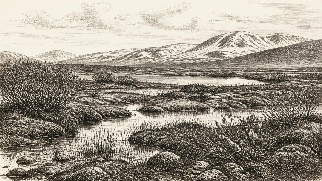
The Derryvree fossils describe a treeless, periglacial landscape rather than the wooded Atlantic island familiar today. Grasses, sedges, juniper and herbs occurred with mosses and cold-adapted plants. Fossil evidence includes dwarf willow, mountain avens, lesser clubmoss and bogbean. Water-milfoil and other aquatic remains show that shallow freshwater existed. Insect evidence complements the plant record: this was not a sterile wilderness, but a wet, organic-rich mosaic with open pools and mossy margins.
“Tundra” or “muskeg” is therefore a useful shorthand, but not a complete picture. Derryvree would have included wetter hollows, shallow water, sedge edges, exposed frost-affected ground and patches of low vegetation. Winter cold was severe; seasonal thaw, meltwater and drainage would have repeatedly altered the ground. Plants could exploit short growing seasons in sheltered wet places even while exposed terrain remained thinly vegetated. A single wind-borne pollen grain cannot demonstrate a nearby woodland, which is why the broader combination of macrofossils, pollen, insects and sediments matters more than any one specimen.
At about 32,000 years ago, climatic change could be abrupt in geological terms. Greenland ice cores show repeated cold and comparatively mild oscillations during Marine Isotope Stage 3, but Irish evidence is too fragmentary to translate each Greenland shift into a precise local weather narrative. Speleothem growth in Crag Cave, County Kerry, demonstrates episodes when water could percolate through the limestone and calcite could form. That is evidence of changing hydrological and ground conditions, not a thermometer reading for all Ireland. It reinforces the wider point that the island’s Ice Age environment was dynamic rather than permanently frozen or uniform.
Ice, Uplands and Changing Coasts
The expansion of the British–Irish Ice Sheet was an important regional development, although its exact timing and thickness remain debated. Reconstructions based on landforms, offshore sediments, exposure dating and numerical modelling show that ice centres in Ireland, Scotland and the Irish Sea changed rapidly in response to climate and topography. Some reconstructions suggest growing local ice caps in western and south-western Ireland during this broad period; other evidence leaves room for ice-free or thinly covered high ground in particular districts. The maximum extent of the last ice sheet came later, broadly around 26,000–20,000 years ago, with regional differences.
For people and animals, if present, ice was more than scenery. It reshaped drainage, removed soils, blocked routes and altered the availability of shelter and forage. Meltwater channels, gravel, moraines and drumlins visible in Ireland today are the long-term result of such processes, though most cannot be tied to the nominal year. Sea level was lower than today, exposing more of the continental shelf and shifting coastlines far beyond their modern positions. That did not necessarily make movement easy: ice margins, cold seas, changing rivers and exposed terrain could all be formidable barriers.
Cave Fauna and a Human Question
County Cork offers a different, less securely ordered archive. Castlepook Cave near Doneraile, once called Mammoth Cave, produced remains of mammoth, reindeer, giant deer, wolf, fox, arctic fox, bear, spotted hyaena and lemmings. Radiocarbon measurements on parts of the older assemblage have placed some animal material in the broader Middle Devensian or Midlandian period. These animals should not be imagined as one herd or one complete food web seen on a single day. Cave deposits accumulated across long spans, while carnivores, water, sediment movement and early twentieth-century excavation all complicated their context.
Nevertheless, Castlepook establishes that Ireland or its immediately relevant landscapes supported a striking cold-stage fauna during the wider period. Reindeer imply open grazing country; mammoth and giant deer add to the impression of extensive non-wooded habitats; predators and scavengers indicate that carcasses and living prey entered a larger ecological network. The absence of a modern Irish species from the list is as revealing as its presence: this was a mainland-connected Pleistocene fauna, not the later island fauna of the Holocene.
A reindeer femur from Castlepook has been publicised as bearing a deep mark interpreted by zooarchaeologist Ruth Carden as having been made on fresh bone with a sharp stone tool. If that interpretation and its chronological association are sustained by further study, it may be evidence that an Upper Palaeolithic visitor processed a reindeer in Ireland roughly within this broad horizon. It is potentially important, but it remains a narrow claim. The dated bone establishes the age of the animal, not automatically the moment, maker or purpose of the mark.
No securely associated stone-tool assemblage, hearth, dwelling floor, burial, artwork, human skeleton or repeated camp of this age has been published from Ireland. Recent work at Castlepook is valuable precisely because it may improve the context of the old collections, not because it permits a settled narrative already. The evidence does not establish continuous occupation, an Irish population, or a route by which people arrived and departed.
No Polity, No Proven Settlement
There is no evidence from around 30,182 BCE for political affairs, diplomacy, warfare, chiefs, tribes, territories or institutions in Ireland. Nor is there evidence for agriculture, livestock keeping, mining, seaborne trade, permanent houses, monuments or formal religious places. It would be misleading to fill those silences with later Celtic, Neolithic or medieval ideas. Ireland’s documented political and cultural traditions belong overwhelmingly to much later worlds.
If the Castlepook modification proves human-made, the most that can responsibly be inferred is modest: one or more highly mobile people possessed a sharp stone edge and handled a reindeer carcass. They might have hunted it, found it dead, removed meat, hide or sinew, or broken the limb for marrow; the existing evidence cannot decide between these possibilities. Such a moment would speak to immediate subsistence and practical knowledge, not to a known society, language, religion or trading system.
An Island Preserved in Fragments
The best account of Ireland at this time is consequently environmental. Fermanagh preserves a freshwater refuge between episodes of ice; Cork caves preserve animals from a cold, open landscape and a possible human trace; Kerry speleothems register changing subterranean water conditions. Together, they show regional variation and repeated change. They do not amount to a map of an inhabited island.
That limitation is itself historically significant. The last glaciation erased evidence as well as creating it. Every buried silt, fossil seed, bone fragment and cave layer is therefore disproportionately valuable. Around the modern label 30,182 BCE, Ireland was a landscape of frost, wet ground, shifting ice and mobile animals. Whether people were present even briefly remains an important but unresolved archaeological question; the evidence supports caution, not a confident tale of settlement.
Primary Sources
- Middle Midlandian Freshwater Series at Derryvree, Maguiresbridge, County Fermanagh, Northern Ireland
- Middle Midlandian Freshwater Series at Derryvree, Maguiresbridge, County Fermanagh, Northern Ireland
- Figure 6.— The Subdivision of the Quaternary Period in Ireland
- Irish Pleistocene Biostratigraphy
- BSBI: Menyanthes trifoliata
- BSBI: Salix herbacea
- BSBI: Selaginella selaginoides
- Introduction to the Glacial Sand and Gravel Landscapes of Northern Ireland
- Last Glacial Maximum Cirque Glaciation in Ireland and Implications for Reconstructions of the Irish Ice Sheet
- Reconstructing the Last Irish Ice Sheet 2: A Geomorphologically-Driven Model of Ice Sheet Growth, Retreat and Dynamics
- Growth and Retreat of the Last British–Irish Ice Sheet, 31,000 to 15,000 Years Ago: the BRITICE-CHRONO Reconstruction
- Spatio-Temporal Dynamics of Speleothem Growth and Glaciation in the British Isles
- Episodic Speleothem Deposition Tracks the Terrestrial Impact of Millennial-Scale Last Glacial Climate Variability in SW Ireland
- Stratigraphic and Palaeo-Geomorphological Evidence for the Glacial-Deglacial History of the Last British-Irish Ice Sheet in the North-Western Irish Sea
- Early Deglaciation of the British-Irish Ice Sheet on the Atlantic Shelf Northwest of Ireland Driven by Glacioisostatic Depression and High Relative Sea Level
- Deglaciation Chronology of the Donegal Ice Centre, North-West Ireland
- Trimlines, Blockfields and the Vertical Extent of the Last Ice Sheet in Southern Ireland
- Heritage Artefacts of County Cork
- 32564 — Castlepook Cave, Co. Cork
- New Insights on the Fauna of Ireland's Younger Dryas and Early Holocene from Alice & Gwendoline Cave
- The Mesolithic in Ireland: When Was It?
- Archaeological Survey
- Irish Quaternary Association
- IntCal20 Northern Hemisphere Radiocarbon Age Calibration Curve (0–55 cal kBP)
