
BIRM 166 Calibration30380 BCE
30,380 BCE is not a recoverable Irish historical year but falls within the climatically unstable Marine Isotope Stage 3. At Derryvree, County Fermanagh, BIRM-166 dated freshwater organic deposits between glacial tills to roughly 36,900–31,700 calibrated years before present, indicating an ice-free interval before later ice-sheet expansion. Plant remains reveal cold, treeless wetlands with open water, sedges, mosses and hardy shrubs. Southern cave finds show that large mammals occurred during the wider period, though not necessarily together. No secure evidence identifies human occupation, society or culture. The record instead documents dynamic glacial change and ecologically active landscapes, while retaining considerable uncertainty.
Dateline
“30,380 BCE” is a useful modern label, not a recoverable year in Ireland’s prehistoric record. No written calendar existed, and neither archaeology nor environmental science can identify an event, a community or even a particular season on the island in that single year. The responsible history of Ireland at this depth of time is therefore a broad reconstruction of the Late Pleistocene, assembled from stratified sediments, fossil plants and animals, cave deposits, ice-sheet landforms and scientific dates with substantial margins of uncertainty.
A Date Within a Wide Window
This point falls within Marine Isotope Stage 3, a long and climatically unstable part of the last glacial period. Ireland was not yet at the maximum extent of the last British–Irish Ice Sheet, which later covered the whole island and much of its continental shelf, broadly around 27,000–23,000 calibrated years before present. Conditions before that maximum varied greatly between regions and over time: glaciers advanced and retreated, while ice-free ground could support cold-adapted plants and animals.
The closest important Irish evidence comes from Derryvree, near Maguiresbridge in County Fermanagh. During road works, an exposure through a drumlin revealed a striking sequence: a lower deposit of till, laid down by glacier ice; freshwater silts, sands and organic muds; and then another thick layer of till. The order matters more than any picturesque label. It demonstrates that ice had occupied the locality, that a non-glacial interval subsequently permitted freshwater and organic material to accumulate, and that later ice or glacial processes sealed the deposit beneath fresh sediment.
An organic sample from this deposit, BIRM-166, produced a conventional radiocarbon age of about 30,500 radiocarbon years before present, with a large reported uncertainty of approximately +1,170 and −1,030 years. “Before present” is conventionally counted from AD 1950; radiocarbon years also cannot simply be converted into calendar years because atmospheric carbon-14 levels changed over time. Published calibration has placed the Derryvree result broadly around 36,900–31,700 calibrated years before present, approximately 34,950–29,750 BCE. The nominal year 30,380 BCE falls within that broad range, but it cannot be attached to a single layer, plant, animal or human lifetime.
A Freshwater Landscape Between Ice Advances
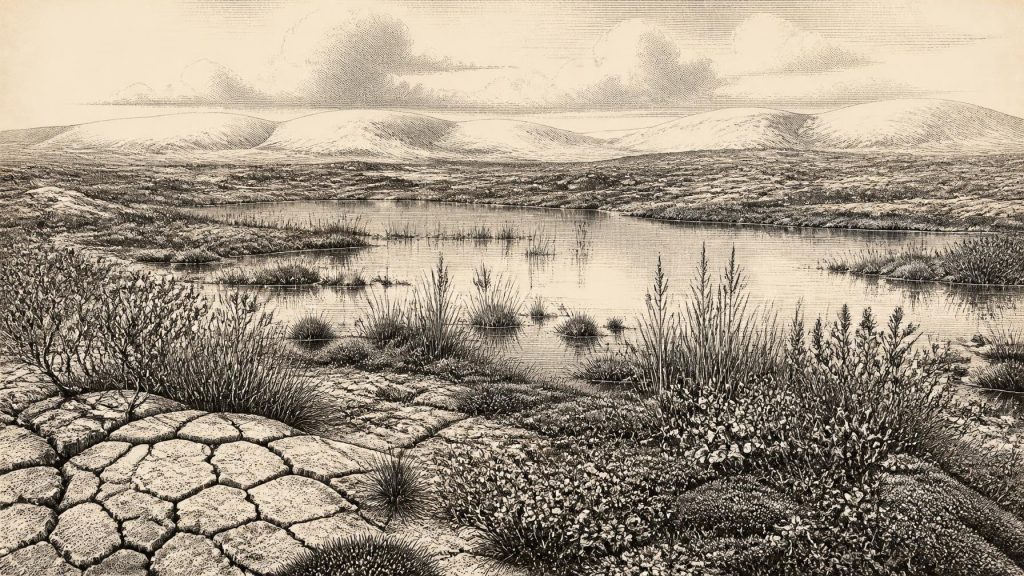
The Derryvree evidence offers a local environmental window rather than a map of the entire island. Its organic silts, fine sands, plant remains and small fossil assemblages indicate freshwater in or beside a basin during a cold, treeless phase. The landscape has often been compared with tundra or muskeg: terms that convey wet ground, shallow water, mosses, sedges, herbs and low shrubs, but which should not be treated as exact modern ecological equivalents. The evidence supports a mosaic of open water, wet margins and sparsely vegetated ground, not a familiar wooded Irish countryside.
Among the reported plant evidence are aquatic and waterside forms, including water-milfoil and bogbean, alongside sedges, mosses and low-growing vegetation suited to rigorous conditions. Dwarf willow, juniper, mountain avens and other hardy plants are part of the wider picture reconstructed from the deposit. Such remains are direct evidence that particular organisms grew in or near this freshwater environment; they do not establish that every Irish valley looked the same. The surrounding region may have included exposed mineral soil, frost-shattered slopes, seasonal meltwater channels and snow patches, while higher ground and other parts of the island experienced different glacial conditions.
The climate was severe by modern Irish standards. A brief growing season, cold winters and periglacial processes — repeated freezing and thawing in ground not necessarily covered by permanent ice — are consistent with the Derryvree assemblage. Yet the presence of standing or slow-moving freshwater is a reminder that an Ice Age was not a uniform white wilderness. Even in a cold landscape, sheltered basins could support complex wetland communities. The later ice cover that buried these deposits is also why the record survived at all, though glacial erosion destroyed or rearranged much other evidence from the same immense span of time.
Animals on a Changing Island
Southern Irish cave deposits help to establish that sizeable mammals reached or lived in Ireland during the wider Middle Midlandian interval. Castlepook Cave, also called Mammoth Cave or Doneraile Cave, in County Cork, has produced remains attributed to woolly mammoth, reindeer, giant deer, brown bear, wolf and spotted hyaena. These finds are invaluable but should not be compressed into a single imagined scene at 30,380 BCE. Cave deposits may accumulate over long periods, and improved radiocarbon pretreatment has shown that some older dates and associations require reconsideration.
The safest conclusion is that Ireland formed part of a north-west European zone in which animal populations could move during favourable intervals, with changing sea levels and ice configurations affecting possible routes. Mammoth, reindeer and hyaena are not evidence for a stable, permanently open grassland across the entire island; equally, their presence in the wider period cautions against imagining Ireland as wholly lifeless. Predators, scavengers and herbivores would have occupied shifting habitats whose extent depended on climate, vegetation, snow cover, coastlines and access from Britain and continental Europe.
No Recoverable Human History
There is no securely dated settlement, hearth, dwelling, cemetery or artefact assemblage from Ireland that permits a history of human communities in 30,380 BCE. Consequently, there are no identifiable political institutions, leaders, wars, alliances, diplomatic encounters, religious observances, trade networks or systems of learning to describe. To supply any of them would be invention. The earliest currently recognised evidence for people in Ireland belongs much later, in the closing stages of the Pleistocene, while the sustained archaeological record of settlement begins later again in the Mesolithic.
This absence does not prove that a person could never have crossed the region during an earlier cold interval. It means only that the surviving Irish evidence cannot demonstrate such an episode at this date. Archaeological silence is especially difficult to interpret in glaciated landscapes: later ice may erode surface sites, move artefacts far from their original position or bury deposits deeply. A stray animal bone, an ambiguous mark on bone, or a stone found out of context cannot carry the same evidential weight as a securely excavated living surface with tools, hearths and repeated activity.
Economy, Society and Culture in Ecological Terms
For this period, “economy” is best understood as the circulation of energy through a cold ecosystem, rather than as human production or exchange. Mosses, sedges and herbs captured the short summer’s growth; wetland plants occupied shallow water and saturated margins; herbivores browsed or grazed where vegetation and snow conditions allowed; carnivores and scavengers followed prey and carrion. If people did enter Ireland intermittently, no Irish evidence presently reveals their subsistence, technology, seasonal movements or social relationships.
Nor can religion or culture be read into the Derryvree wetland. There are no monuments, ornaments, images, graves or deliberate deposits from which symbolic practice could responsibly be inferred. The culture visible here is instead scientific: the careful recovery and comparison of pollen, seeds, mosses, insect fragments, sediments, bones and radiocarbon determinations. Each category answers a limited question. A seed identifies a plant near the deposit; a till records glacial action; a cave bone documents an animal; a radiocarbon result gives a probability-bearing chronological constraint. Together, they produce a powerful but incomplete history.
Regional Change Before the Maximum Ice Sheet
The most important development around this broad date was environmental instability. Derryvree shows that at least one part of Fermanagh had an ice-free freshwater interval before the later expansion of the last ice sheet. It does not establish that the whole island was simultaneously open, nor does it fix the exact timing, thickness or direction of every glacier. Modern reconstructions combine onshore landforms, offshore sediment cores, radiocarbon dates and exposure dating to show that the last ice sheet was dynamic and that its maximum came later than the Derryvree interval.
For Ireland, then, 30,380 BCE should be understood not as a year of named events but as a point within a long, uncertain interval when Fermanagh’s drumlin country briefly preserved freshwater life between glacial episodes. BIRM-166 is important precisely because it gives this otherwise vanishing world a chronological anchor. Its lesson is one of restraint as well as discovery: Ireland was cold, changing and ecologically alive, but the evidence does not permit a calendar-year narrative.
Primary Sources
- A Middle Midlandian Freshwater Series at Derryvree, Maguiresbridge, County Fermanagh, Northern Ireland
- Deglacial Rates and Controls for the British-Irish Ice Sheet Western Margin
- Trimlines, Blockfields and the Vertical Extent of the Last Ice Sheet in Southern Ireland
- Early Deglaciation of the British-Irish Ice Sheet on the Atlantic Shelf Northwest of Ireland Driven by Glacioisostatic Depression and High Relative Sea Level
- Pattern and Timing of Retreat of the Last British-Irish Ice Sheet
- Radiocarbon Constraints on the Age of the Maximum Advance of the British-Irish Ice Sheet in the Celtic Sea
- Late Pleistocene Chronostratigraphy and Ice Sheet Limits, Southern Ireland
- Ireland: Submerged Prehistoric Sites and Landscapes
- The IntCal20 Northern Hemisphere Radiocarbon Age Calibration Curve (0–55 cal kBP)
- The IntCal20 Approach to Radiocarbon Calibration Curve Construction: A New Methodology Using Bayesian Splines and Errors-in-Variables
- A Reconsideration of the Radiocarbon Dating of the Marine Isotope Stage 3 Fauna from Southern Ireland
- The Irish Quaternary Fauna Project
- Occurrence of Mammalia Relicts at Site Castlepook Cave
- New Insights on the Fauna of Ireland's Younger Dryas and Early Holocene from Alice & Gwendoline Cave
- Prehistoric Details: Stone Age
- Figure 6: The Subdivision of the Quaternary Period in Ireland
- Environmental Site Record: Quaternary Deposits
- The Geological Heritage of County Leitrim
- The Exploration of Castlepook Cave, County Cork
- Sedimentary Ancient DNA Reveals Late Pleistocene Faunal Connectivity Between Ireland and Eurasia