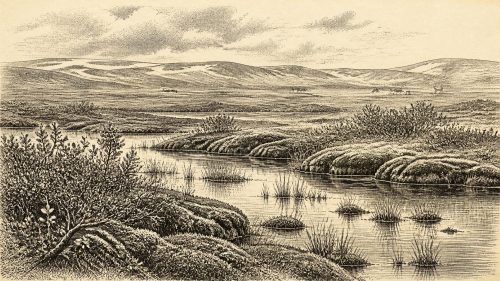
Derryvree’s Arctic Wetland30379 BCE
At the modernly assigned date of 30,379 BCE, Ireland has no year-specific historical record. Derryvree, County Fermanagh, preserves organic freshwater sediments between two glacial tills, dated broadly to 34,950–29,750 BCE. They show that north-central Ireland was locally ice-free during Marine Isotope Stage 3 before renewed glaciation buried the wetland. Macrofossils indicate shallow water, mossy margins, sedges and sparse arctic-alpine tundra vegetation under severe periglacial conditions. Comparable deposits confirm changing regional ice cover. Castlepook Cave records cold-stage fauna over millennia, but not a contemporary local census. Possible early human evidence remains uncertain; no settlements, systems or year-specific events can be reconstructed.

Dateline
Modern calendar-year precision is not available for Ireland in 30,379 BCE. No community on the island left writing, a calendar or an event that can be isolated to this year. The date is therefore best treated as a modern point within a much broader Late Pleistocene interval, not as an anniversary. Its most useful Irish anchor is the freshwater sequence discovered at Derryvree, near Maguiresbridge in County Fermanagh. A conventional radiocarbon determination from its organic sediments, BIRM-166, was reported as 30,500 +1,170/−1,030 radiocarbon years BP. Calibration is essential: radiocarbon years are not calendar years. Published treatment of the determination places the deposit broadly at about 36,900–31,700 calibrated years BP, or roughly 34,950–29,750 BCE. The nominal year falls within that wide range, but cannot be assigned to a particular layer, season, generation or occurrence.
A Freshwater Record Beneath Ice
Derryvree was exposed by roadworks in February and March 1969, when a cutting passed through a north-east to south-west drumlin around two kilometres north-east of Maguiresbridge. The section contained two substantial sheets of till, the unsorted debris deposited directly by glacier ice. Between them lay freshwater silts, fine sands and moss-rich organic mud. That order of layers provides the strongest conclusion available: ice had previously affected the locality; an interval then permitted fresh water, sediment and organic material to accumulate; later glacial activity covered and preserved the deposit beneath a second till sheet.
This is powerful evidence for local environmental change, not a complete map of Ireland. The Derryvree basin was one place in south Fermanagh, and ice margins, precipitation, ground conditions and vegetation differed across the island. Nevertheless, the sequence demonstrates that at least part of north-central Ireland was ice-free when the freshwater bed formed. It also shows why a simple image of a permanently ice-covered Ireland is misleading. The late Ice Age was marked by major climatic shifts, and the island contained changing combinations of glacier ice, frost-disturbed ground, shallow water, sediment and cold-adapted life.
Open Tundra and Wet Margins
The fossils recovered from the Derryvree freshwater sediments make the landscape unusually tangible. Pollen was poorly preserved, but plant macrofossils, mosses and small animal remains survived. Their combined evidence indicates a treeless, open tundra-like environment under periglacial conditions: ground affected by severe cold and seasonal freezing near, rather than necessarily beneath, glacier ice. The record includes plants associated with wet ground and open water, notably bogbean or buckbean (Menyanthes trifoliata) and water-milfoil, alongside sedges and a varied moss flora. A bogbean seed is especially informative because the species grows in shallow fresh water, wet margins and peat-forming ground.
Other fossils point beyond the basin’s edge. Low-growing arctic-alpine and tundra plants, including mountain avens, dwarf willow, clubmoss and rosy saxifrage, support the interpretation of sparse, exposed vegetation rather than woodland. These remains should not be used as a precise thermometer, and they do not prove that every species formed one continuous carpet at the same moment. They do establish a mosaic: shallow or slow-moving fresh water, wet mossy margins, sedgy ground and drier, frost-prone open surfaces. Seasonal productivity was sufficient to sustain vegetation and invertebrate life, even though the setting was climatically severe.
That mosaic mattered. In a cold landscape, water collected in hollows can support a richer local plant community than adjacent exposed ground. Mosses and aquatic plants testify to such sheltered niches. The sediment itself records quiet or low-energy water much more readily than a rushing river or bare glacial outwash. Derryvree was therefore neither a forested lake country nor a featureless ice desert. It was a lowland wetland within a wider, treeless cold-stage landscape, vulnerable to renewed glacial advance.
An Island of Shifting Connections
Derryvree is one of several Irish deposits that complicate older, overly simple models of the last glaciation. Related inter-till and lacustrine deposits at Hollymount near Maguiresbridge, Greenagho near Belcoo and Aghnadarragh in County Antrim show that ice cover and ice-free conditions varied through time and by region. In wider North Atlantic terminology, this was Marine Isotope Stage 3, a long and unstable part of the last glacial cycle. The great Last Glacial Maximum came later, conventionally placed in Ireland and Britain at roughly 26,000–19,000 years ago. Around the broad interval represented by Derryvree, the decisive historical development was environmental instability: ice had withdrawn or was absent locally, but it would return.
The later till above the wetland is thus more than a geological lid. It is evidence of the environmental reversal that ended the freshwater interval. Glacial advance could scour soils, redirect water, reshape ridges and bury habitats. It also destroyed or obscured much of the evidence by which archaeologists might otherwise reconstruct animal movements or human visits. At Derryvree, however, burial preserved the older organic bed as a rare archive. The drumlin that dominates the modern landscape became, by chance, a container for evidence of an earlier living basin.
Animal Worlds Beyond Fermanagh
For the broader Irish fauna of this era, Castlepook Cave near Doneraile, County Cork, is the crucial but complicated comparison. More than 2,000 bones have been recovered from its limestone passages, and individual radiocarbon results span a very long interval, from about 45,700 to 19,950 BP. The assemblage includes woolly mammoth, giant deer, reindeer, brown bear and spotted hyaena; Arctic fox, wolf and both Norwegian and collared lemmings occur among later cold-stage material. These animals demonstrate that Ireland was intermittently connected ecologically with wider north-west European populations and could support, or receive, substantial cold-climate mammals and their predators.
But the cave must not be turned into a single scene for 30,379 BCE. Bones accumulated over millennia, and their route into the cave could include carnivore activity, natural death, water movement and disturbance during early excavation. Spotted hyaenas, in particular, probably helped introduce some remains. Improved radiocarbon pretreatment has also shown that several older Irish cave dates were too young, requiring reassessment of earlier chronologies. Castlepook therefore illuminates a changing Ice Age fauna across a broad span, not a precise local animal census for Derryvree’s wetland or this nominal year.
People: A Necessary Restraint
The evidence for people in Ireland at this depth in time remains exceptionally slight. A reindeer femur from Castlepook has been presented as approximately 33,000 years old and as bearing a deep mark interpreted as stone-tool damage made during butchery. If that interpretation is sustained, it would be potentially important evidence for a very early human action on the island. It would not, however, establish that people lived permanently in Ireland, that they occupied Castlepook, or that they were present in 30,379 BCE. The date records the animal bone, while the identification and timing of the incision require separate taphonomic judgement.
No securely contemporary Irish house, hearth, occupation floor, stone-tool assemblage, burial, food store or settlement has been identified for the Derryvree interval. There are no human remains from it, and no basis for attaching any possible visitors to a named Upper Palaeolithic tradition. It is reasonable only as a conditional inference to say that people able to move through such country would have needed detailed knowledge of weather, seasonal movement, animal behaviour, shelter and stone resources. That inference comes from wider hunter-gatherer archaeology; it is not direct evidence for a resident Fermanagh community.
What Cannot Be Recovered
Accordingly, there is no responsible political narrative for Ireland at this point: no rulers, territories, laws, diplomacy, warfare or alliances can be identified. Nor can the evidence recover kinship, language, social rank, clothing, music, teaching or religious belief. There are no monuments, graves, ritual deposits or artworks from which to infer a spiritual system. Trade and economy are equally beyond reach. The freshwater deposits reveal natural resources and environmental possibilities, not exchange networks, farming, ownership or a managed landscape. Cultivation and domesticated animals belong to a vastly later Irish past.
The absence of such evidence should not be mistaken for an empty history. It identifies the proper scale of the story. Around this modernly numbered year, Ireland’s recoverable past is chiefly a history of habitats: an ice-free Fermanagh hollow holding fresh water; mosses, sedges and aquatic plants along its margins; sparse arctic-alpine vegetation beyond; and, elsewhere on the island over related Ice Age spans, a mobile fauna of herbivores, predators and scavengers. The most secure conclusion is not a year-specific event but a regional transformation in progress.
A Date Within Deep Time
Derryvree makes 30,379 BCE meaningful precisely because it resists false precision. The BIRM-166 date has a large laboratory uncertainty, calibration adds further breadth, and the organic mud accumulated over time rather than on a single day. Yet the succession between the tills is unequivocally valuable. It records an ice-free freshwater episode in a cold, treeless Ireland before later ice sealed the basin. Together with cave-fauna research and continuing work on glacial chronology, it reveals an island that was environmentally diverse, intermittently habitable for cold-adapted organisms and highly sensitive to climatic change. That is the historically responsible Ireland of this remote date: not a kingdom or a settlement, but a buried wetland world at the edge of returning ice.
Primary Sources
- A Middle Midlandian Freshwater Series at Derryvree, Maguiresbridge, County Fermanagh, Northern Ireland
- Palaeoecology: IQUA Field Guide 16
- Exploring Controls on the Last Deglaciation of the British-Irish Ice Sheet
- Cork County Geological Site Report: Castlepook Cave
- Menyanthes trifoliata L., Bogbean
- A Reconsideration of the Radiocarbon Dating of the Marine Isotope Stage 3 Fauna from Southern Ireland
- The Irish Quaternary Fauna Project
- Archaeology Research Excavation Grant 2022: Castlepook Caves Project Final Report
- 32564: Castlepook Cave, Castlepook South, Doneraile, Cork
- Heritage Artefacts of County Cork
- The IntCal20 Northern Hemisphere Radiocarbon Age Calibration Curve (0–55 cal kBP)
- Last Glacial Maximum Cirque Glaciation in Ireland and Implications for Reconstructions of the Irish Ice Sheet
- Deglaciation Chronology of the Donegal Ice Centre, North-west Ireland
- Trimlines, Blockfields and the Vertical Extent of the Last Ice Sheet in Southern Ireland
- Freshwater Organic Deposits and Stratified Sediments Between Early and Late Midlandian (Devensian) Till Sheets, at Aghnadarragh, County Antrim, Northern Ireland
- New Insights on the Fauna of Ireland’s Younger Dryas and Early Holocene from Alice & Gwendoline Cave
- New Data for the Last Glacial Maximum in Great Britain and Ireland
- Irish Pleistocene Biostratigraphy
- The Stratigraphic Position and Age of the Gortian
- Clogher Valley
- The Geological Heritage of County Leitrim